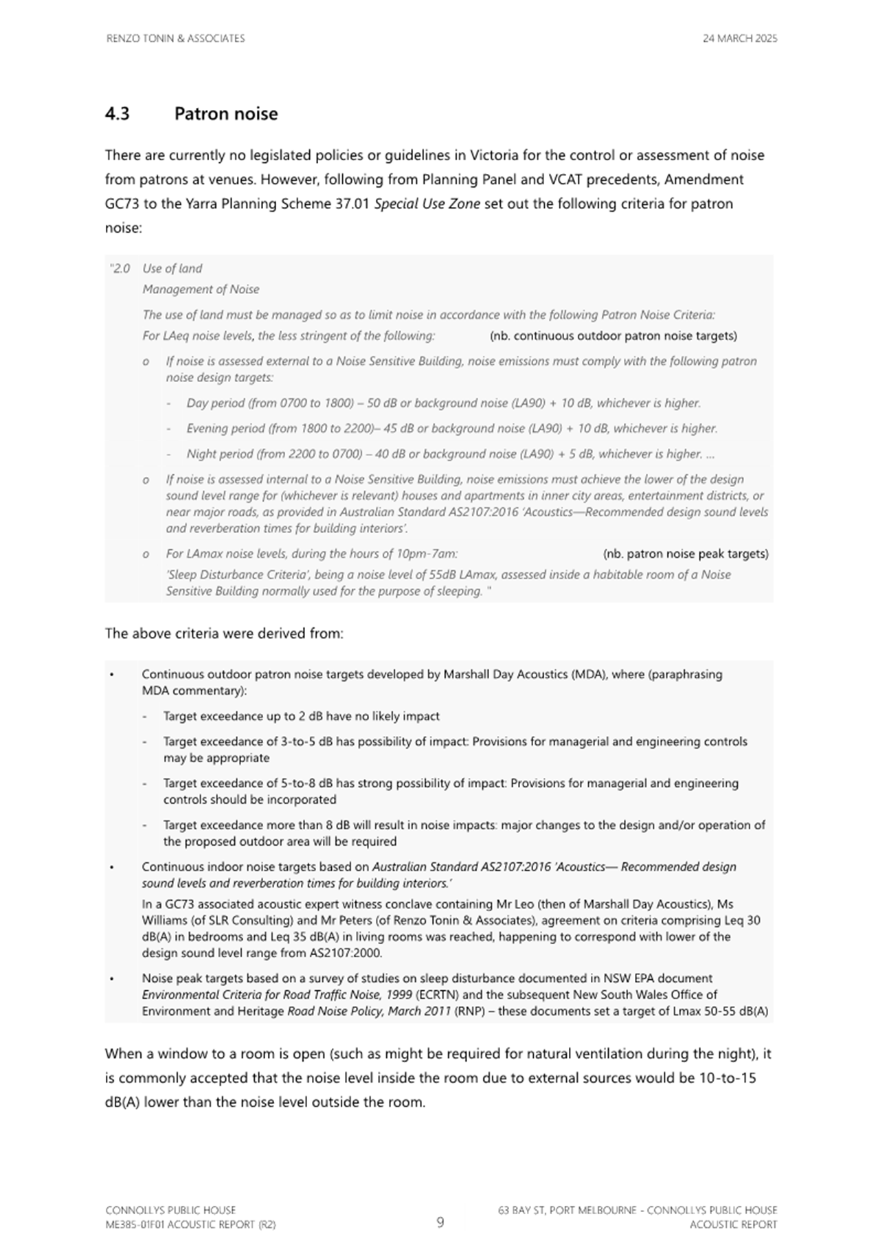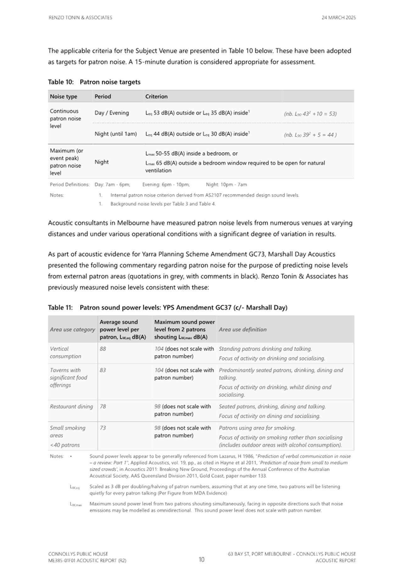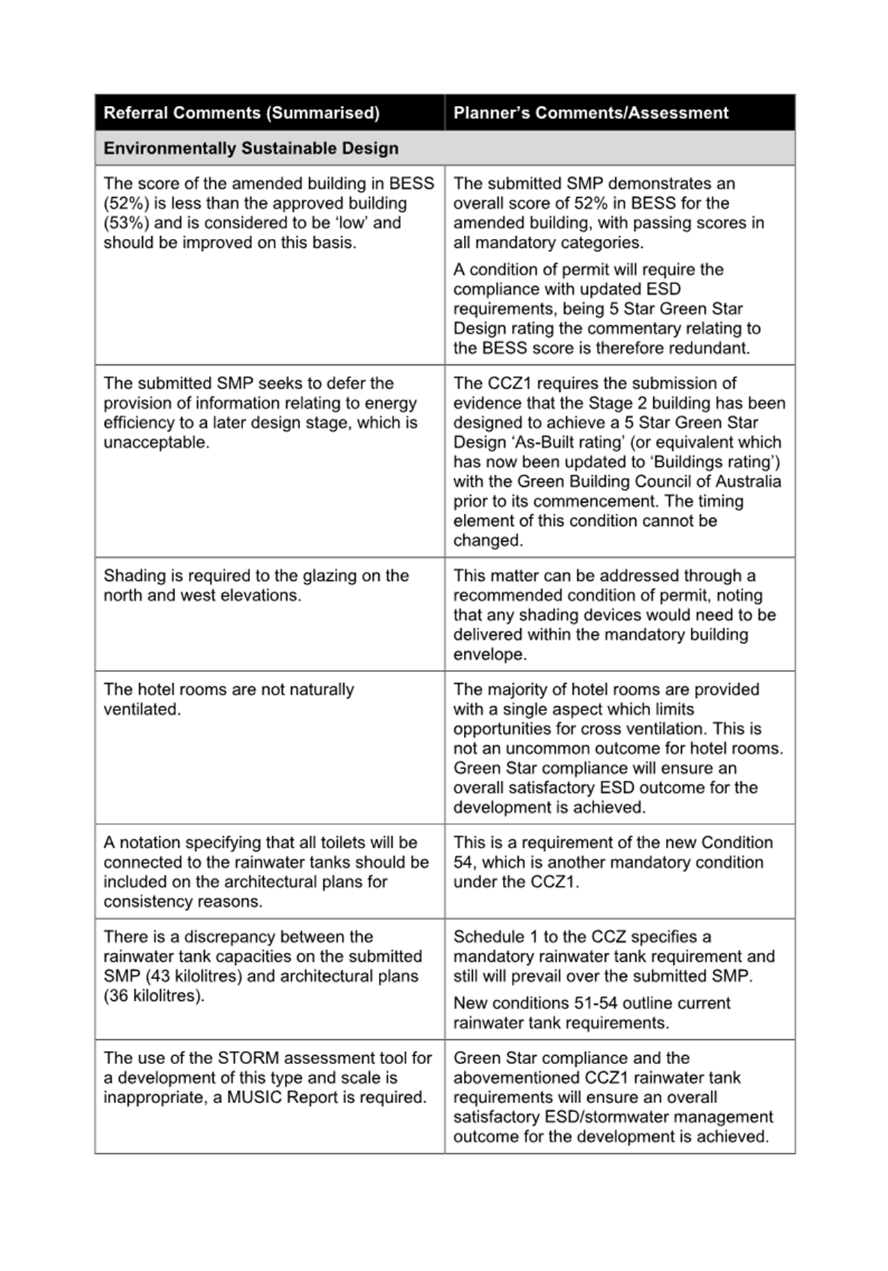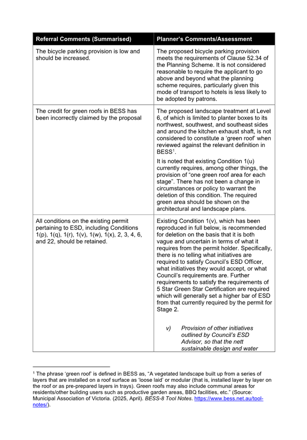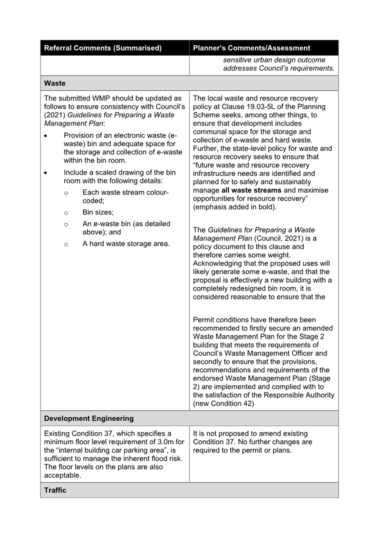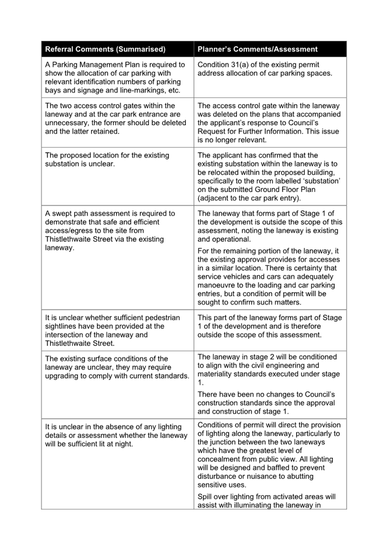
Planning Committee
23 April 2025
|
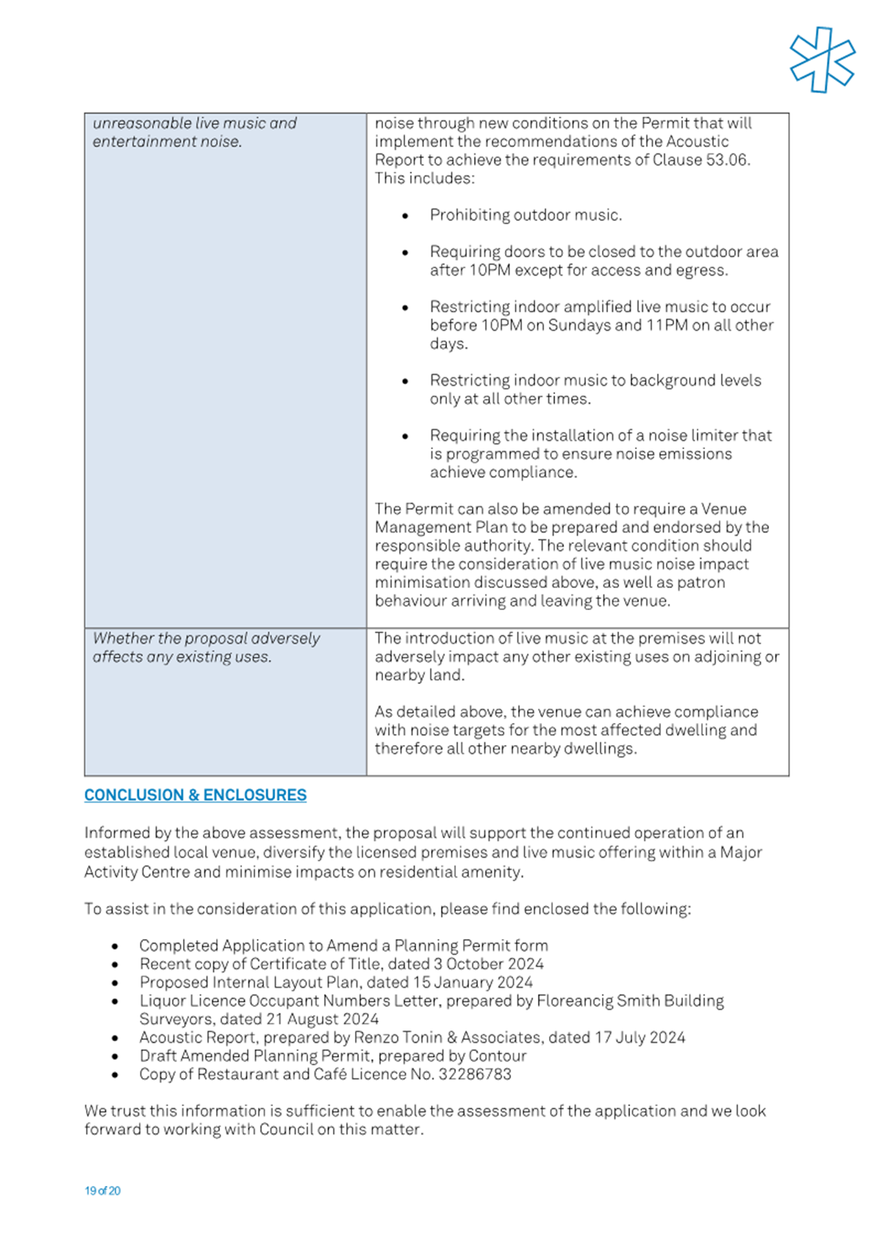
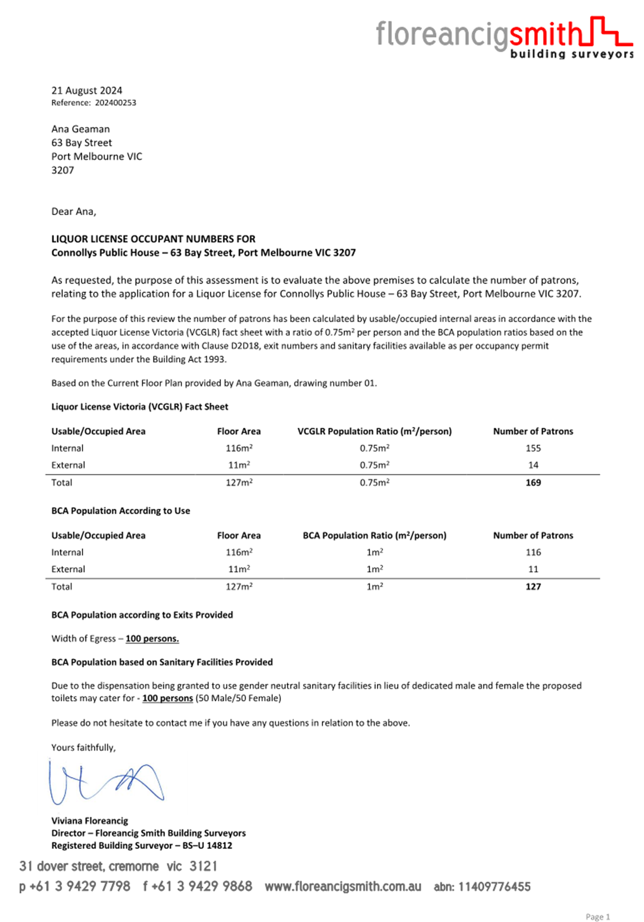
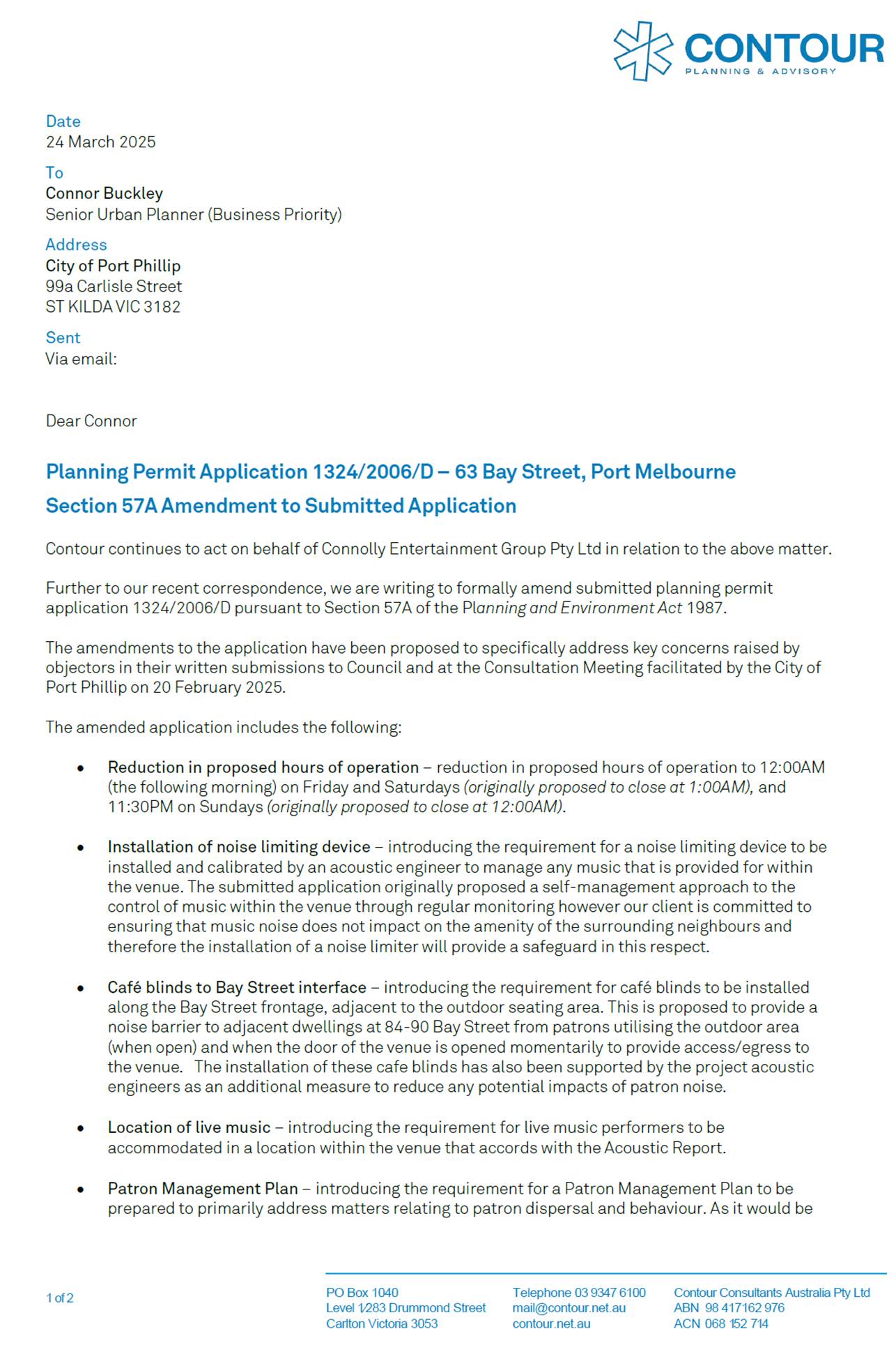
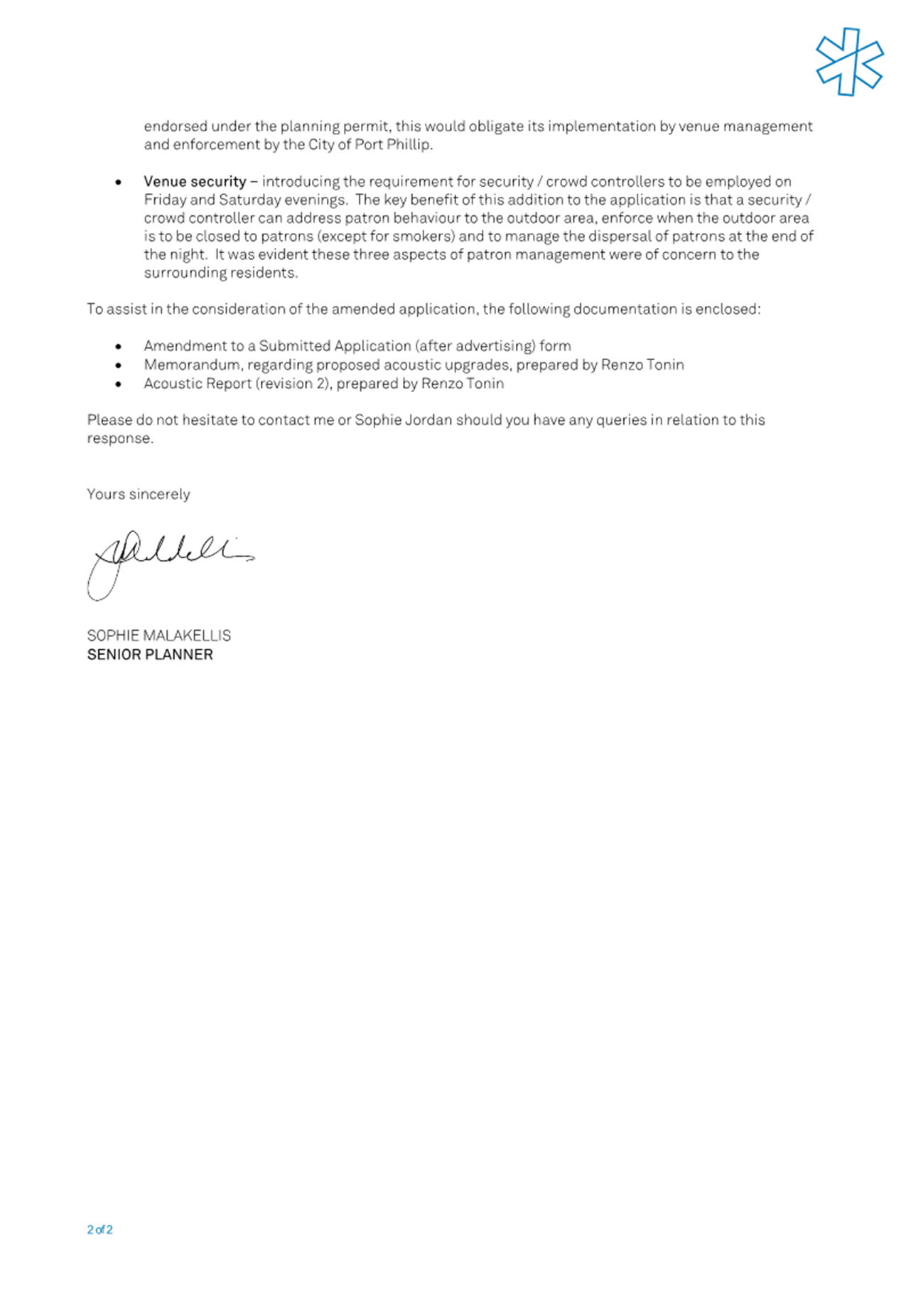
Welcome Welcome to this Planning Committee Meeting of the Port Phillip City Council. The aim of this Committee is to consider, within the framework of the Planning and Environment Act, State and Local Planning Schemes, major planning applications or applications that will have a large impact on the local area. This Committee also allows you to be involved in the statutory and strategic planning decision making processes of Council.
About this meeting There are a few things to know about tonight’s meeting. The first page of tonight’s Agenda itemises all the different parts to the meeting. Some of the items are administrative and are required by law. In the agenda you will also find a list of all the items to be discussed this evening. Each item has a report written by a Council officer outlining the purpose of the report, all relevant information and a recommendation. The Committee will consider the report and either accept the recommendation or make amendments to it. This Committee has delegated authority. A recommendation is carried if it receives majority support of the Councillors in attendance at the Committee meeting. |
Public Question Time and Submissions Public Question Time Provision is made at the beginning of the meeting for general question time from members of the public concerning planning matters. All contributions from the public will be heard at the start of the meeting during the agenda item 'Public Questions and Submissions.' Members of the public have the option to either participate in person or join the meeting virtually via Teams to ask their questions live during the meeting. If you would like to address the Council and /or ask a question on any of the items being discussed, please submit a ‘Request to Speak form’ by 4pm on the day of the meeting via Council’s website: Request to speak at a Council meeting - City of Port Phillip
|
|
|
|
|
PORT PHILLIP CITY COUNCIL Planning Committee |
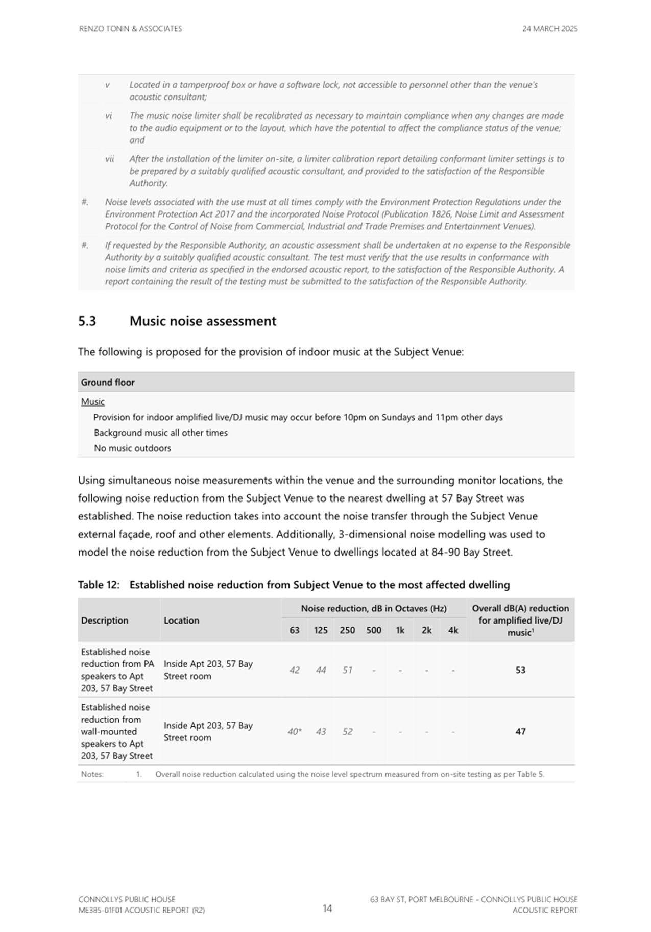
To Councillors
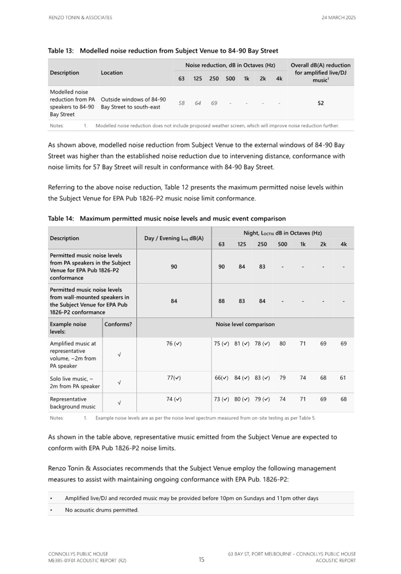
Notice is hereby given that a Planning Committee Meeting of the Port Phillip City Council will be held in and virtually via Teams on Wednesday, 23 April 2025 at 6:30pm. At their discretion, Councillors may suspend the meeting for short breaks as required.
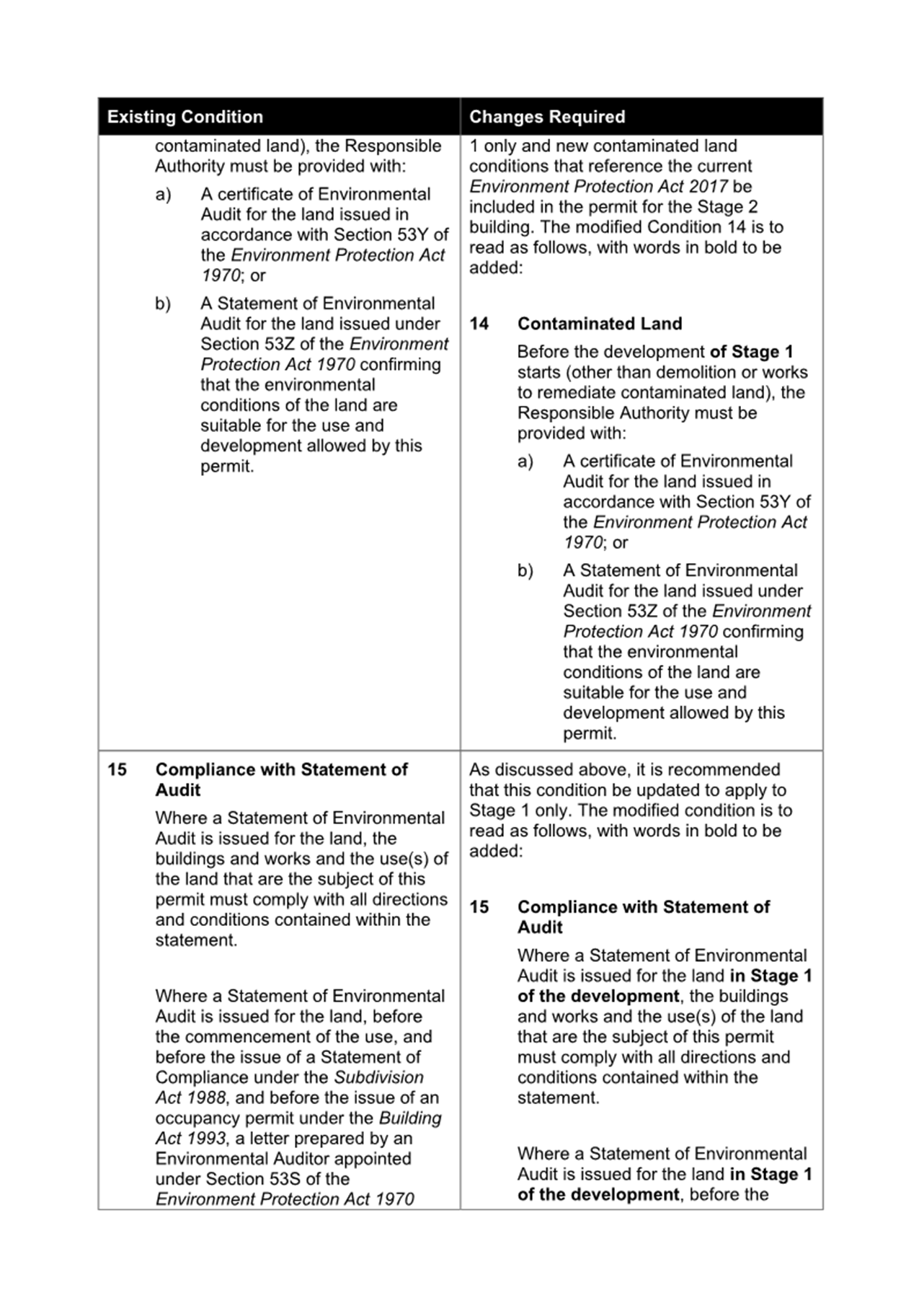
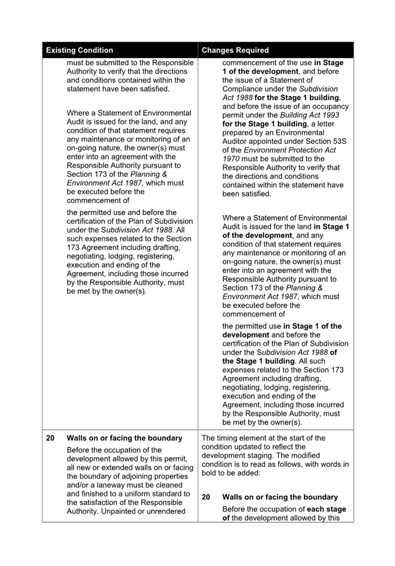
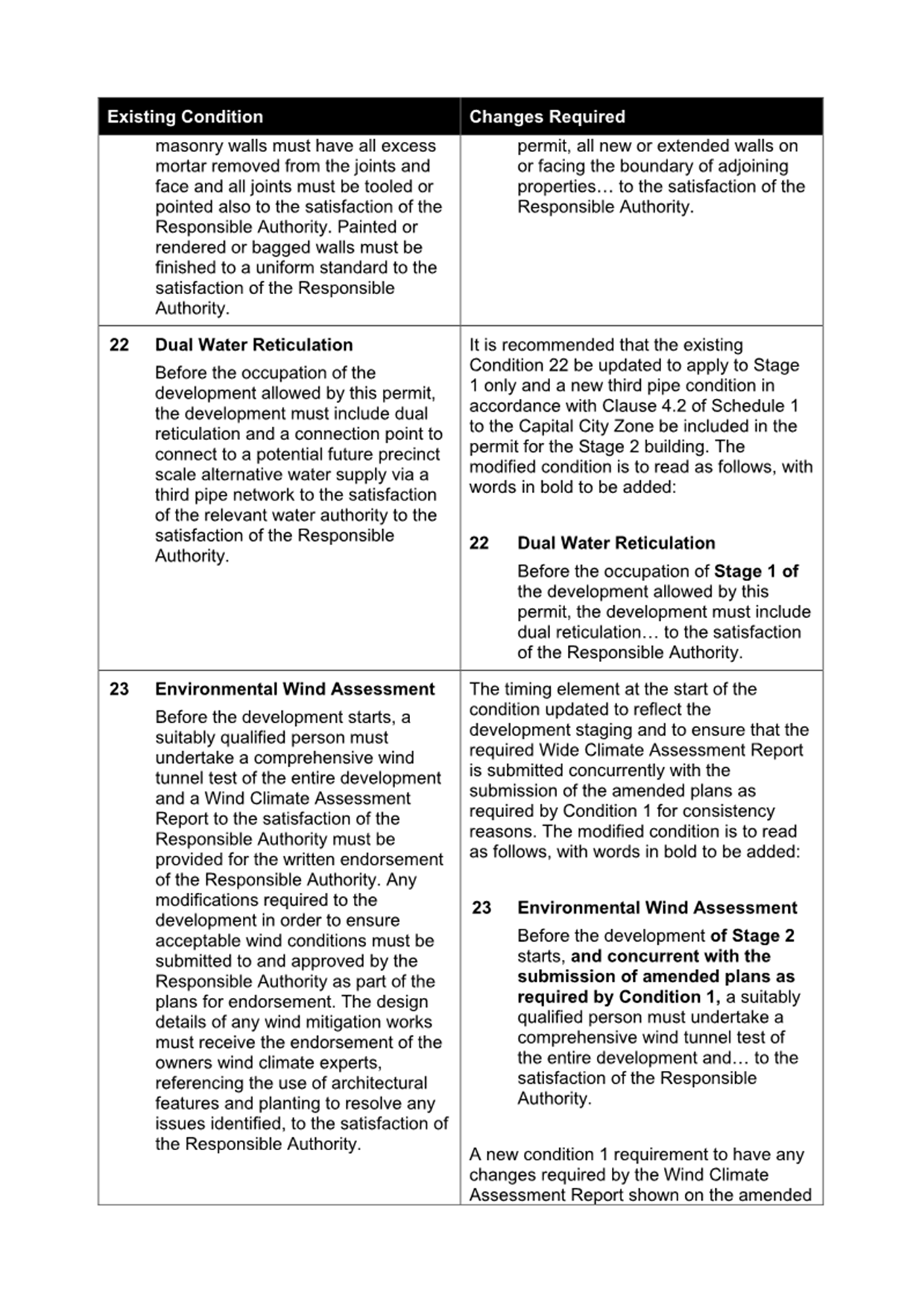
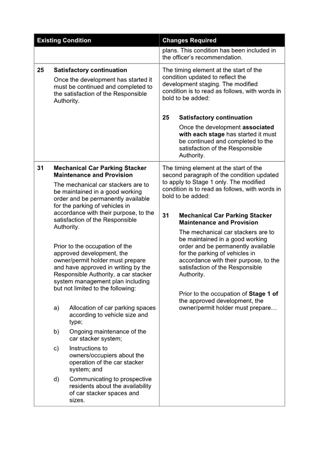
AGENDA
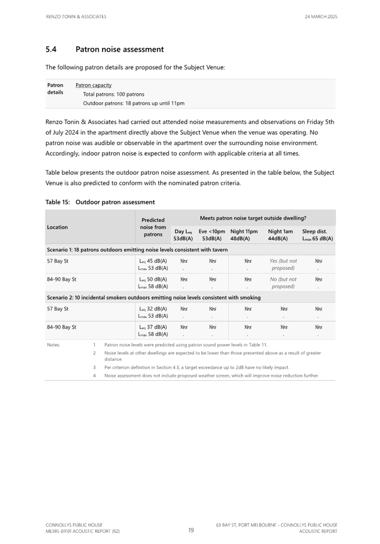
1 APOLOGIES
2 MINUTES OF PREVIOUS MEETINGS
Minutes of the Planning Committee 26 February 2025.
3 Declarations of Conflicts of Interest
4 Public Question Time and Submissions
5 Councillor Question Time
6 Presentation of Reports
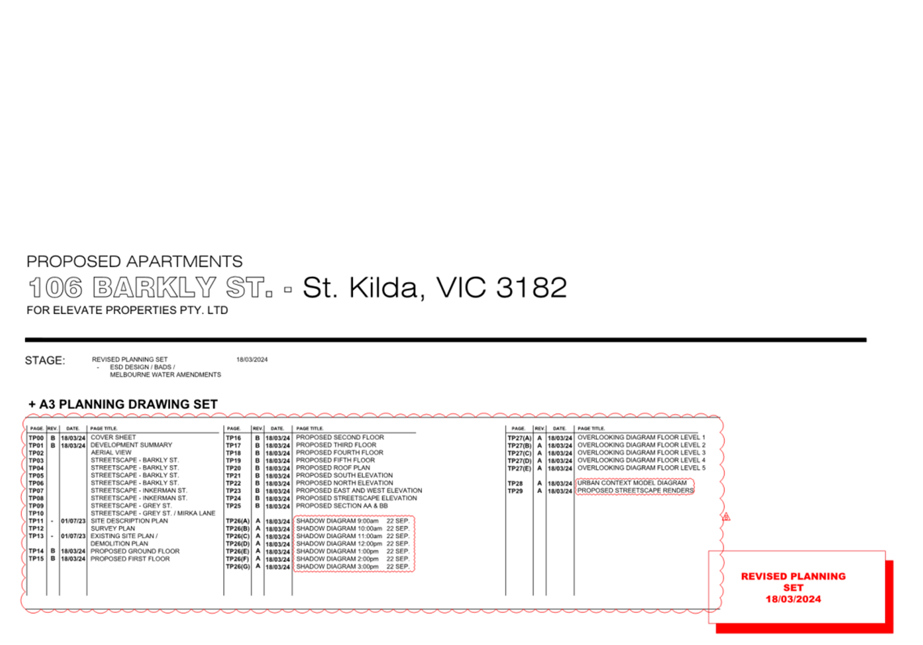
6.1 106 Barkly Street, St Kilda - 757/2018....................................... 5
6.2 63 Bay Street, Port Melbourne - 1324/2006/D............................. 111
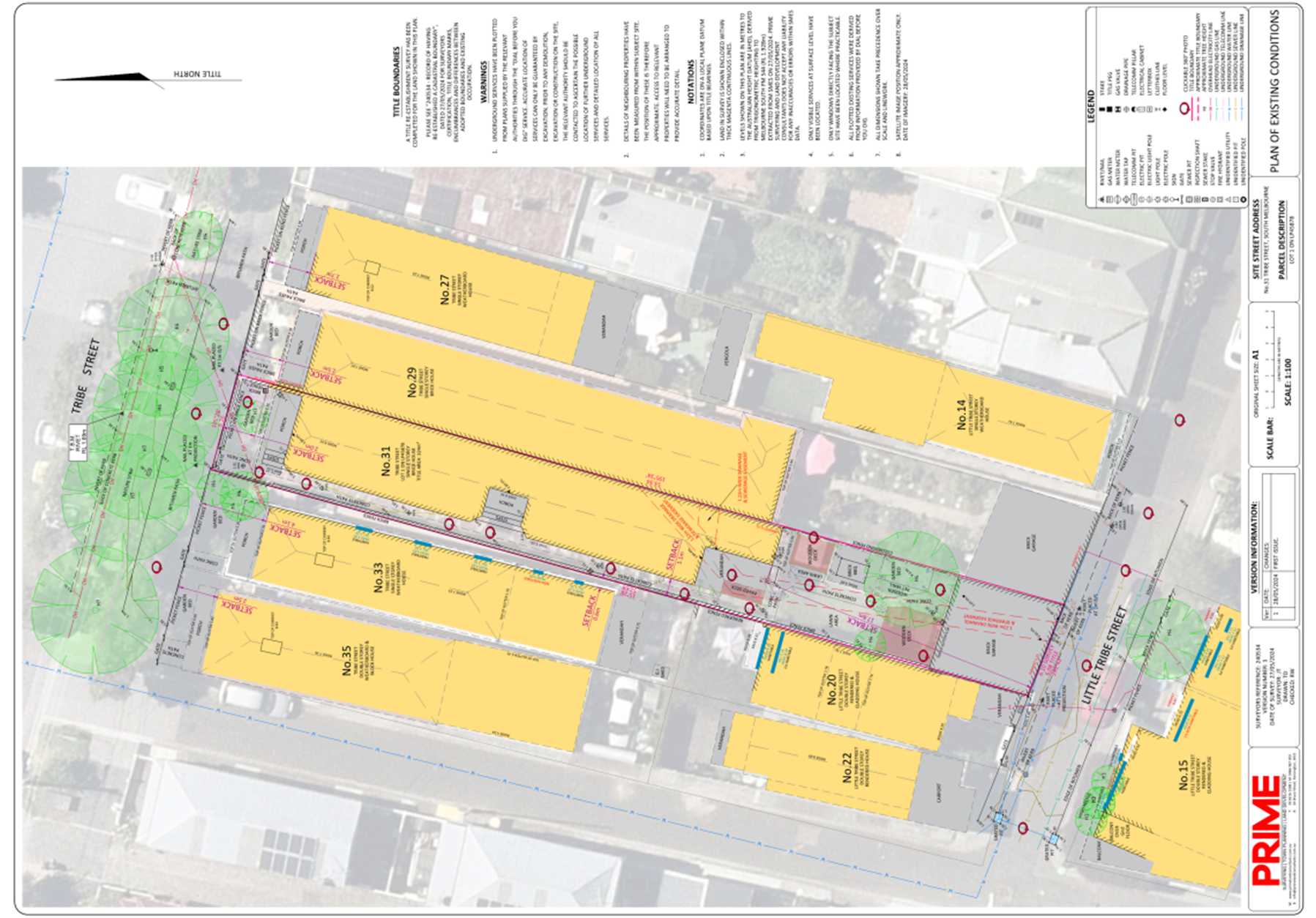
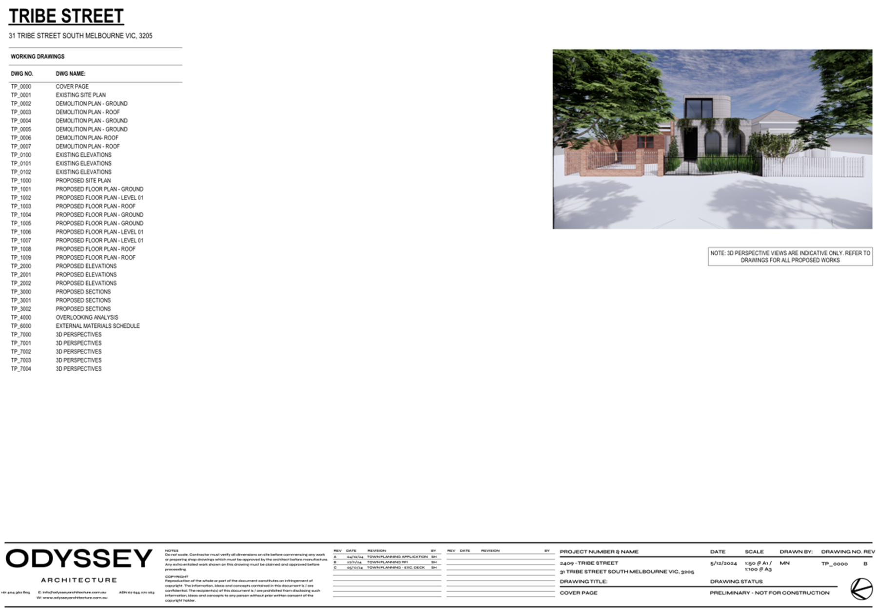
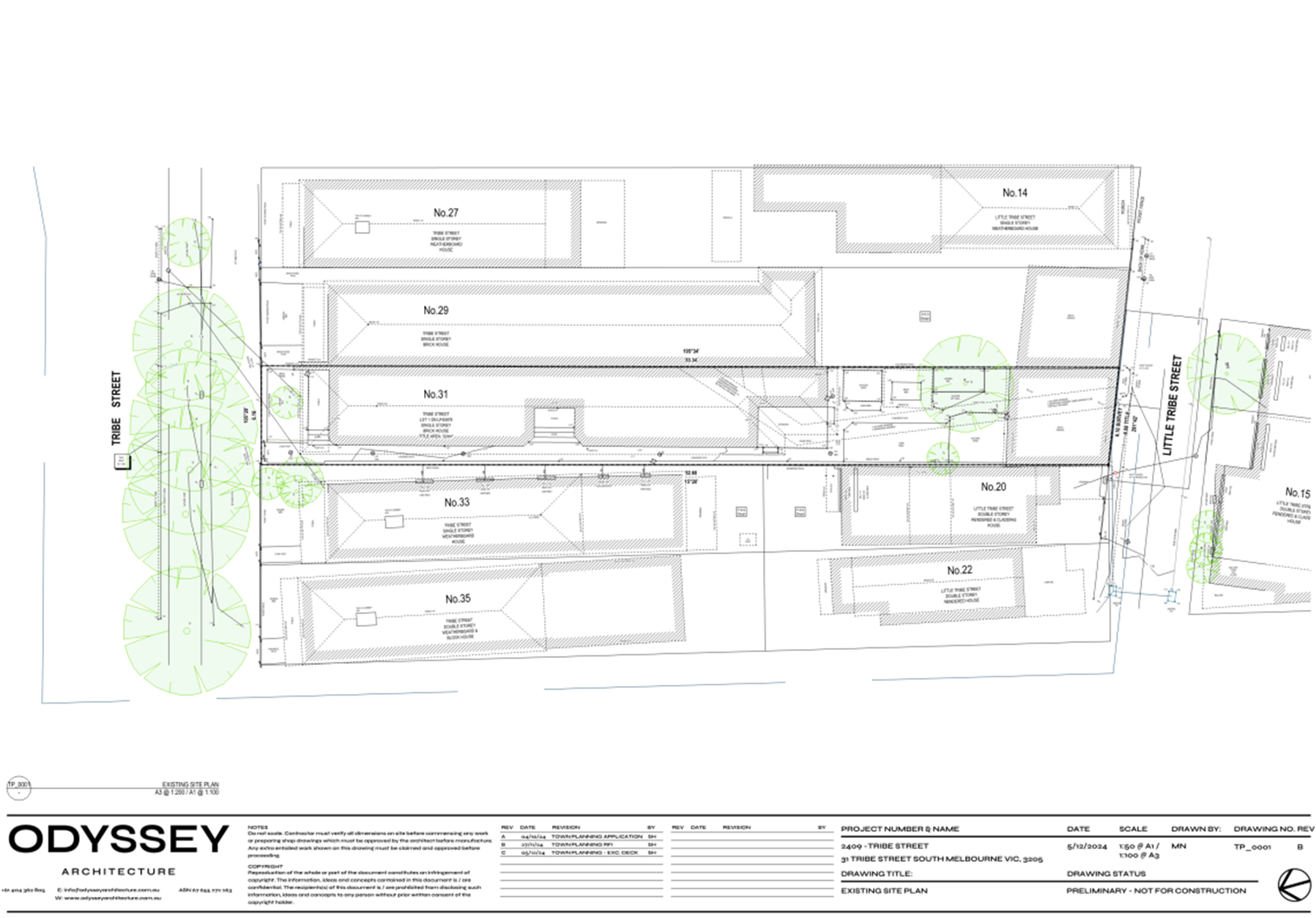
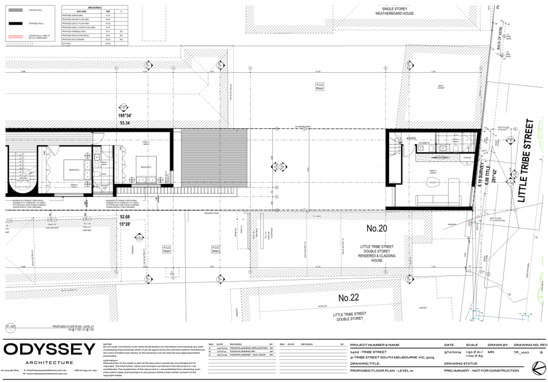
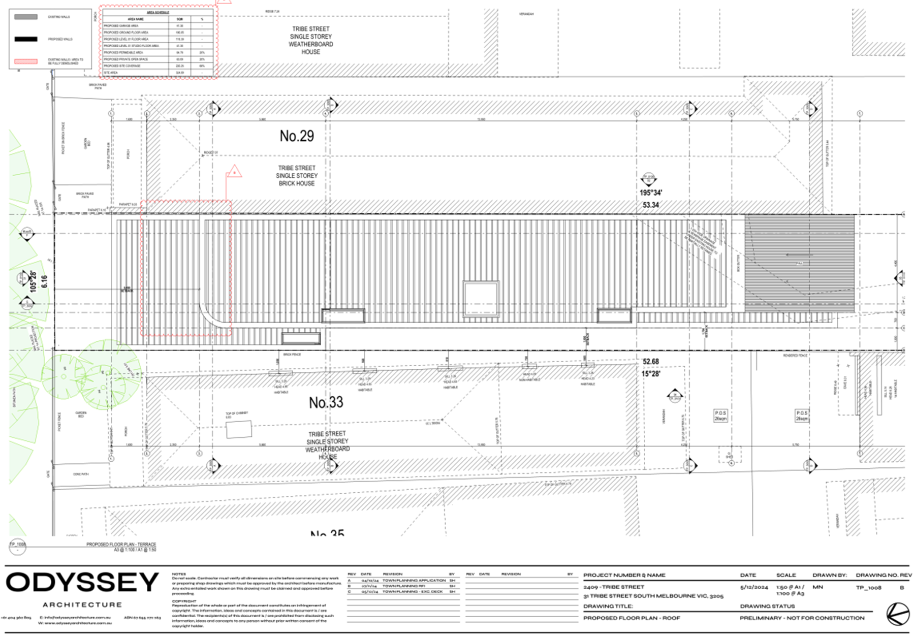
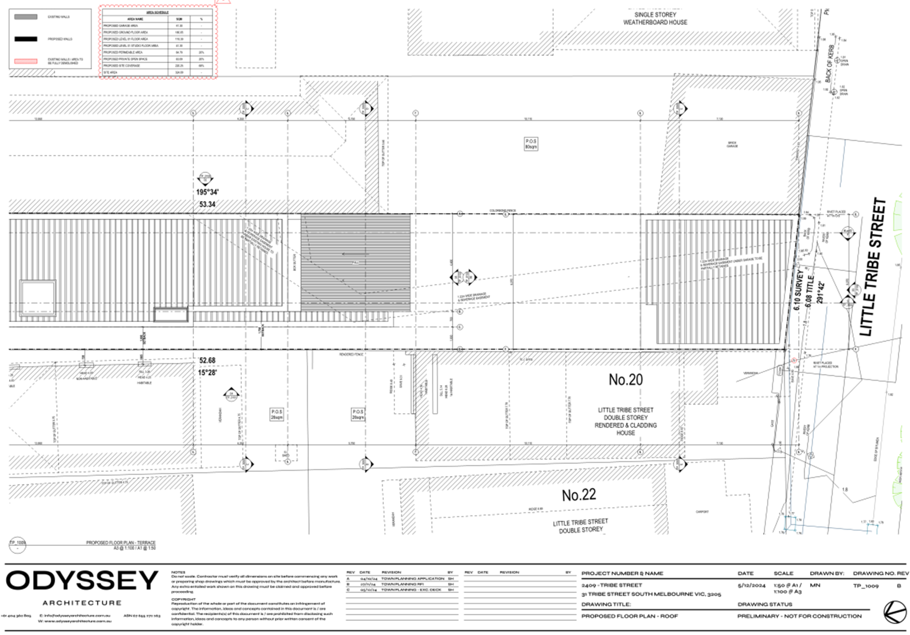
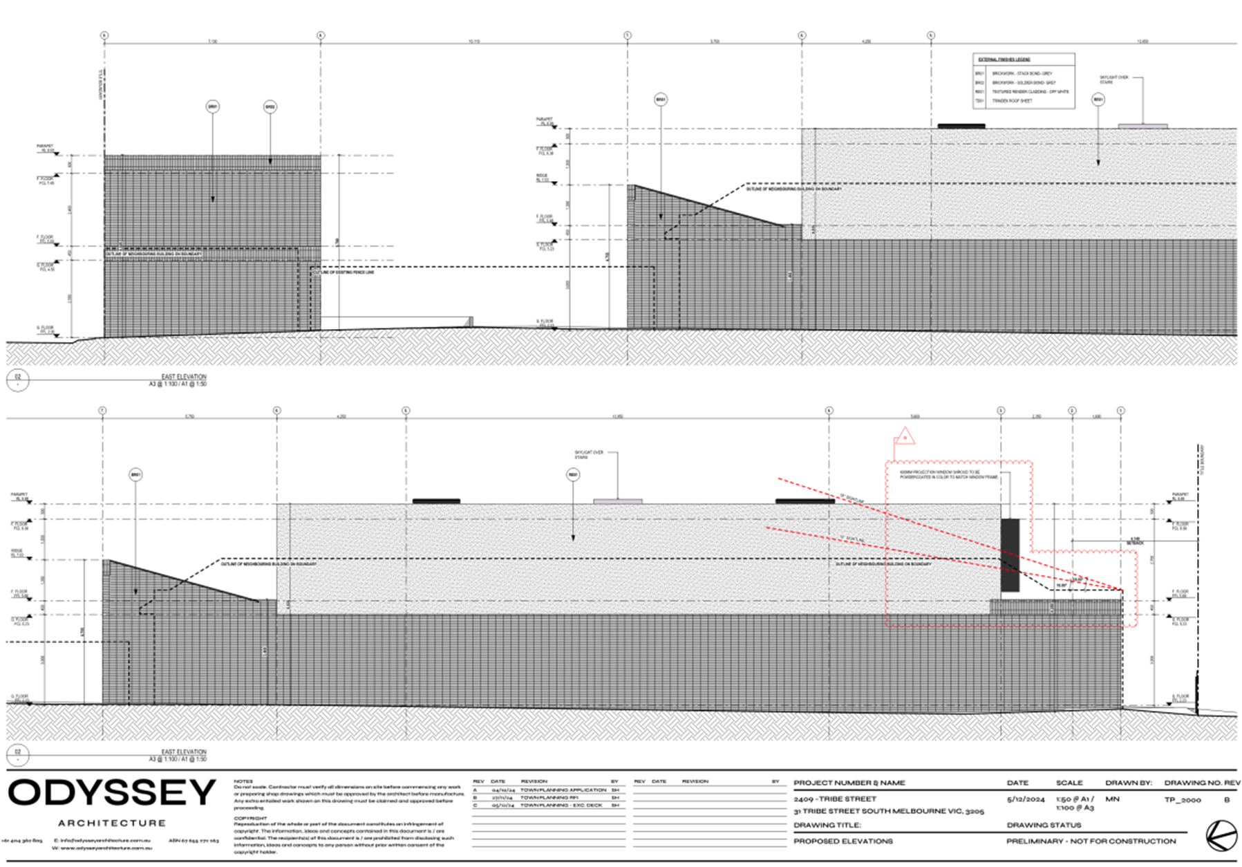
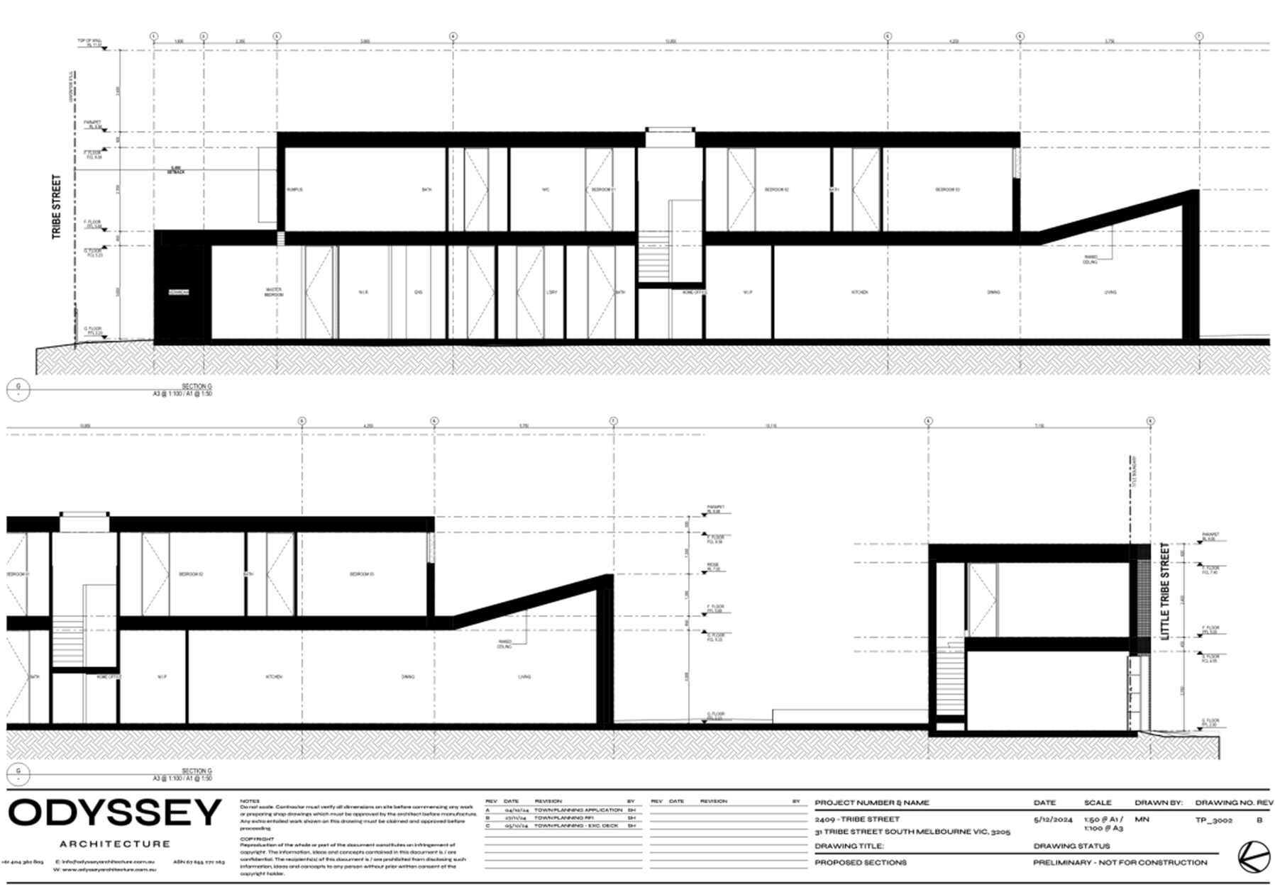
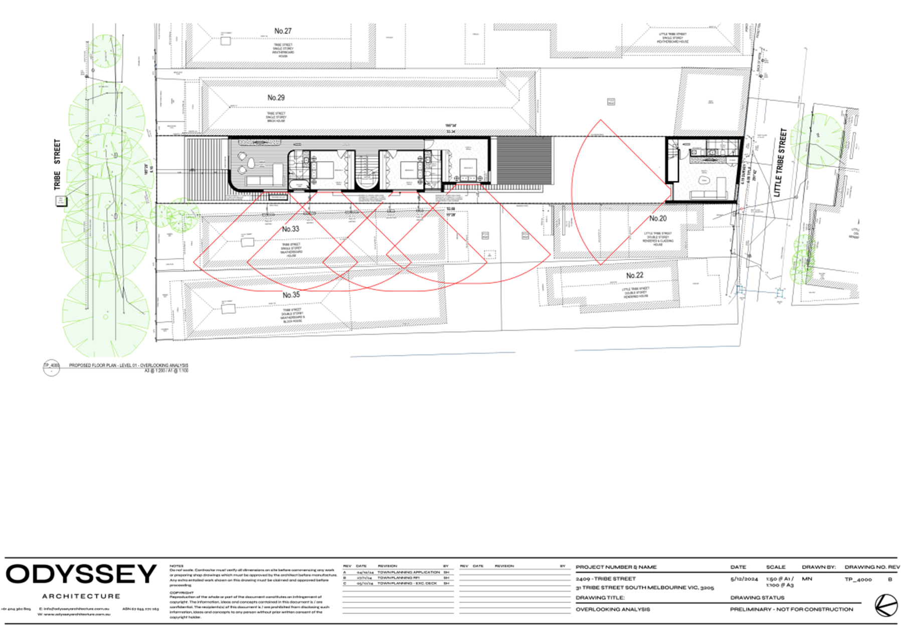
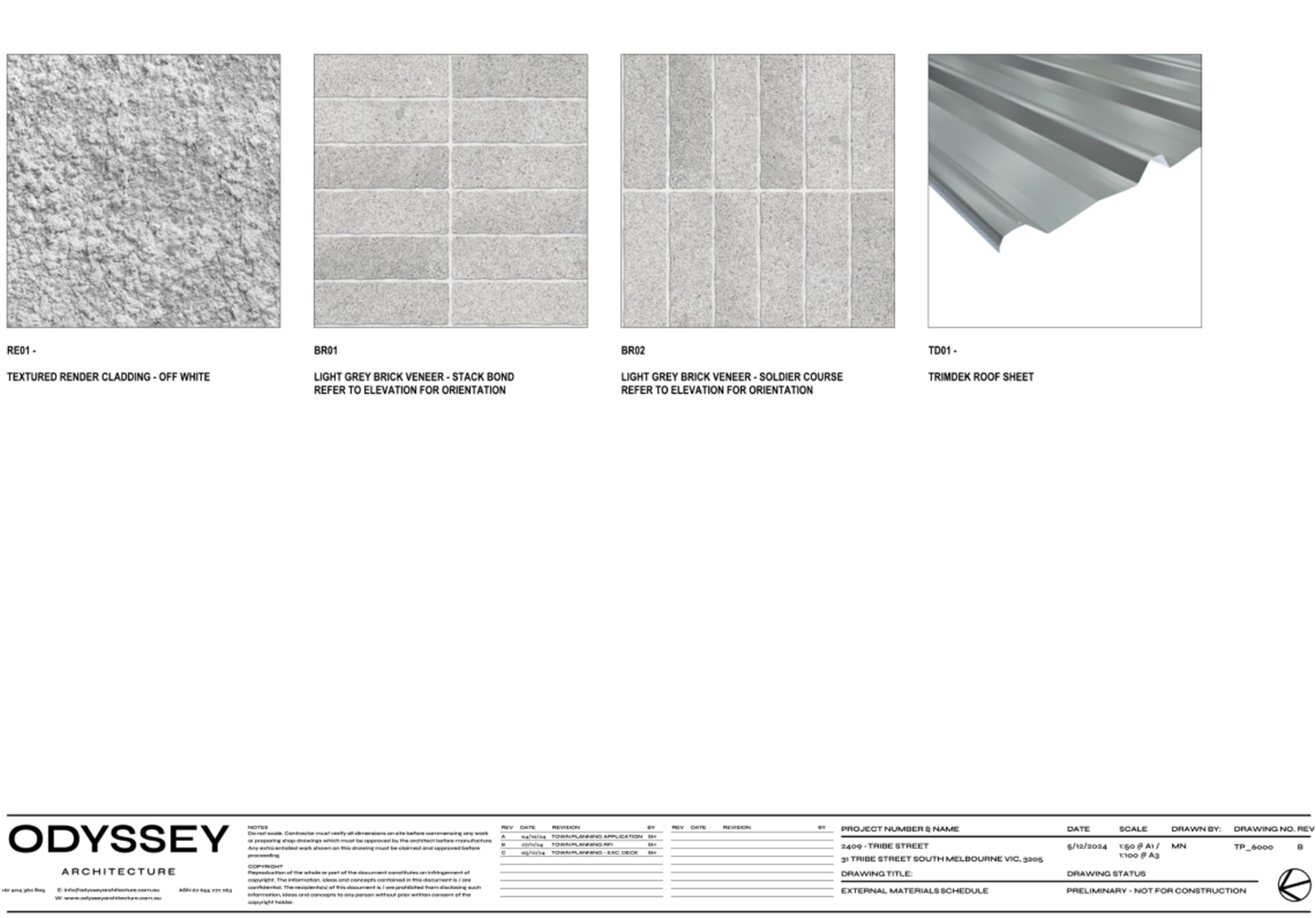
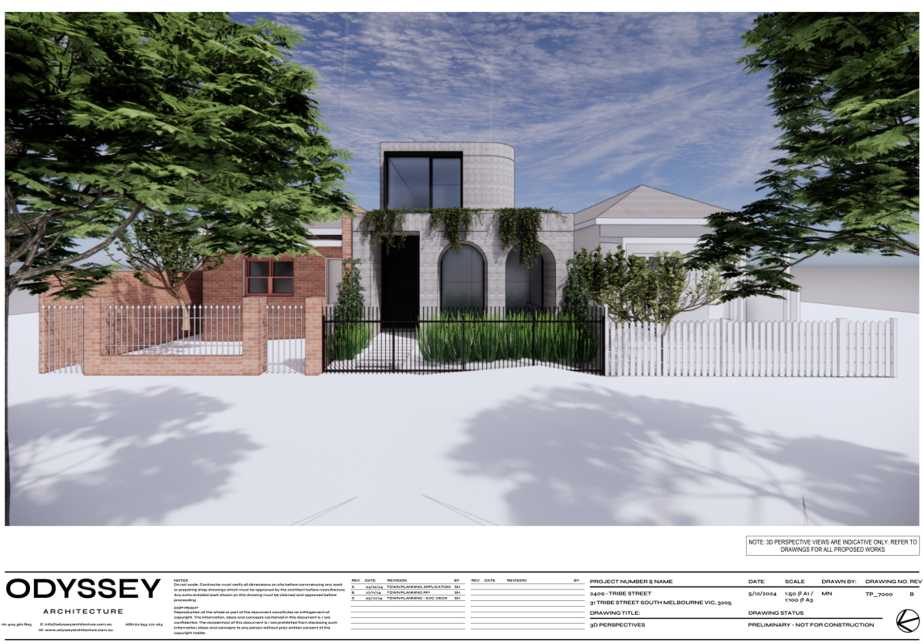
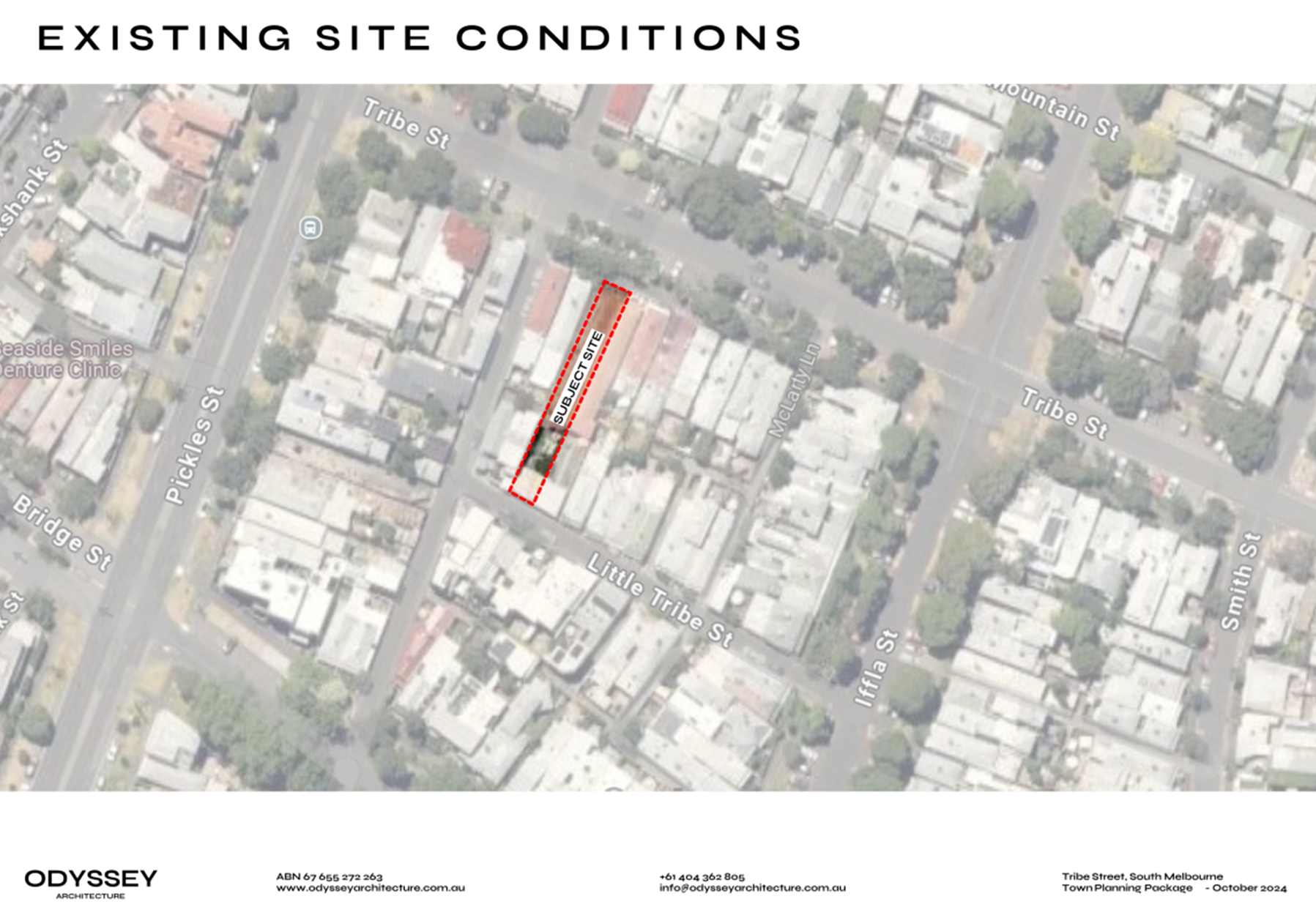
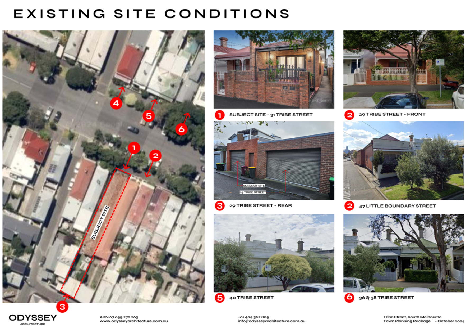
6.3 31 Tribe Street, South Melbourne - PDPL/00565/2024..................... 266
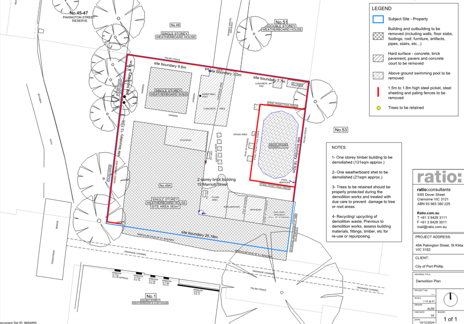
6.4 49A Pakington Street, St Kilda - PDPL/00073/2025..................... 330
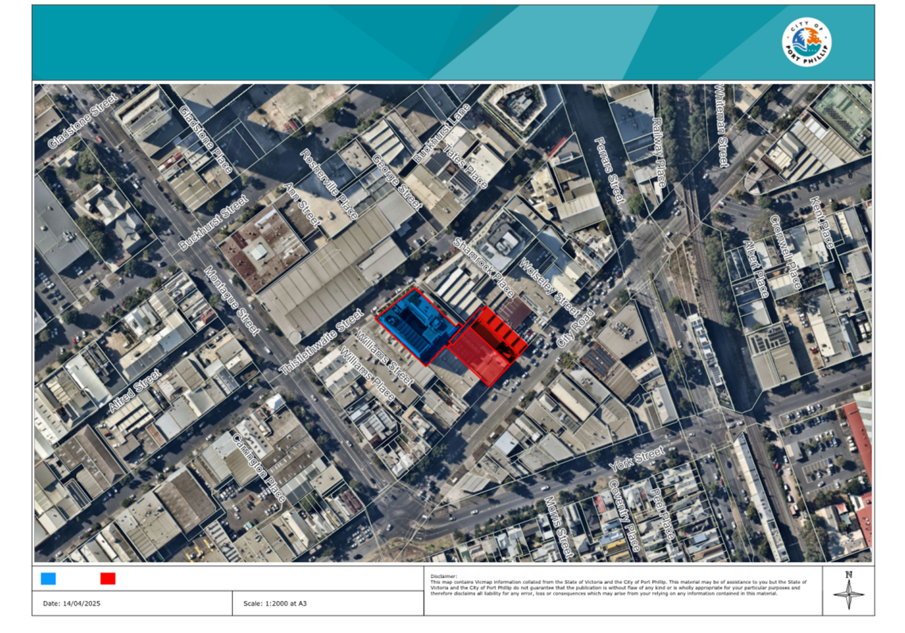
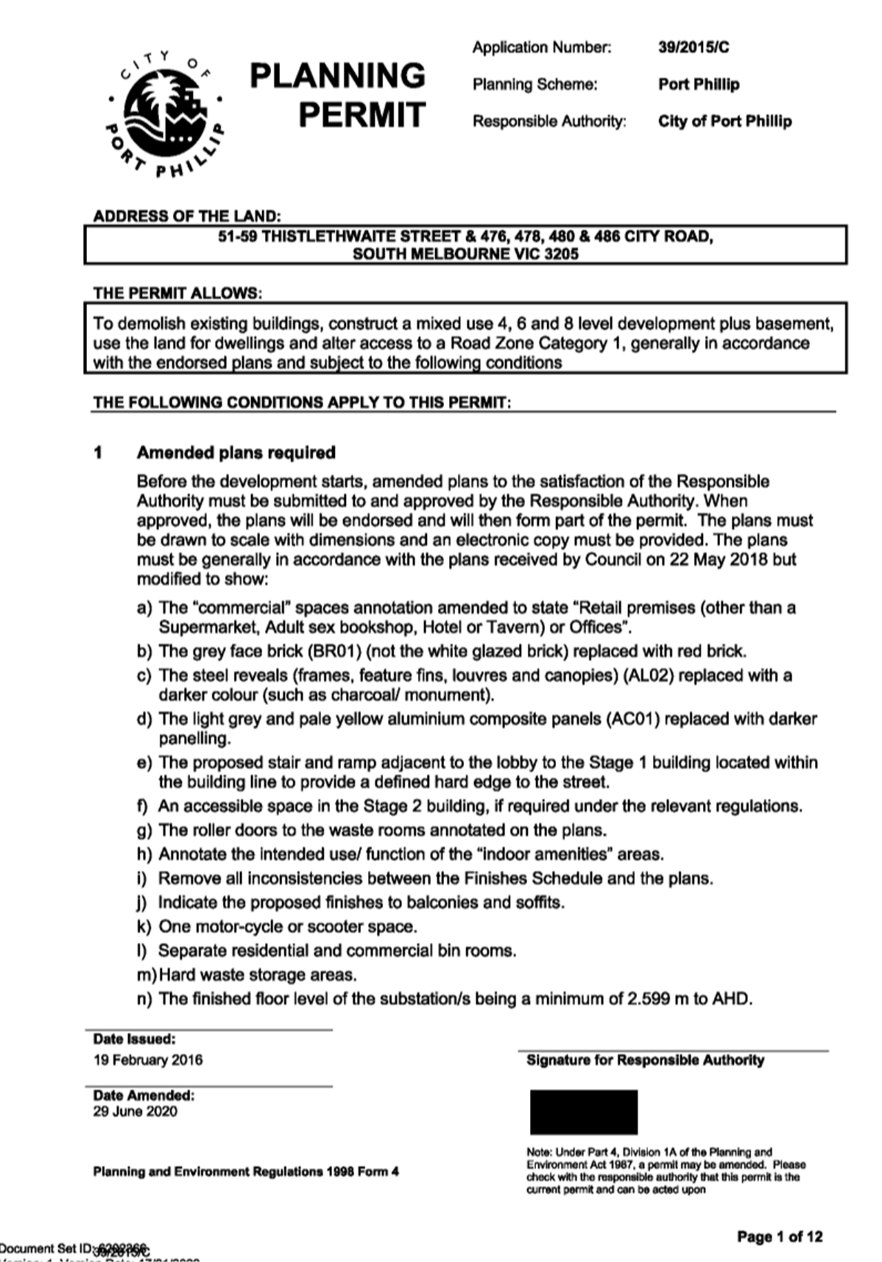
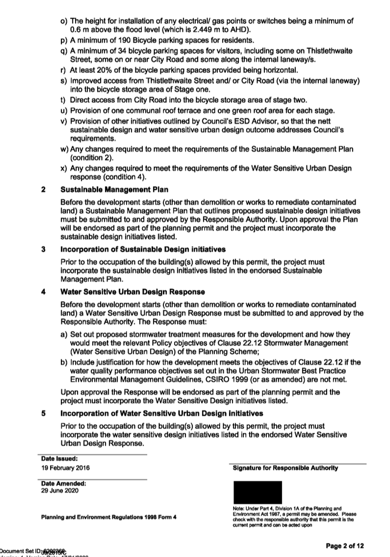
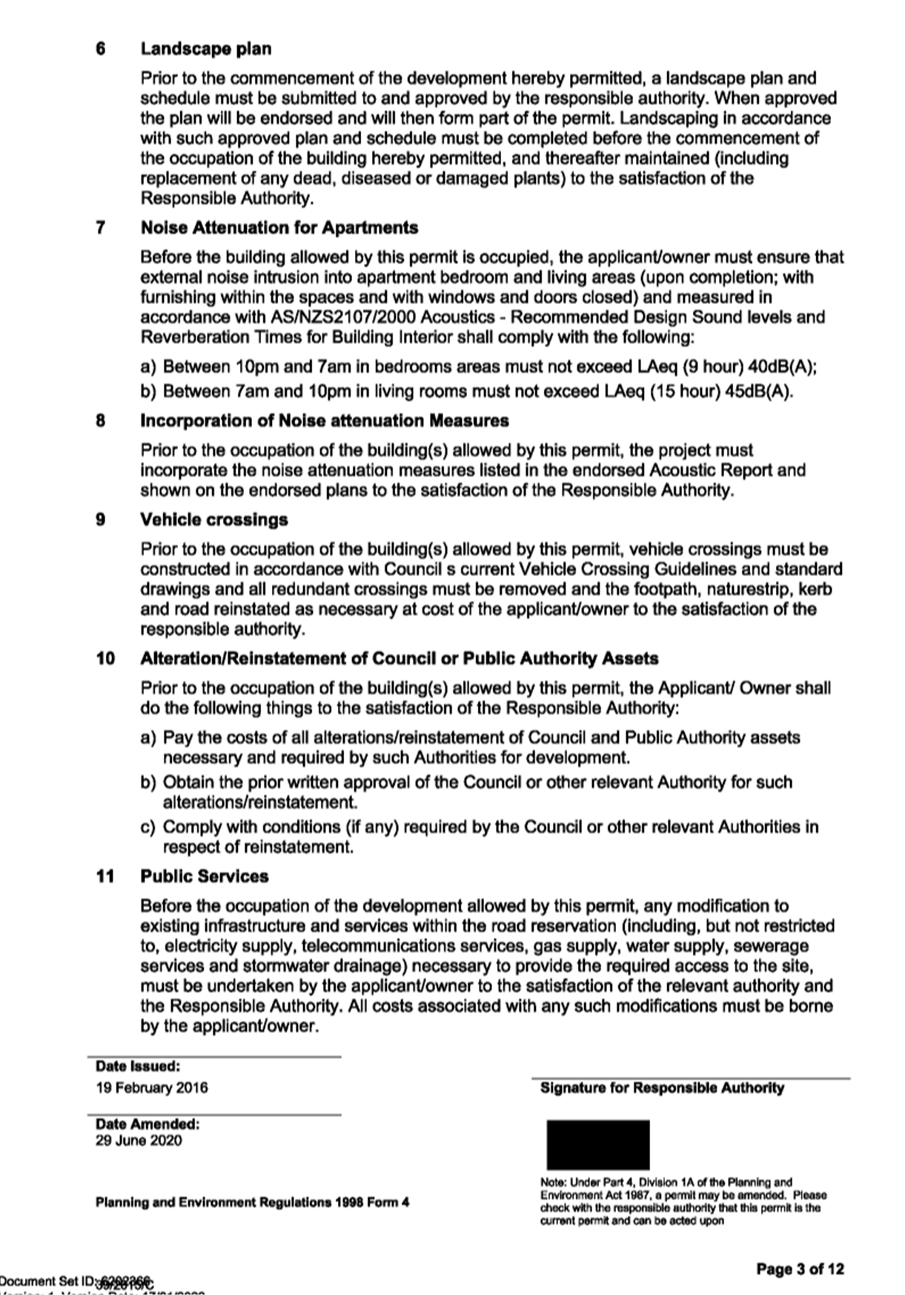
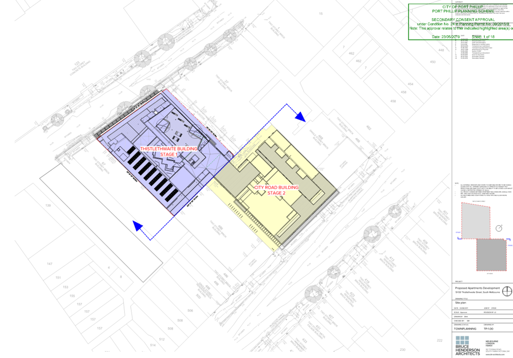
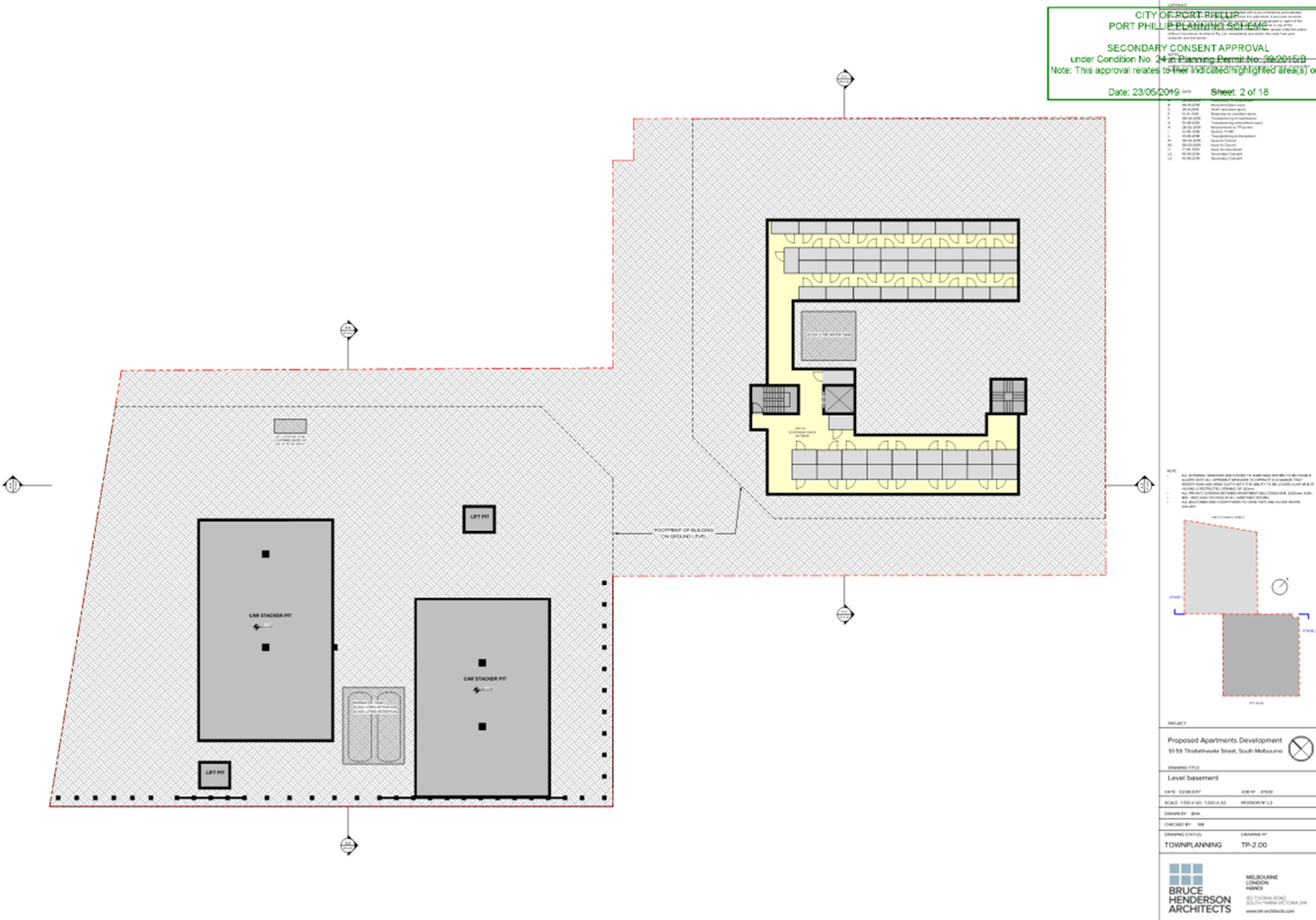
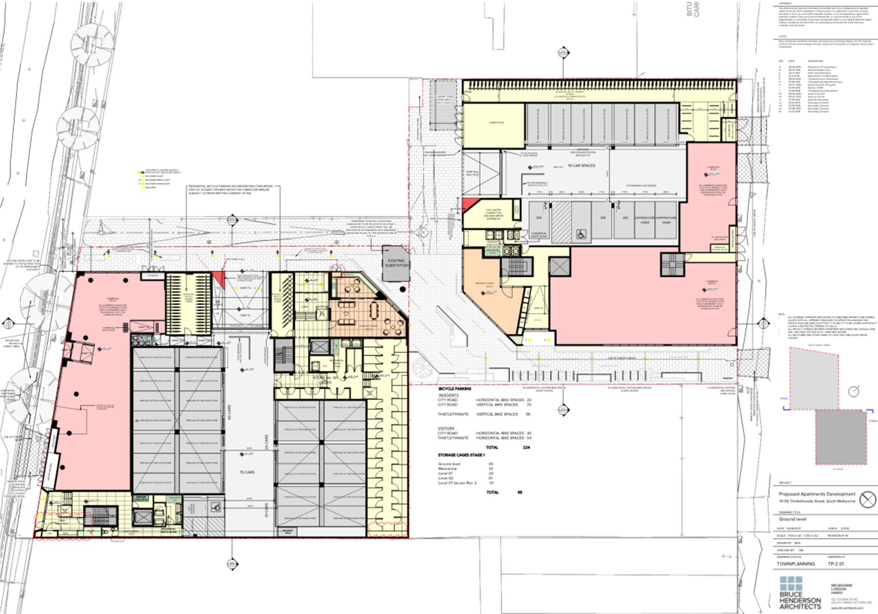
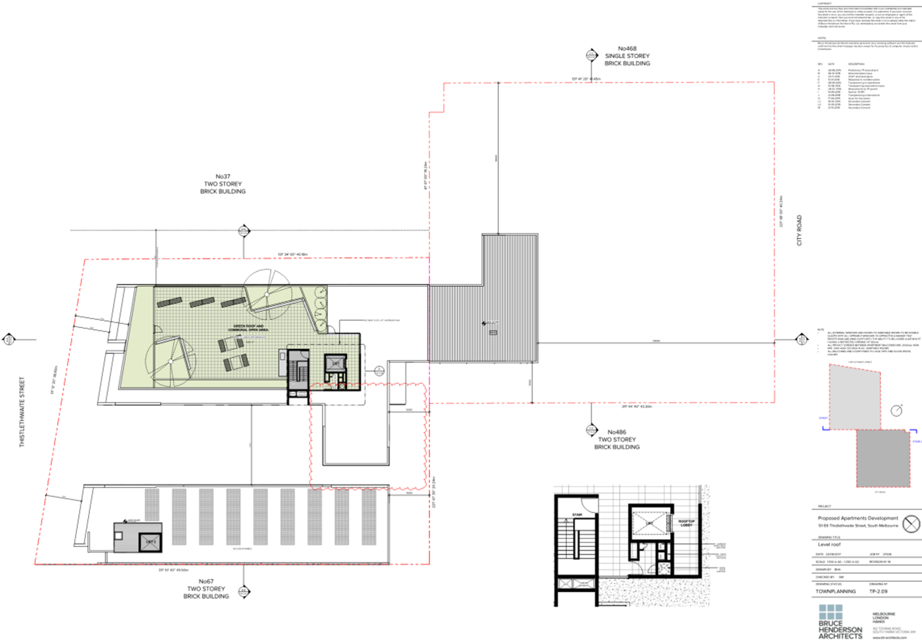
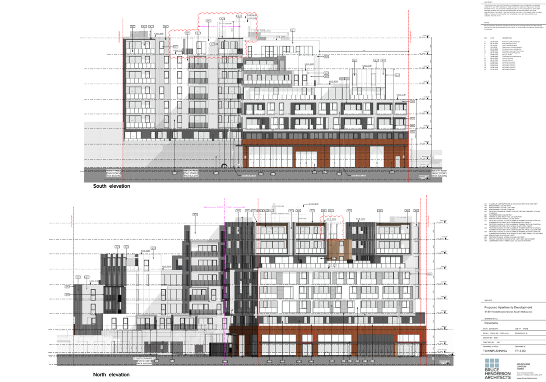
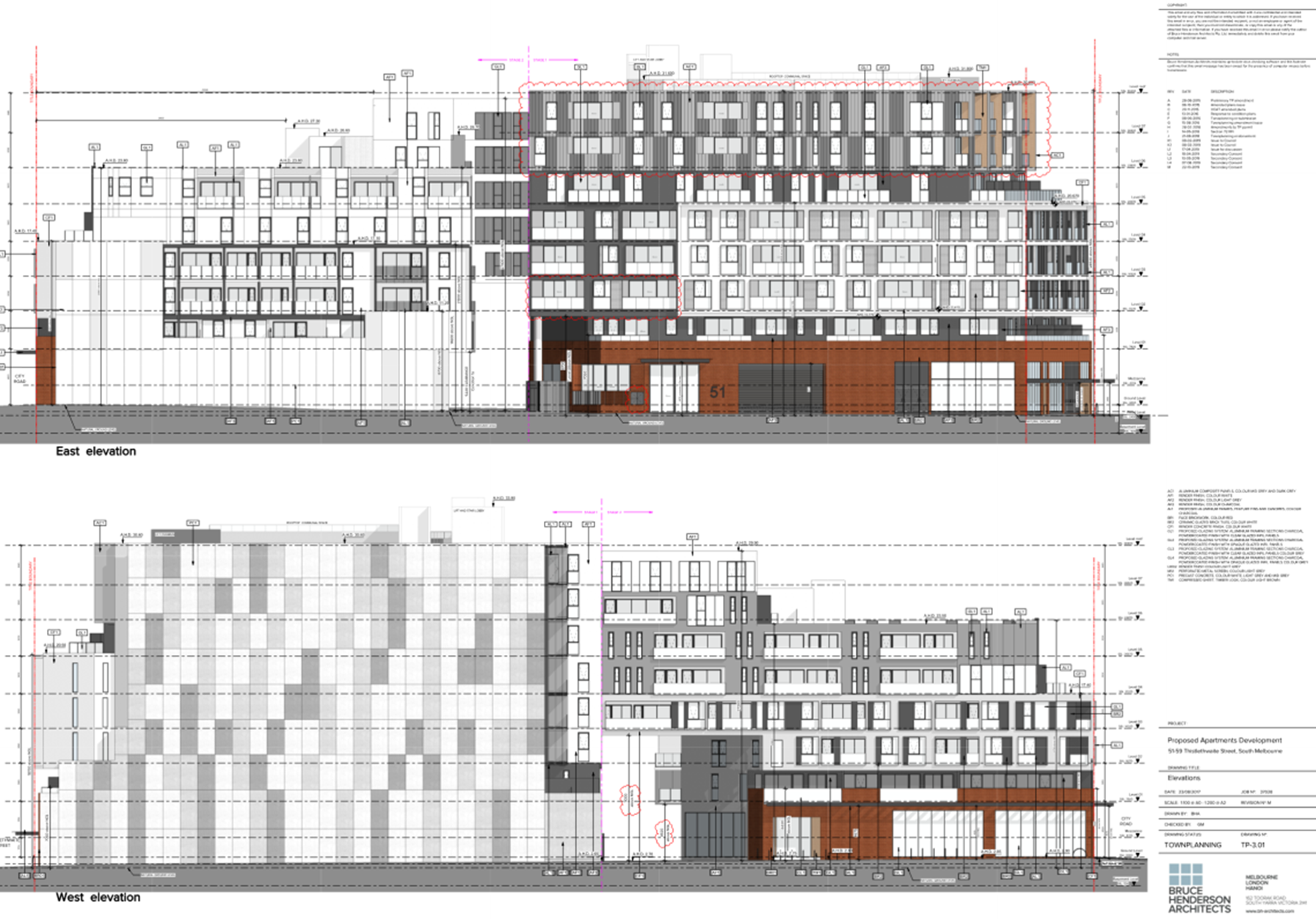
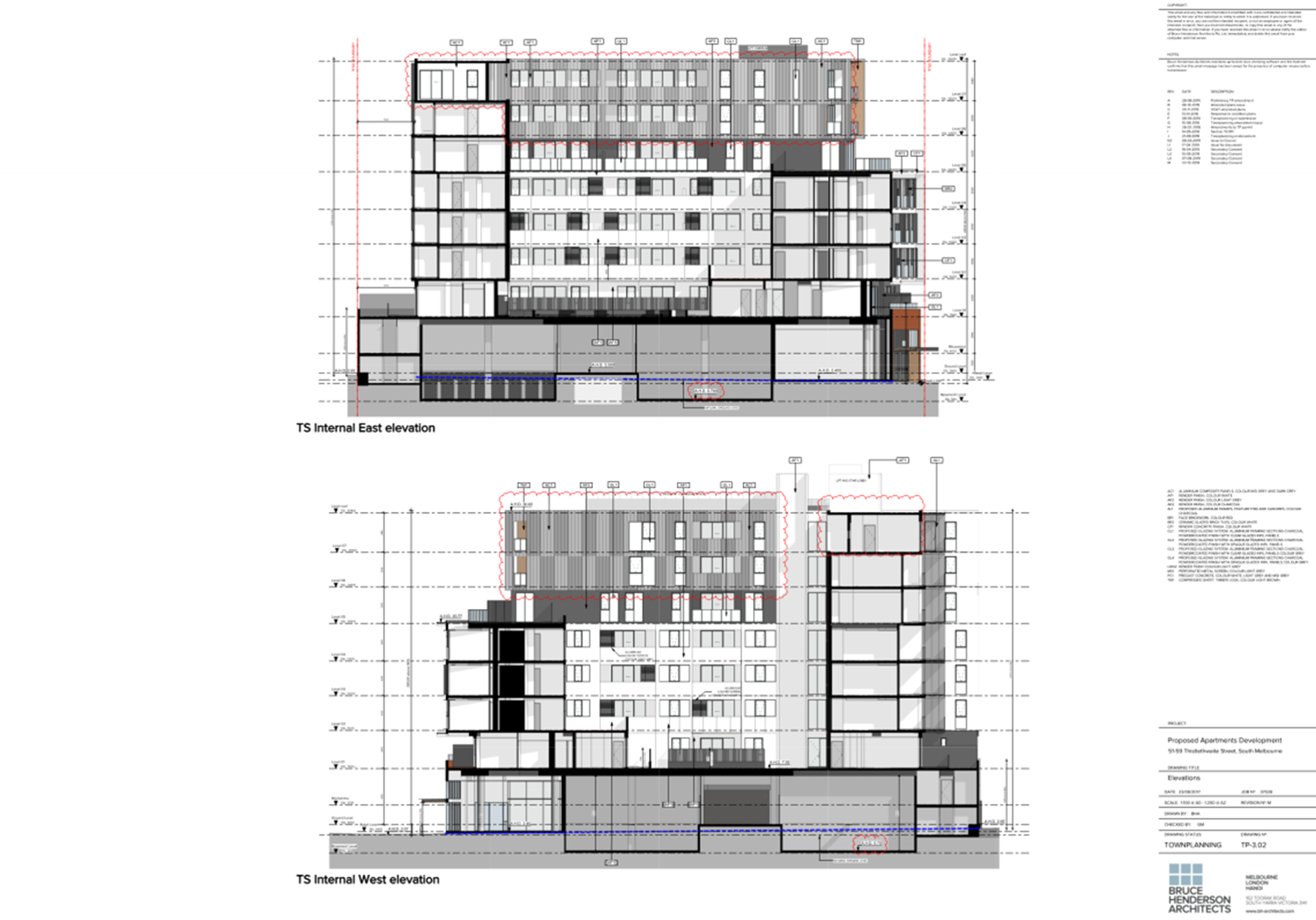
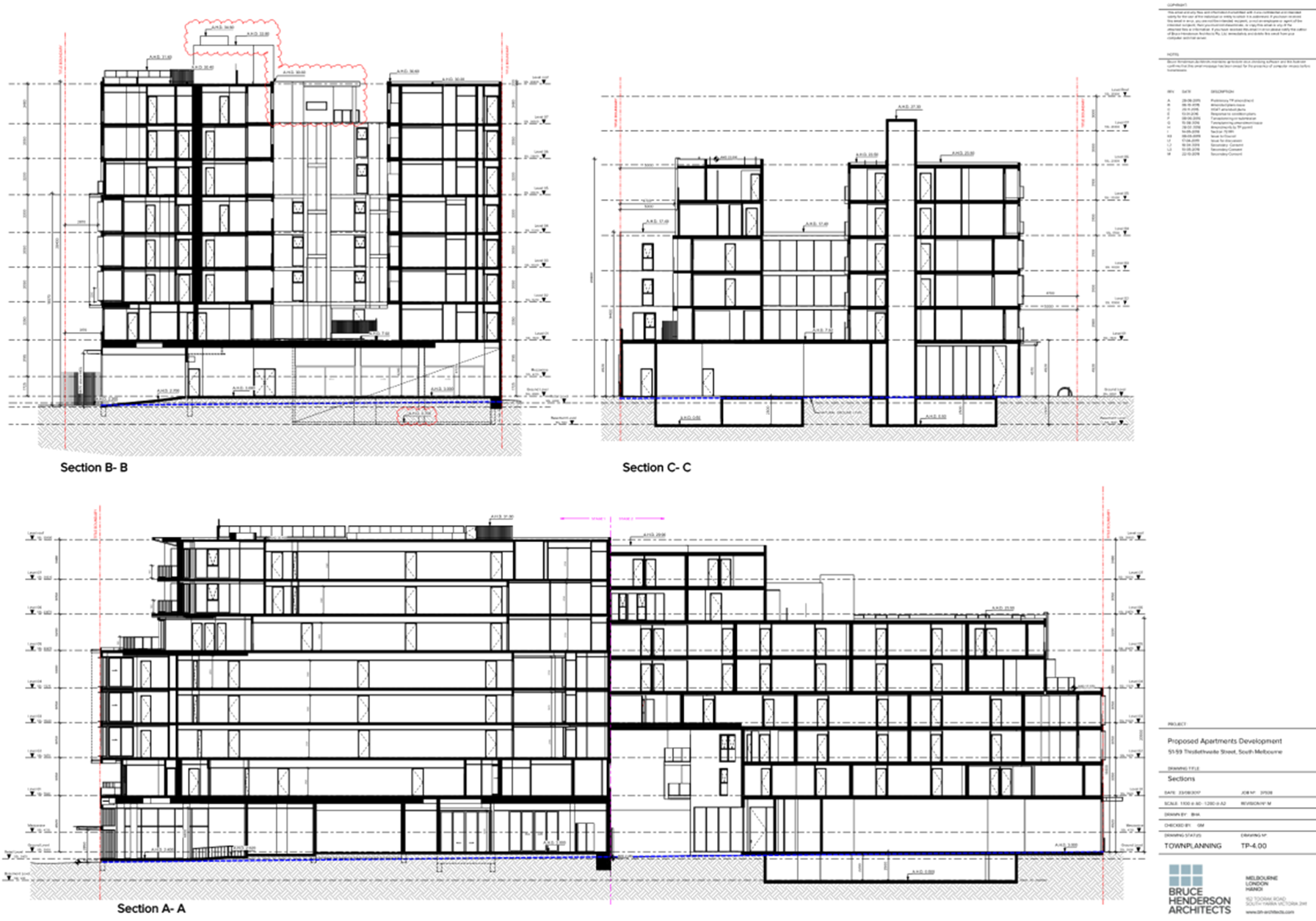
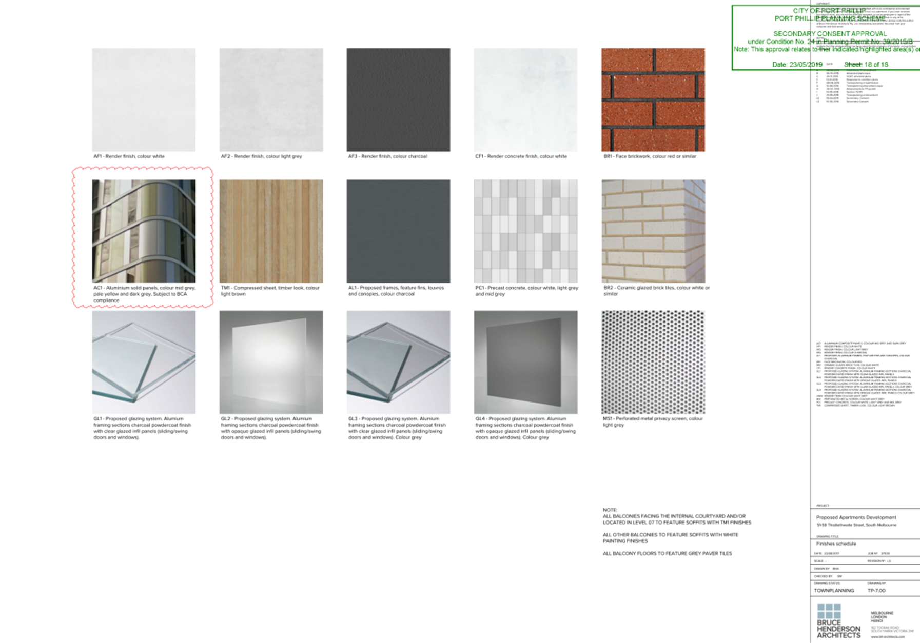
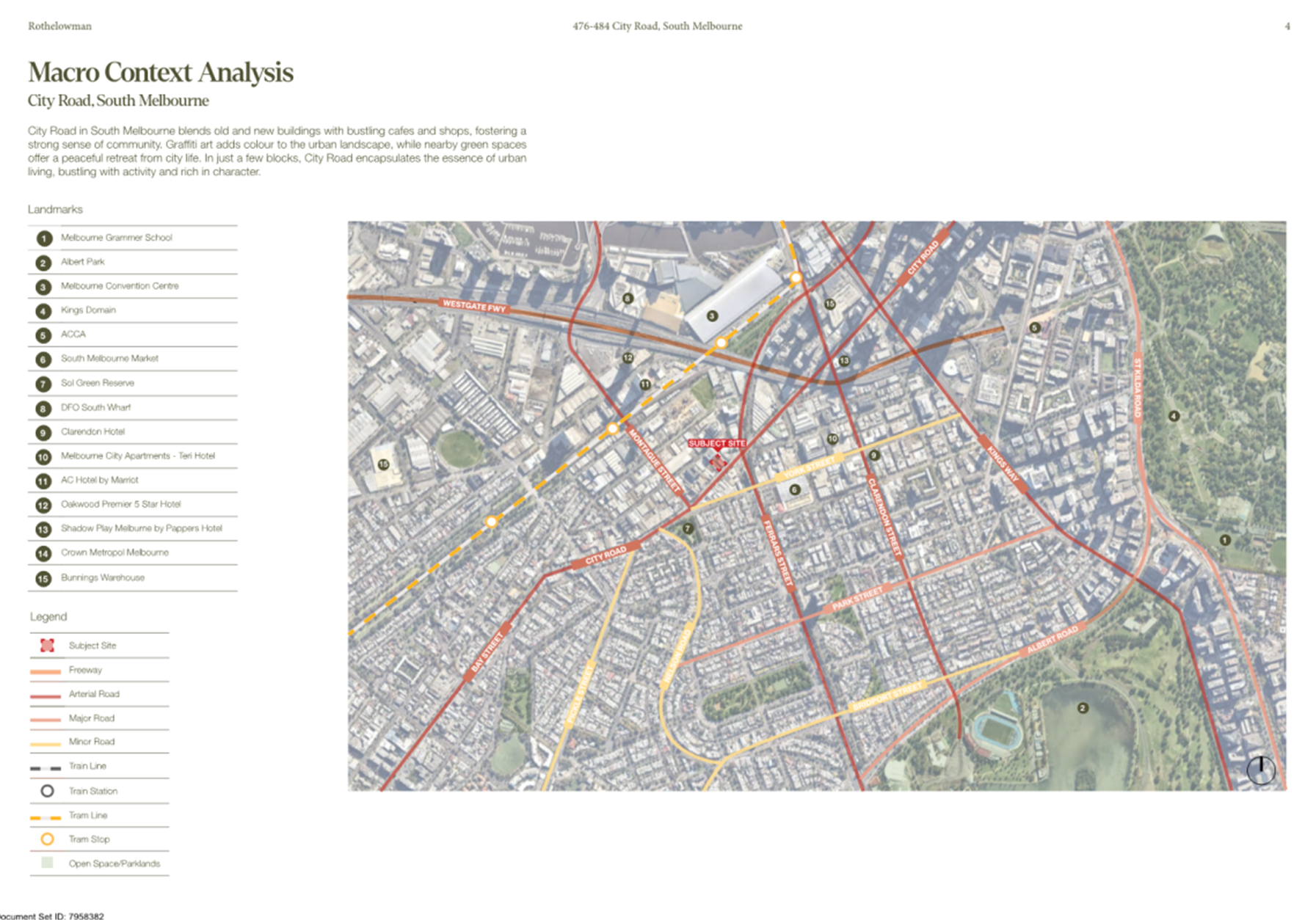
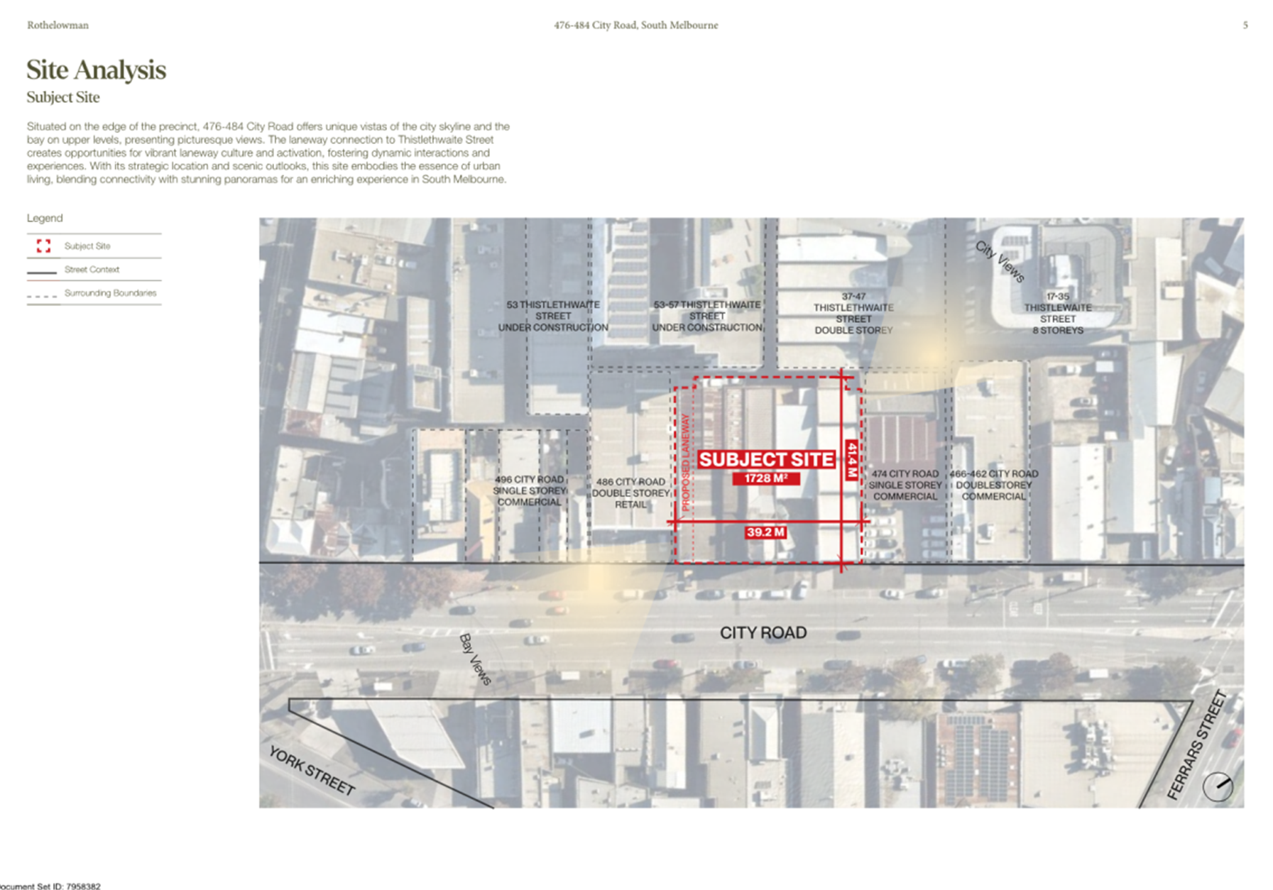
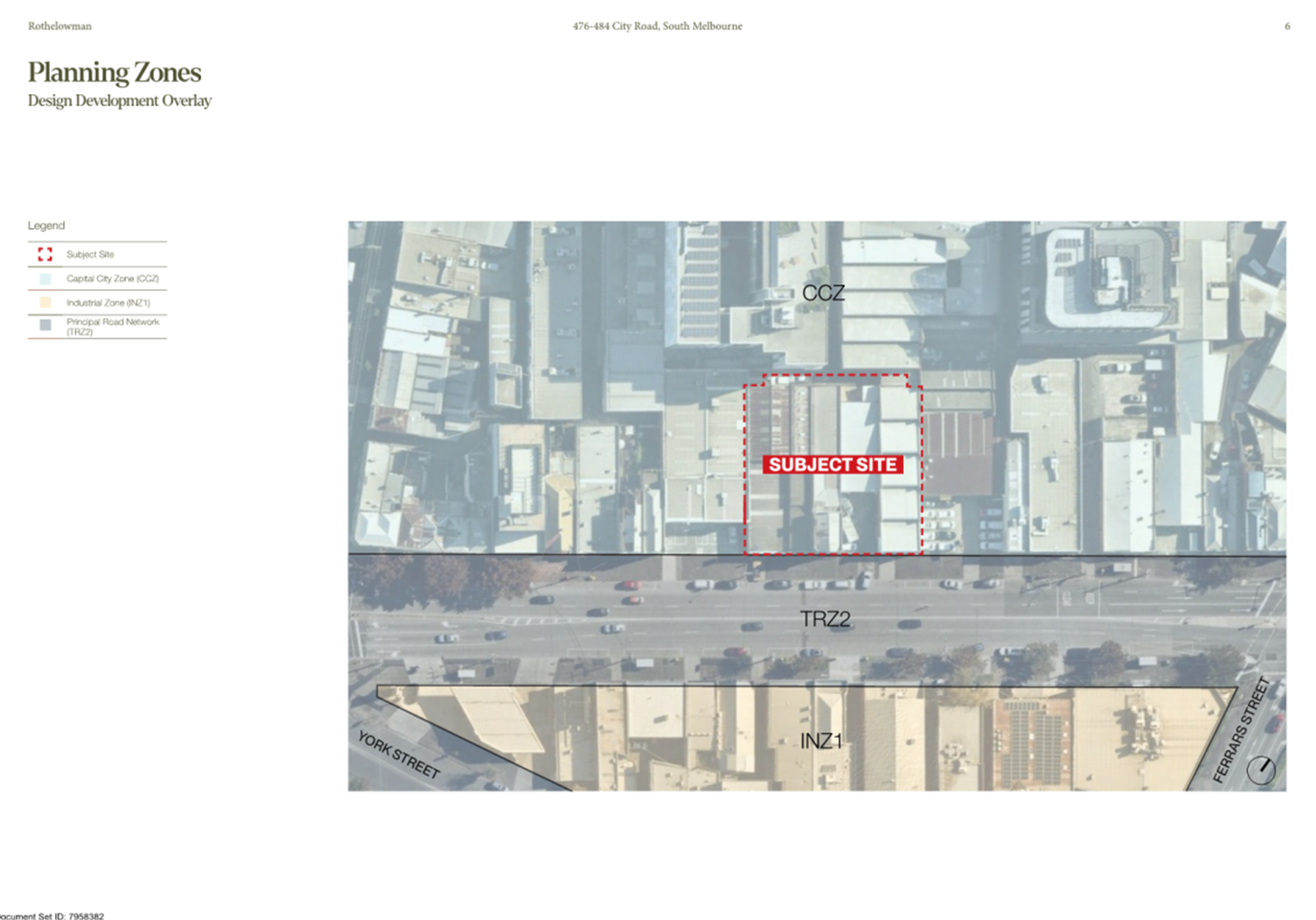
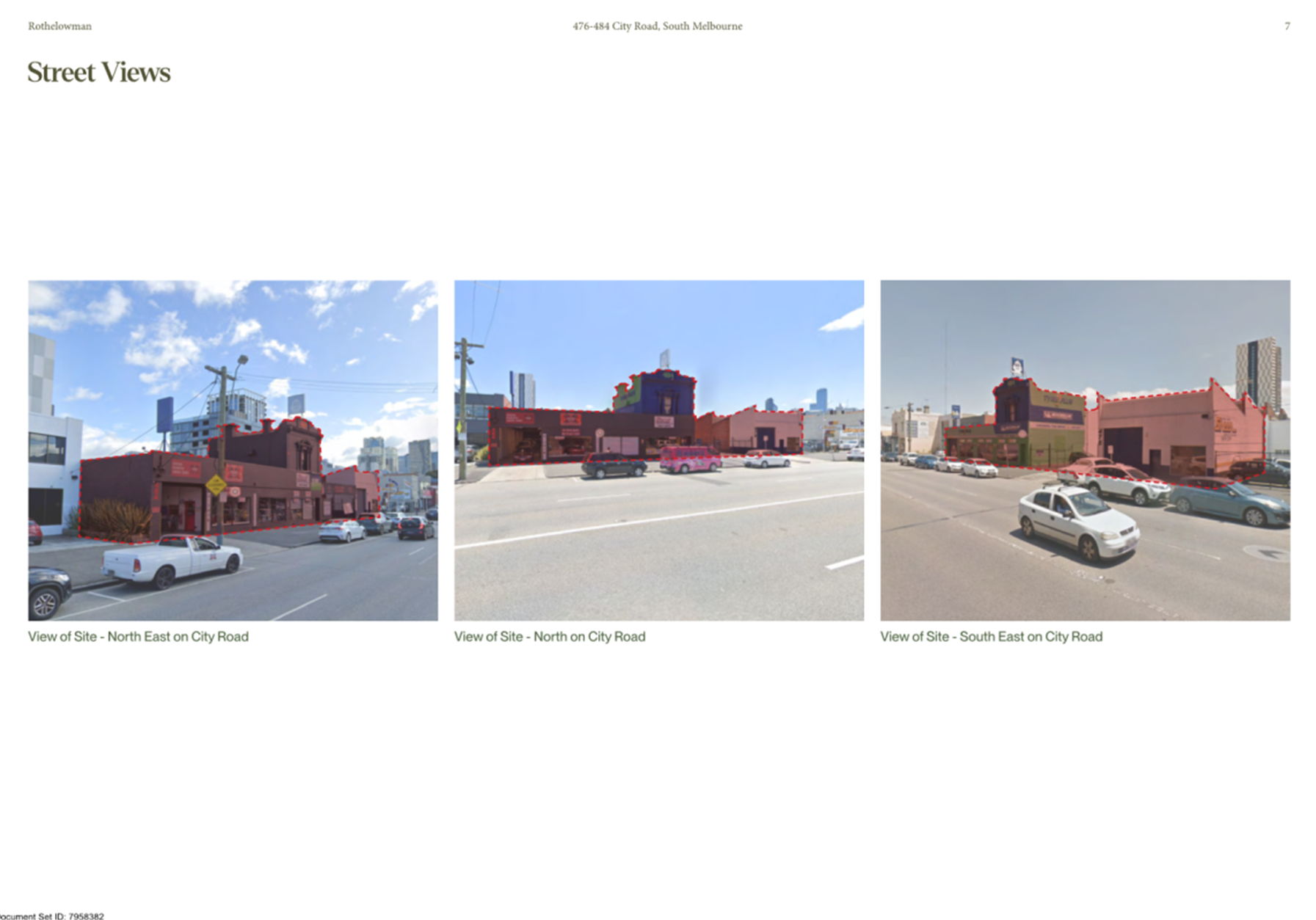
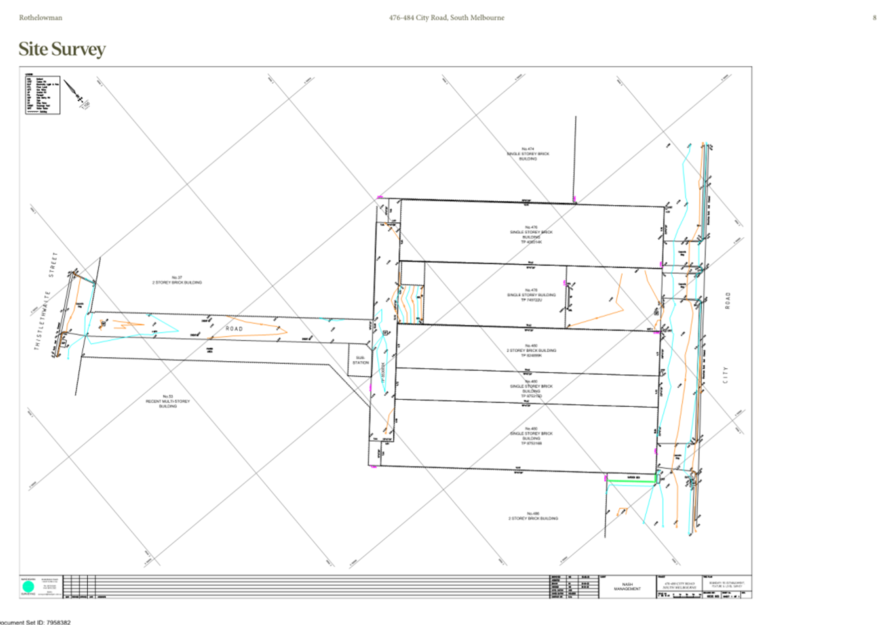
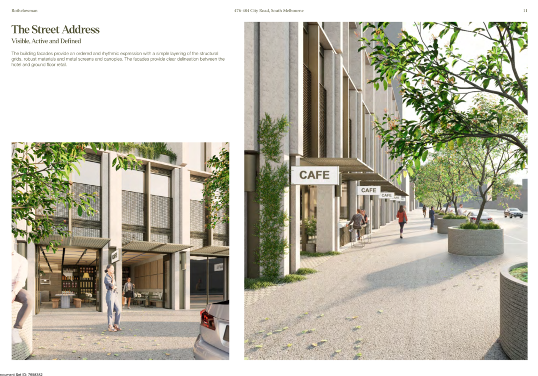
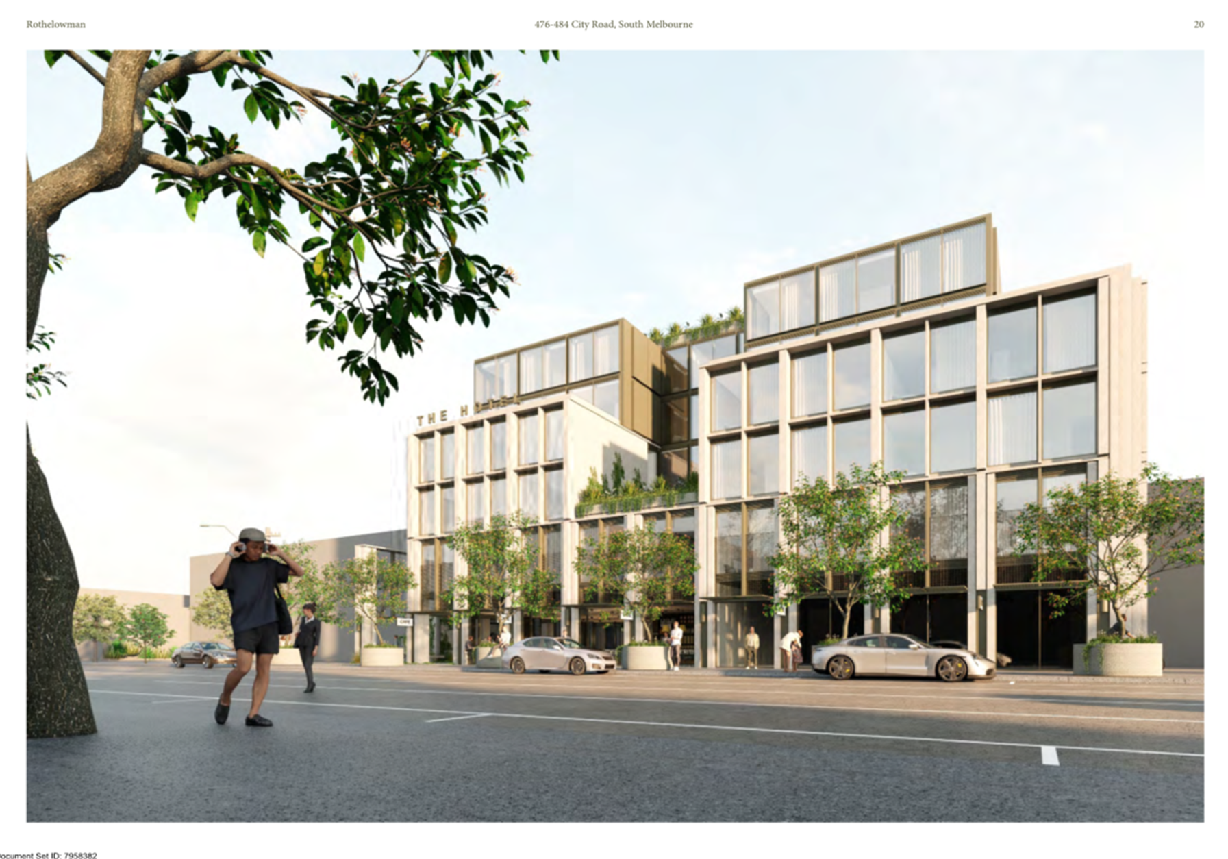
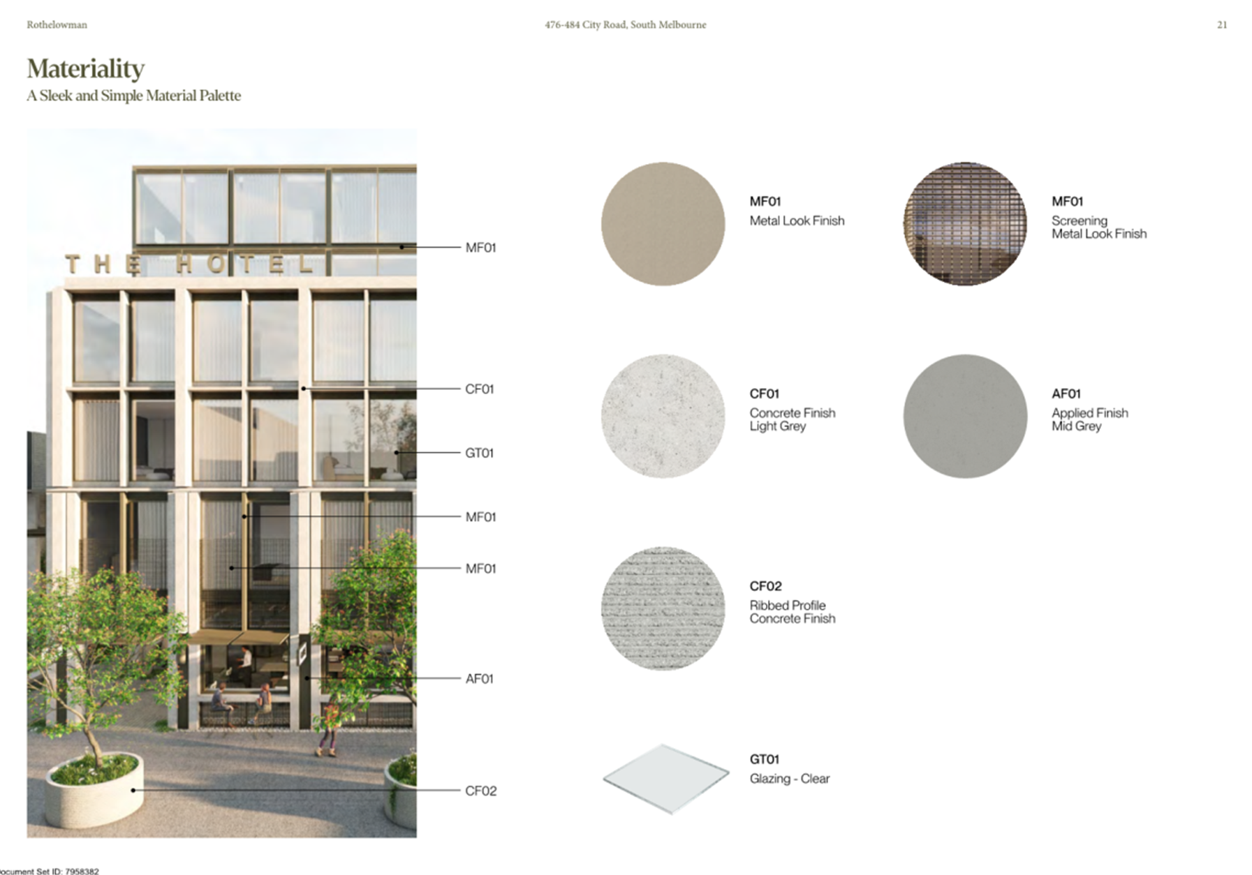
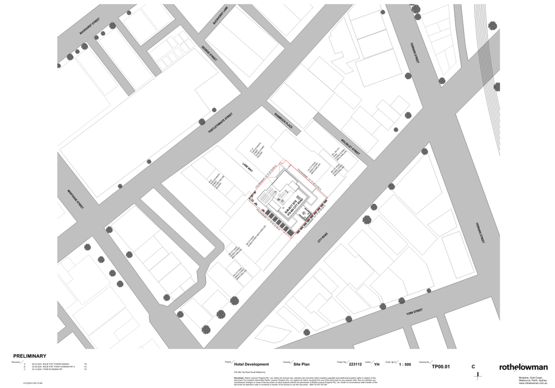
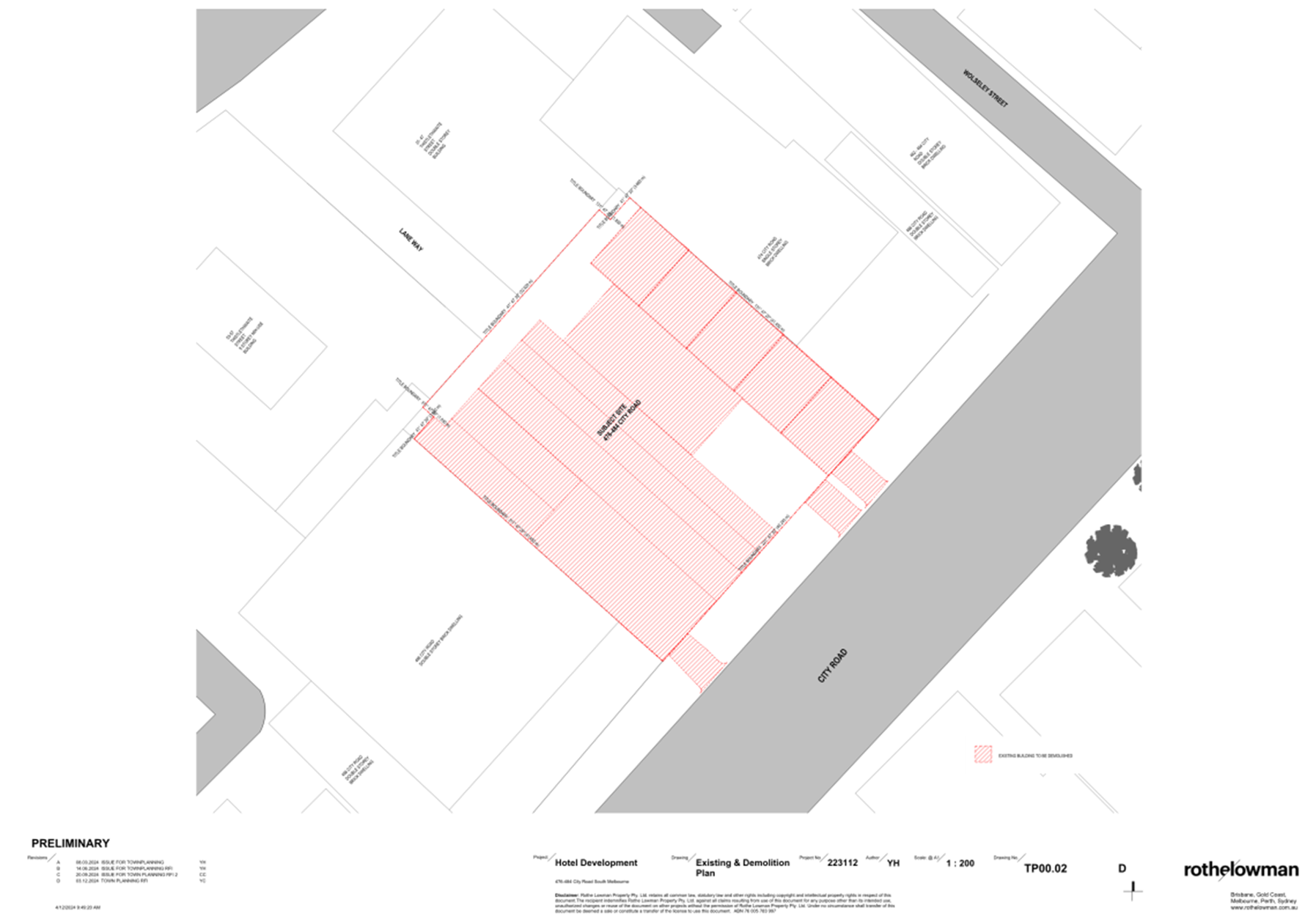
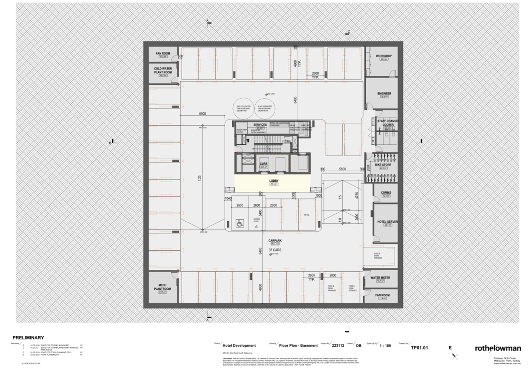
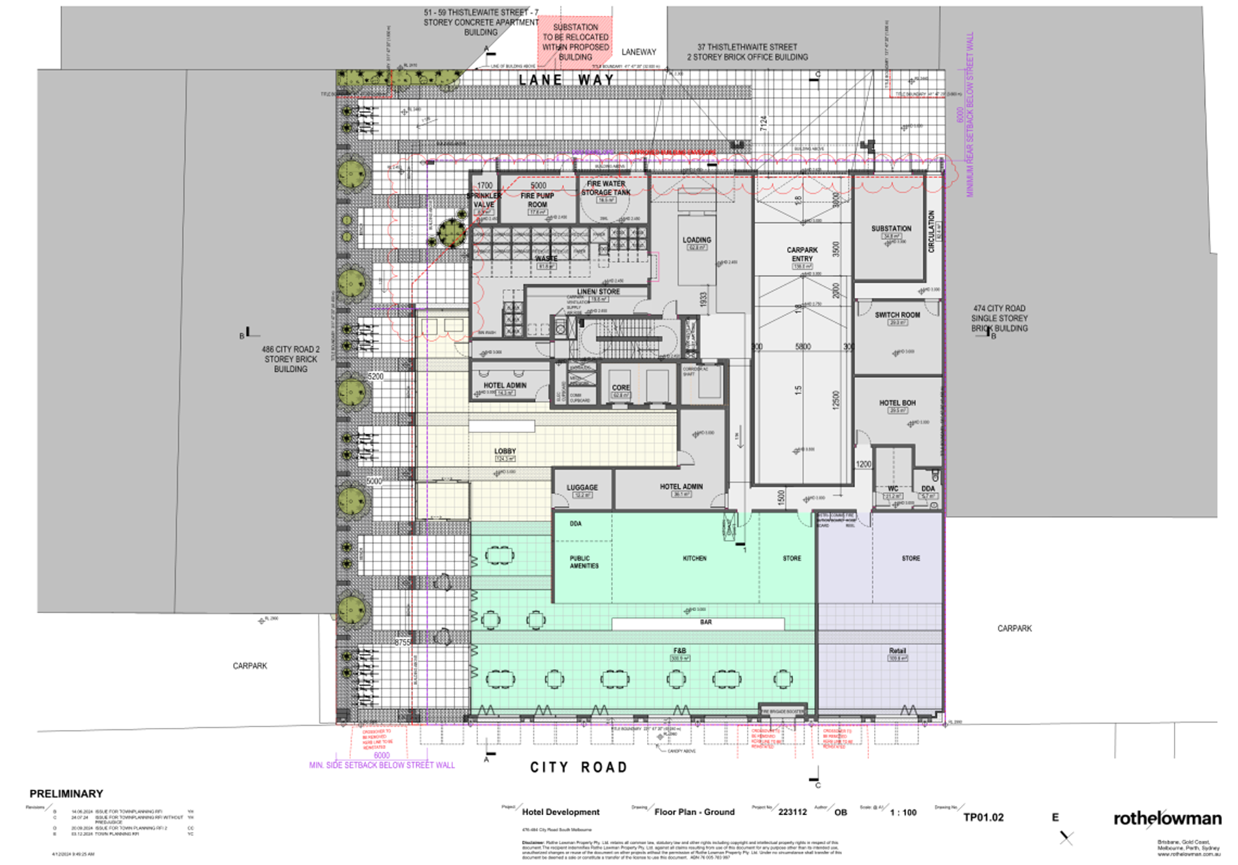
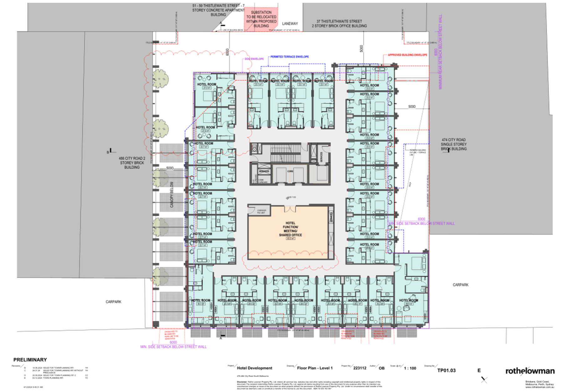
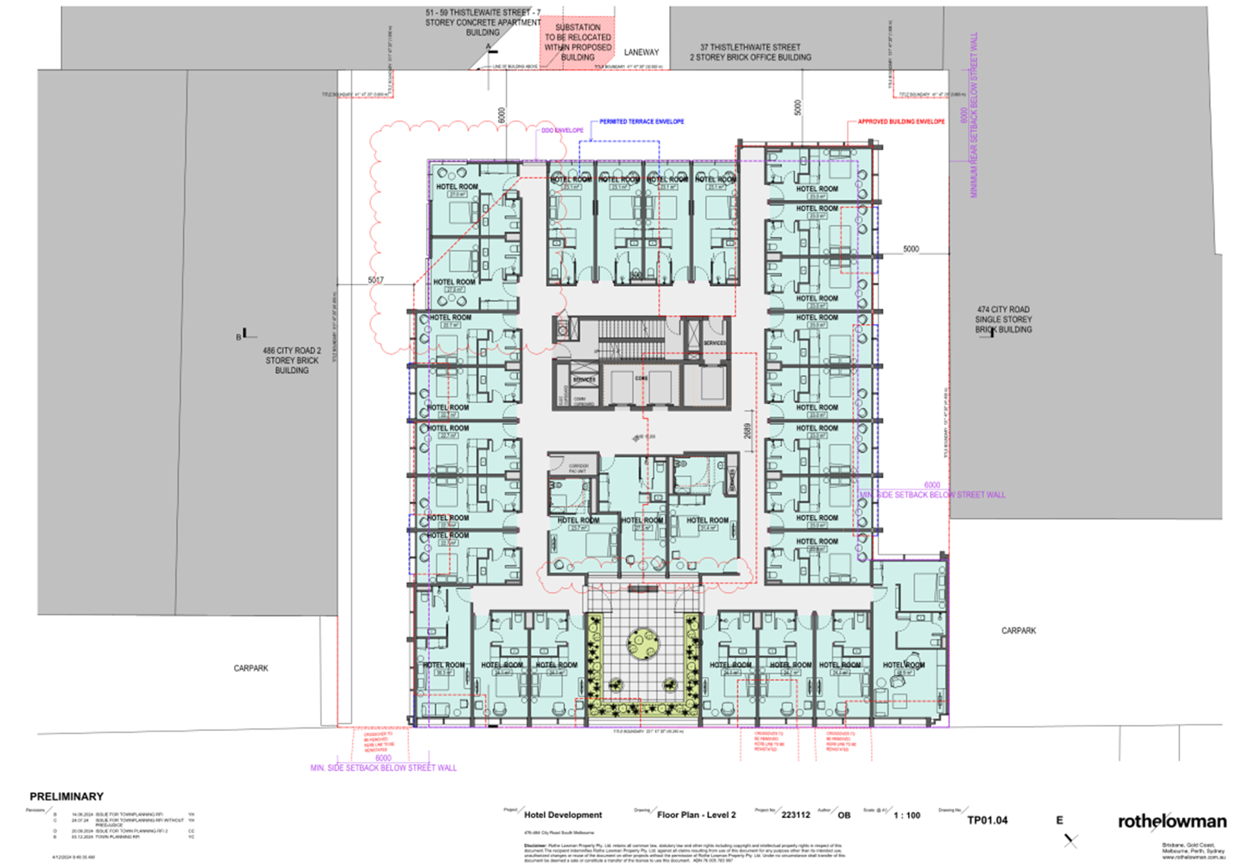
6.5 51-59 Thistlethwaite Street and 476-484 City Road, South Melbourne - 39/2015/D............. 349
7 URGENT BUSINESS
8 Confidential Matters
Nil
1. Apologies
2. Minutes of Previous Meetings
|
That the minutes of the Planning Committee of the Port Phillip City Council held on 26 February 2025 be confirmed. |
3. Declarations of Conflicts of Interest
4. Public Question Time and Submissions
Nil
5. Councillor Question Time
Nil
6.1 106 Barkly Street, St Kilda - 757/2018.............................. 5
6.2 63 Bay Street, Port Melbourne - 1324/2006/D 111
6.3 31 Tribe Street, South Melbourne - PDPL/00565/2024........... 266
6.4 49A Pakington Street, St Kilda - PDPL/00073/2025 330
6.5 51-59 Thistlethwaite Street and 476-484 City Road, South Melbourne - 39/2015/D........................ 349
Planning Committee
23 April 2025
|
106 Barkly Street, St Kilda - 757/2018 |
|
|
location/address: |
106 BARKLY STREET ST KILDA |
|
Executive Member: |
Brian Tee, General Manager, City Growth and Development |
|
PREPARED BY: |
James McInnes, Principal Planner |
1. PURPOSE
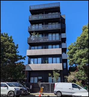
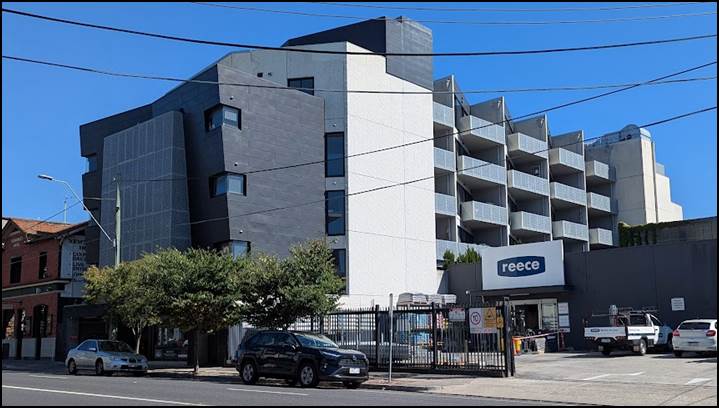
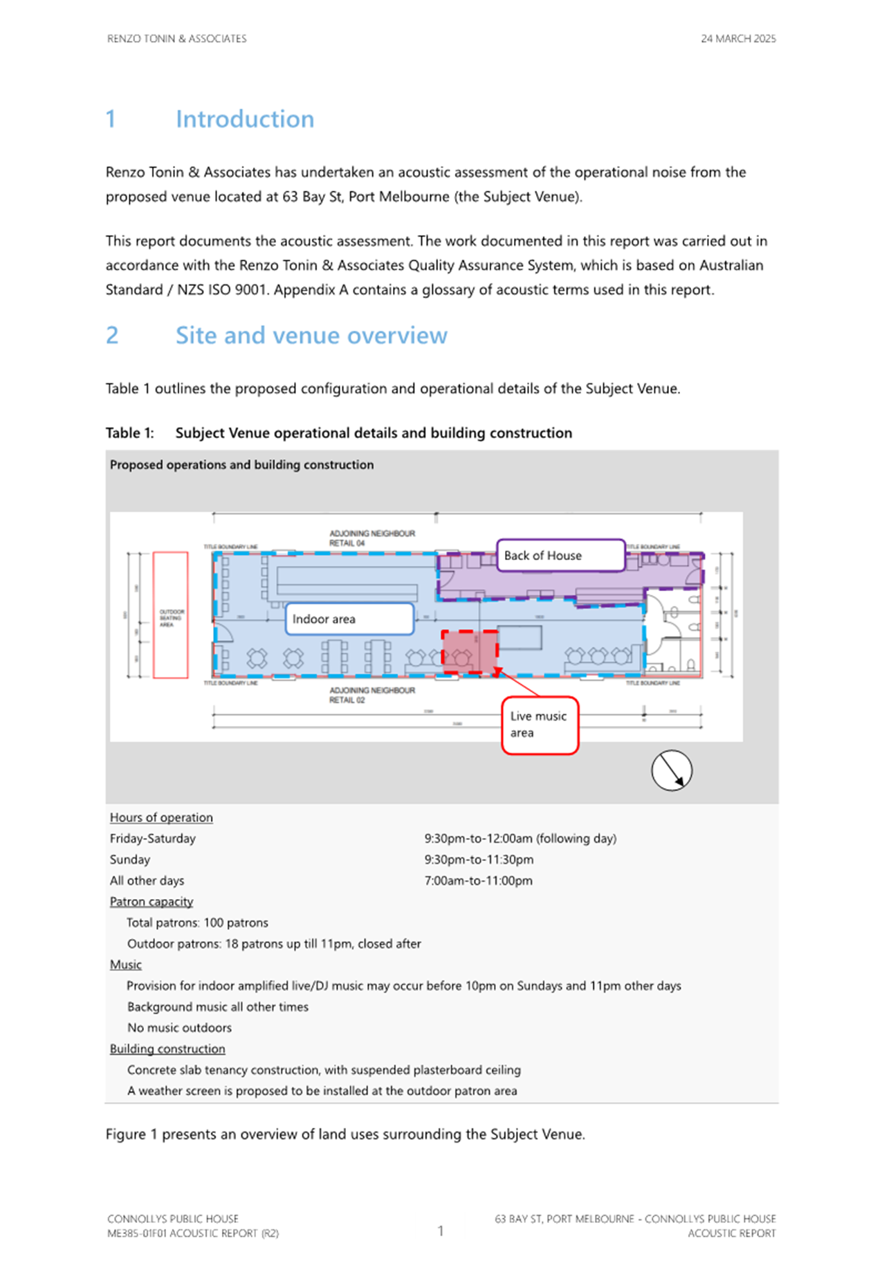
1.1 To consider and determine Planning Application 757/2018 for the construction of a six-storey mixed-use building comprising commercial space at ground floor, and 24 dwellings at levels 1 to 5 in a Commercial 1 Zone, Transport Zone 2, and Special Building Overlay.
2. EXECUTIVE SUMMARY
|
Ward: |
St Kilda |
|
Trigger
for determination |
More than 16 objections Reduction in car parking requirement |
|
ApplicATION NO: |
757/2018 |
|
Applicant: |
Urban Planning Collective |
|
Existing use: |
Art gallery and studio |
|
Abutting uses: |
Residential and commercial |
|
Zoning: |
Commercial 1 Zone Transport Zone 2 |
|
Overlays: |
Special Building Overlay, Schedule 1 |
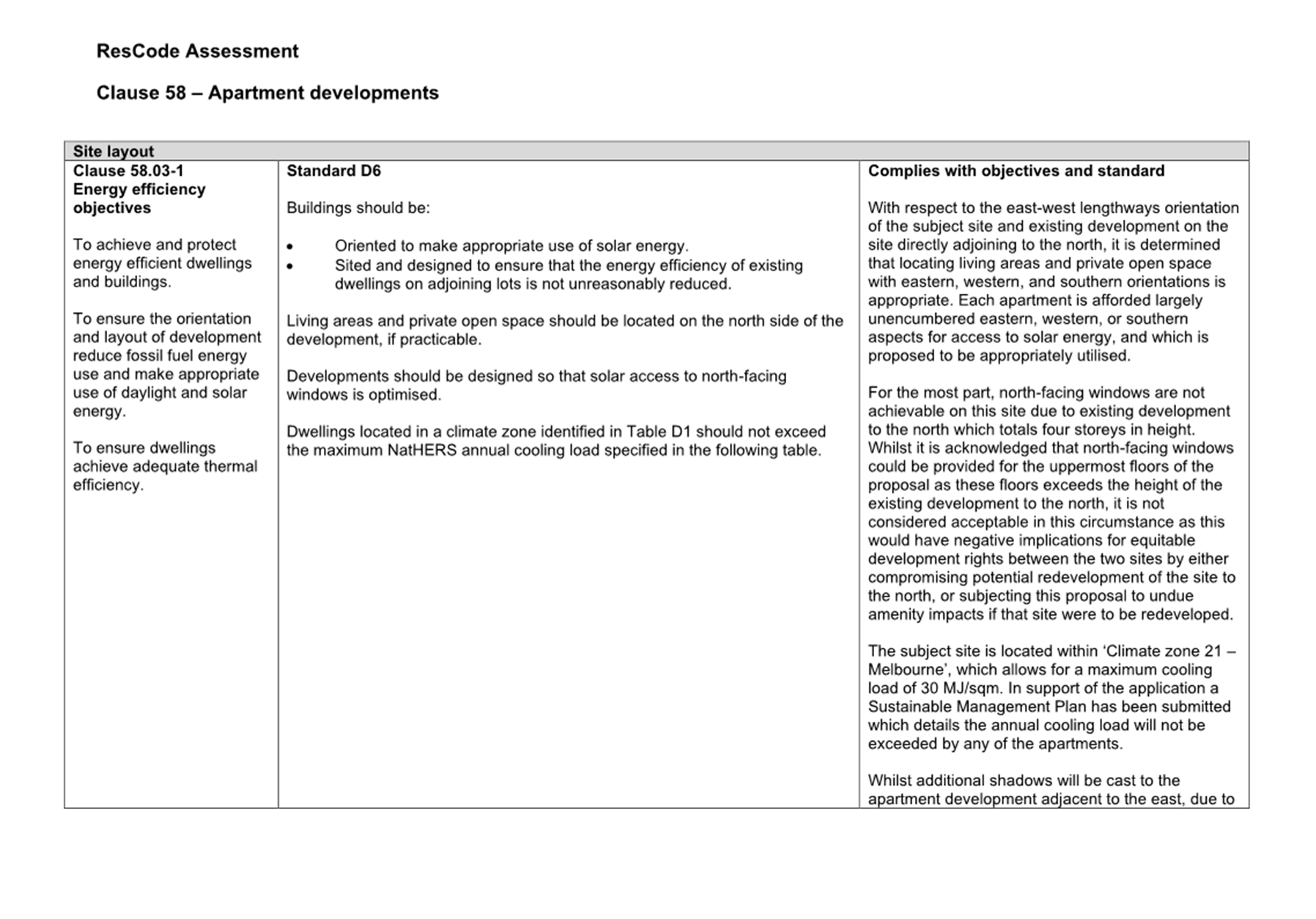
2.1 This report provides Council with an assessment of planning application 757/2018 at 106 Barkly Street, St Kilda. The key considerations are whether the built form and appearance of the six-storey building is appropriate having regard to zoning, policy, and built form context, whether the layout of the apartments will provide an acceptable level of amenity for future occupants, whether the building will cause unreasonable amenity impacts to adjoining and nearby properties, and whether the provision of car parking and bicycle facilities are acceptable.
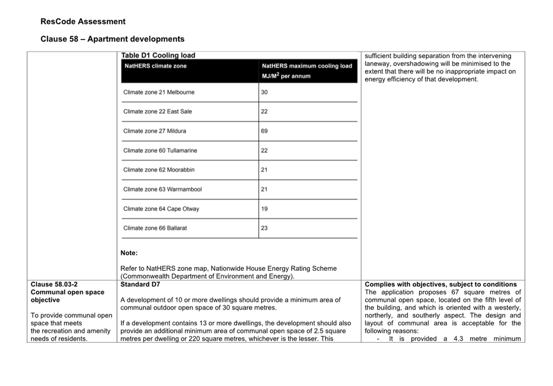
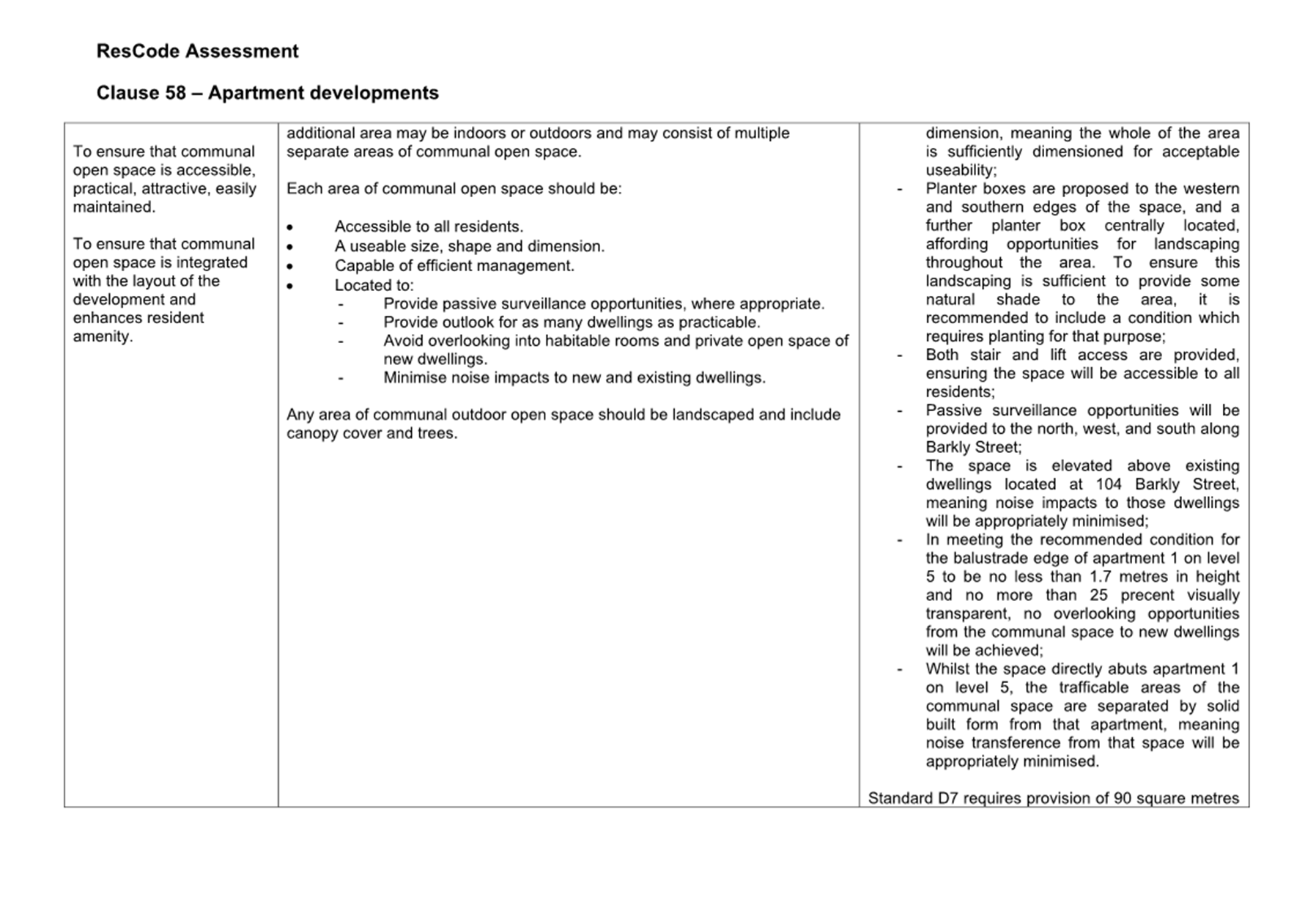
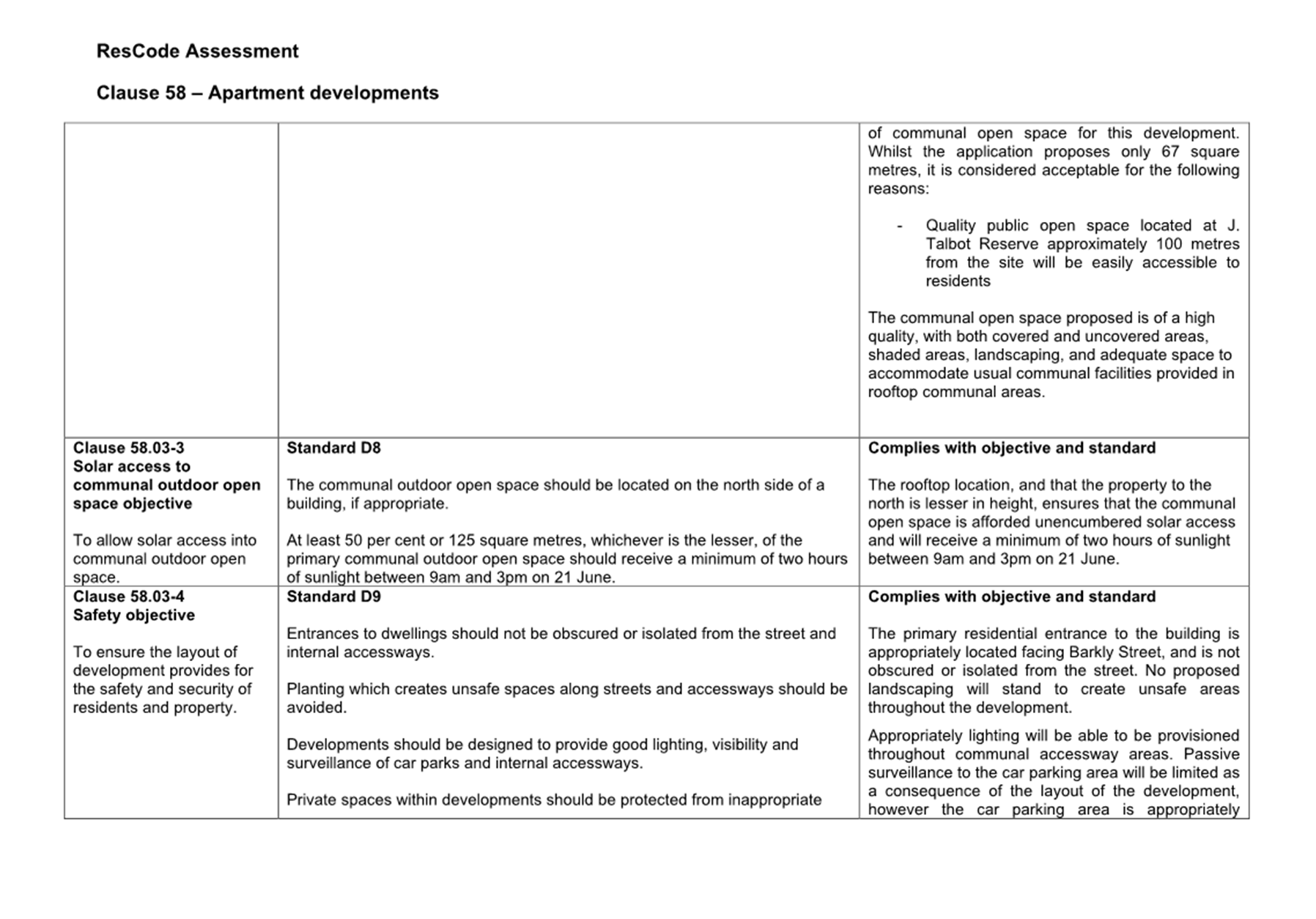
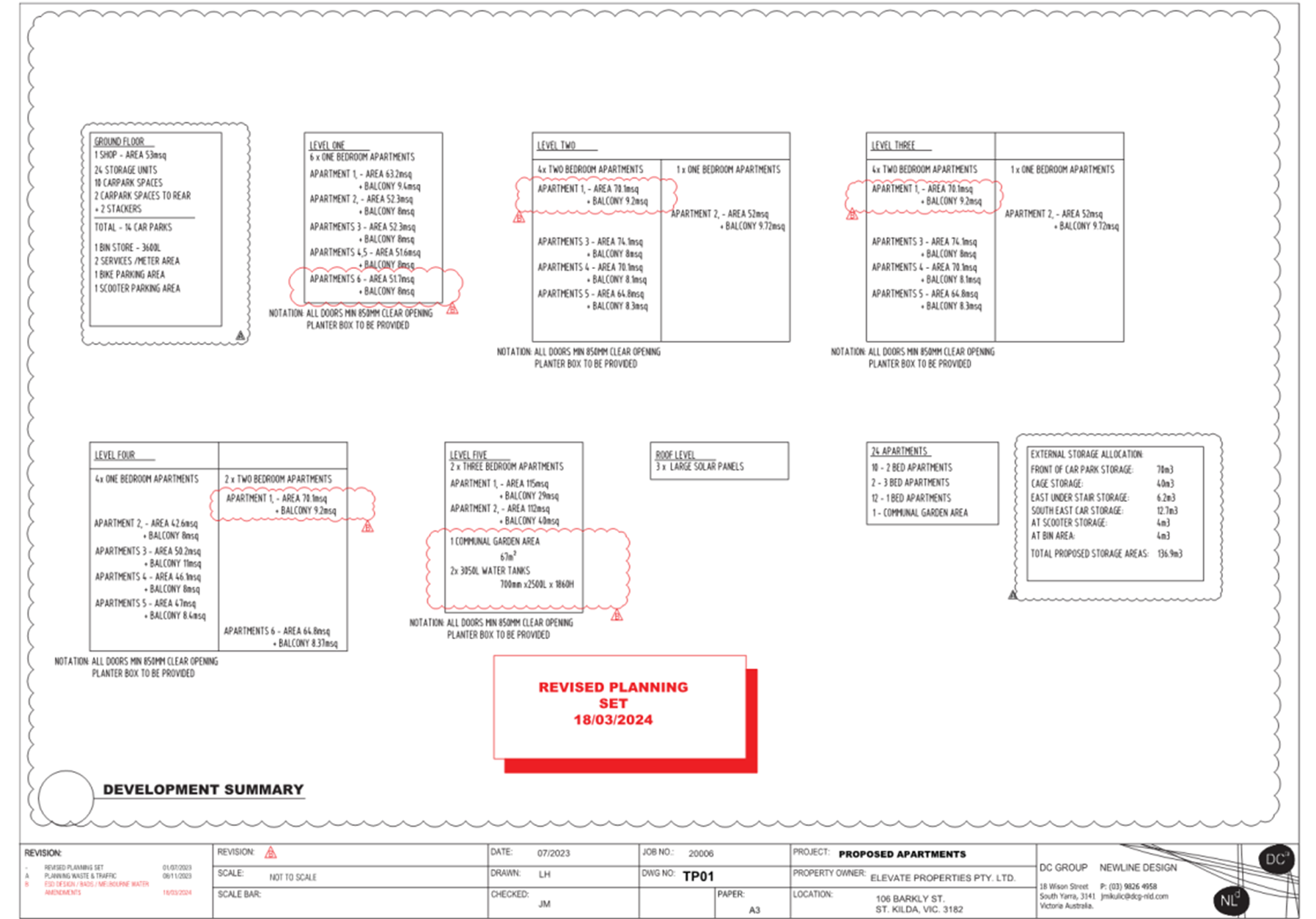
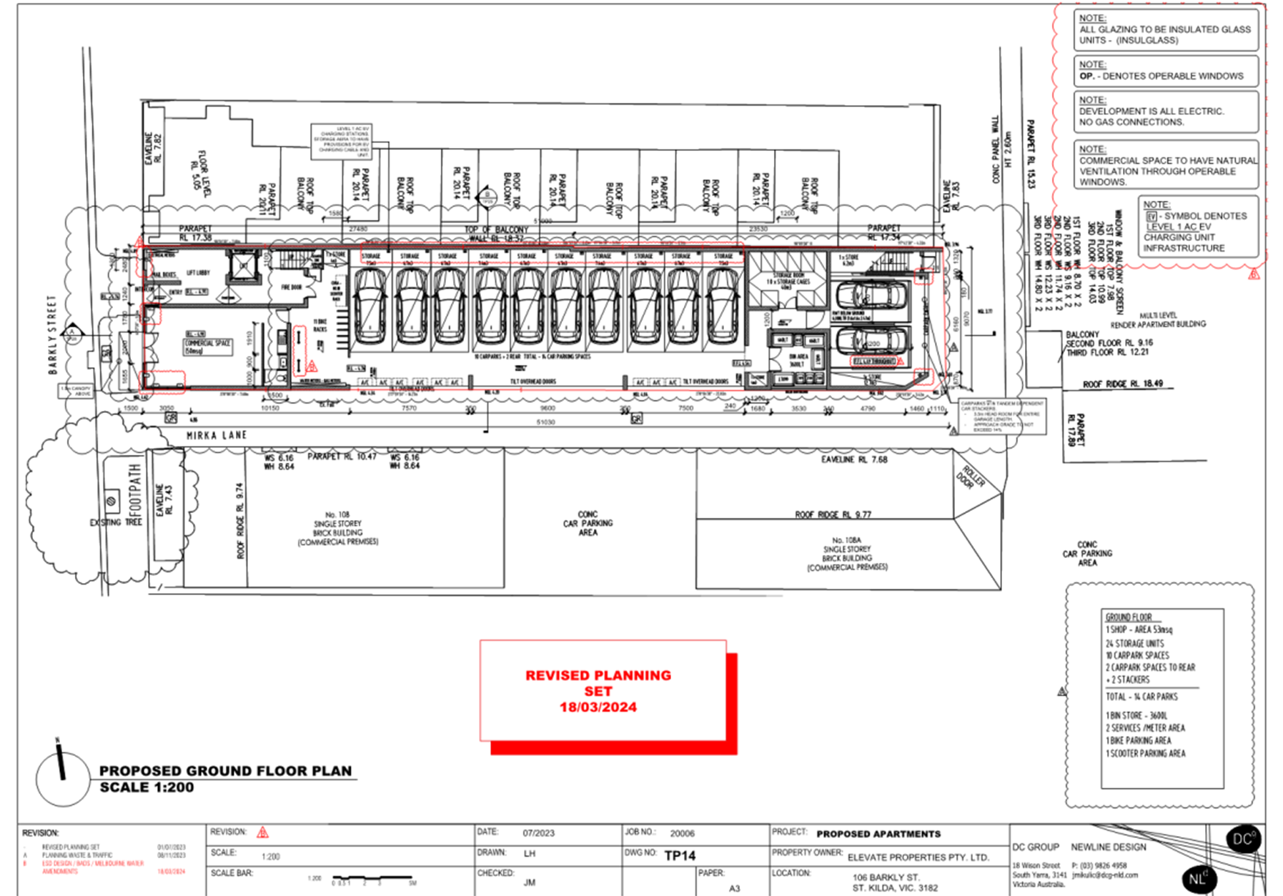
2.2 The application proposes a six-storey building with a maximum height of 21.07 metres which will include 50 square metres of commercial floor space at ground floor, 24 apartments across levels 1 to 5 (with an apartment mix of one studio apartment, 12 x one-bedroom, 10 x two-bedroom, and 2 x three-bedroom), 67 square metres of communal space at level 5, and 14 car parking spaces at ground floor (a reduction of 13 spaces).
2.3 The application was originally submitted to Council in 2018 and has been subject to amendments under Section 57a of the Planning and Environment Act 1987, the most recent being on 21 June 2024. Changes to the proposal include removal of the sixth floor and reduction in overall height, reduction in apartment numbers from 27 to 24, redesign of car parking areas and reduction of total car spaces from 28 to 14, redesign of bicycle parking area and reduction of total bicycle spaces from 27 to 11, inclusion of 10 space scooter rack, internal rearrangements including reorientation of some balconies to face Barkly Street and removal of balcony overhang over Mirka Lane, and changes to external materials and finishes.
2.4 Both versions of the application were advertised to the surrounding community, with submissions received from 38 objectors (noting of these 4 objectors made submissions of the re-advertised plans). Concerns within objections relate to overdevelopment, building height, visual bulk, car parking, traffic, overshadowing, loss of views, overlooking, poor internal amenity, noise, and loss of the existing art gallery and studio.
2.5 A consultation meeting was held on 27 February 2025. The meeting was attended by elected members of Council, a Council Planning Officer, a representative of the permit applicant and members of the public who made submissions on the application. The meeting did not result in any formal changes to the application.
2.6 The application has been assessed against the relevant planning policies contained within the Port Phillip Planning Scheme, the purpose and decision guidelines of the Commercial 1 Zone, Transport 2 Zone, and Special Building Overlay, local activity centres policy, the vehicle access and car parking requirements of Clause 52.06, bicycle facility requirement of Clause 52.34, and the design standards for apartment developments at Clause 58.
2.7 On balance, in meeting the recommended conditions, the proposal is an appropriate design response in an area where the proposed density of residential development can and should be supported. The development is acceptable in relation to design and siting requirements of the Port Phillip Planning Scheme and will provide an appropriate level of internal amenity to future occupants.
2.8 The proposal is recommended for approval, subject to the conditions below.
|
3.1 That the Responsible Authority, having caused the application to be advertised and having received and noted the objections, issue a Notice of Decision to Grant a Permit for Application No. 757/2018 at 106 Barkly Street, St Kilda. 3.2 That a Notice of Decision to Grant a Permit be issued subject to the following permissions:
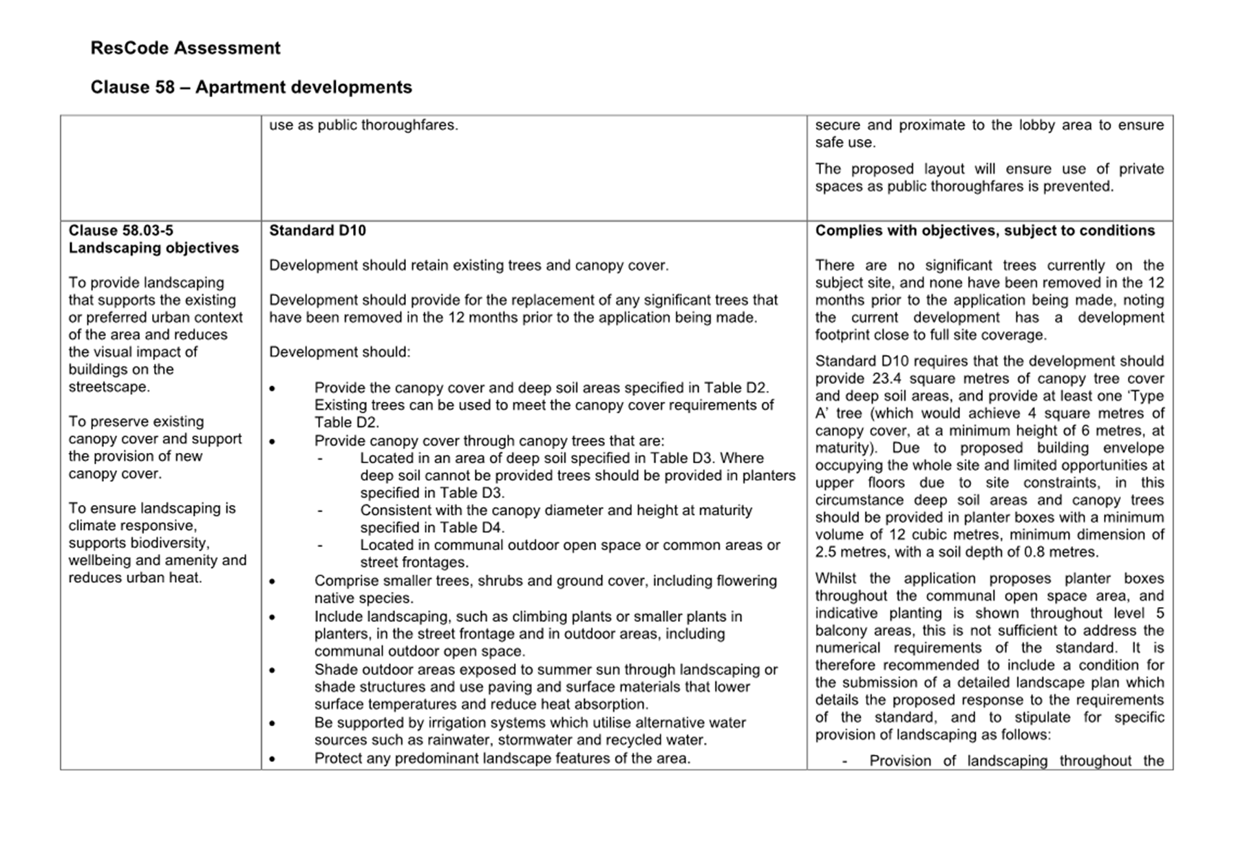
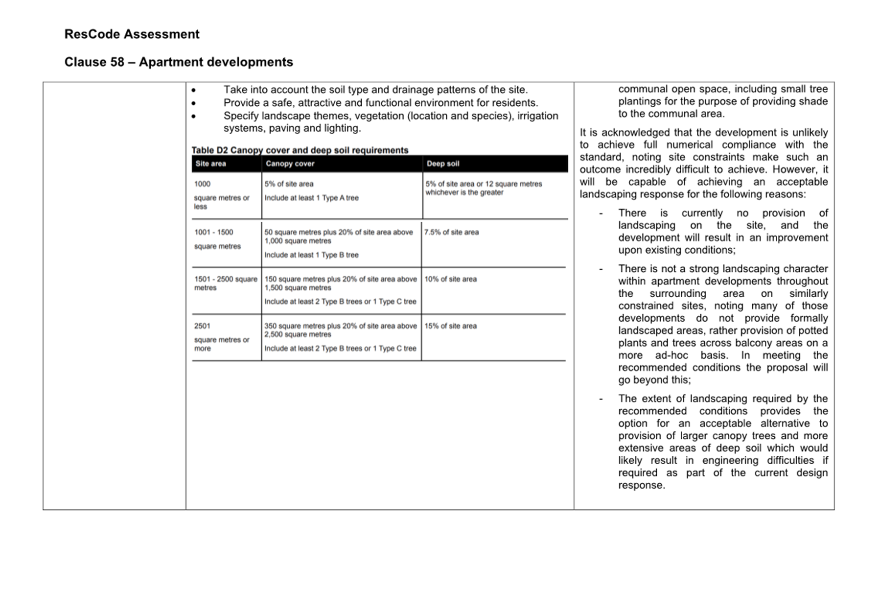
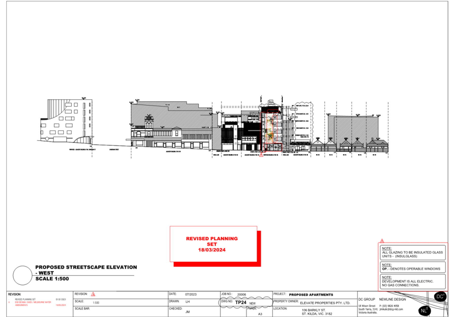
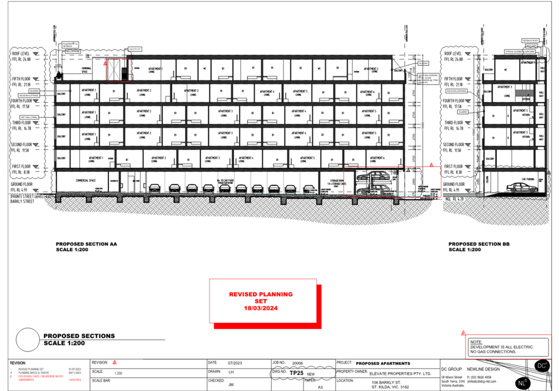
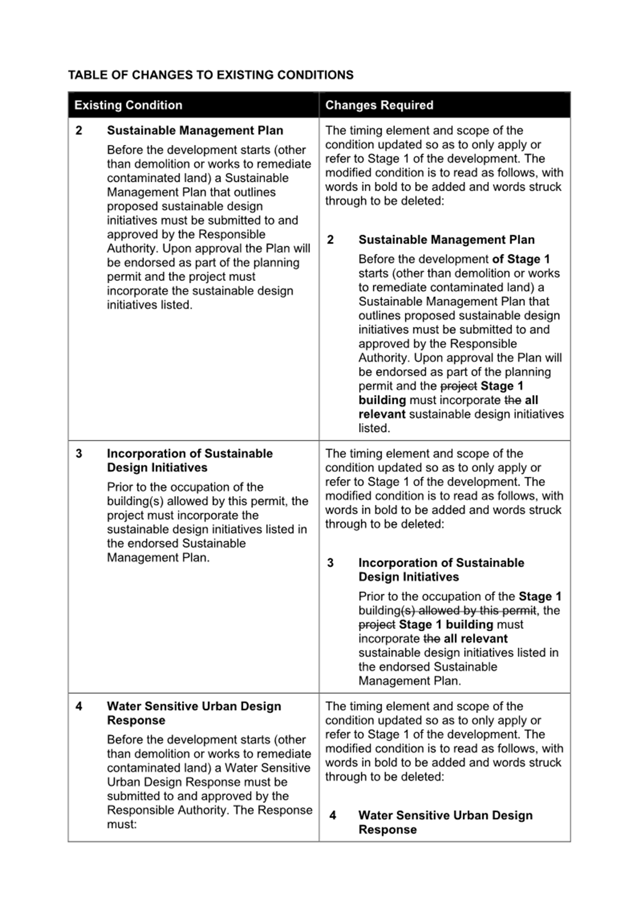
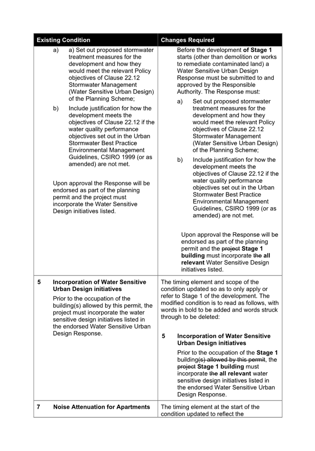
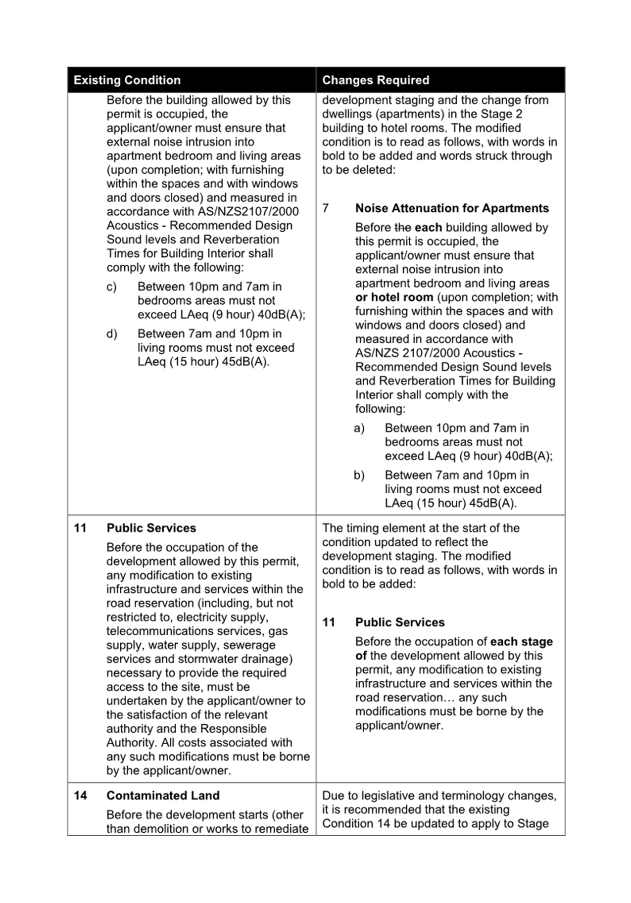
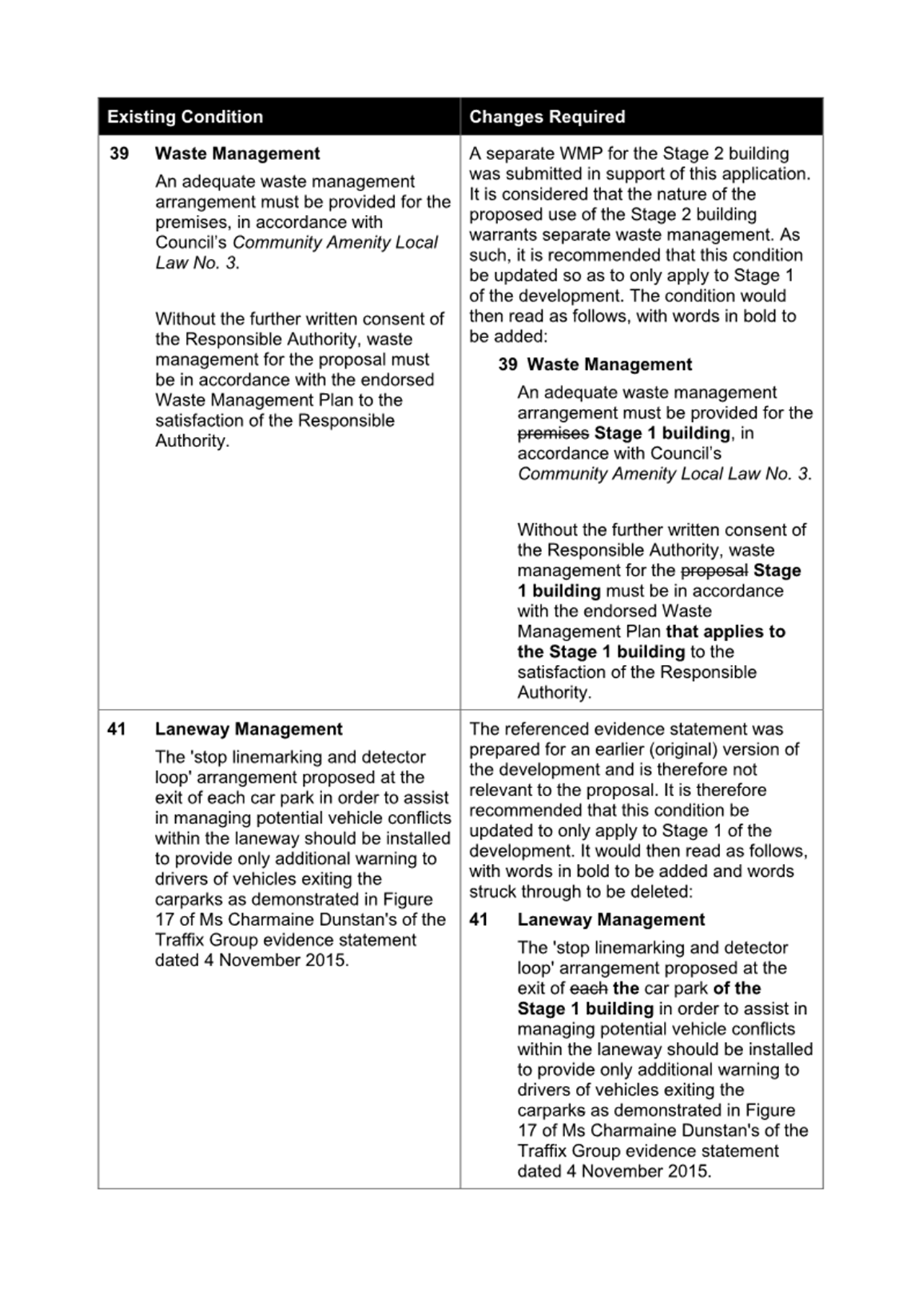
3.3 That the decision be issued subject to the following conditions: Amended plans 1. Before the use and development starts, amended plans and documents to the satisfaction of the Responsible Authority must be submitted to and approved by the Responsible Authority. When approved, the plans will be endorsed and will then form part of the permit. The plans must be drawn to scale with dimensions and must be generally in accordance with the advertised plans identified as TP14, TP21, TP23 & TP25 (Revision B – dated 18 March 2024), and TP15 to TP20 (inclusive) & TP22 (Revision A – 18 March 2024), prepared by DC Group Newline Design, but further modified to show: a) Any changes as a result of the Landscape Plan required by Condition 3 of this permit; b) A Landscape Management Plan in accordance with Condition 4 of this permit; c) A Waste Management Plan in accordance with Condition 6 of this permit; d) A Sustainable Management Plan and Water Sensitive Urban Design response in accordance with Condition 8 of this permit; e) Removal of gas notations in accordance with Condition 19 of this permit; f) The glazing panel at the western edge of the balcony to Apartment 1 at Level 5 no less than 1.7 metres in height, and no more than 25 percent visually transparent; g) A notation detailing minimum storage volume within each apartment, and total minimum storage volumes allocated to each apartment to be in accordance with the requirements of Standard D21 of Clause 58.05-4 of the Port Phillip Planning Scheme; h) Either: i. A swept path assessment, prepared by a suitably qualified person, demonstrating that a B85 design vehicle can achieve front-in access and reverse-out egress with no more than the maximum number of vehicle movements permitted by Australian Standard AS2890.1 for all car parking spaces which are accessed from Mirka Lane where it adjoins the south of the site, or alternatively; ii. those car parking spaces designed with minimum dimensions in accordance with Design standard 2 of Clause 52.06-9 of the Port Phillip Planning Scheme; i) Either: i. A vehicle scrape analysis, prepared by a suitably qualified person, demonstrating that a B85 design vehicle can achieve access to all car parking spaces without scraping or bottoming out, or alternatively; ii. all vehicle accessways designed with summit and sag grade changes in accordance with Design standard 3 of Clause 52.06-9 of the Port Phillip Planning Scheme. j) Car parking spaces and aisle widths fully dimensioned; k) All common corridors with a minimum width of 1.2 metres, and common doorways with a minimum width of 850mm; l) A notation detailing operation of all garage doors will be contained wholly within the boundaries of the site; m) A corner splay area at ground floor extending 2 metres along the Barkly Street frontage from the edge of Mirka Lane, and 2.5 metres along the southern boundary from the south-western corner of the site; n) Bicycle spaces dimensioned in accordance Clause 52.34-6 of the Port Phillip Planning Scheme. Layout not altered 2. The layout of the use and development must not be altered from the layout on the approved and endorsed plans without the written consent of the Responsible Authority. Landscape plan 3. Before the development starts, a Landscape Plan to the satisfaction of the Responsible Authority must be submitted to and approved by the Responsible Authority. When approved the plan will be endorsed and will then form part of the permit. The landscape plan must be prepared by a person suitably qualified or experienced in landscape design and must be drawn to scale with dimensions. All species selected must be to the satisfaction of the Responsible Authority. The landscape plan must show how the landscaping design meets the canopy cover, deep soil, and tree type requirements of Standard D10 of Clause 58.03-5, or indicate how an alternate solution provides a suitable outcome, through submission of the following: a) A site plan that indicates the required amount of canopy cover, number of canopy trees, and volume of planter soil; b) A development summary table that includes: i. The site area; ii. The required number of canopy trees and their size in diameter, and the total amount of canopy cover provided for the site; iii. The required volume of planter soil, and the total amount provided for the site. c) A planting schedule of all proposed vegetation including botanical names, common names, pot sizes, sizes at maturity, quantities of each plant, and details of surface finishes throughout landscaped areas; d) Landscaping and planting within all planter boxes, including provision trees within the Level 5 communal area for the purpose of providing shade to that area; e) Details for use of plant species which do not require watering after an initial establishment period in accordance with ‘BESS Credit 3.1 – Water Efficient Landscaping’ nominated in the Sustainable Management Plan required by Condition 8 of this permit, OR Details of irrigation systems or alternative watering methods for all landscape areas, including irrigation sources, supply, and connection points, and the ‘Water Efficient Landscaping’ credit removed from the Sustainable Management Plan. Landscape Management Plan 4. Before the development starts, a Landscape Management Plan to the satisfaction of the Responsible Authority must be submitted to and approved by the Responsible Authority. When approved the plan will be endorsed and will then form part of the permit. The Landscape Management Plan must be prepared by a person suitably qualified or experienced in landscape management and must be consistent with the landscape plan required by Condition 3 of this permit. The Landscape Management Plan must include: a) If irrigation systems are proposed in accordance with Condition 3(e), details of a maintenance program for the irrigation systems including flushing, checking systems integrity, monitoring sensors, and calibration settings; b) The allocation of responsibility to the owners corporation for the ongoing maintenance of the irrigation systems (if required) and maintenance of all landscaping unless otherwise to the satisfaction of the Responsible Authority, including specific measures relating to: i. maintenance of any proposed on-structure landscaping; and ii. obligations on the owners corporation to ensure consistent maintenance and matching themes for the landscaping into the future. c) Notes and diagrams detailing the maintenance of all proposed trees, shrubs, and climbers. d) Protocols for gaining access for maintenance purposes to privately owned land where required. Completion of landscaping 5. Before the building is occupied, or by such later date as approved in writing by the Responsible Authority, the landscaping works shown on the endorsed Landscape Plan must be carried out and completed to the satisfaction of the Responsible Authority. Waste Management Plan 6. Before the development starts, an amended Waste Management Plan (WMP) to the satisfaction of the Responsible Authority must be submitted to and approved by the Responsible Authority. When approved, the WMP will be endorsed and will then form part of the permit. The WMP must be generally in accordance with the WMP dated 8 November 2023 and prepared by TTM, but further modified to show: a) Any changes as a result of the amendments required by Condition 1 of this permit. 7. The provisions, recommendations and requirements of the endorsed WMP must be implemented and complied with to the satisfaction of the Responsible Authority and must not be varied except with the prior written consent of the Responsible Authority. Sustainable Management Plan 8. Before the development starts, an amended Sustainable Management Plan (SMP) and Water Sensitive Urban Design (WSUD) response to the satisfaction of the Responsible Authority must be submitted to and approved by the Responsible Authority. When approved, the SMP and WSUD will be endorsed and will then form part of the permit. The amended SMP and WSUD must be generally in accordance with the SMP and WSUD submitted with the application identified as Sustainable Management Plan & Water Sensitive Urban Design Response, dated 28 March 2024, and prepared by Ark Resources, but further modified to show the following details: a) Any changes as a result of the amendments required by Condition 1 of this permit. Where alternative environmentally sustainable design (ESD) measures are proposed to those specified in this condition, the Responsible Authority may vary the requirements of this condition at its discretion, subject to the development achieving equivalent (or greater) ESD outcomes in association with the development. 9. Before the development is occupied, an as-built report for the ESD measures to the satisfaction of the Responsible Authority must be submitted to and approved by the Responsible Authority. The report must confirm and provide supporting evidence that all ESD initiatives in the endorsed SMP and WSUD response have been implemented in accordance with the approved plans to the satisfaction of the Responsible Authority. The ESD and WSUD initiatives must be maintained throughout the operational life of the development to the satisfaction of the Responsible Authority. Car parking layout and access 10. Before the use and development starts, the areas set aside for parking of vehicles and bicycles, and access lanes as shown on the endorsed plans must be: a) constructed b) properly formed to such levels that they can be used in accordance with the plans c) surfaced with an all-weather-seal coat d) drained e) line marked to indicate each car space and all access lanes to the satisfaction of the responsible authority. At all times car spaces, access lanes and driveways must be kept available for these purposes. Once constructed, these areas must be maintained to the satisfaction of the responsible authority. Allocation of car parking spaces 11. No fewer than 14 car parking spaces must be provided on the land, with one car space provided to each two-bedroom apartment, and two car spaces to each three-bedroom apartment. The car spaces provided to each three-bedroom apartment must be within the car stacker system, with each of those car spaces only being provided in tandem with the other space provided to the same apartment. Provision of car stackers and ongoing maintenance 12. Before the building is occupied, a Car Stacker System Management Plan (CSSMP) to the satisfaction of the Responsible Authority must be submitted to and approved by the Responsible Authority. When approved, the plan will be endorsed and will then form part of the permit. The CSSMP must show: a) Allocation of car stacker spaces according to vehicle size and type; b) Ongoing maintenance of the car stacker system; c) Instruction to owners and occupiers about the operation of the car stacker system, including the requirement to maintain car stacker platform clearances for pedestrian access through the door between the storage room and bin area; d) Communicating to prospective residents about the availability of car stacker spaces and sizes; 13. The provisions, recommendations and requirements of the endorsed CSSMP must be implemented and complied with to the satisfaction of the Responsible Authority and must not be varied except with the prior written consent of the Responsible Authority. Urban Art Plan 14. Before the building is occupied, an Urban Art Plan (UAP) to the satisfaction of the Responsible Authority must be submitted to and approved by the Responsible Authority. When approved, the plan will be endorsed and will then form part of the permit. The UAP must be in accordance with the ‘City of Port Phillip Urban Art Strategy 2002’ and must detail the value of the urban art to the Barkly Street elevation is at least 0.5% of the estimated cost of development, or otherwise as agreeing in writing by the Responsible Authority. Urban art in accordance with the approved plan must be installed prior to the occupation of the building to the satisfaction of the Responsible Authority. Screening of windows and balconies 15. Before the building is occupied, all screening shown on the endorsed plans must be installed in accordance with the endorsed plans. The screening measures shown on the endorsed plans are not to be altered or removed except with the prior written consent of the Responsible Authority, Directional signage 16. Before the building is occupied, bicycle signage that directs cyclists to the bicycle parking area must be provided to the satisfaction of the Responsible Authority. The signage should be in accordance with the design requirements of Clause 52.34-7 of the Port Phillip Planning Scheme. Plant and equipment 17. No plant, equipment, services, or substations other than those shown on the endorsed plans are permitted except with the prior written consent of the Responsible Authority. Due care during construction 18. The developer must show due care in the development of the land approved by this permit so as to ensure that no damage is incurred to any adjoining buildings or property. Gas connection not permitted 19. Any new apartment development allowed by this permit must not be connected to a reticulated gas service (within the meaning of clause 53.03 of the relevant planning scheme). This condition continues to have force and effect after the development authorised by this permit has been completed. Vehicle Crossings 20. Before the building is occupied, vehicle crossings must be constructed in accordance with Council’s current Vehicle Crossing Guidelines and standard drawings to the satisfaction of the Responsible Authority. Melbourne Water 21. Prior to the endorsement of plans, amended plans must be submitted to and approved by Melbourne Water. The plans must be generally in accordance with the revised set date stamped 1/7/2023, but modified to show: a) The finished floor level of the car parking spaces occupied by the two easternmost spaces to be set no lower than 4.49m AHD which is 300mm above the applicable flood level. 22. The Finished Floor Level of the ground floor is to be set no lower than 4.49m AHD which is 300mm above the applicable flood level. 23. All car parking spaces and car stackers are to be set no lower than 4.49m AHD which is 300mm above the applicable flood level. Permit expiry 24. This permit will expire if one of the following circumstances applies: a) The development is not started within 2 years of the issued date of this permit. b) The development is not completed within 4 years of the issued date of this permit. c) The use does not start within 2 years of completion of the development. In accordance with Section 69 of the Planning and Environment Act 1987, an application may be submitted to the Responsible Authority for an extension of the periods referred to in this condition. |
4. RELEVANT BACKGROUND
4.1 There is no planning history or background for the subject site relevant to assessment of this application.
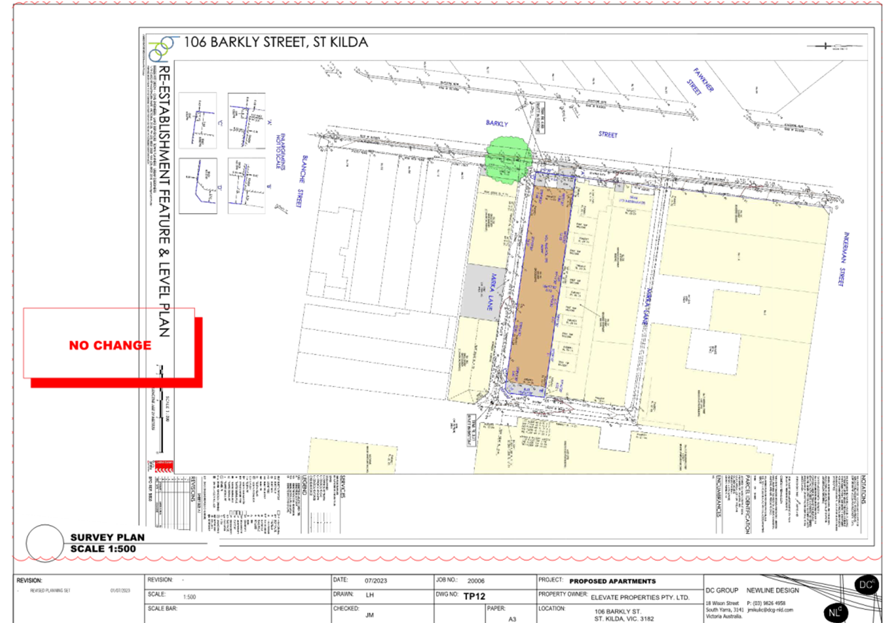
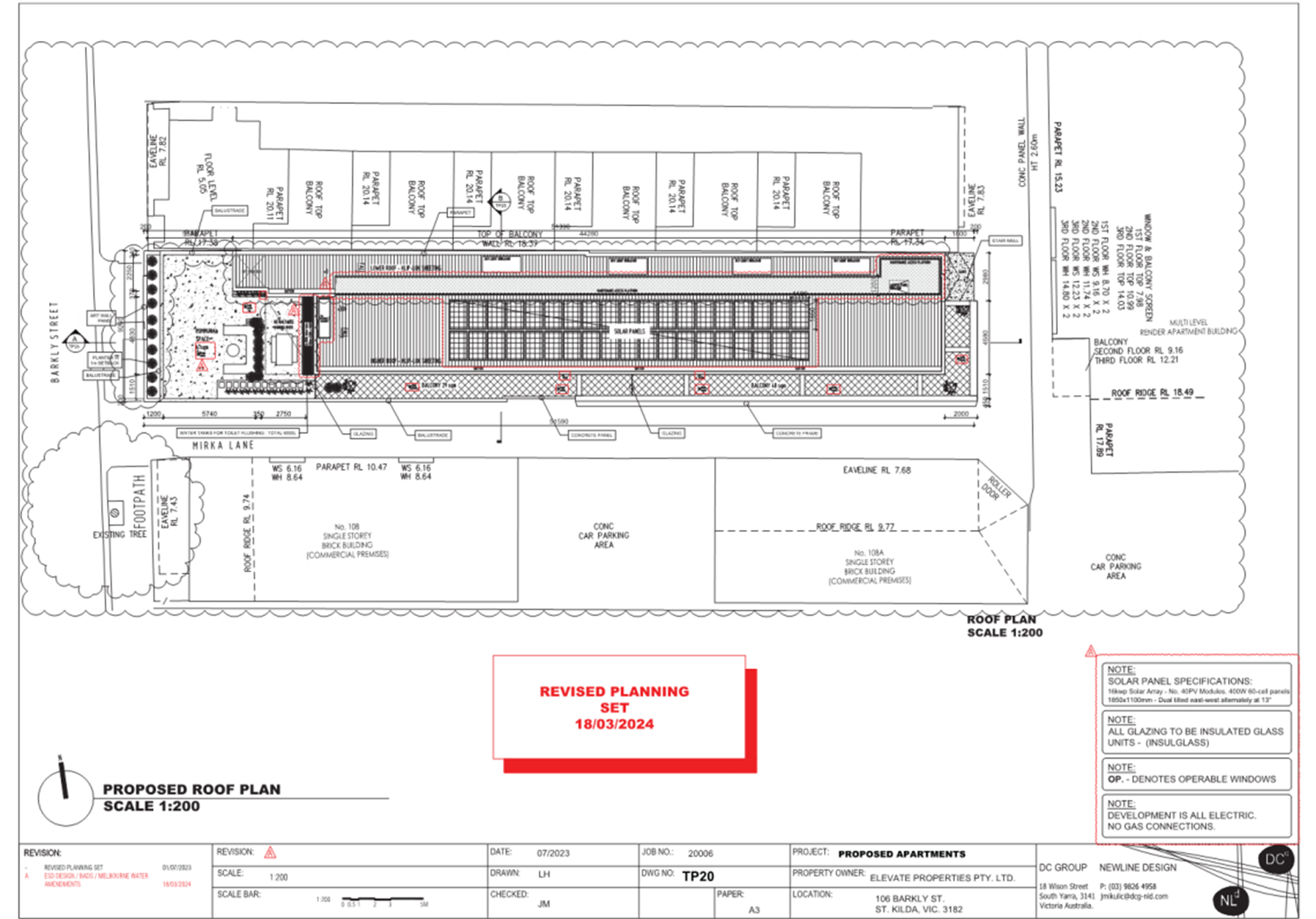
5. PROPOSAL
5.1 The application proposes the construction of a six-storey mixed-use building containing 24 dwellings and commercial space at ground level. Specific details of the proposal include:
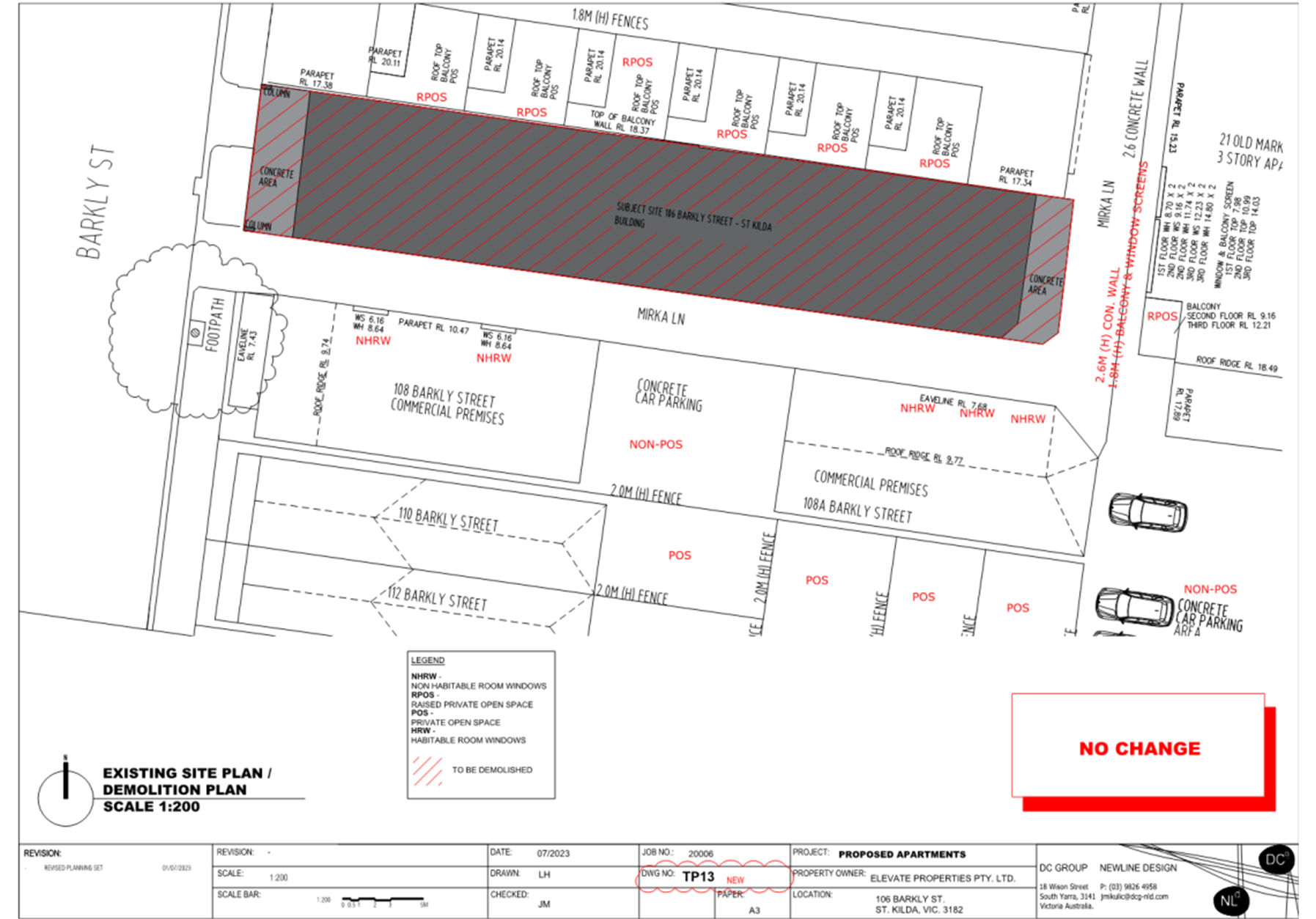
· Demolition of the existing building on the site (no planning permit required)
· Construction of a six-storey building, built to each boundary at all floors, barring the sixth storey which facilitates a setback of 5.31 metres from the western boundary (Barkly Street frontage)
· Details of each level are as follows:
- The ground floor would contain a commercial space which is identified as a ‘shop use’ in the submitted Planning Report to the property frontage, pedestrian entrance and residential lobby, 14 car spaces (including a 4 space car stacker), 11 bicycle spaces, 10 scooter spaces, a bin storage area, and storage cages.
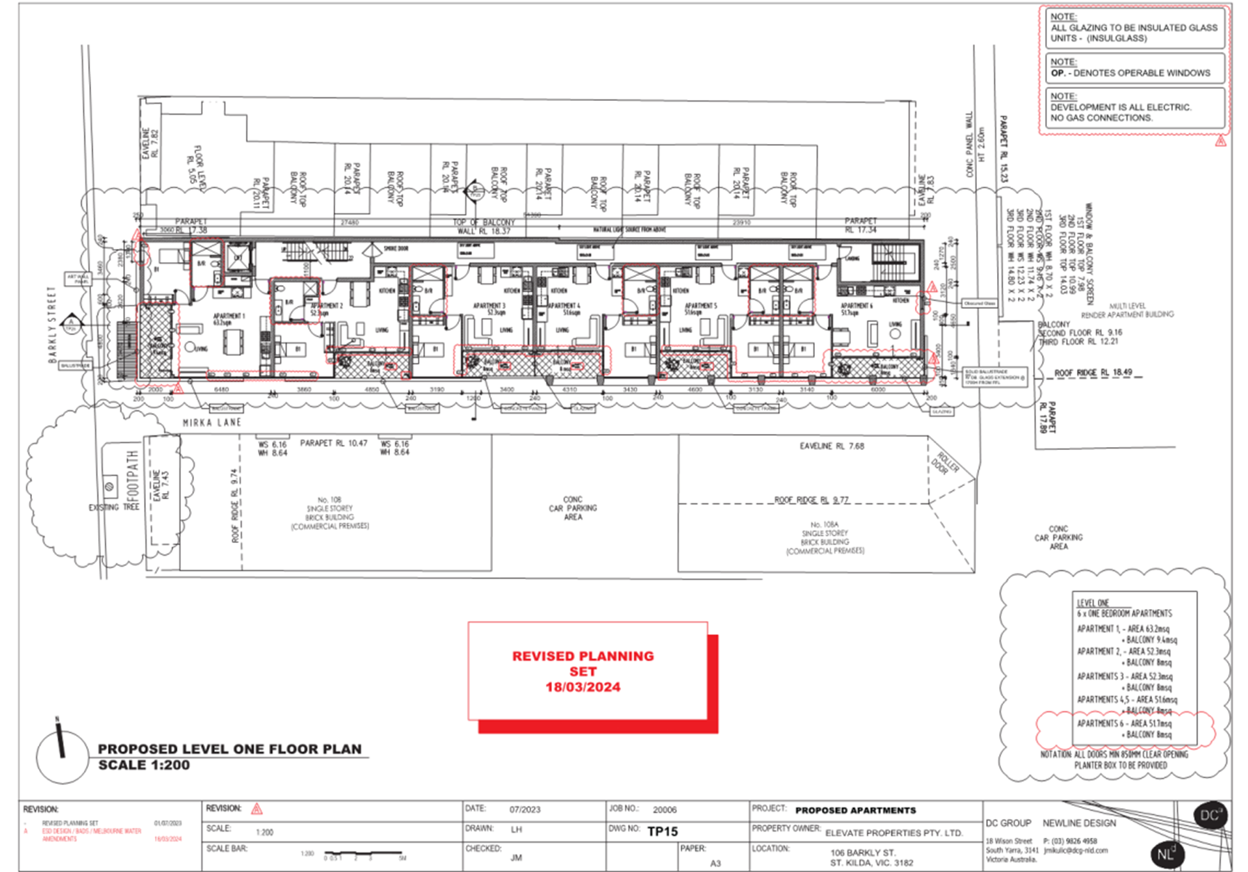
- The first floor will contain six apartments, all one-bedroom
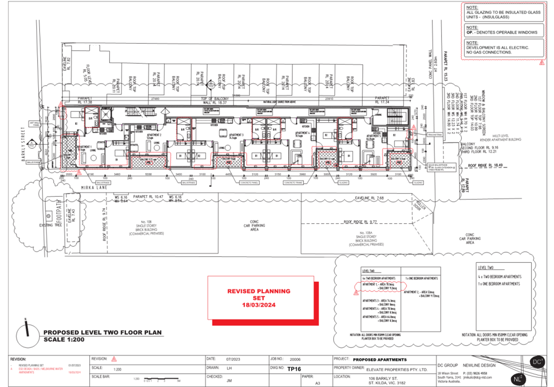
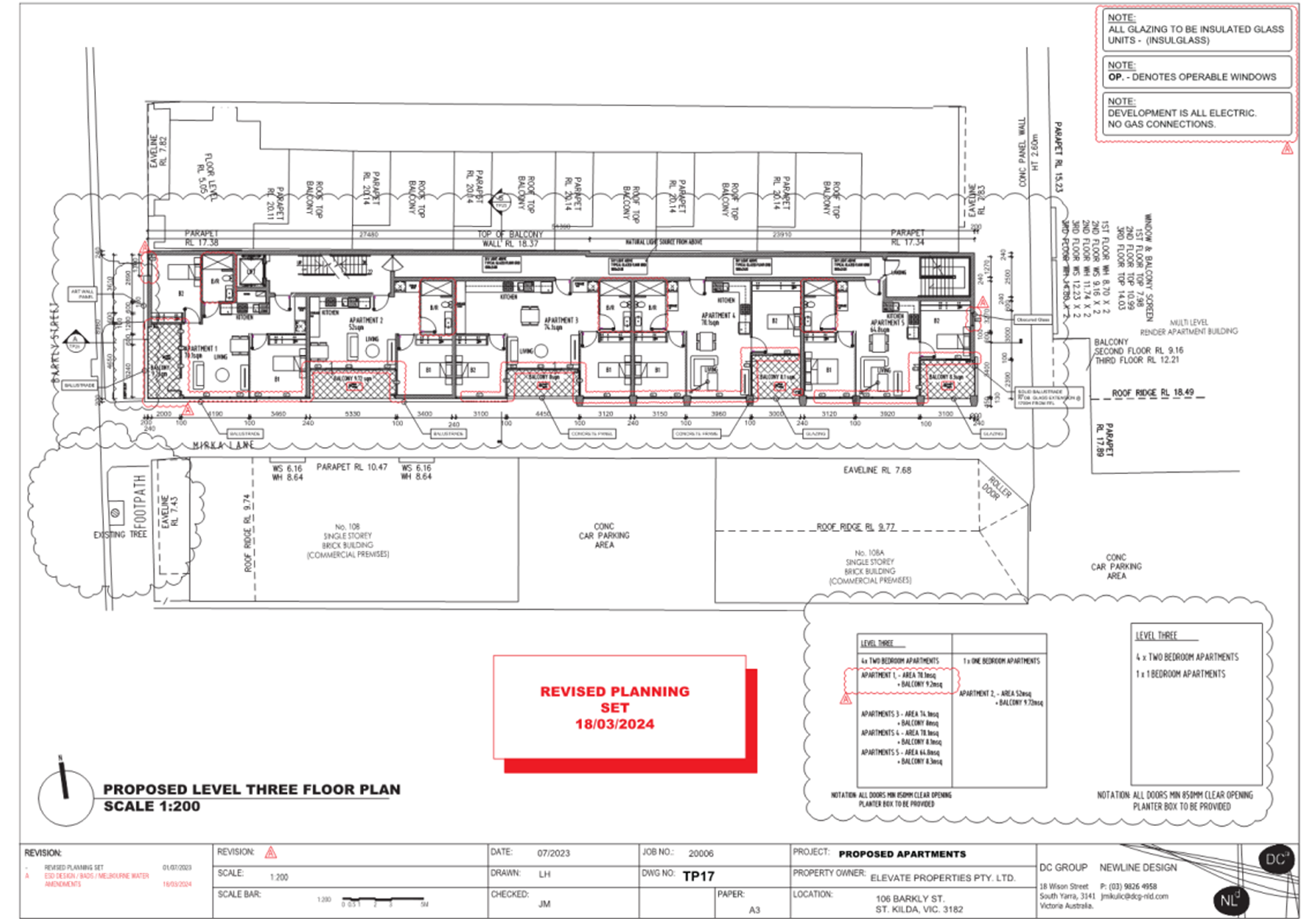
- The second and third floors will each contain five apartments, 4 x two-bedroom and 1 x one-bedroom
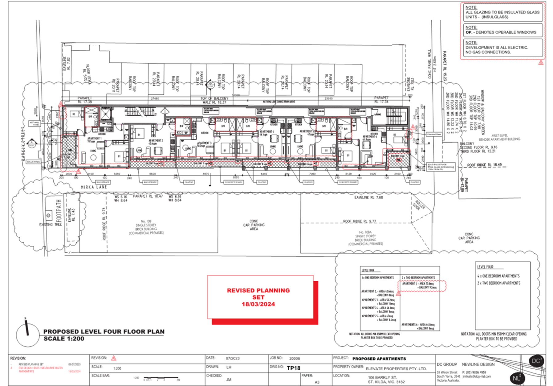
- The fourth floor will contain six apartments, 4 x one-bedroom and 2 x two-bedroom
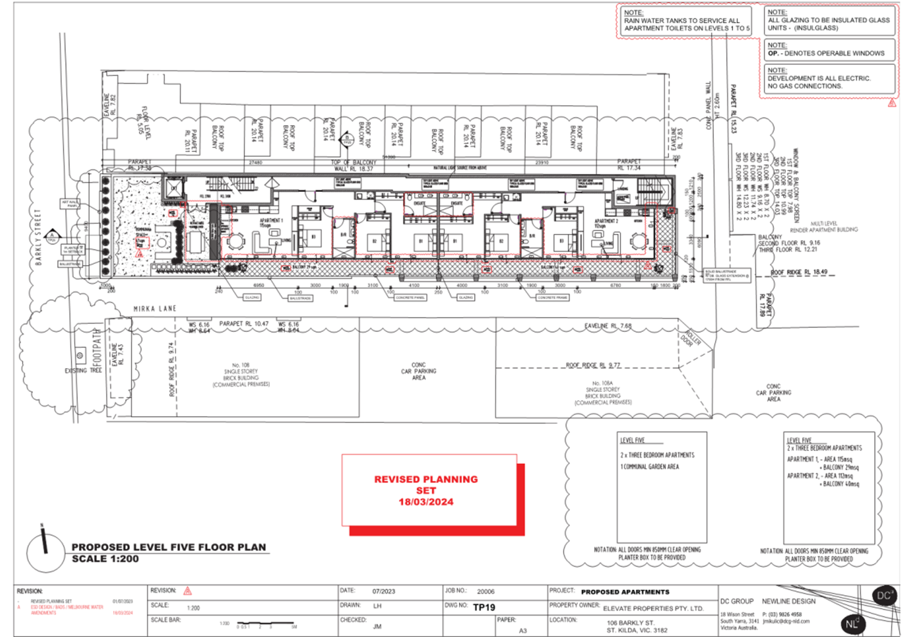
- The fifth floor will contain two apartments, both containing three bedrooms, and a 67 square metre communal space facing west to Barkly Street
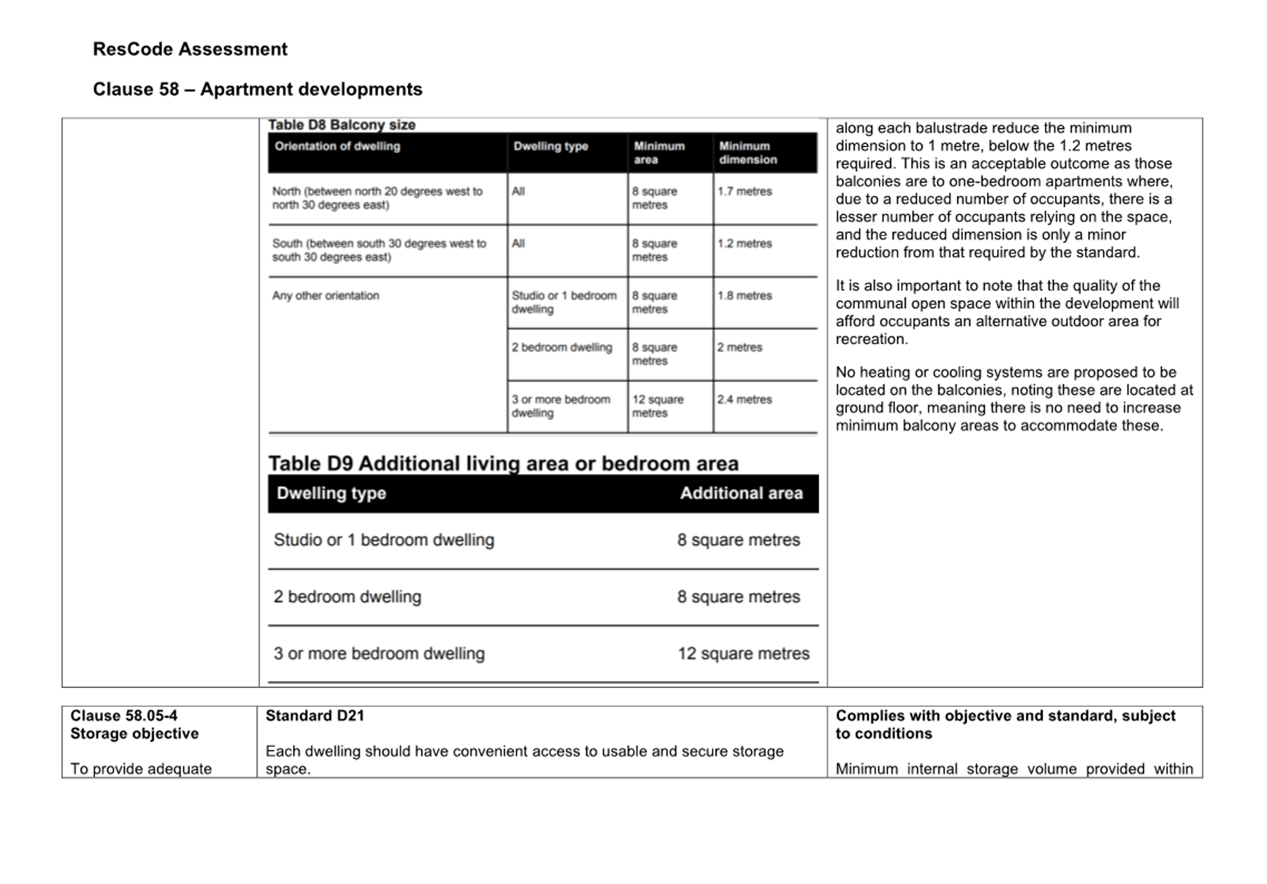
- All apartments are provided a balcony which faces either east, south, or west, and is a minimum of 8 square metres in area.
· Vehicle access is to Mirka Lane abutting the site to the south and east
· The maximum building height is 21.07 metres
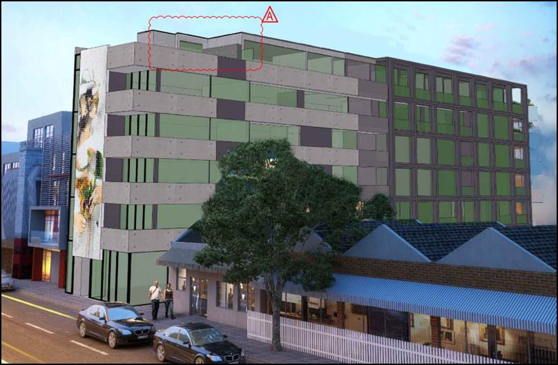
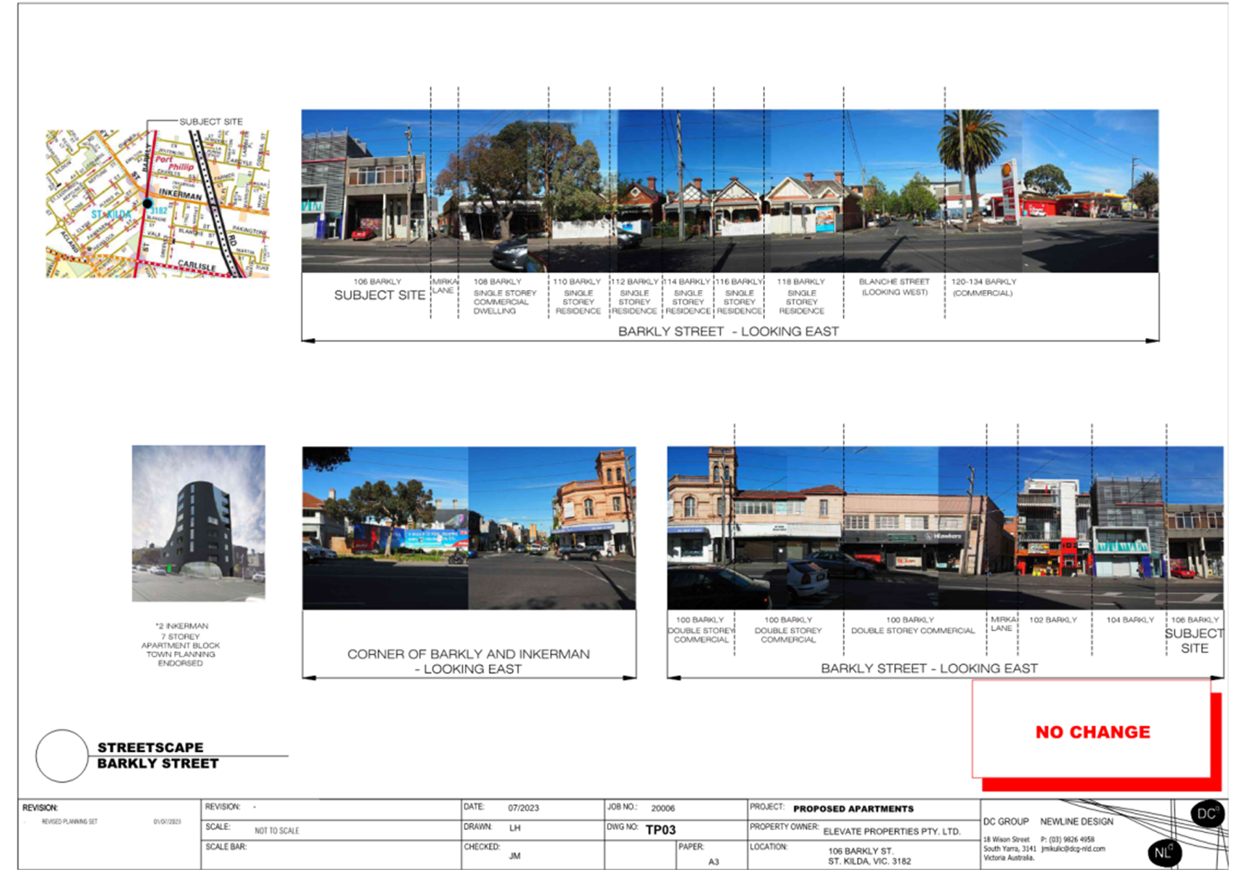
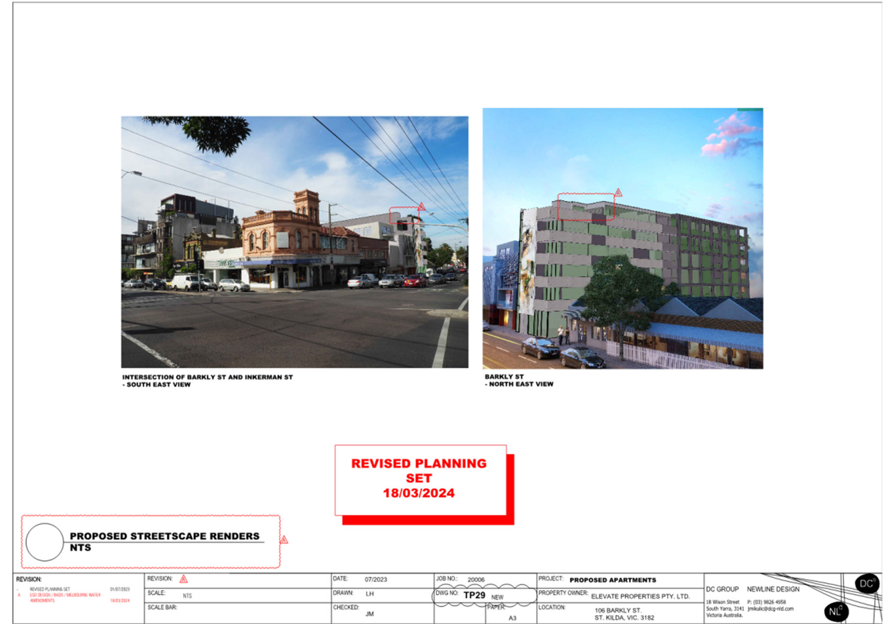
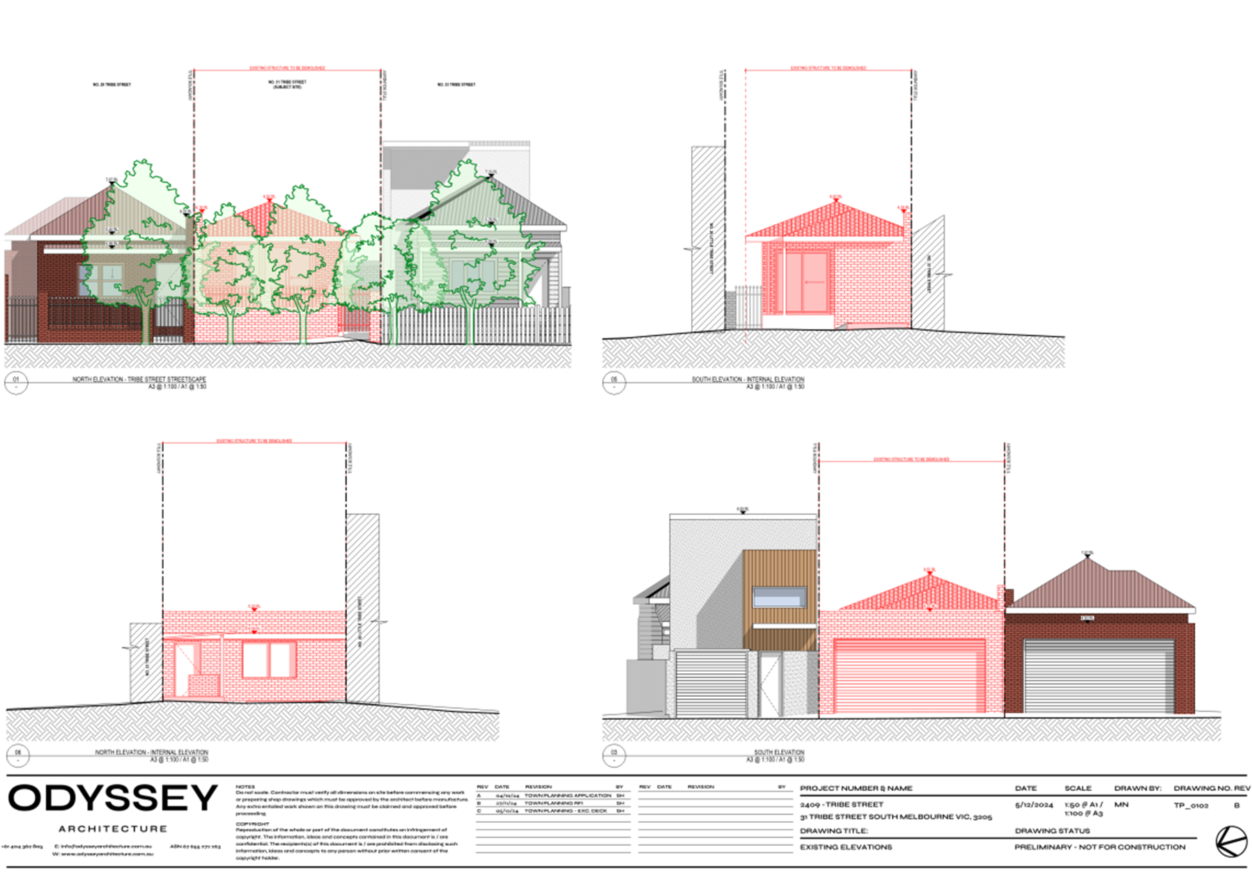
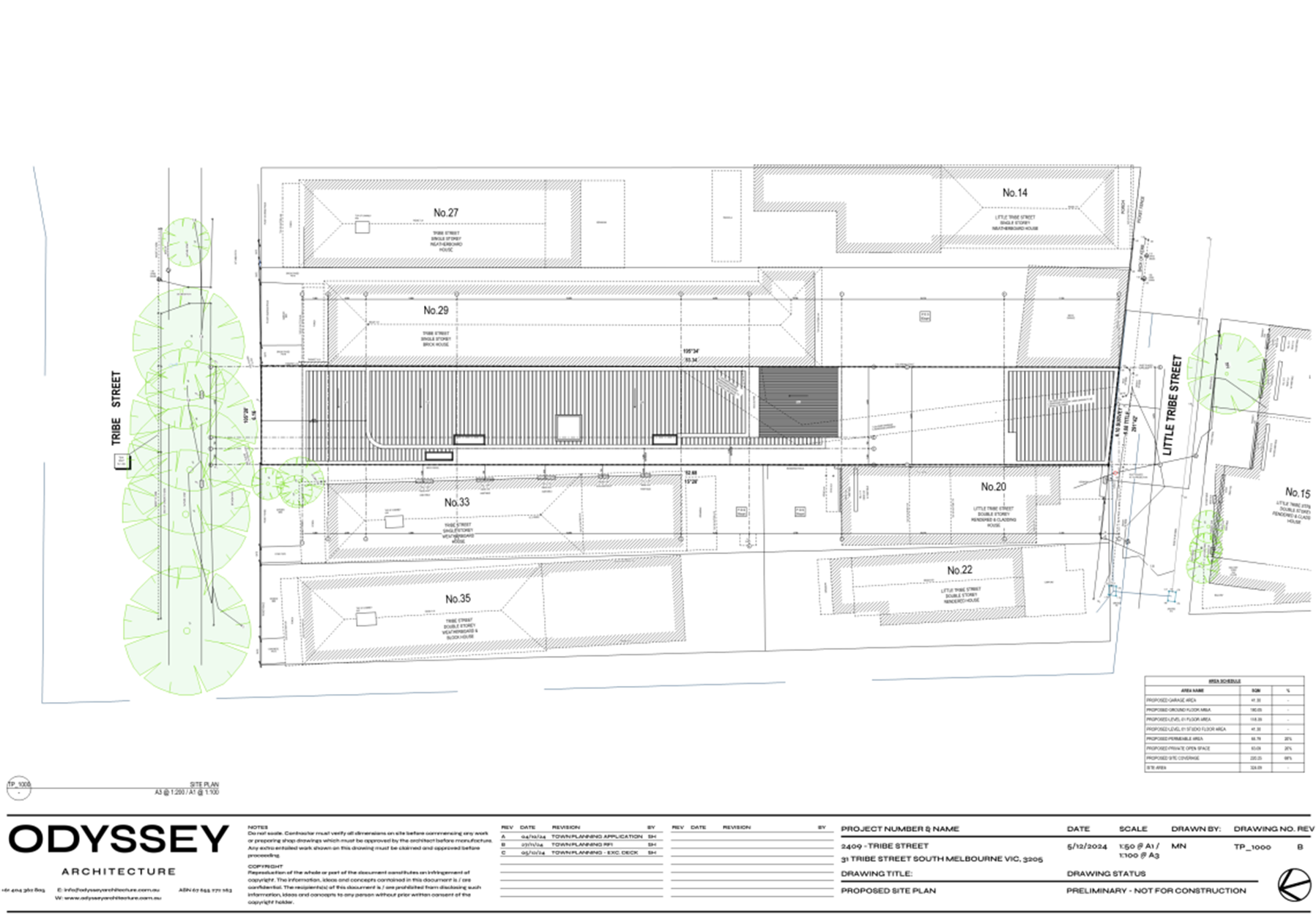
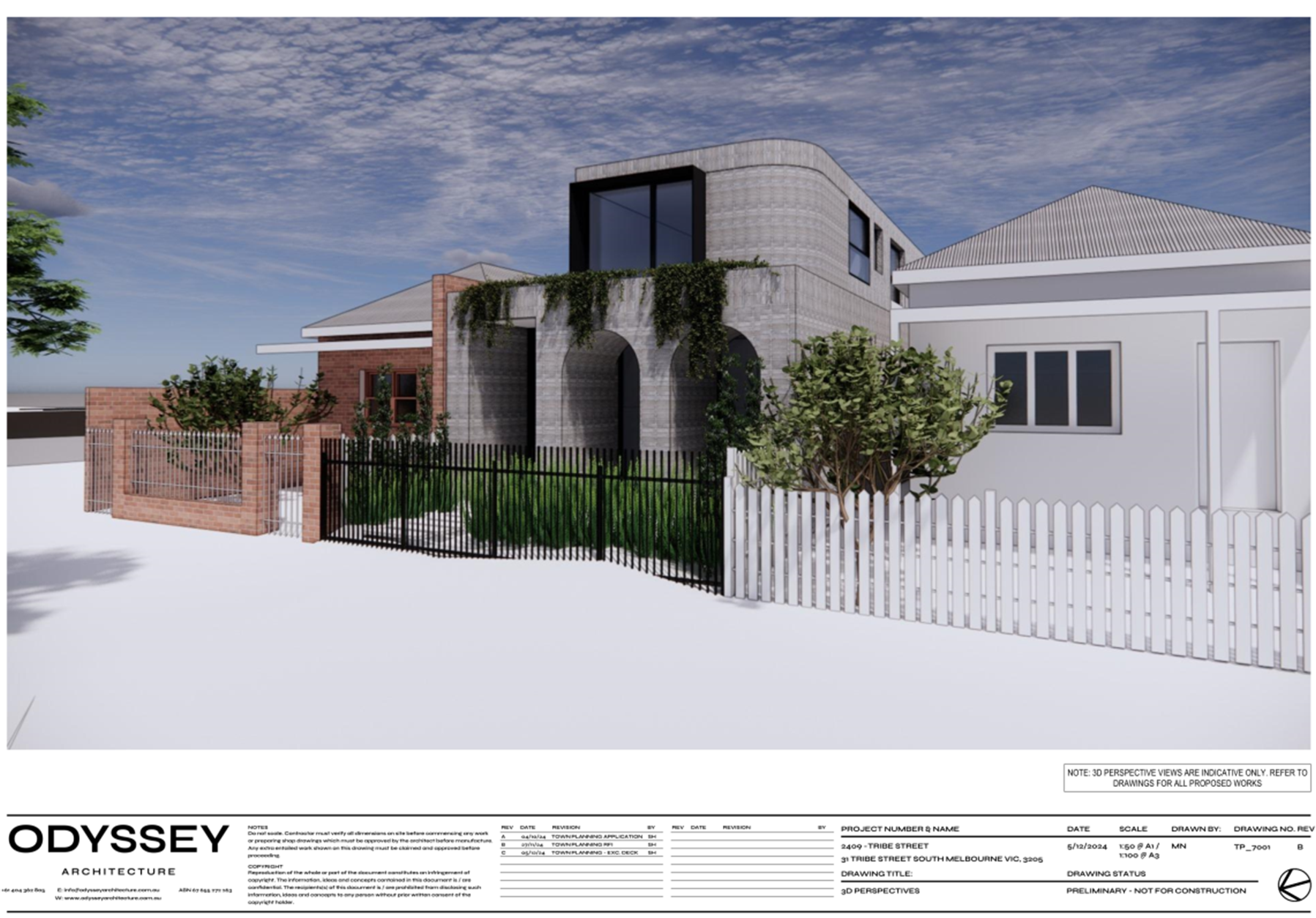
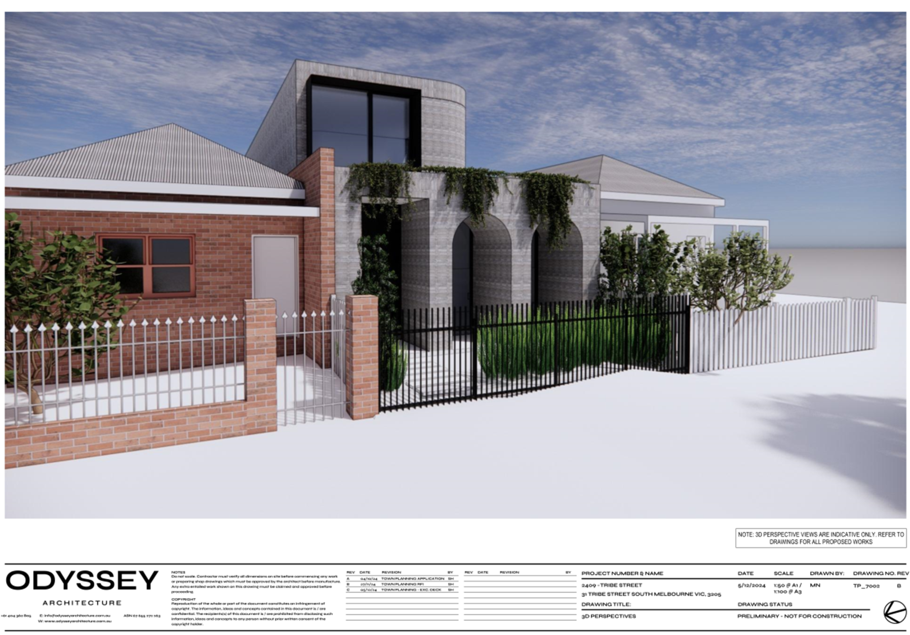
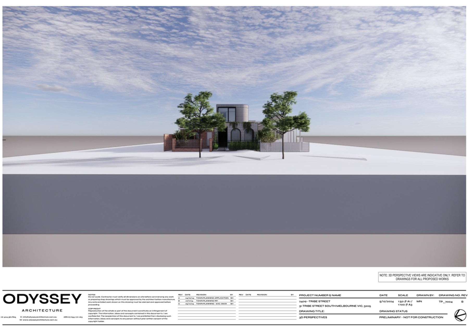
Figure 1 – Artist’s rendering of proposal as viewed from Barkly Street (elevated) to the south-west
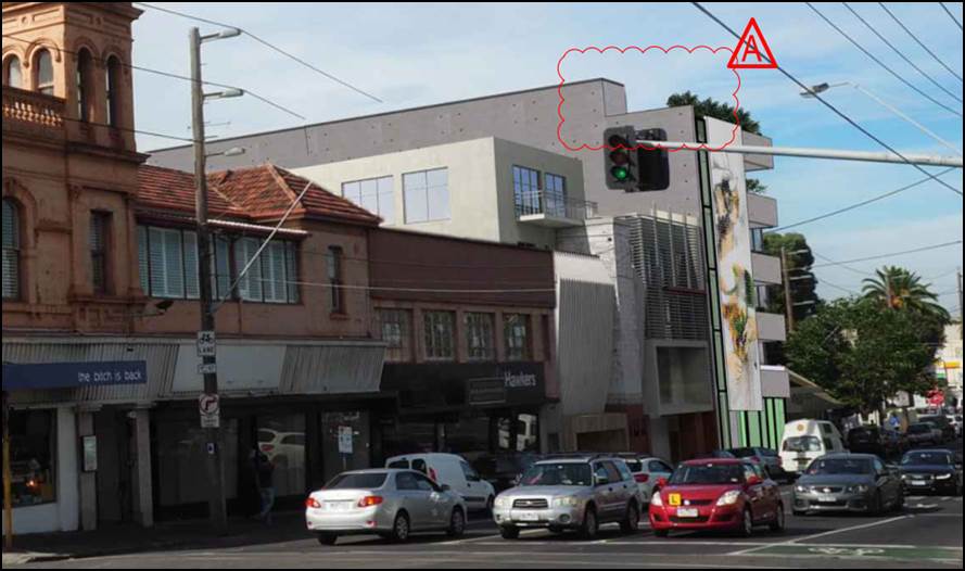
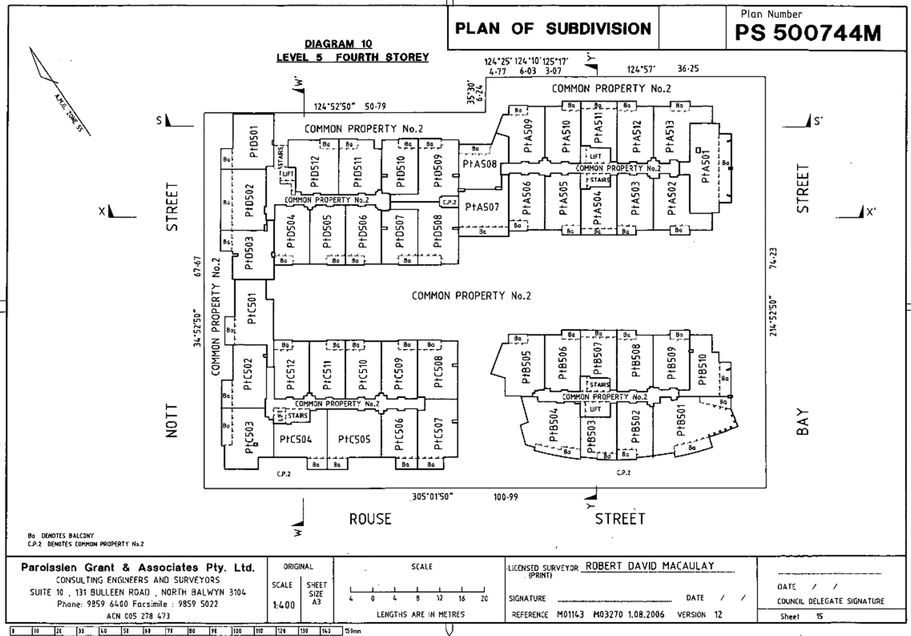
Figure 2 – Artist’s rendering of proposal as viewed from Barkly Street/Grey Street intersection to the north-west
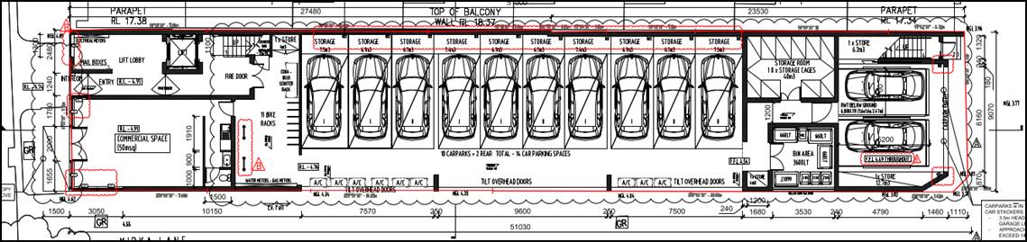
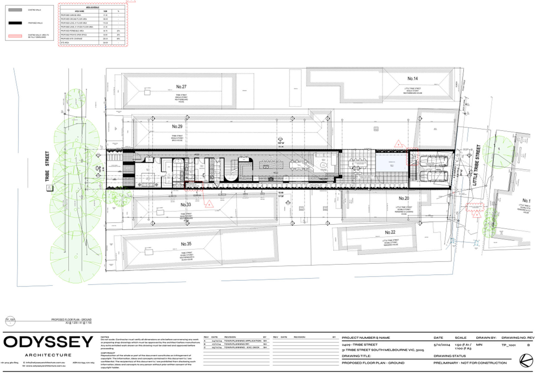
Figure 3 – Excerpt from proposed Ground Floor Plan
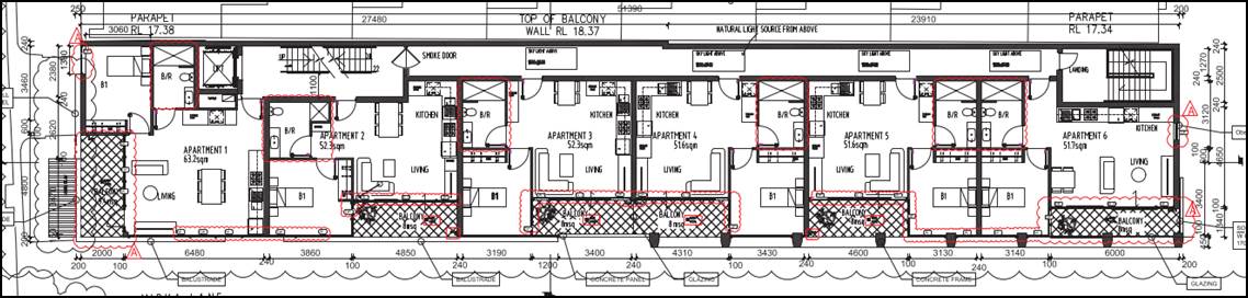
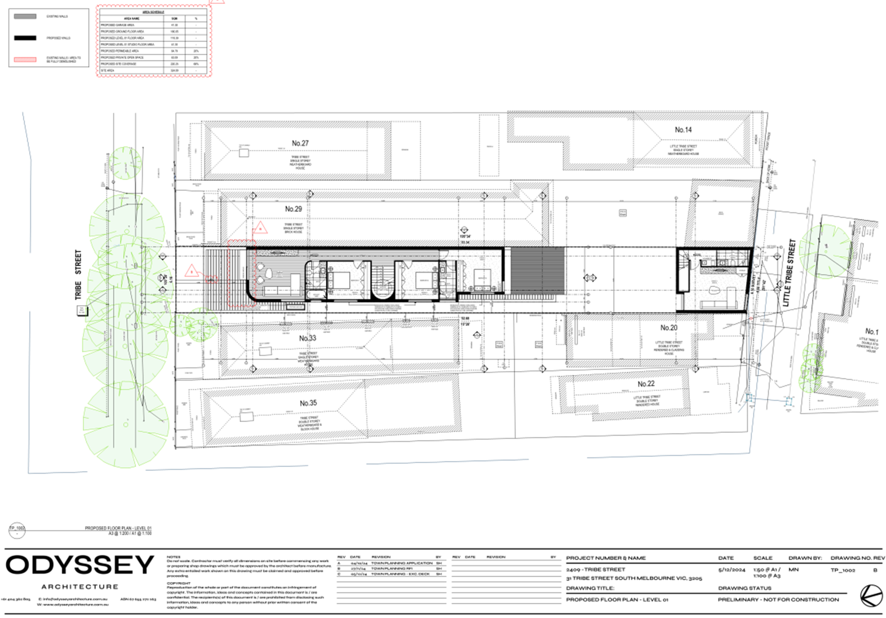
Figure 4 – Excerpt from proposed Level One Floor Plan
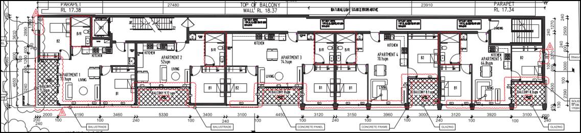
Figure 5 – Excerpt from proposed Level Two Floor Plan
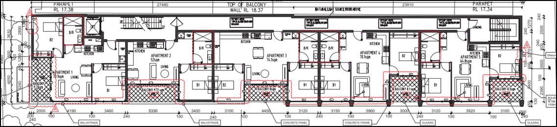
Figure 6 – Excerpt from proposed Level Three Floor Plan
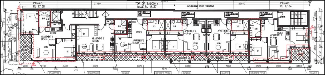
Figure 7 – Excerpt from proposed Level Four Floor Plan
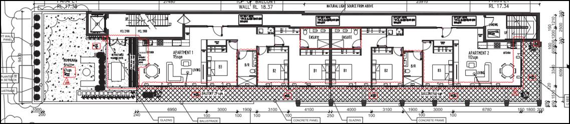
Figure 8 – Excerpt from proposed Level Five Floor Plan
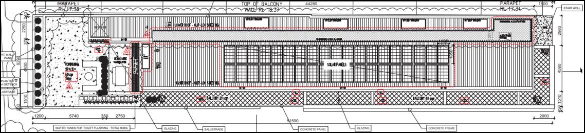
Figure 9 – Excerpt from proposed Roof Plan
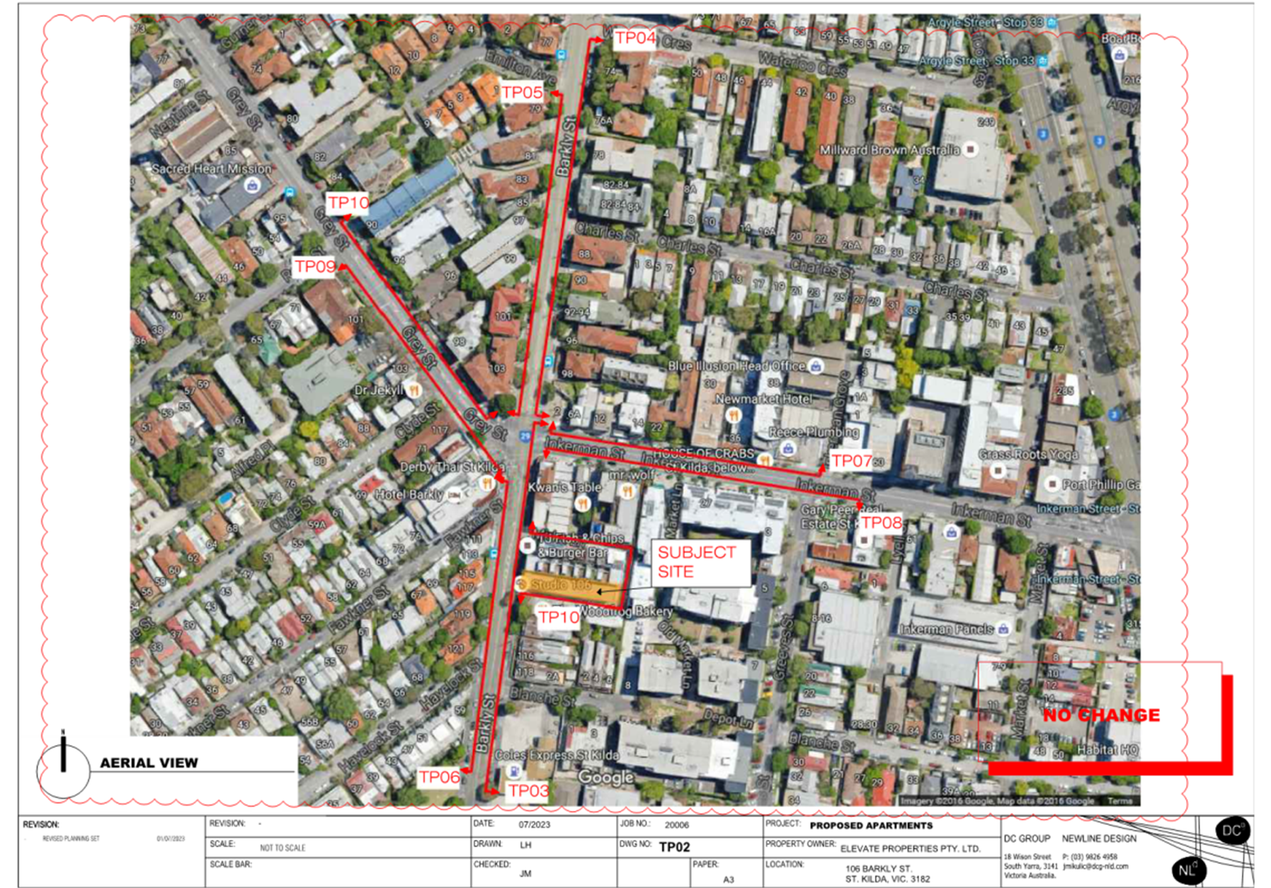
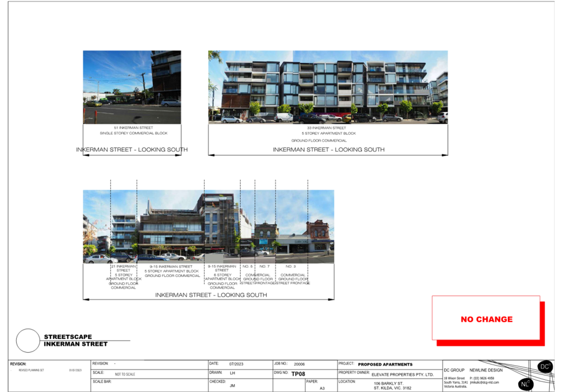
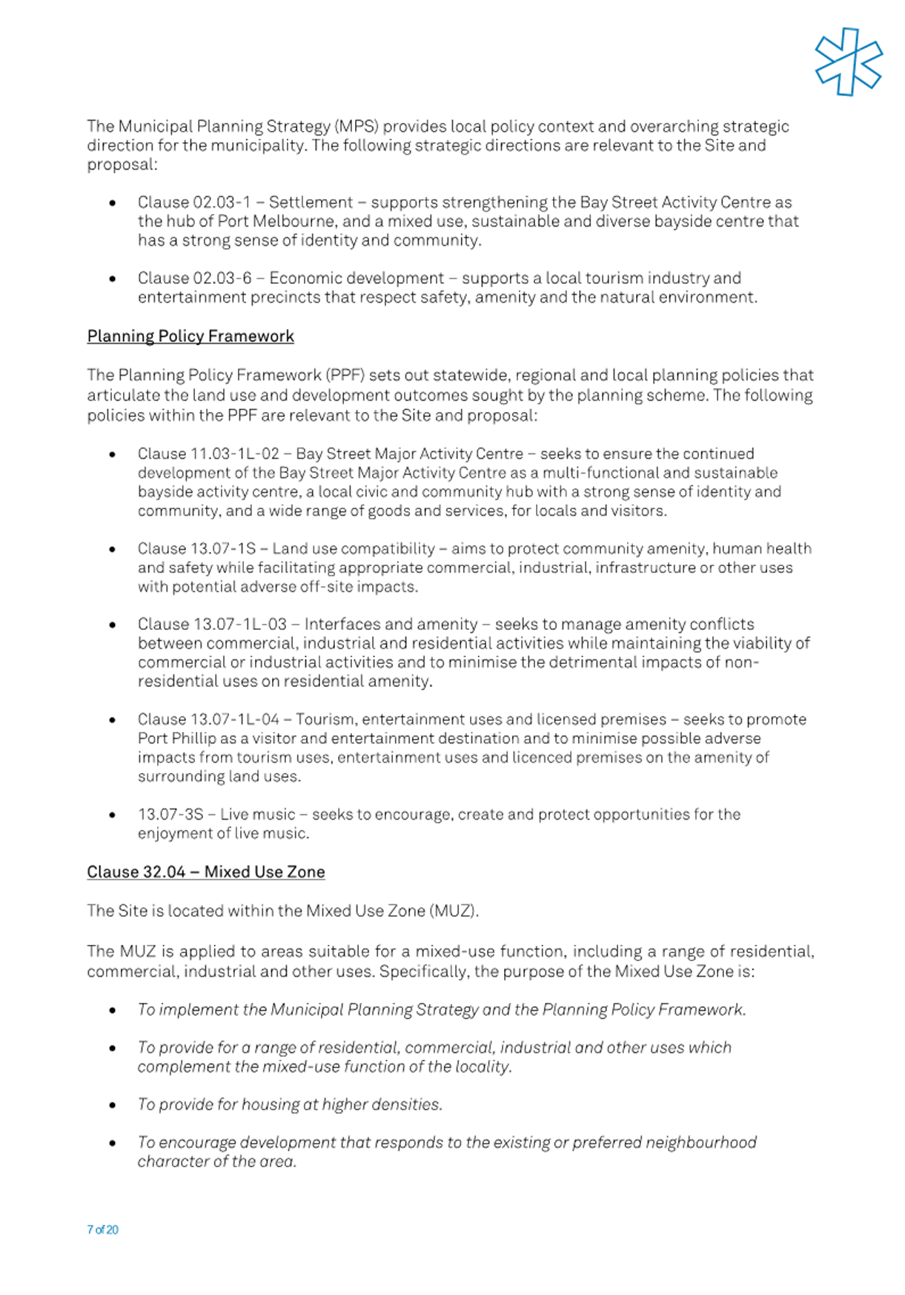
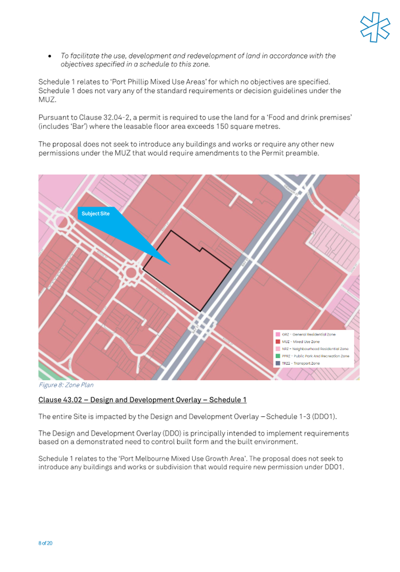
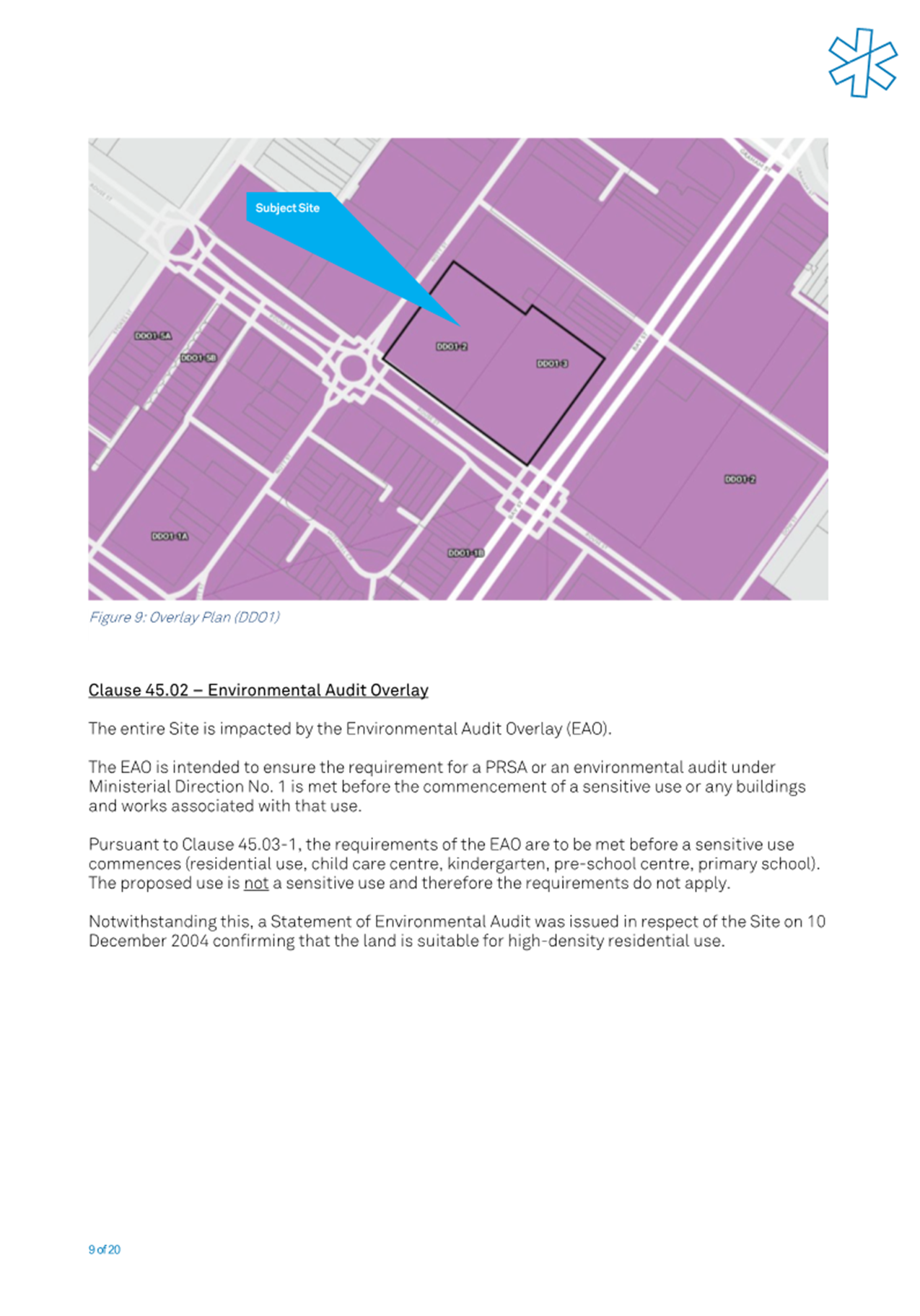
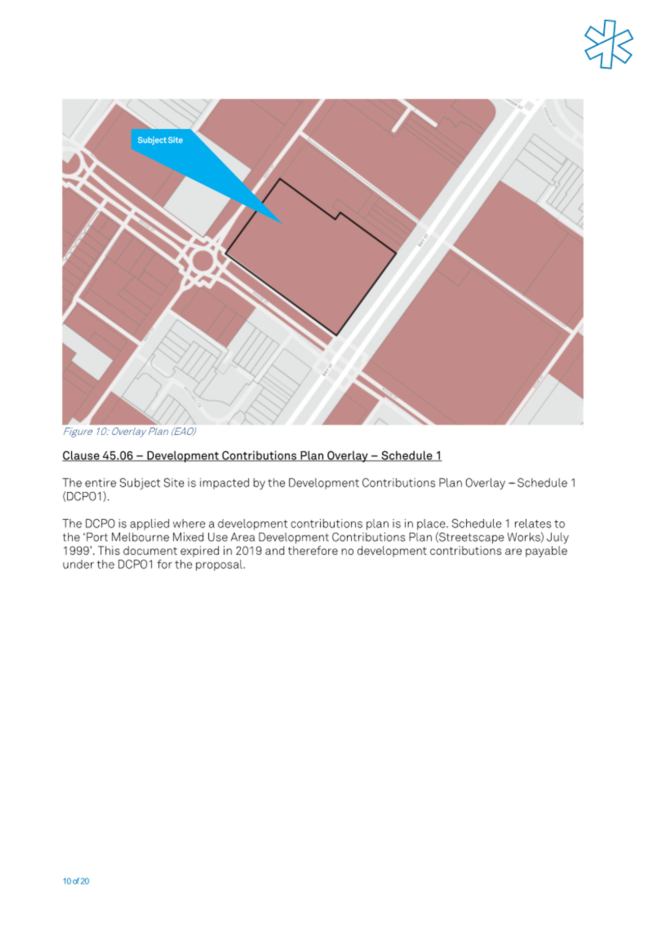
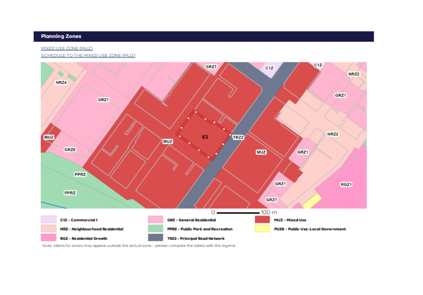
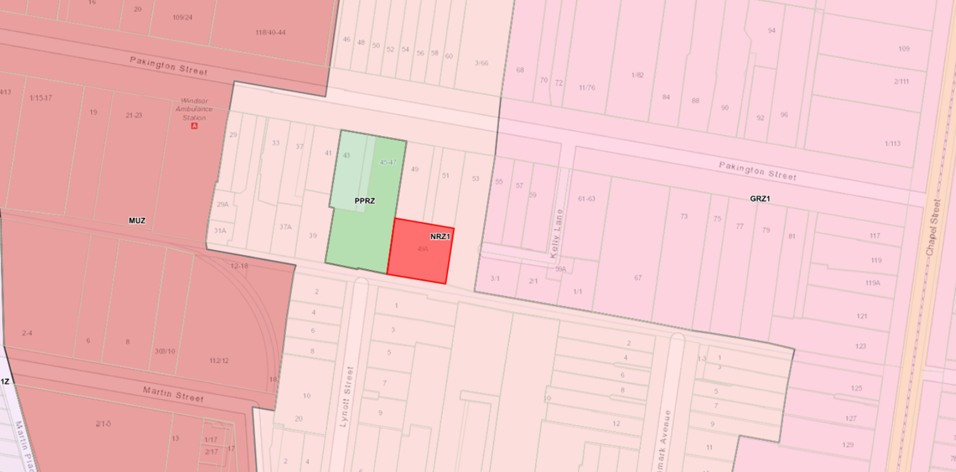
6. SUBJECT SITE AND SURROUNDS
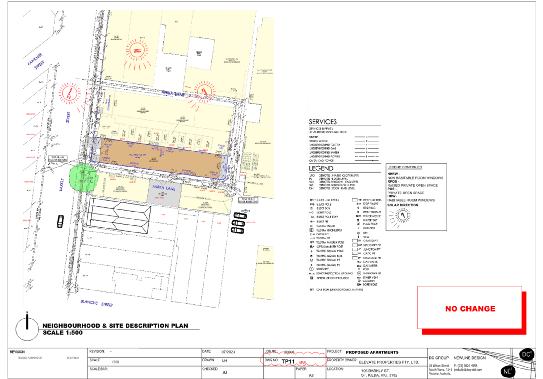
The subject site
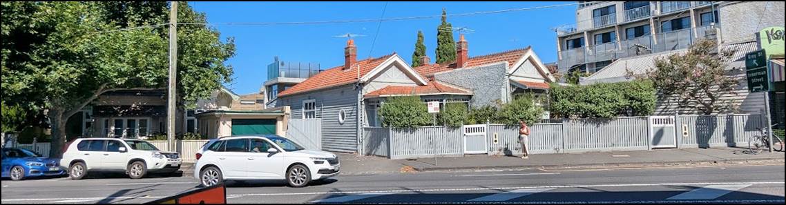
6.1 The subject site is an irregular shaped allotment, approximately 466 square metres in area, with a fall from west to east of approximately 1.1 metres. The site fronts Barkly Street to the west for a width of 9.16 metres and is 51.01 metres long at its deepest point. The site is bounded by Mirka Lane along the southern and eastern boundaries. The site is currently developed with a two-storey brick building which is used as an art gallery and studio. There is an existing vehicle crossover and pedestrian entrance to Barkly Street, and a vehicle crossover to Mirka Lane at the rear of the site. There is a power pole within the road reserve to the front of the site.
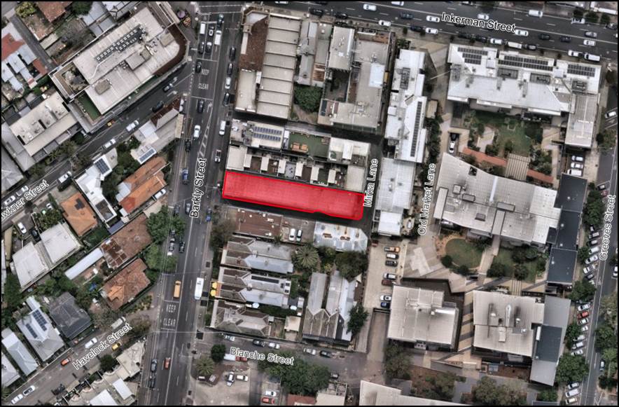
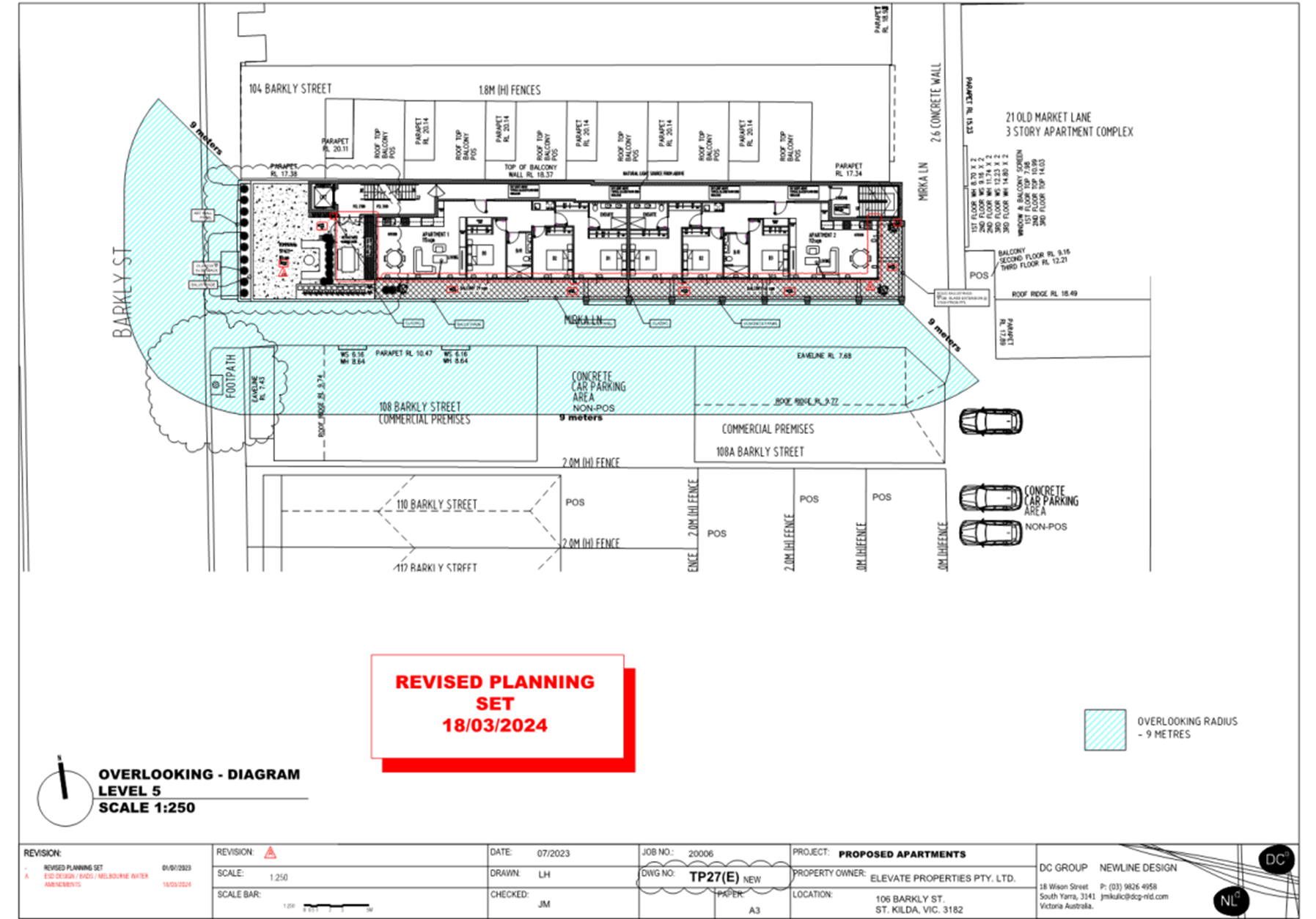
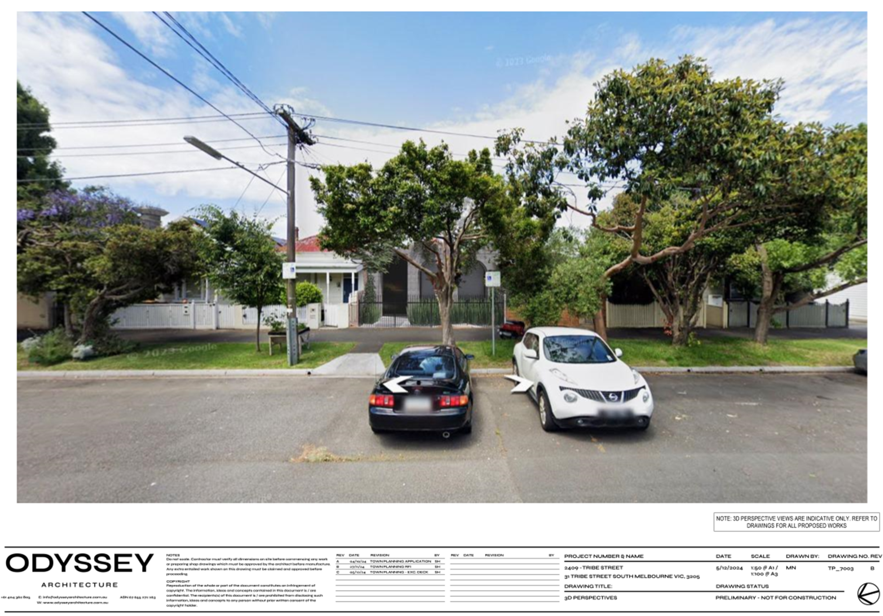
Figure 10 – Aerial image of subject site and surrounding area (NearMap – 1 December 2024)
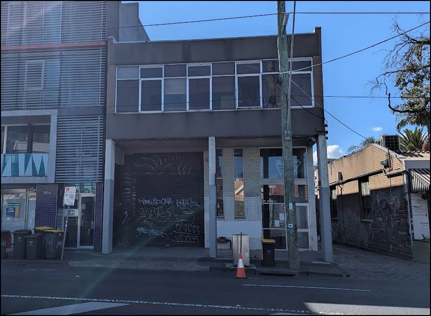
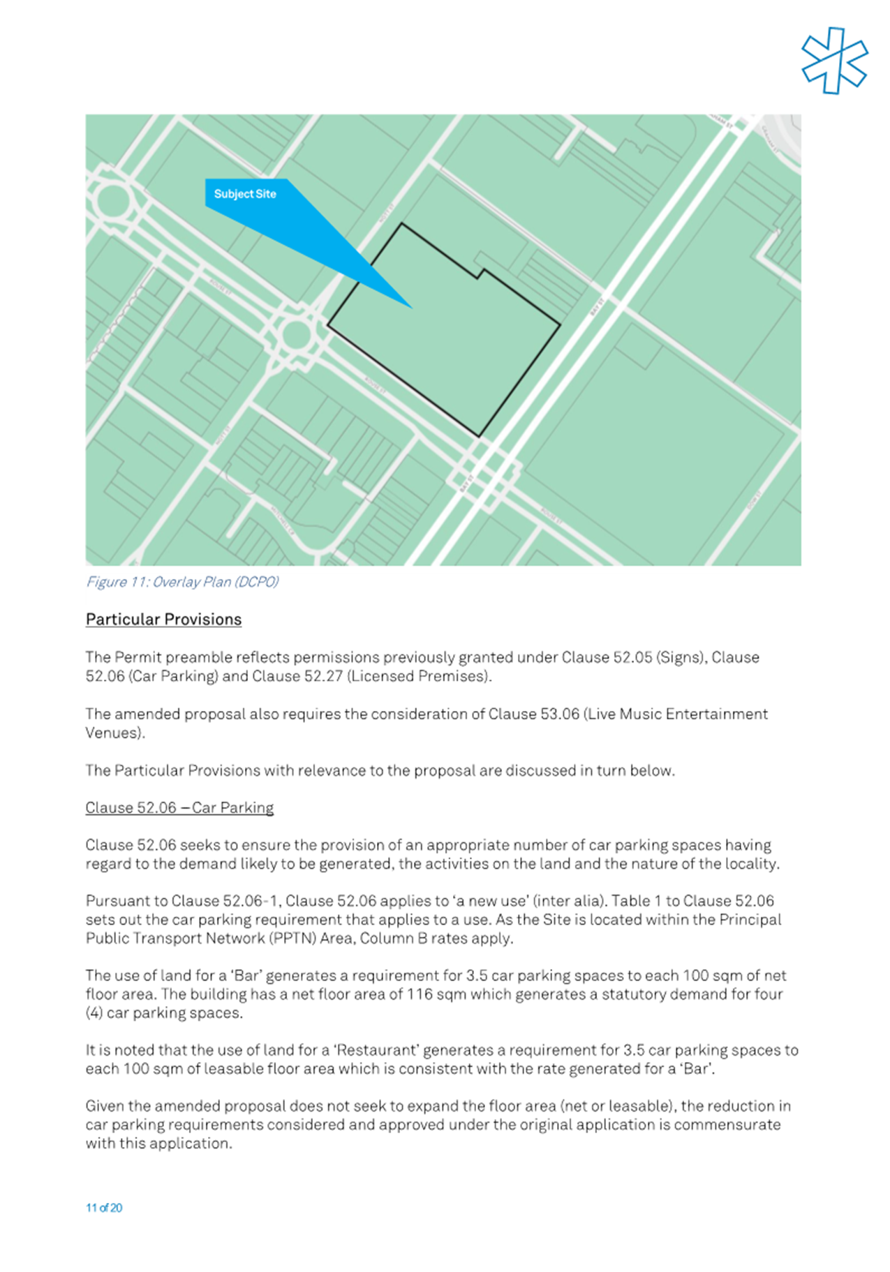
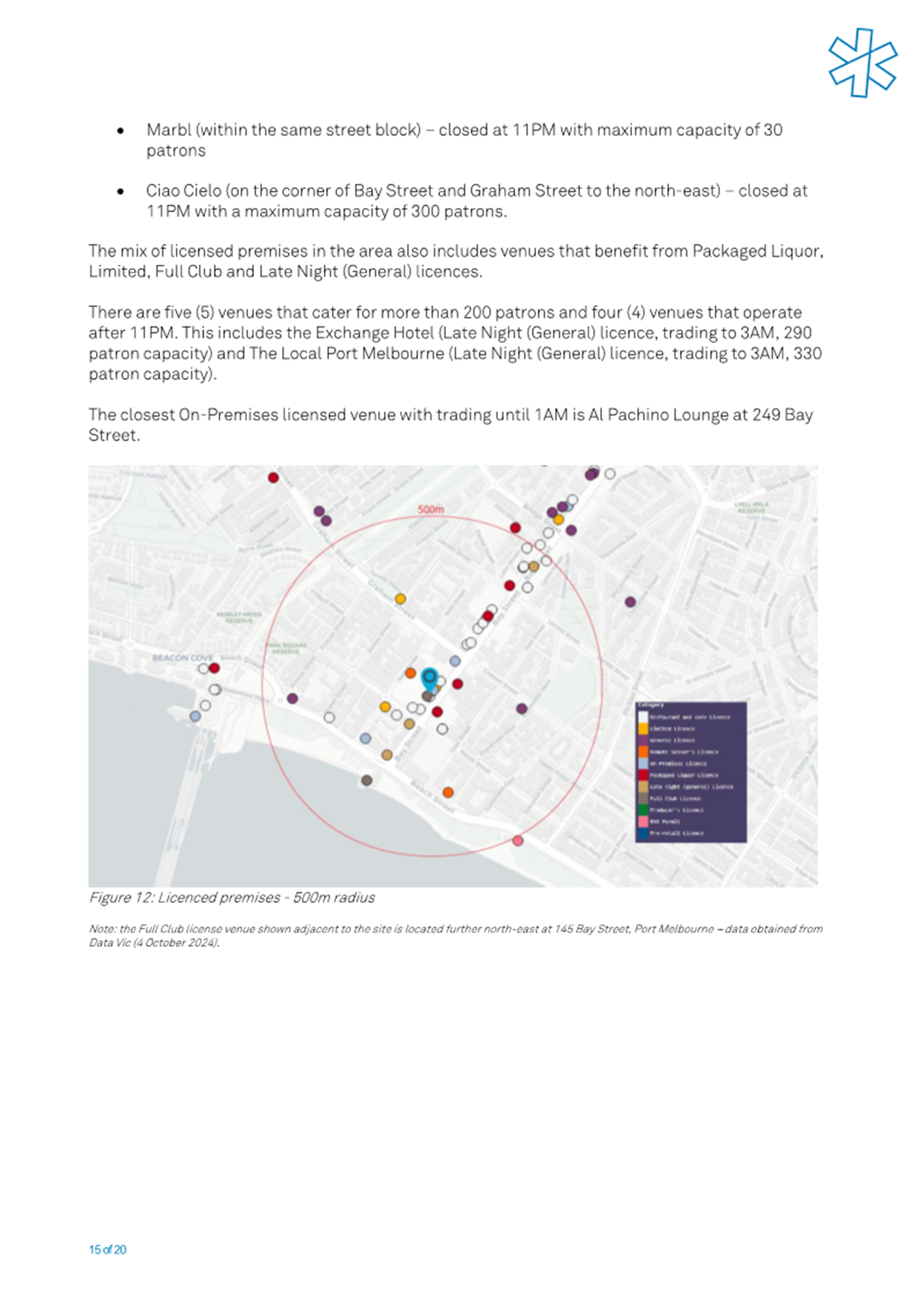
Figure 11 – Photo of subject site looking east from the opposite side of Barkly Street (Officer inspection – 18 February 2025)
|
|
|
|
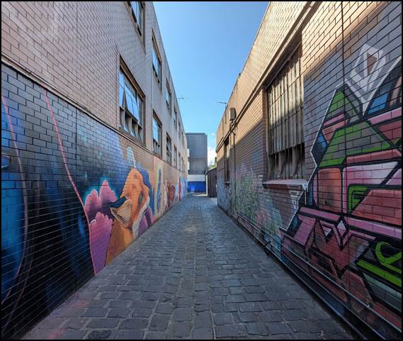
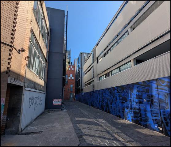
Figure 12 - Photo of Mirka Lane looking east from Barkly Street (Officer inspection – 18 February 2025) |
Figure 13 - Photo of Mirka Lane looking north from rear of subject site (Officer inspection – 18 February 2025) |
The surrounding area
6.2 The surrounding area sees a mix of commercial and residential zoning, and consequently a variety of land uses and development typologies, outlined below:
· Directly adjoining to the north is land zoned Commercial 1 Zone (C1Z) which is developed with a four-storey mixed-use building with a commercial tenancy at ground floor fronting Barkly Street and dwellings at the levels above. Beyond this to the north is also land zoned Commercial 1 Zone, which is also developed with a four-storey mixed use building with a commercial tenancy at ground floor and backpackers’ accommodation at the levels above.
· Adjacent to the east is land zoned Mixed Use Zone (MUZ) developed with a three-storey apartment building. This building forms part of a larger multi-building mixed use development with its primary frontages to Inkerman Street and Greeves Street.
· Adjacent to the south is land zoned Commercial 1 Zone developed with two separate commercial buildings with a centrally located car parking area. Beyond this to the south-west is land also zoned Commercial 1 Zone, and to the south-east is land zoned Mixed Use Zone, developed with single-storey dwellings.
· Adjacent to the west is land zoned General Residential Zone (GRZ), developed with single dwellings of a mix of one and two storey built form.
6.3 Barkly Street, directly adjoining to the east, is in the Transport Zone 2, being a declared road that is under the management of the Department of Transport and Planning.
Figure 14 – Map showing zoning of site and surrounding area
6.4 The following table details nearby sites which have been redeveloped with apartment, mixed-use, or commercial developments:
|
104 Barkly Street Four-storey mixed-use development |
102 Barkly Street Four-storey mixed use development |
|
1 Mirka Lane Four-storey apartment development |
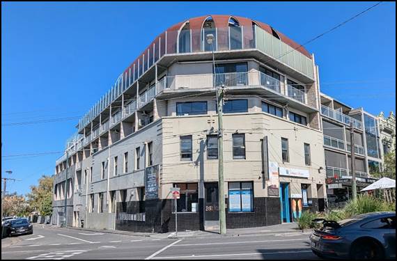
109 Barkly Street & 127-131 Grey Street Five-storey hotel and backpacker accommodation |
|
9-15 Inkerman Street Five to six-storey mixed-use development |
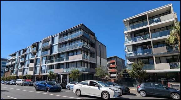
33 Inkerman Street, 3-7 Greeves Street, 1 Depot Lane & 8 Blanch Street Large redevelopment site containing six buildings varying from three to six-storeys |
|
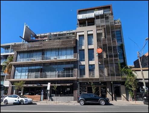
71 Inkerman Street Seven-storey residential development |
38 Inkerman Street Five-storey mixed-use development |
|
78 Inkerman Street Six-storey mixed-use development |
61-63 Inkerman Street Seven-storey office development |
|
|
|
|
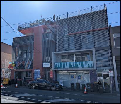
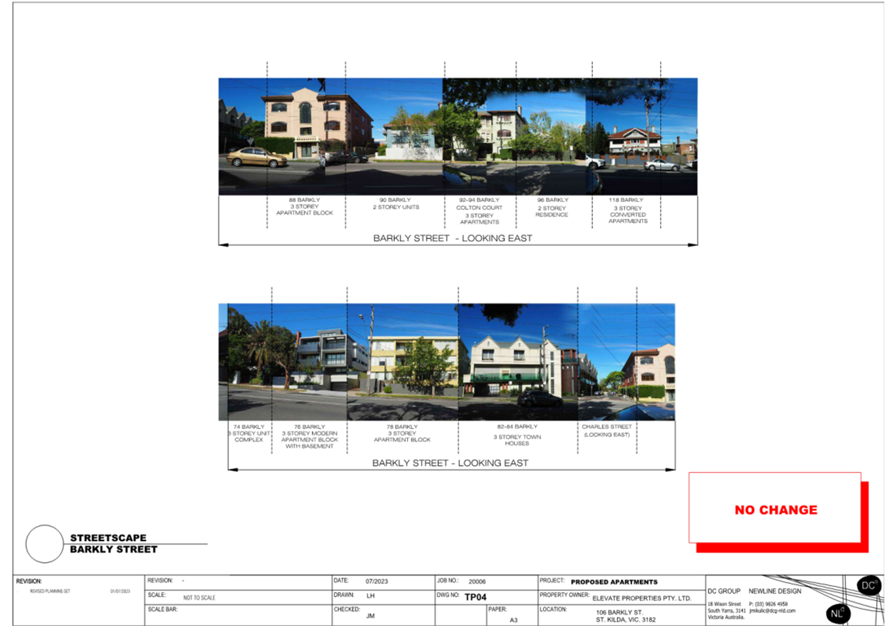
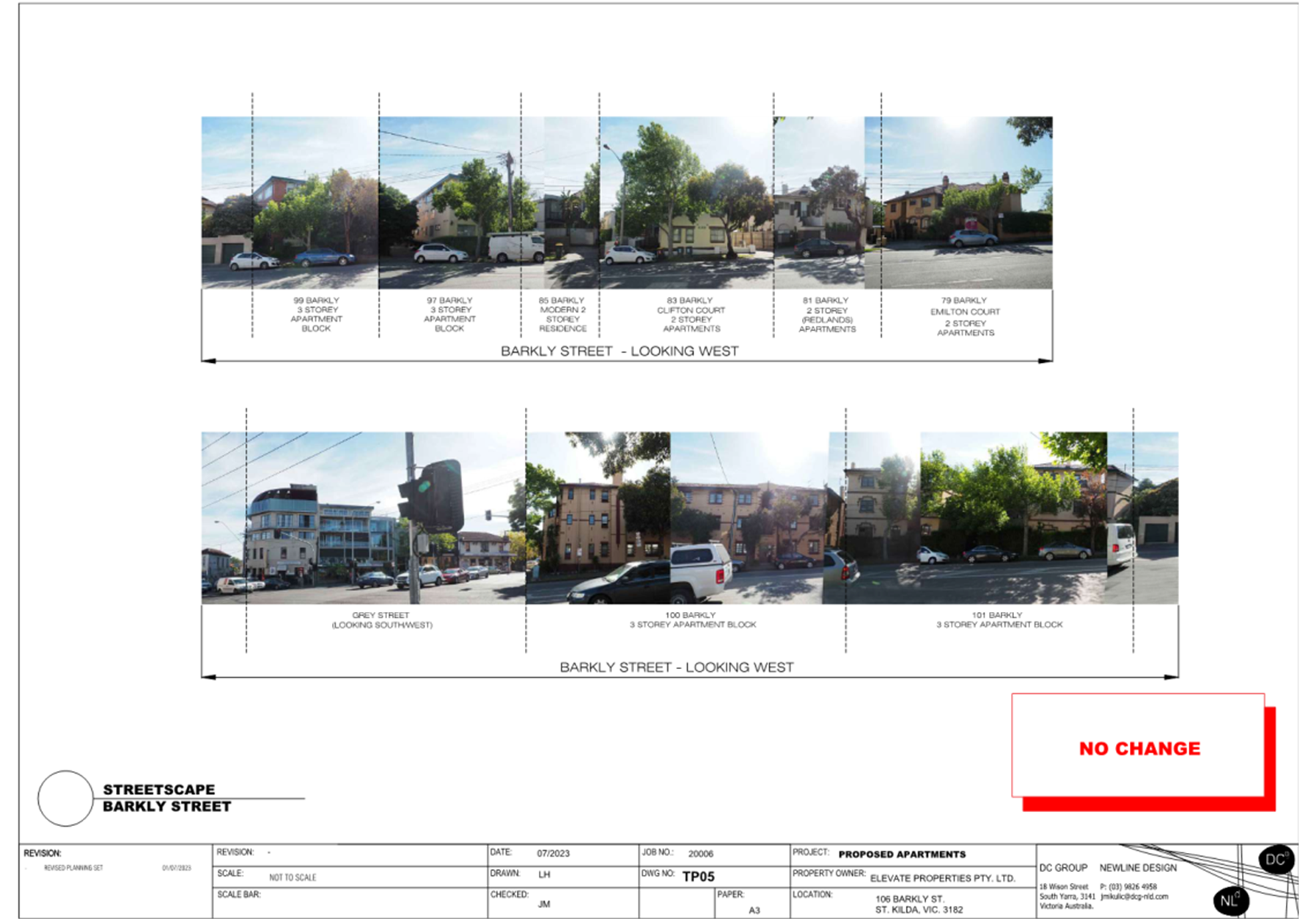
Figure 15 – Photo of 102 and 104 Barkly Street frontages, adjoining subject site to north (Officer inspection – 18 February 2025) |
Figure 16 – Photo of 108 and 110 Barkly Street frontages, adjacent subject site to south (18 February 2025)
|
|
|
|
|
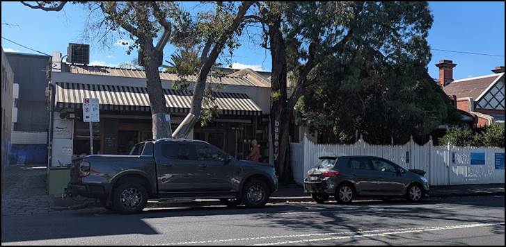
Figure 17 – Photo of 115 to 119 Barkly Street, adjacent subject site to west (Officer inspection – 18 February 2025) |
|
|
|
|
|
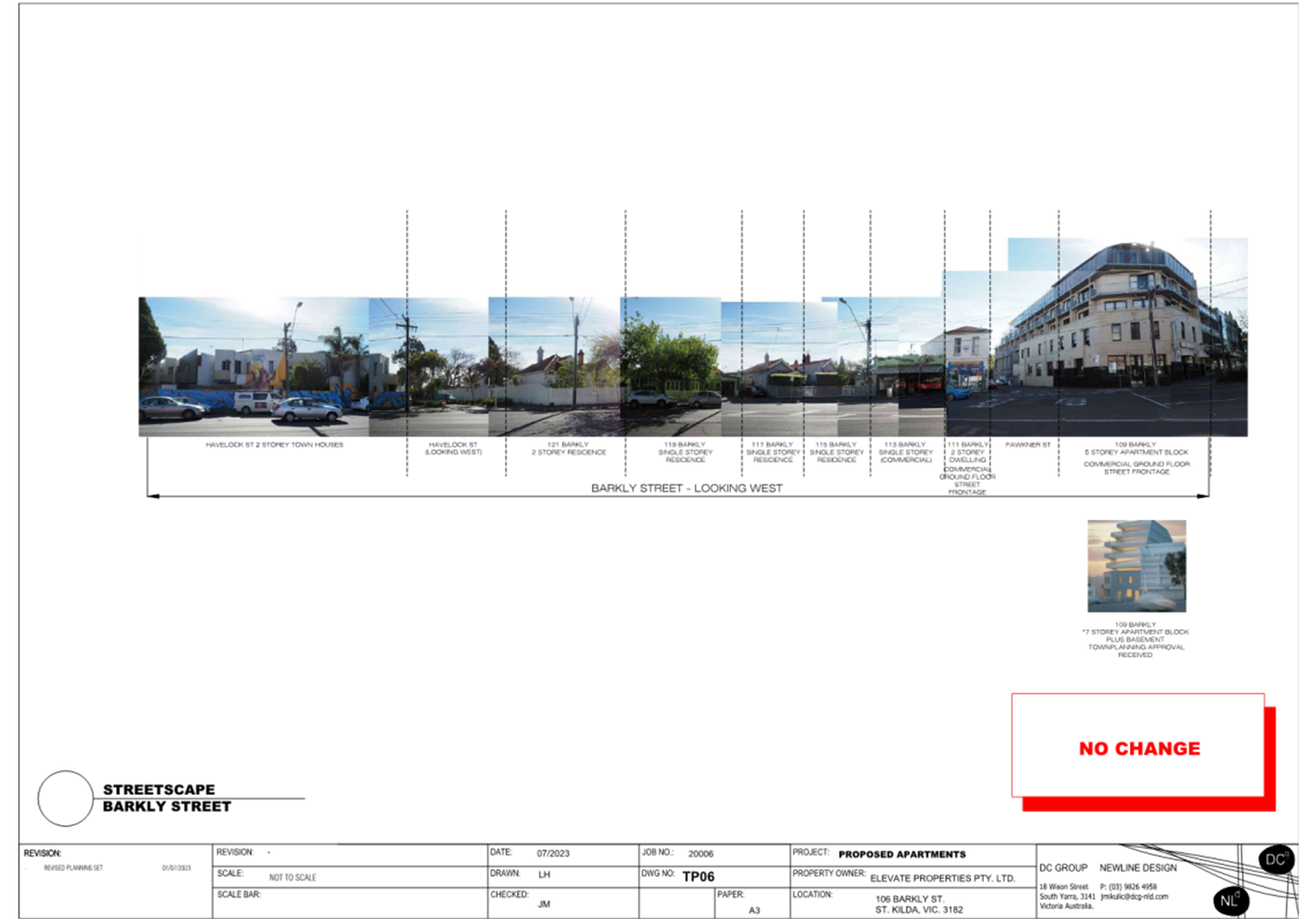
Figure 18 – Photo of 109 Barkly Street, nearby subject site to north-west (Officer inspection – 18 February 2025) |
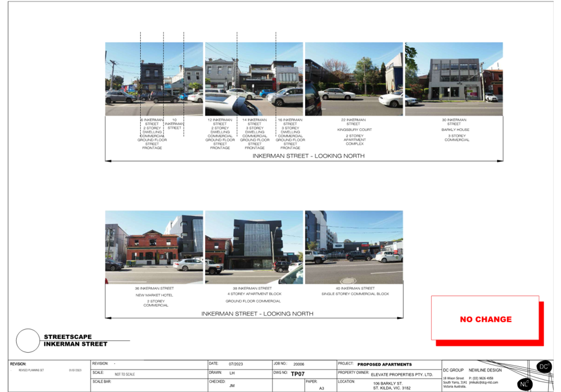
Figure 19 – Photo of 9-15 Inkerman Street, nearby subject site to north (Officer inspection – 18 February 2025) |
|
|
|
|
Figure 20 – Photo of 33 Inkerman Street, nearby subject site to north-east (Officer inspection – 18 February 2025) |
Figure 21 – Photo of 71 Inkerman Street, nearby subject site to north-east (Officer inspection – 18 February 2025) |
|
|
|
Figure 22 – Photo of 38 Inkerman Street, nearby subject site to north-east (Officer inspection – 18 February 2025) |
7. PERMIT TRIGGERS
7.1 The following zone, overlay, and particular provisions apply to the site and are relevant to assessment of the proposal. Planning permission required as described below:
|
Planning control |
Why is a permit required? |
|
Clause 34.01 Commercial 1 Zone (C1Z) |
Use A permit is not required to use the land for the purpose of a shop (Section 1 Use, no maximum leasable floor space specified). A permit is required to use the land for accommodation where any frontage exceeds 2 metres noting the frontage associated with the dwellings onto Barkly Street is approximately 3.6m wide. Buildings and works A permit is required to construct a building or construct or carry out works. An apartment development must meet the requirements of Clause 58. |
|
Clause 36.04 Transport Zone (TRZ2) |
Buildings and works A permit is required to construct a building or construct or carry out works. This includes an application requirement pursuant to Clause 36.04-3 for the application to be accompanied by the written consent of the Head, Transport for Victoria indicating that the Head, Transport for Victoria consents generally or conditionally to either: · The application being made. · The application being made and to the proposed use or development. Consent has been provided from Head, Transport for Victoria. |
|
Clause 44.05 Special Building Overlay, Schedule 1 (SBO1) |
Buildings and works A permit is required to construct a building or to construct or carry out works. |
|
Clause 52.06 Car Parking |
A permit is required to reduce the number of car parking spaces required under Clause 52.06-5. The development generates a requirement for 27 spaces. A reduction of 13 spaces is sought. |
8. PLANNING SCHEME PROVISIONS
8.1 The following policies, controls, and provisions are relevant to assessment of this application:
Municipal Planning Strategy (MPS) and Planning Policy Framework (PPF)
· Clause 02 – Municipal Planning Strategy
o Clause 02.01 – Context
o Clause 02.02 – Vision
o Clause 02.03 – Strategic Directions
· Clause 11 – Settlement
o Clause 11.03 – Planning For Places
§ Clause 11.03-1L-04 – Local and neighbourhood activity centres
· Clause 13 – Environmental Risks and Amenity
o Clause 13.01 – Climate Change Impacts
o Clause 13.03 – Floodplains
§ Clause 13.03-1S – Floodplain management
o Clause 13.07 – Amenity, Human Health and Safety
§ Clause 13.07-1S – Land use compatibility
§ Clause 13.07-1L-03 – Interfaces and amenity
· Clause 15 – Built Environment and Heritage
o Clause 15.01 – Built Environment
§ Clause 15.01-1S – Urban design
§ Clause 15.01-1L-02 – Urban design
§ Clause 15.01-2S – Building design
§ Clause 15.01-2L-01 – Building design
§ Clause 15.01-2L-10 – Environmentally sustainable development
§ Clause 15.01-2L-03 – Urban art
§ Clause 15.01-4S – Healthy neighbourhoods
§ Clause 15.01-4R – Healthy neighbourhoods – Metropolitan Melbourne
§ Clause 15.01-5S – Neighbourhood character
§ Clause 15.01-5L – Neighbourhood character
· Clause 16 – Housing
o Clause 16.01 – Residential Development
§ Clause 16.01-1S – Housing supply
§ Clause 16.01-1R – Housing supply – Metropolitan Melbourne
§ Clause 16.01-1L-01 – Housing diversity
§ Clause 16.01-1L-02 – Location of residential development
§ Clause 16.01-2S – Housing affordability
· Clause 17 – Economic Development
o Clause 17.01 – Employment
§ Clause 17.01-1S – Diversified economy
o Clause 17.02 – Commercial
§ Clause 17.02-1S – Business
· Clause 18 – Transport
o Clause 18.01 – Land Use and Transport
§ Clause 18.01-1S – Land use and transport integration
§ Clause 18.01-1L-01 – Land use and transport integration
§ Clause 18.01-3S – Sustainable and safe transport
o Clause 18.02 – Movement Networks
§ Clause 18.02-4L-01 – Car parking
· Clause 19 – Infrastructure
o Clause 19.03 – Development Infrastructure
§ Clause 19.03-3L – Stormwater management (water sensitive urban design)
Zone and Overlay Controls
· Clause 34.01 – Commercial 1 Zone
· Clause 36.04 – Transport Zone 2
· Clause 44.05 – Special Building Overlay, Schedule 1
Particular, General, and Operational Provisions
· Clause 52.06 – Car Parking
· Clause 53.03 – Residential Reticulated Gas Service Connection
· Clause 53.18 – Stormwater Management in Urban Development
· Clause 58 – Apartment Developments
· Clause 65 – Decision Guidelines
· Clause 71.02-3 – Integrated decision making
9. REFERRALS
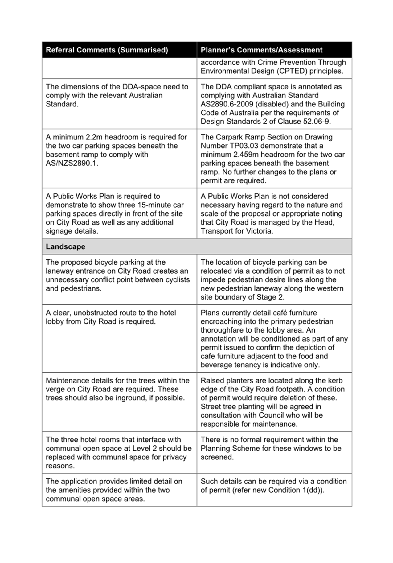
Internal referrals
9.1 The application was referred to the following areas of Council for comment. Below is a summary of those comments and requirements, and a response to each where further assessment or a condition to address an issue was required. Where referral comments were provided detailing an element of the proposal was satisfactory, these have not been included in the table below:
|
Waste Services comments |
Planner’s response |
|
Hard waste storage and green waste stream not provided |
The proposal has been amended to include a green waste stream. A hard waste storage area has not been included in the amended application. On balance this is considered an acceptable outcome, acknowledging that City of Port Phillip provide sufficient hard waste collection services to multi-unit developments. If additional disposal services are required these can be arranged by residents on an as-required basis. Considering the alternative to require provision of a hard waste area, due to the constraints of the site, this would only be achievable if the equivalent area was repurposed at ground floor and likely other facilities or car parking spaces removed. Doing so is not considered an acceptable outcome in this instance. |
|
Additional information required for operation of bin room (i.e. washing and drainage facilities) |
An updated Waste Management Plan has been provided with additional details for washing and drainage facilities for the bin room. |
|
Waste collection from Mirka Lane should not be supported as this is a ‘No Standing’ area. |
Waste collection remains proposed via Mirka Lane. Whilst an alternative collection method which avoids blocking the laneway has not been provided, additional details have been included in the WMP detailing the expected length of time the collection vehicle will be required to stage (2-3 minutes, twice a week). It is considered there is no other viable alternatives for waste collection. It is not feasible to require collection from Barkly Street due to the bluestone construction of the laneway meaning bins are not easily transferred to-and-from the property frontage. Doing so would also create additional issues where bins would be temporarily located within the footpath area which can result in a poor presentation to the front of the property and impact on ease of footpath use for pedestrians. It is also considered inappropriate to require waste collection to occur wholly within the confines of the site, noting again that the site is highly constrained and to do so would require further removal of car parking spaces and changes to vehicle access design to Mirka Lane. For these reasons, and that waste collection will occur for at worst 6 minutes each week, the proposed collection method is appropriate. |
|
Urban Design comments |
Planner’s response |
|
3D realistic perspectives and photomontages not submitted
|
3D realistic perspectives and photomontages are not necessary to conduct a detailed assessment, nor would be endorsed to form part of a permit if one were to issue. The level of detail contained within the architectural plan set, which includes a streetscape elevation showing the development in context, is sufficient to assess the application. |
|
Development equity not provided to land opposite to the south due to lack of balcony screening
|
It is not deemed an acceptable outcome to require screening of the south-facing balconies to achieve development equity. Additional screening measures would severely compromise the internal daylight access of the south-facing apartments. It is acknowledged that screening measures may be required for a potential development opposite to the south, however as those apartments opposite would be north-facing with greater daylight access, internal amenity impacts would be much lesser than if the same was required for this proposal. |
|
Insufficient awning along Barkly Street frontage
|
Awnings are not a common design response along Barkly Street, with neither of the two mixed-use developments to the north have an awning to the frontage. The proposed recessed residential entry provides adequate cover for occupants, and the proposed awning sufficient cover to the commercial tenancy. |
|
Poor circulation areas around lift
|
It is acknowledged that the circulation area adjoining the lift and stairwell is constrained. It is recommended this be increased to a minimum of 1.2 metres, and any doorways in common areas to be a minimum 850mm in width to reflect circulation area requirements for accessibility. |
|
Poor internal access to car park (via bike storage area)
|
It is not of concern that internal access to the car parking area traverses a bicycle and scooter parking area. It is a common design response for areas to be shared like this in developments of this scale and where internal space is of a premium. The minimum dimensions of that area are sufficient to ensure no conflict between occupants accessing the car parking area and parked bicycles. |
|
Toilet within commercial tenancy not accessible to those with limited mobility
|
It is unnecessary to assess the internal layout of the proposed commercial tenancy. The use contained within that tenancy is exempt from requiring a planning permit, and any subsequent internal fit out of that tenancy will be required to meet relevant building regulations, including accessibility requirements. |
|
Balconies and internal layouts of apartments non-compliant with applicable apartment standards |
See Officer assessment against Clause 58 (Apartment Developments) at Attachment 1. The assessment acknowledges that some variations are proposed to the requirements of the relevant standard, however these are considered acceptable in this circumstance. |
|
Building services and appearance not detailed
|
A standard ‘plant and equipment’ condition will ensure building services are constructed in accordance with the endorsed plans, with any changes to the design requiring further planning permissions. |
|
More detail required for urban art wall
|
A condition requiring submission of an Urban Art Plan in accordance with Council’s Urban Art Strategy is recommended. |
|
Blank wall architecture proposed to eastern elevation
|
The amended design has introduced additional fenestration to the eastern elevation to provide more visual interest than previously proposed. Whilst the eastern elevation is still somewhat sparce in appearance, the eastern elevation presents solely to the laneway and similarly developed and presenting buildings to the east. |
|
No landscape plan provided
|
A condition requiring submission of a detailed landscape plan is recommended. |
|
Traffic Engineering comments |
Planner’s response |
|
Complete waiver of car parking for all on-bedroom apartments is not supported. |
See Officer assessment against the requirements of Clause 52.06 (Car Parking) below in this report. |
|
A passing area is required as more than 10 car parking spaces are proposed and the site abuts an arterial road . |
Pursuant to Design Standard 1 of Clause 52.06-9 a passing area is only required for internal accessways which directly connect to a road in a Transport Zone 2. The does not apply in this instance as all vehicle access is proposed directly to Mirka Lane. |
|
Width, length, and aisle width dimensions are not shown on the plans. |
A condition is recommended which requires these dimensions to be shown on the plans to ensure ongoing compliance. |
|
2.1 metre headroom must be provided throughout the entire car park. |
Elevation plans and sectional diagrams headroom clearance at its lowest point to be 2.8 metres. |
|
Car spaces must be a minimum of 2.6 metres wide. |
See Officer assessment against the requirements of Clause 52.06 (Car Parking) below in this report. |
|
Car spaces which abut a wall on one side must be provided an additional 300mm clearance in accordance with Australian Standard AS2890.1 |
See Officer assessment against the requirements of Clause 52.06 (Car Parking) below in this report. |
|
Car stacker design does not meet Australian Standard AS2890.1 |
See Officer assessment against the requirements of Clause 52.06 (Car Parking) below in this report. |
|
The garage door must not encroach into Mirka Lane. |
A condition is recommended which requires annotation of the plans to detail operation of the garage door will be contained wholly within the boundaries of the site. |
|
The car stacker system is a dependent type system which in some circumstances will require queuing of vehicle within the laneway. Use of an independent-type stacker system would resolve this issue. |
See Officer assessment against the requirements of Clause 52.06 (Car Parking) below in this report. |
|
Pedestrian sightline splay is not provided on the site at the Mirka Lane and Barkly Street intersection . |
A condition is recommended to require a splay at this intersection in accordance with the referral comments. It is acknowledged that the sightline splay requirements of Clause 52.06 do not strictly apply to the intersection in question, however, given the increase in the level of traffic and consequential increase in opportunity for pedestrian-to-vehicle conflict from vehicles exiting Mirka Lane, it is recommended to require the splay to acceptably mitigate this conflict. It is further acknowledged that this will result in changes to the commercial tenancy presentation to Barkly Street, however these are considered minor and acceptable in this context, with the ability to absorb those changes within the current layout of the commercial tenancy. |
|
Swept path assessment show predominately reverse-in manoeuvres for car parking spaces which is inappropriately for the narrowness of the proposed spaces. |
See Officer assessment against the requirements of Clause 52.06 (Car Parking) below in this report. |
|
Over bonnet storage is not appropriate for reverse-in parking. |
Over bonnet storage is not proposed, with all storage adjacent to parking spaces wholly clear of the parking space. This is demonstrated within the submitted sectional plans. |
|
On-street parking near the northern end of Mirka Lane results in sightline issues for vehicles exiting Mirka Lane. |
The speed of vehicles traversing and existing Mirka Lane is sufficiently slow that drivers will be able to moderate and control their views when exiting onto Barkly Street. |
|
Right turns into Barkly Street should only occur at the southern end of Mirka Lane. |
It is not possible to condition for this to occur, nor is traffic management of this nature appropriate as part of an approval for an application of this scale. |
|
No detailed traffic analysis has been undertaken of existing and expected post-development traffic volumes. |
It is not considered necessary to require detailed traffic analysis for the scale of the proposal. The submitted Traffic Engineering report contains sufficient detail to assess the application against the requirements of the Scheme. |
|
It is unclear if existing surface conditions of the laneway are satisfactory to enable additional traffic volumes. |
It is not considered necessary to require surface upgrades to Mirka Lane to facilitate expected traffic volumes resulting from the development. Vehicles currently traverse the laneway to achieve vehicle access to car parking for a number of nearby developments with no known issues to Council. |
|
Drainage implications resulting from the development are unclear. |
The application appropriately addresses stormwater management requirements at Clause 53.18 (Stormwater Management in Urban Development) detailed below in this report. Detailed drainage computations will be required as part of subsequent engineering and building permit requirements, and are not required to be contemplated as part of the planning assessment. |
|
Comments from the Department of Transport must be obtained as part of the decision-making process. |
Head, Transport for Victoria have provided their written consent to the application being made in accordance with the application requirements of the Transport Zone. There are no other statutory requirements for further comments to be obtained as part of assessment of this proposal as physical changes to the access directly to the Transport Zone 2 is not proposed, and the number of apartments proposed does not exceed the minimum threshold to require a formal referral. |
|
The redundant crossover to Barkly Street needs to be removed to the satisfaction of Council. |
It is not recommended to require the existing crossover to be reinstated as doing so would facilitate an additional permit trigger which has not been formally considered as part of this proposal. |
|
No loading and unloading facilities have been provided on site. |
There is no requirement within the Scheme for loading or unloading facilities to be provided. |
|
Waste collection requires the waste collection truck to prop in Mirka Lane. |
This is assessed in detail above with respect to the comments provided from Waste Services. |
|
The front canopy for the commercial tenancy needs to be designed and installed in accordance with relevant requirements in the Building Code. |
Any design or structural requirements for the canopy will be contemplated under applicable building regulations at such time that building permits are issued. |
|
Environmentally Sustainable Design comments |
Planner’s response |
|
Natural daylight access for south-facing single-aspect apartments is of concern. |
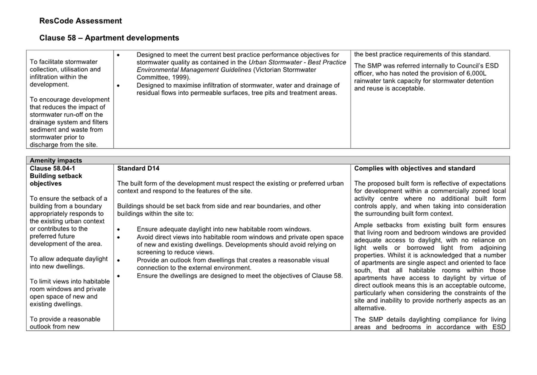
The Sustainable Management Plan (SMP) details daylighting compliance for living areas and bedrooms in accordance with the ESD credits claimed within that same report. A detailed assessment of natural daylight access is provided against Clauses 58.04-1 (Building setback objective), 58.07-2 (Room depth objective), and 58.07-3 (Windows objective) within Attachment 1. The assessment finds that the proposal complies with those objectives. |
|
External shading devices should be provided to west-facing apartments on levels 1 to 4. |
The SMP details that even without claiming credits for use of external shading devices, overall indoor environmental quality requirements are still met by the proposal. It is not considered appropriate to require external shading devices given those requirements are met. |
|
The proposal will achieve only a 6.5 star energy rating. The National Construction Code 2022 (NCC) now requires developments to be a minimum of 7 star energy rating. |
Whilst achieving a 7-star energy rating is a requirement under the NCC 2022, transitional provisions under the Building Act 1993 are afforded this application. The applicant has provided a letter from the relevant building surveyor confirming as such. |
|
Notations on the plans for provision of gas need to be removed. |
The SMP clearly details that the development will be all-electric with no connection to gas. A condition is recommended for the gas notations on the plans to be removed. |
|
Landscape plan is required to demonstrate how water efficient landscaping outcome will be achieved. |
A condition is recommended requiring the submission of a landscape plan which includes details of how the landscape response will meet the water efficient landscaping credit claimed within the SMP. |
|
An increase in the provision of bicycle parking to one for each dwelling and on for the commercial tenancy is preferred. |
The bicycle parking requirements of Clause 52.34 (Bicycle Facilities) are met by the proposal. It is not considered appropriate to require bicycle facilities beyond those requirements of the planning scheme. |
|
Space for food-and-garden organics (FOGO) bins must be provided.
|
A FOGO waste stream is provided as part of the development, and is detailed within the WMP. |
|
Limited commitment to use of environmentally sustainable materials or use of low carbon concrete |
As demonstrated by the BESS Report contained within the SMP, the proposal meets overall best practice requirements, including individual requirements for Waste and IEQ categories which both contemplate building materials. It is not considered appropriate to require changes to the proposal which go beyond those requirements. |
External referrals
9.2 Pursuant to Clause 44.05-6 of the Port Phillip Planning Scheme, the application was required to be referred to Melbourne Water in accordance with Section 55 of the Planning and Environment Act 1987 as a determining referral authority. Melbourne Water were twice referred the application as it was deemed appropriate to re-refer the application to them following the first amendment which included some changes of relevance to their assessment. Below summarises their response:
|
Referral Authority |
Response |
Conditions |
|
Melbourne Water |
No objection subject to conditions |
Refer to Conditions 20 to 22 (inclusive) |
10. PUBLIC NOTIFICATION/OBJECTIONS
Public notification
10.1 Public notice of the application was initially given in May 2019, including by the mailing of 212 notices to the owners and occupiers of directly adjoining and nearby properties, and display of a notice on the land.
Application formally amended and re-notified
10.2 The application was first amended under Section 57A of the Act on 13 July 2023. The application was then further amended under Section 57A of the Act on 21 June 2024, and re-notified to adjoining and nearby owners and occupiers, and previous objectors to the application in July 2024.
Objections received
10.3 There have been objections received from 38 people as part of the two notification processes. These contain grounds of objection which include themes of the following:
· Overdevelopment
· Building height
· Visual bulk
· Car parking
· Traffic
· Overshadowing
· Loss of views
· Overlooking
· Poor internal amenity
· Noise
· Loss of art gallery and studio
Consultation meeting
10.4 A consultation meeting was held on 27 February 2025. The meeting did not result in any changes to the current S57a plans which form the basis of this assessment.
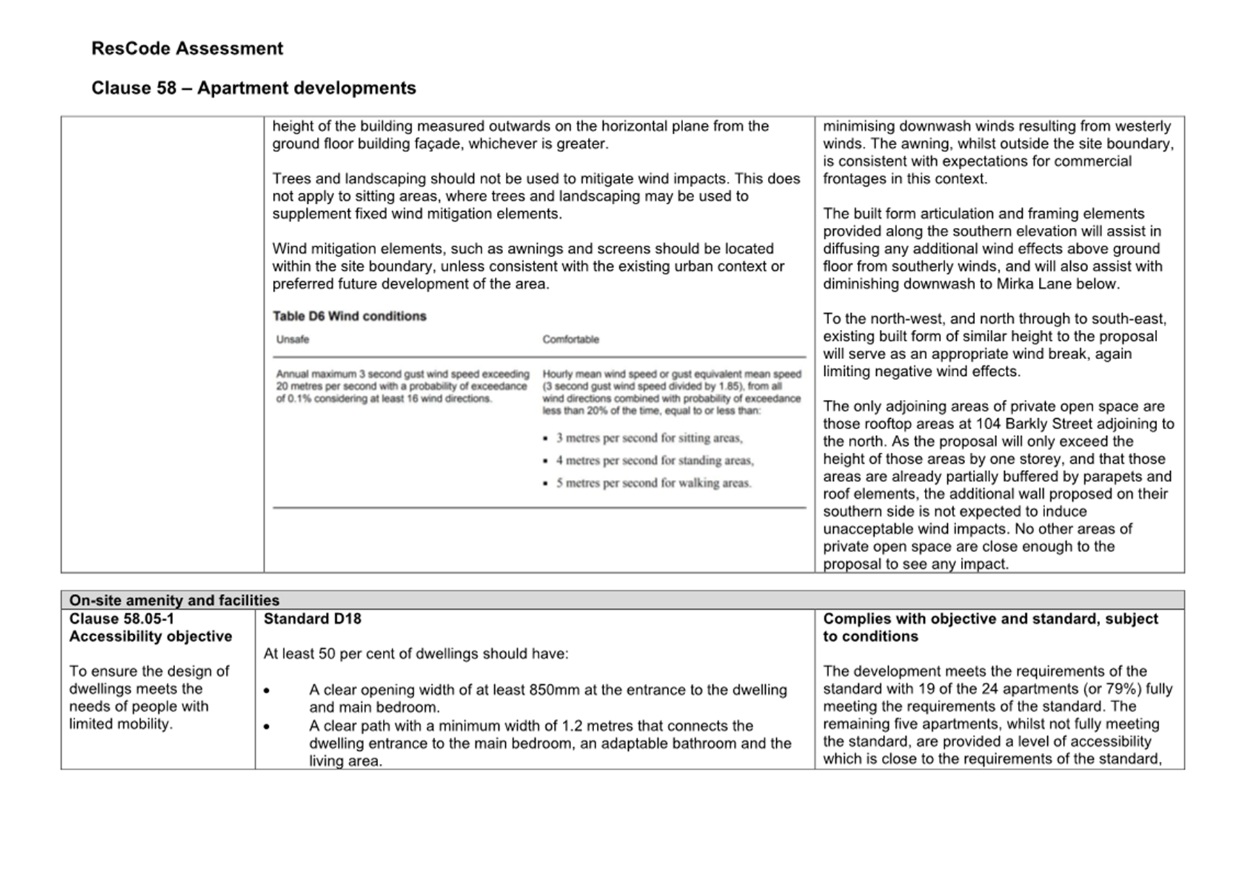
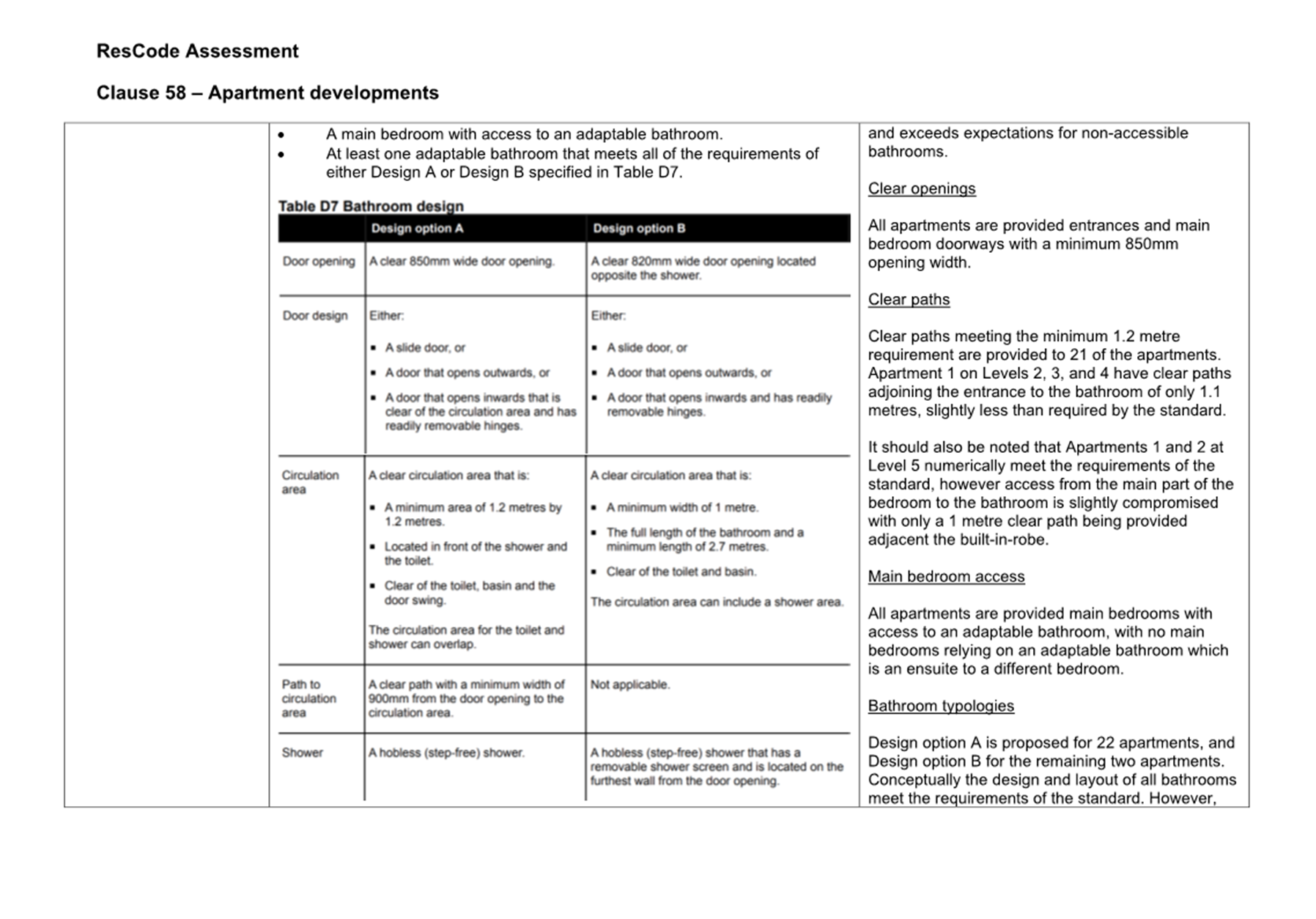
11. OFFICER’S ASSESSMENT
11.1 The planning controls relevant to this application each contain a purpose and decision guidelines, and the following assessment will respond to the relevant requirements along with other matters required to be considered under the Scheme and the Planning and Environment Act 1987. This will be done by responding to the following questions:
· Does the proposal respond appropriately to the Municipal Planning Strategy and the Planning Policy Framework?
· Is the proposal consistent with the purpose of the Commercial 1 Zone?
· Is the proposal consistent with the purpose of the Transport Zone 2?
· Is the proposal consistent with the purpose of the Special Building Overlay?
· Is the height and built form acceptable?
· Does the proposal cause unacceptable amenity impacts?
· Are the transport arrangements acceptable, including the provision of car parking and bicycle facilities and layout of car parking areas?
· Has the proposal adequately addressed the stormwater management provisions?
· Are there any other matters that require consideration, including outstanding objector concerns?
Does the proposal respond appropriately to the Municipal Planning Strategy and the Planning Policy Framework?
11.2 The proposal satisfies the applicable land use and development objectives within the Planning Policy Framework by providing a high level of compliance with the relevant policies within the Scheme. It is considered that a six-storey building, with slight built form recession of the highest floor, which benefits from being bound to the south and east by a laneway, will provide an appropriate scale of development in the context of a local activity centre with a commercial frontage and more sensitive residentially zoned interface to the east.
11.3 It is considered that the proposal supports the relevant Planning Policy Framework strategies for settlement, built environment, housing and transport by:
· Providing a form and density that supports sustainable transport use to reduce greenhouse gas emissions and which will limit urban sprawl by making efficient use of an opportunity for infill development.
· Minimising the detrimental impact of development by ensuring form, scale and appearance of the development enhances the function of the public realm.
· Providing an appropriate urban design response along the commercial frontage of the site.
· Providing additional dwellings within an established commercial local activity centre with excellent access to jobs, transport, shops, public facilities such as schools and parks, assisting in creating a city of 20-minute neighbourhoods.
· Being proximate to excellent public transport in the form of multiple bus and tram routes and supporting the use of sustainable transport by providing greater than the number of bicycle spaces required by the planning Scheme, as well as additional scooter parking.
· Providing a small shop tenancy for provision of convenience scale retail or service uses.
· Providing a zero street setback to Barkly Street in line with expectations for the Inkerman Street/Grey Street Local Activity Centre.
· Being sufficiently distanced from nearby places of heritage value as to not impact on the heritage significance of those places.
Is the proposal consistent with the purpose of the Commercial 1 Zone?
11.4 The purpose of the Commercial 1 Zone is to respond to the Municipal Planning Strategy and Planning Policy Framework, to create vibrant mixed-use commercial centres for retail, office, business, entertainment and community uses and to provide for residential uses at densities complementary to the role and scale of the commercial centre.
11.5 The proposal will align with these purposes by providing an apartment building with a commercial frontage at ground floor fronting Barkly Street. In taking cues from nearby developments within the Commercial 1 Zone and Mixed Use Zone, which generally vary from three to seven storeys in height, the proposal is considered to provide a building at a density that is appropriately complementary to the local activity centre at this location.
11.6 In this context, the proposed residential use at ground level is considered acceptable, noting that at the Barkly Street frontage it is limited to the residential entrance and adjoining lobby area. Given the strong policy support for shop top style housing, the residential interface with the frontage is appropriate.
11.7 The development requires some on-site car parking, and vehicle access is appropriately proposed to the laneway interfaces where active frontages are of a lesser importance in this context. This is a marked improvement upon existing conditions on the site which currently have approximately half of the Barkly Street frontage set aside for vehicle access. The provision of car parking at ground level and which is located behind the shop tenancy ensures the ground floor use contains suitable opportunity for commercial activity and activation where viewed from Barkly Street.
Is the proposal consistent with the purpose of the Transport Zone?
11.8 The purpose of the Transport Zone as it relates to this application is to ensure the efficient and safe use of transport infrastructure and land comprising the transport system.
11.9 Whilst a permit is required under the Transport Zone for buildings and works, those works forming part of this proposal which require a permit are limited to the awning at the front of the commercial tenancy and small façade encroachments into the Barkly Street road reserve. In accordance with the requirements of the Transport Zone, the written consent to the application being made from Head, Transport for Victoria (Head, TfV), who is the relevant transport manager for Barkly Street has been provided. Their written consent contained no additional requirements or conditions.
11.10 The awning is appropriately sited and does not encroach upon the trafficable part of the road reserve, being setback approximately 1 metre from the road edge. As such, the awning will not affect the operation and safety of Barkly Street and aligns with the purpose of the Transport Zone. The façade encroachments are quite minor at a maximum of 0.25m, and are likewise
Is the proposal consistent with the purpose of the Special Building Overlay?
11.11 The purpose of the Special Building overlay is:
· To implement the Municipal Planning Strategy and the Planning Policy Framework.
· To identify land in urban areas liable to inundation by overland flows from the urban drainage system as determined by, or in consultation with, the floodplain management authority.
· To ensure that development maintains the free passage and temporary storage of floodwaters, minimises flood damage, is compatible with the flood hazard and local drainage conditions and will not cause any significant rise in flood level or flow velocity.
· To protect water quality and waterways as natural resources by managing urban stormwater, protecting water supply catchment areas, and managing saline discharges to minimise the risks to the environmental quality of water and groundwater.
11.12 In meeting the conditions stipulated by Melbourne Water in their capacity as a determining referral authority, the proposal will align with these purposes by being afforded a ground floor finished floor level which appropriately exceeds the applicable flood level for the site, minimising the risk of flooding and flood damage to the development. Melbourne Water have not identified any further requirements necessary to be met by the development, nor any risks to adjoining or nearby land resulting from any redirecting or obstructing of floodwaters.
Is the height and built form acceptable?
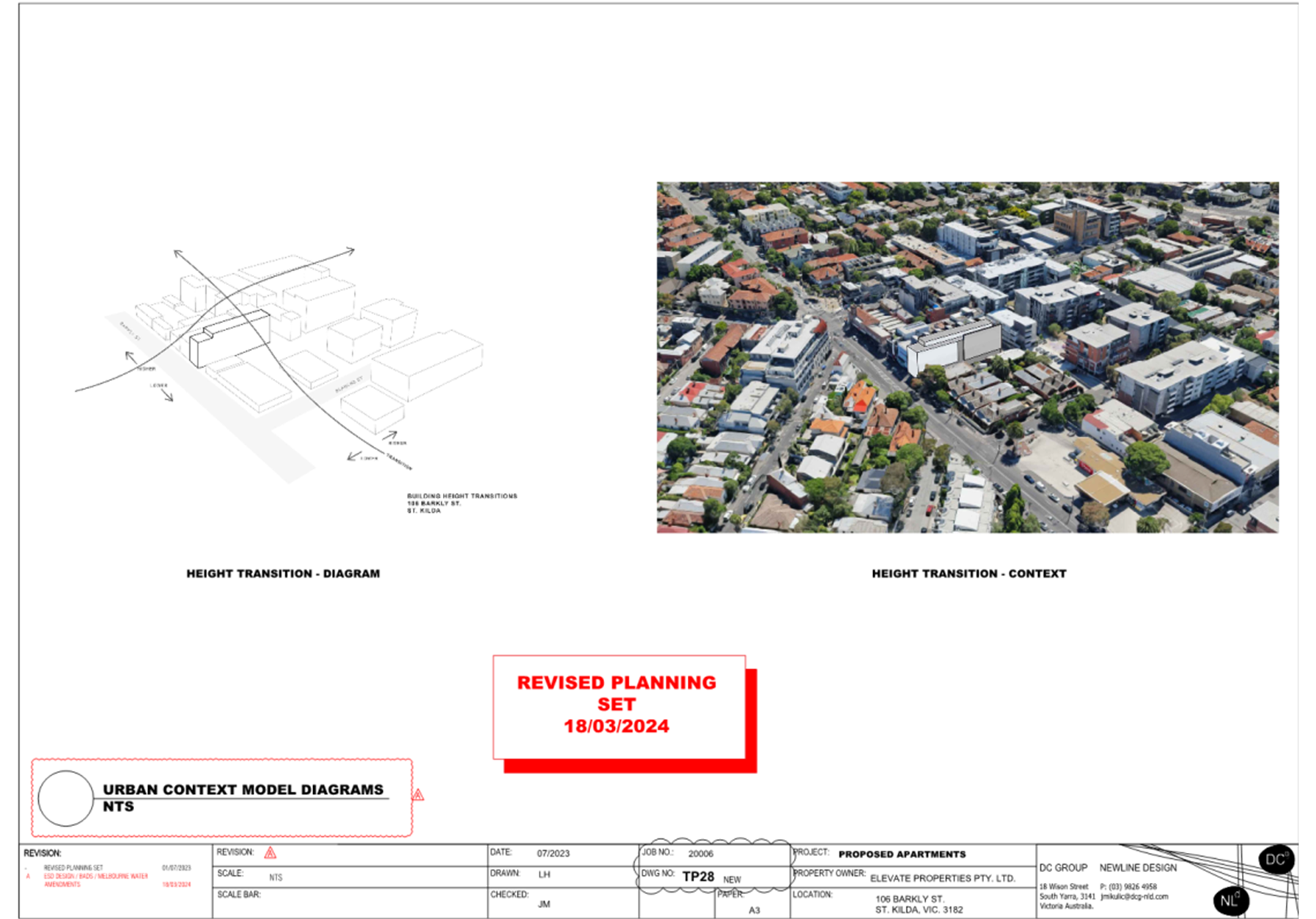
11.13 It is important to note that there are no prescriptive height controls applicable to the subject site, meaning it is imperative to consider the height and built form response on a first principles approach by taking into account to the context of the site and expectations around density of development for the area. In taking cues from nearby mixed-use and apartment developments, it is clear that the proposed six-storey height is appropriate in this context, noting several examples nearby of the same or similar height.
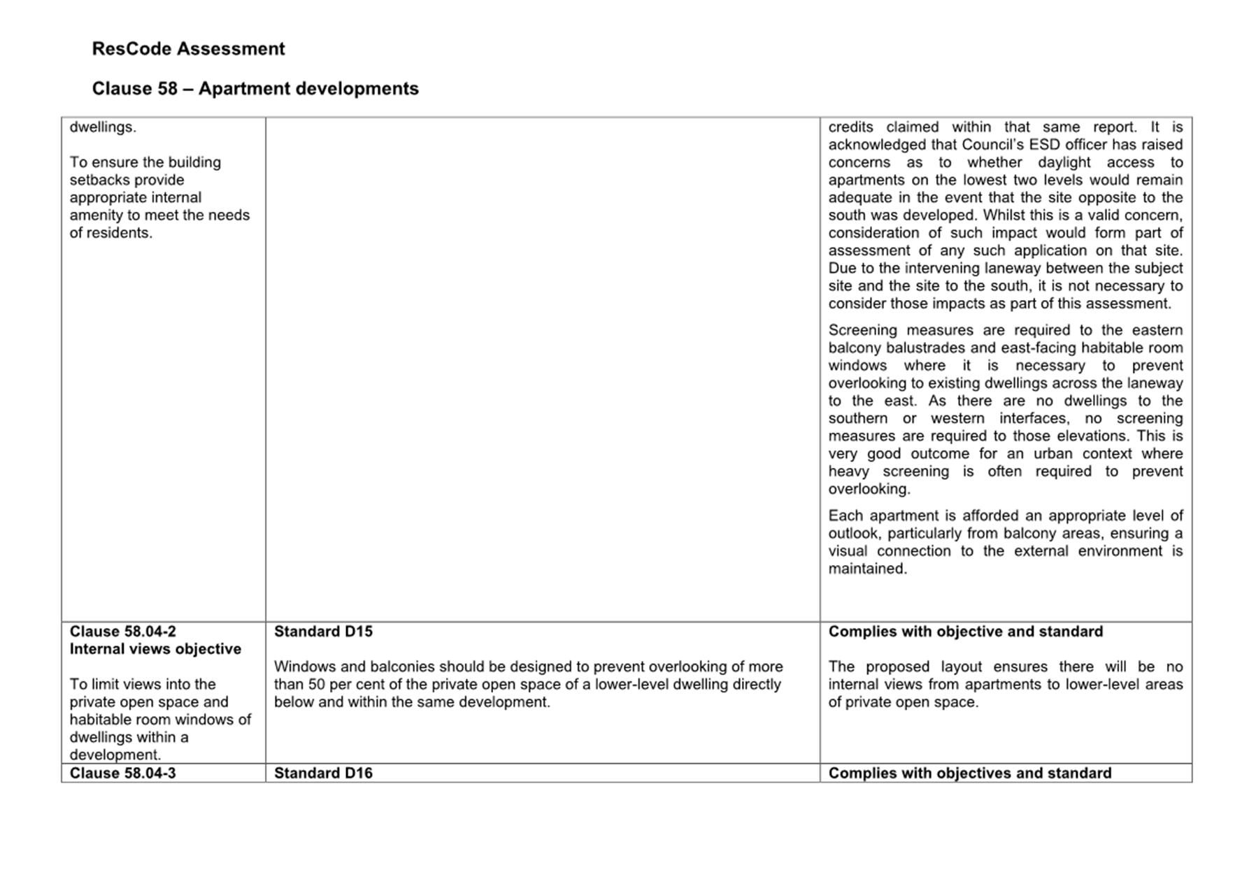
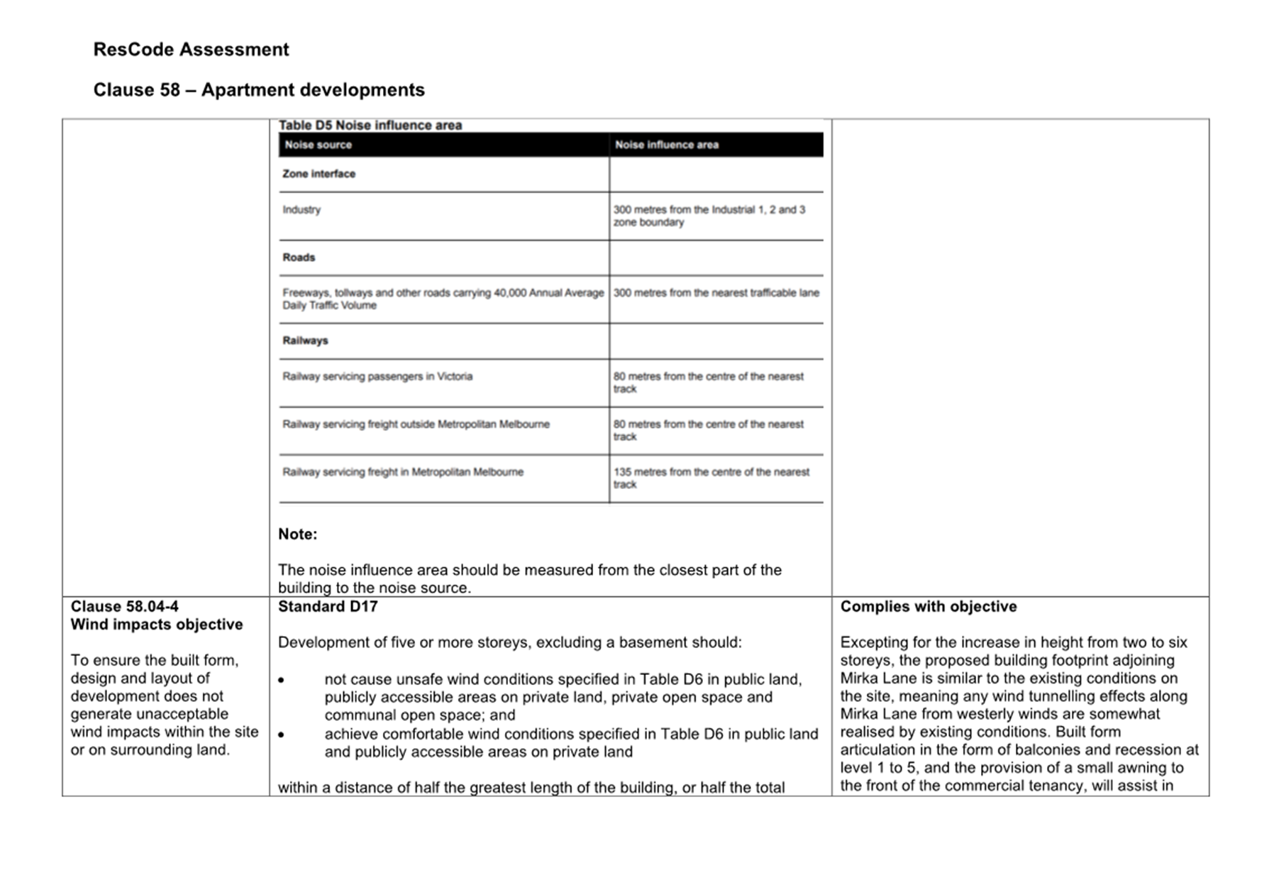
11.14 With respect to the most sensitive residentially zoned interface to the east of the site, the development is afforded appropriate building separation by virtue of the intervening laneway adjoining the east of the site. The sixth storey is setback slightly further than the storeys below to provide an element of built form recession as the development presents to the east. Associated amenity impacts resulting from the proposed built form are further considered later in this report.
11.15 With respect to the density of the development, the site is proximate to public transport in the form of bus and tram routes, and is within a 5 minute walk of the Acland Street portion of the St Kilda Major Activity Centre. This creates an expectation for residential densities which can make appropriate use of the amenity afforded by this proximity. The density proposed is an acceptable outcome for this location, and appropriately aligns with development expectations within broader state and local policies for creating a city of 20-minute neighbourhoods.
11.16 The proposal incorporates built form recession at the uppermost floor, ensuring when viewed from the immediate Barkly Street streetscape, the development will present with a lesser height than proposed. When viewed in the broader surrounding context, due to the downslope across the land, the overall height of the proposal is lesser than a number of existing developments nearby along Inkerman Street.
11.17 At ground level, the building incorporates a 3.7 metre wide residential lobby that includes a window, the shop tenancy that contains floor-to-ceiling glazing, and a 1.5 metre deep awning to the front of the tenancy. This is considered an acceptable design response at ground floor ensuring appropriate activation to the Barkly Street frontage. All vehicle access is proposed via Mirka Lane to the southern and eastern interfaces, which appropriately locates this function away from the active frontage.
11.18 The building is appropriately activated along the upper levels fronting Barkly Street by means of balconies, living areas set behind those balconies, and bedrooms with windows facing Barkly Street, ensuring appropriate visual interest and passive surveillance of the public realm. Passive surveillance will also be achieved to Mirka Lane from south-facing balconies and living areas.
11.19 The south-facing elevation is afforded appropriate visual interest through varied materiality, horizontal articulation in the form of balconies and associated balustrades, and architectural framing elements along the eastern portion. The east-facing elevation, whilst presenting with a partially blank presentation, is provided some visual interest in the form of balconies, architectural framing elements, and a row of east-facing windows.
11.20 The side wall of the building to the north is largely obscured by the existing four-storey development at 104 Barkly Street, extending beyond the height of that building between 4.7 to 7.5 metres. This is not an uncommon design response in circumstances where there are extended shared boundaries with zero setbacks proposed, and provides 104 Barkly Street development equity in the event that site is redeveloped in the future.
Does the proposal cause unacceptable amenity impacts?
Off-site amenity
11.21 The subject site benefits from an east-west lengthways orientation, with commercially zoned land adjoining to the north and south and Barkly Street adjoining to the west. Primary considerations for off-site amenity impacts are focussed to the residentially zoned land adjacent to the east at the rear of 21 Inkerman Street and the dwellings nearby to the south at 2, 4, and 6 Blanch Street.
11.22 In addition to requirements set out at Clause 58 (Attachment 1), the Commercial 1 Zone provides decision guidelines to protect the amenity of adjoining sites in residential zones which include:
· Consideration of the overlooking and overshadowing as a result of building or works affecting adjoining land in a General Residential Zone, Neighbourhood Residential Zone, Residential Growth Zone or Township Zone.
· The impact of overshadowing on existing rooftop solar energy systems on dwellings on adjoining lots in a General Residential Zone, Mixed Use Zone, Neighbourhood Residential Zone, Residential Growth Zone or Township Zone.
11.23 It is important to detail that these decision guidelines provide no prescriptive measures for consideration of overlooking or overshadowing. Furthermore, it is widely accepted that residents living in or near commercially zoned land are not afforded the same expectations for levels of amenity than those living in wholly residentially zoned areas. This is a position well informed by decisions of the Victorian Civil and Administrative Tribunal (VCAT) (including its predecessors), noting there are several key planning decisions which speak directly to and reaffirm principles around ‘legitimate expectations’ for amenity, and which continue to inform decision making in similar contexts. It is important to note this as considerations of amenity impacts in a commercially-to-residentially zoned interface are key in assessment of this application.
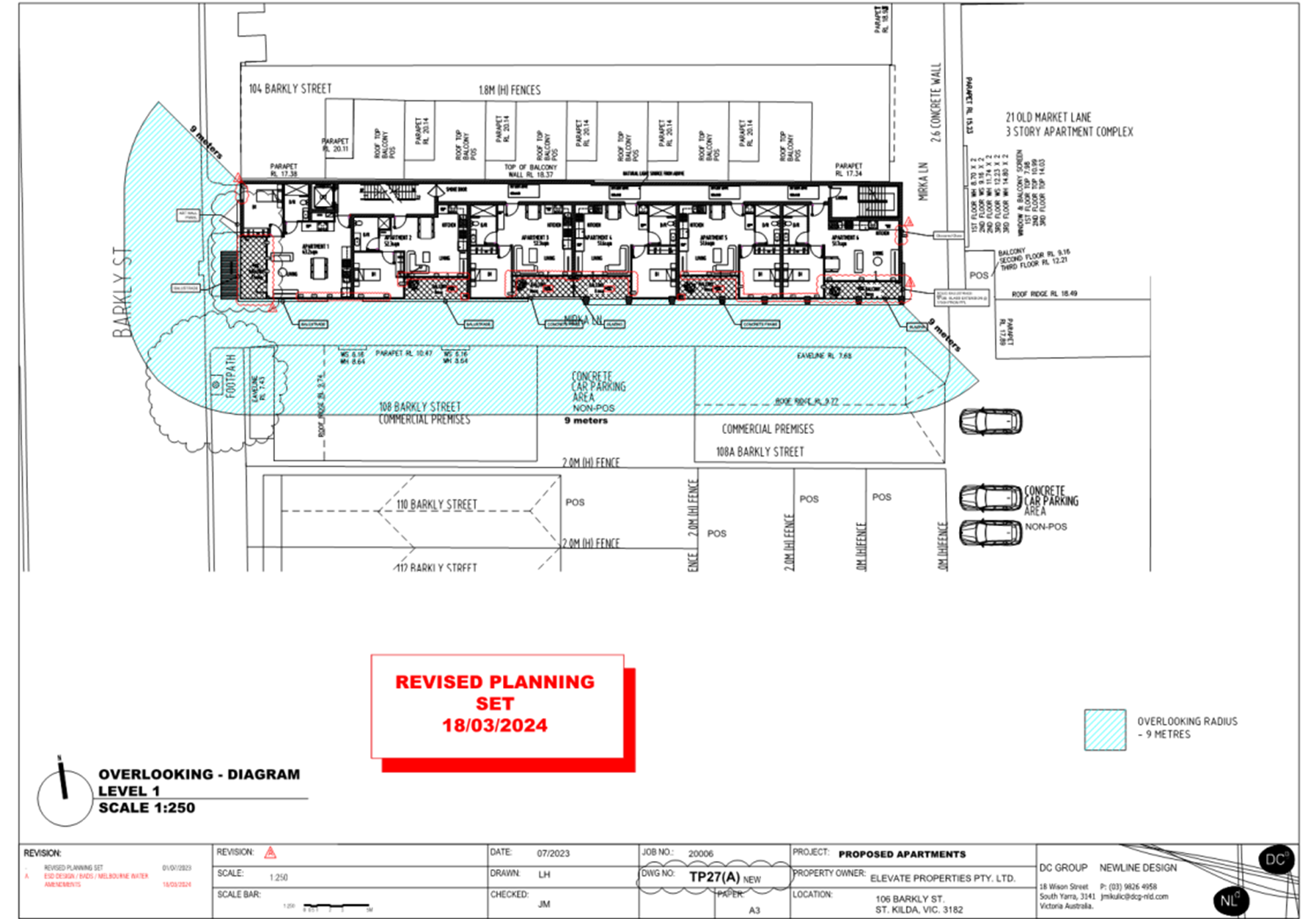
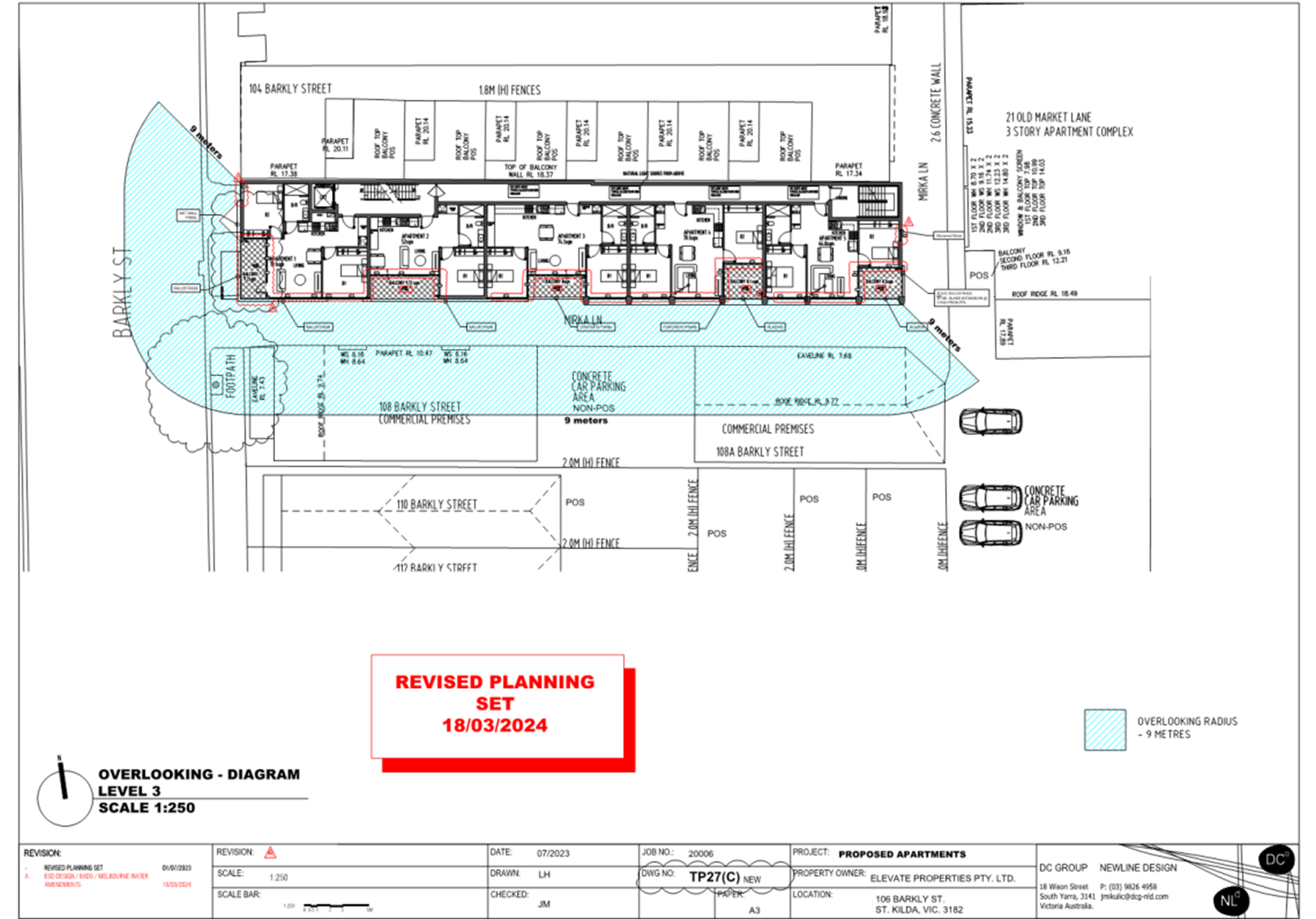
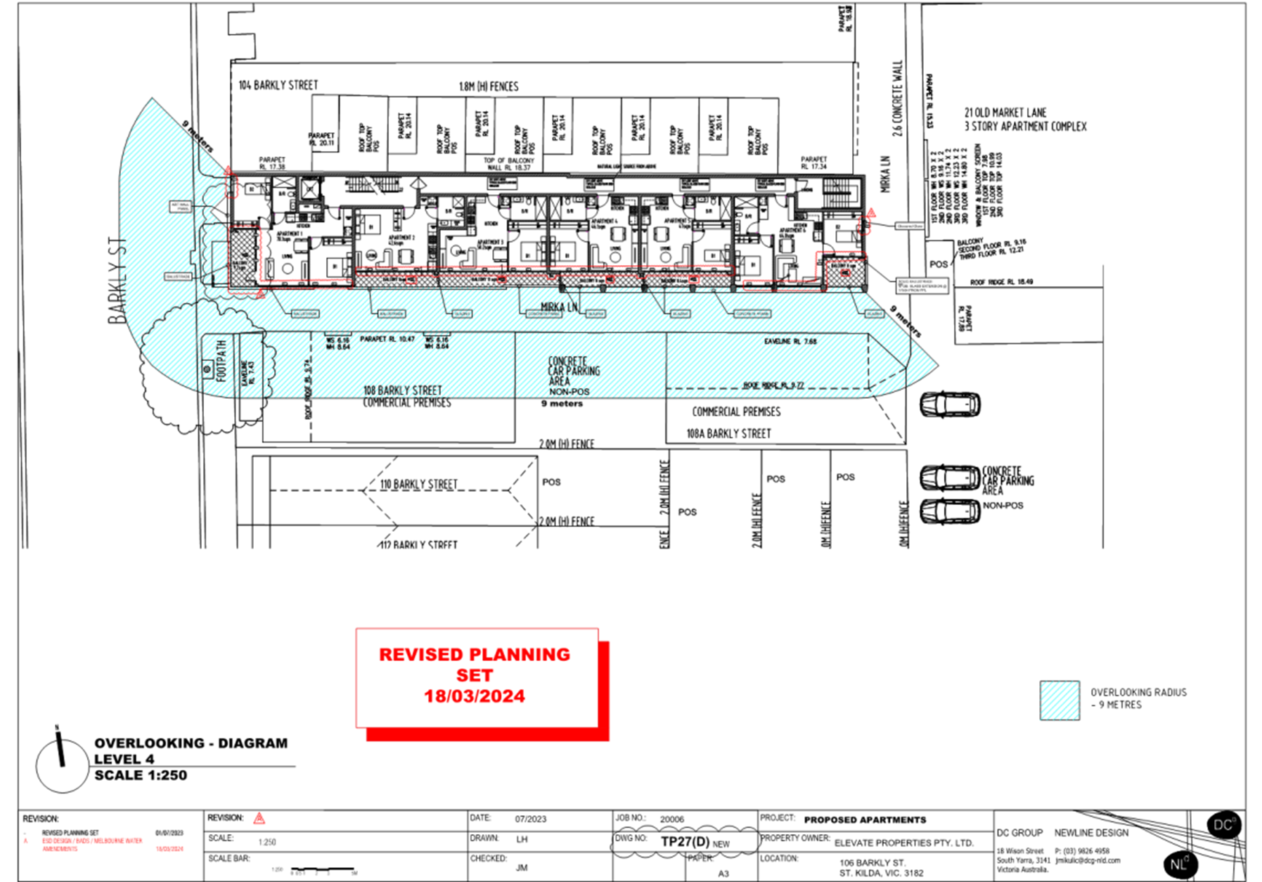
11.24 Overlooking from the east-facing portions of balconies and east-facing habitable room windows towards habitable room windows and balcony at 21 Inkerman Street are proposed to be screened with obscured glass to a height of no less than 1.7 metres. This aligns with expectations for limiting overlooking under the Scheme and is thus an acceptable outcome.
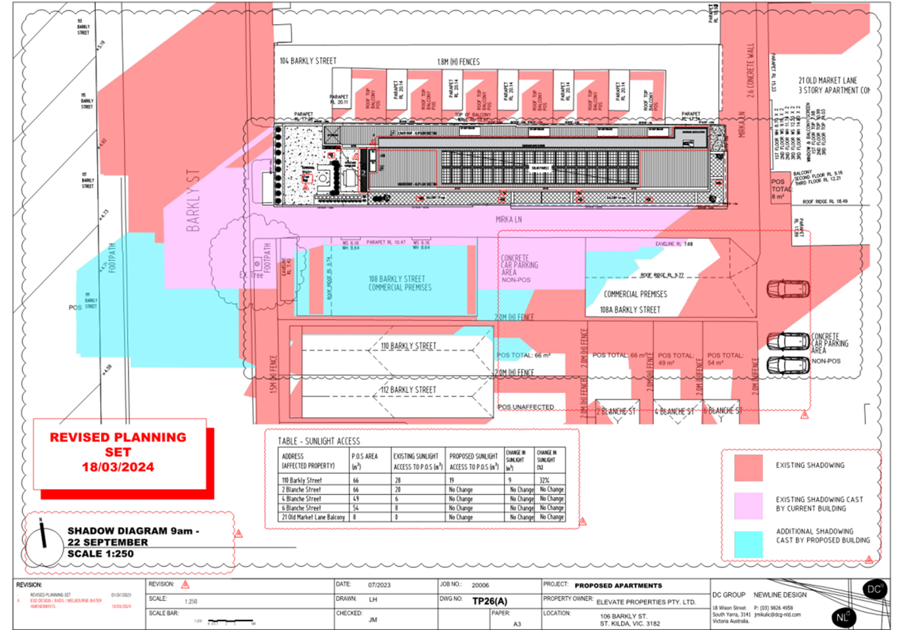
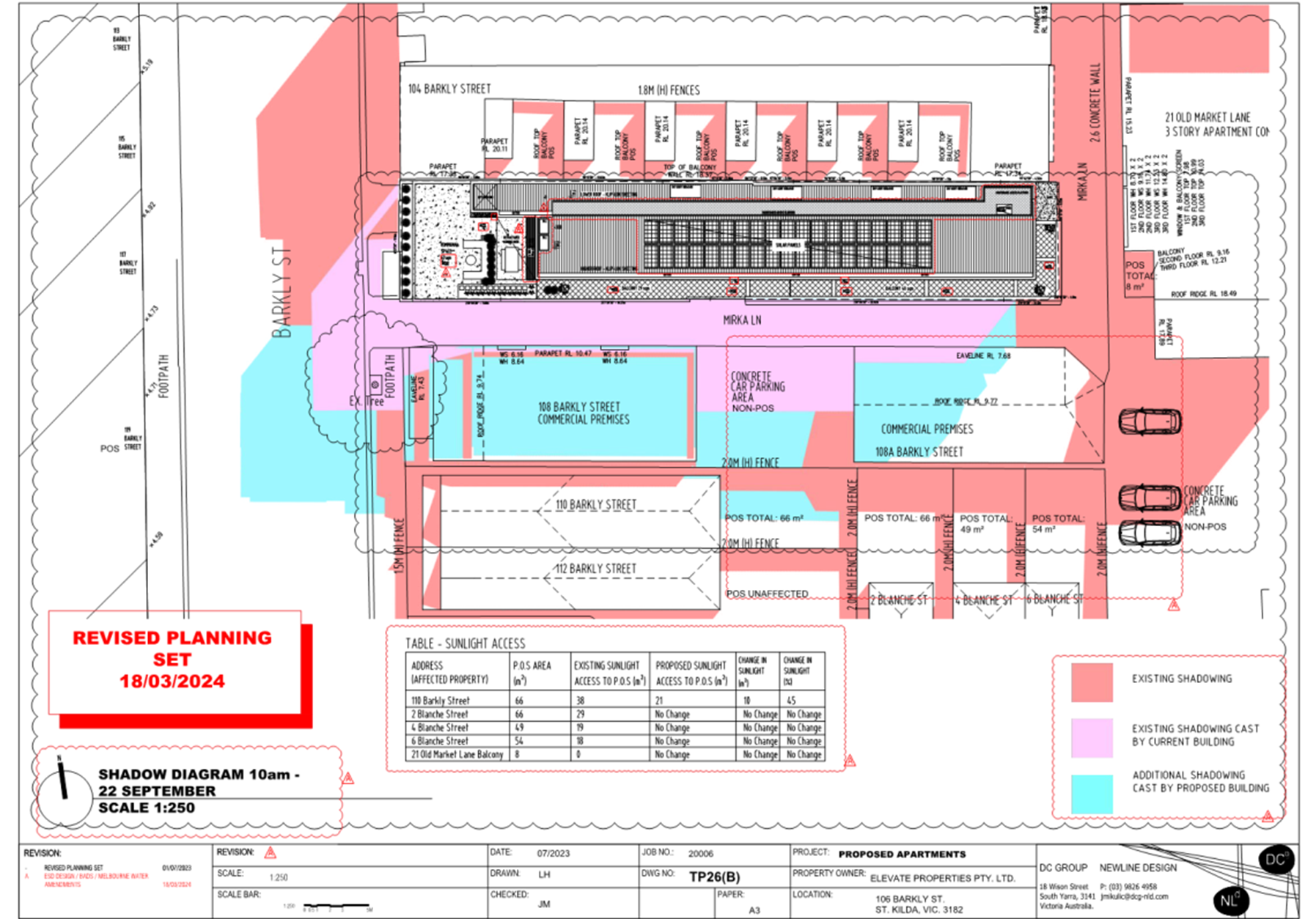
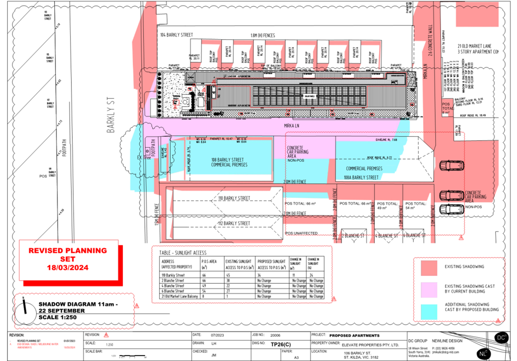
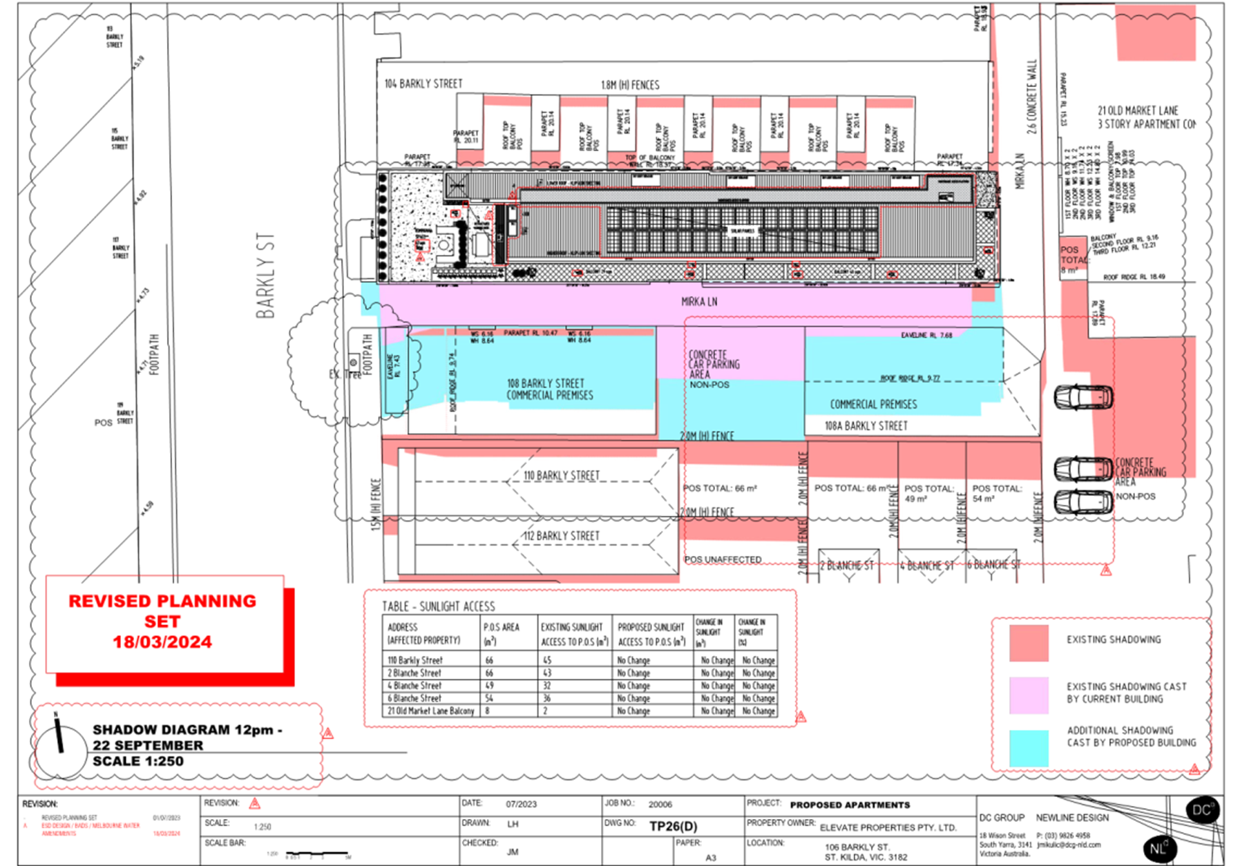
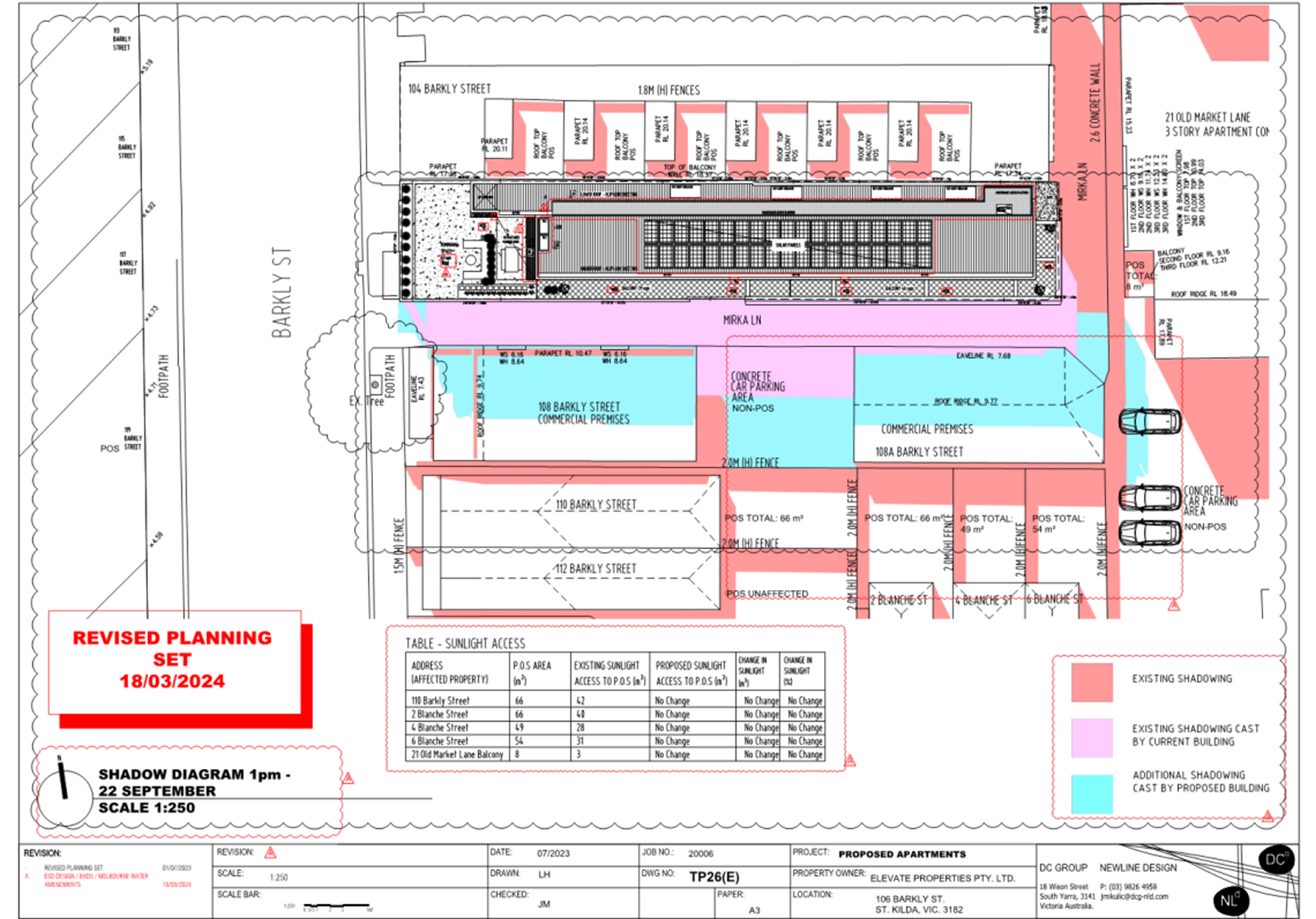
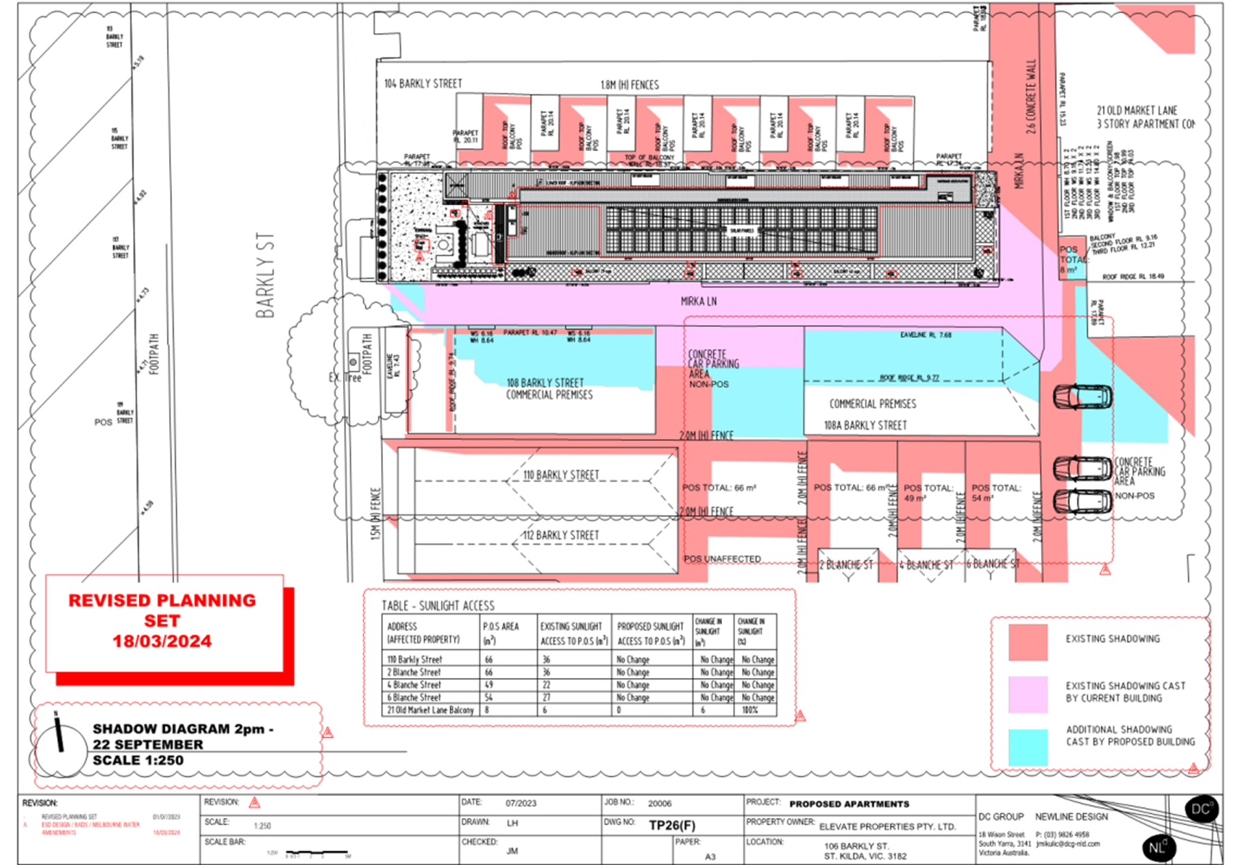
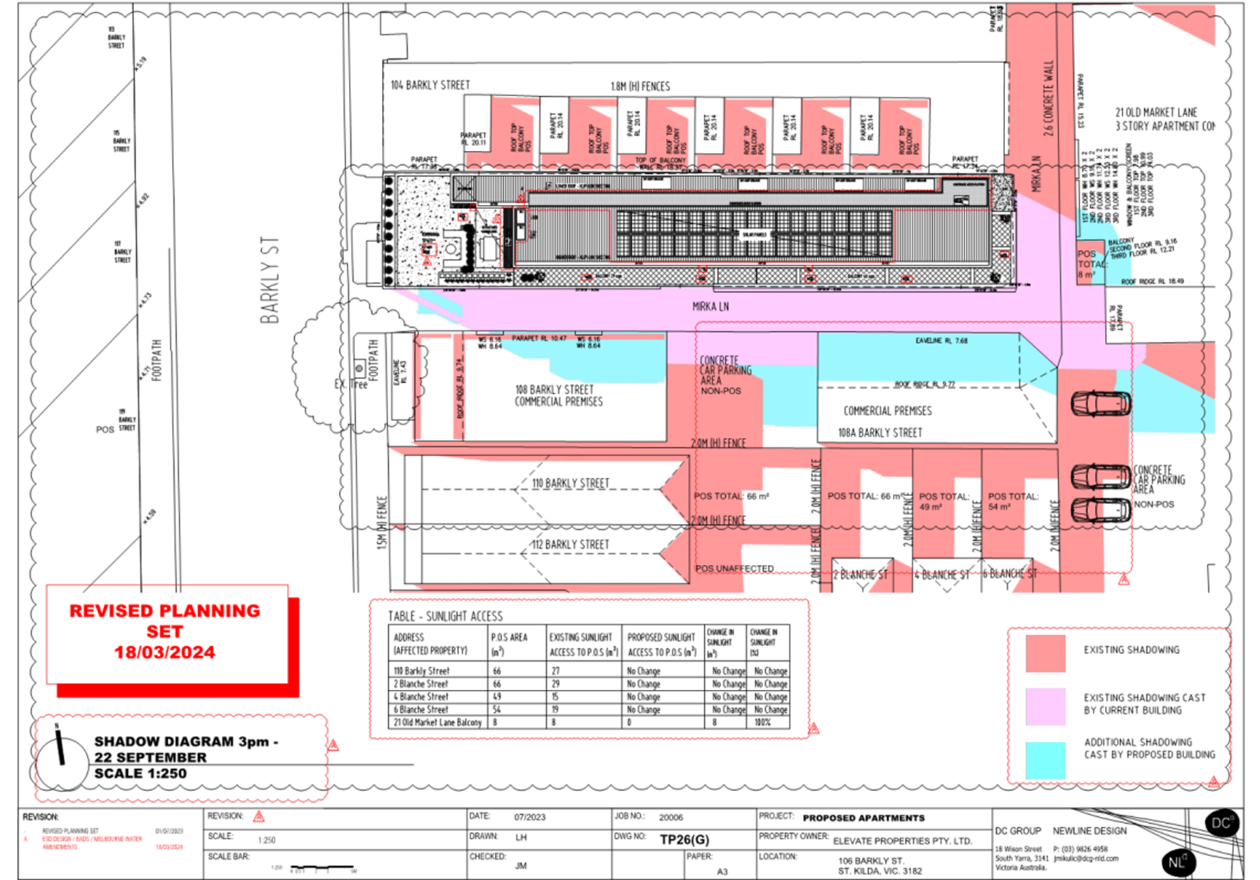
11.25 Additional overshadowing will be cast towards a ground floor terrace and a first and second floor balcony at the south-western corner of the building at 21 Inkerman Street in the afternoon hours of the day on 22 September. Additional shadows from the proposal will reach the ground floor terrace at approximately 1:30pm, and will progressively increase until the terrace and both balconies areas are fully overshadowed by approximately 2pm. Whilst this may seem an unacceptable outcome, it is important to note that the siting of these balconies is not ideal in that they are subject to internal overshadowing by being located to the south of their own built form, at ground and first floor being largely covered by the levels above, and by being heavily enclosed by screening measures on the southern and western orientations. This creates an inappropriate reliance on borrowed sunlight access from Mirka Lane, and subsequently the subject site which is beyond the laneway. In considering this, together with principles of legitimate expectations for amenity in this commercially-adjacent context, the extent of additional overshadowing is considered acceptable.
11.26 Due to 2, 4, and 6 Blanch Street being located greater than 9 metres from the proposal, there are no concerns for overlooking of these properties from the proposal. It is not considered appropriate to require any screening measures to limit overlooking for sightlines greater than 9 metres given this is a well-established threshold for determining overlooking under the Scheme. Proposed overshadowing conditions do not see any additional overshadowing to the secluded private open space areas of those dwellings.
11.27 Whilst additional overshadowing will occur to the secluded private open space to the rear of 110 Barkly Street to the south of the proposal, the decision guidelines of the Commercial 1 Zone do not afford consideration of the amenity impacts to this property as this property is also within the Commercial 1 Zone. This is reinforced by the fact that the requirements of Clause 58 (Apartment Developments) do not provide for any consideration of overshadowing to adjoining properties, and the decision guidelines of the Commercial 1 Zone only require consideration of overshadowing to residentially zoned land. As such, the proposed impacts are deemed to be acceptable in this context.
11.28 Impacts resulting from visual bulk, particularly to the sensitive residentially zoned land to the east, are considered to be appropriately mitigated by built form separation afforded by Mirka Lane. There is also some provision of visual interest to the eastern-elevation as it presents to that land through varied materiality, some articulation, and fenestration.
Internal and onsite amenity and facilities
11.29 Clause 58 (Apartment Developments) sets out several guidelines regarding internal and onsite amenity and facilities for proposed apartments. This is assessed in detail in the Clause 58 – Assessment Table (see Attachment 1), and is summarised below:
· Adequate daylight access will be achieved to all new habitable rooms.
· All apartments are provided an acceptable outlook that creates a reasonable visual connection to the external environment.
· All internal overlooking to lower-level dwellings is limited through an appropriate built form response and internal layout.
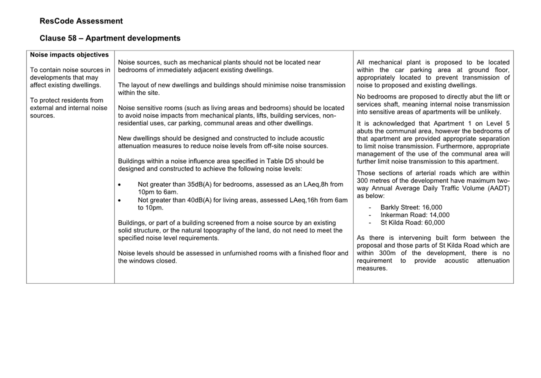
· Mechanical plant is located within the ground floor car parking area to mitigate noise impacts for future occupants.
· Greater than the number of required apartments are designed to meet the clear path and dimensional requirements for accessibility and adaptable bathrooms, subject to minor conditional requirements.
· All apartments are provided with secluded private open spaces areas which meet or exceed the minimum area requirements.
· Excepting for a small number of minor variations, all apartments are provided bedrooms that meet or exceed the minimum area and width requirements, and are provided appropriate daylight access.
· All habitable rooms are provided a window in an external wall of the building.
· Greater than the number required of apartments are provided breeze paths for natural ventilation.
11.30 The development proposes a high level of compliance with these requirements, and as such is considered to provide an acceptable level of internal and onsite amenity and facilities for future occupants.
Are the transport arrangements acceptable, including the provision of car parking and bicycle facilities and layout of car parking areas?
Number of car parking spaces
11.31 Under the provisions of Clause 52.06 (Car Parking), the total number of car parking spaces required for the proposal is 27 (26 for the apartments, and one for the shop use). The application proposes 14 on-site car parking spaces, all of which are to be allocated to the two and three-bedroom apartments. This creates an overall shortfall of 13 spaces (12 for the one-bedroom apartments, and one for the shop use).
11.32 As required by Clause 52.06-7 (Car Parking), Council is required to consider the following relevant requirements:
· The Car Parking Demand Assessment submitted with the application.
· The availability of alternative car parking in the locality of the land, including:
o Efficiencies gained from the consolidation of shared car parking spaces.
o Public car parks intended to serve the land.
o On street parking in non-residential zones.
o Streets in residential zones specifically managed for non-residential parking.
· On street parking in residential zones in the locality of the land that is intended to be for residential use.
· The impact of fewer car parking spaces on local amenity, including pedestrian amenity and the amenity of nearby residential areas.
· Access to or provision of alternative transport modes to and from the land.
11.33 The subject site is located within the Principal Public Transport Network (PPTN) area, noting that it is proximate to numerous public transport routes. Clause 18.01-3S (Sustainable and safe transport) seeks to encourage sustainable transport options, noting it places the reliance on the private motor vehicle as the least preferable option.
11.34 The applicant has provided a traffic engineering report which contains discussion on likely car parking demand generated from the proposal, and transparently details with reference to local car ownership data for nearby apartment developments, that the proposed number of car parking spaces for the development will likely be less than the demand ordinarily generated by a development like this. However, to address this concern, the report further argues the following, with which the planning assessment broadly concurs:
· The shop use is anticipated to attract walk-up customers engaging in multi-purpose trips throughout the locality. Some short-stay car parking demand may be generated as a result, however it is not expected this would be unmanageable by existing on-street parking provision throughout the locality.
· The site has excellent access to public transport due to proximity to bus and tram routes.
· The site has excellent access to the Principal Bicycle Network, with Barkly Street being within this network. St Kilda Road nearby the site to the east is also a Primary Route in the Strategic Cycling Network.
· Future residents will be informed of whether an on-site car parking space will be available to them.
· Council policies to restrict long-stay on-street parking availability will serve to discourage car ownership for those residents of the development who are not allocated a car parking space.
· Reducing on-site car parking provision encourages the use of alternative transport modes, aligning with broader policy expectations of the Scheme.
· Providing vehicle access to the site from Mirka Lane only will ultimately introduce an additional on-street car parking space to the front of the site.
11.35 Council’s Traffic Engineering department, whilst supportive of some reduction in car parking spaces, are not supportive of the extent of the reduction sought by the proposal. Traffic Engineering recommend for at least half of the one-bedroom apartments to be provided a car parking space each, equating to provision of an additional 6 spaces.
11.36 Without a reduction in the number of apartments proposed and possibly the removal of the shop tenancy at ground floor to facilitate internal redesign of the proposal, this is not achievable. Planning assessment considers a requirement to increase the provision of car parking spaces in this circumstance as a somewhat conservative approach which runs counter to broader policy objectives and strategies which strongly encourage a move away from reliance on private motor vehicles as the primary mode of transport.
11.37 On balance, it is considered that the reduction of a total of 13 car parking spaces for the one-bedroom dwellings and shop use is acceptable, as it will encourage the use of more sustainable transport options which are readily accessible from the site. This is strongly encouraged by broader policies within the Scheme and is not expected to inappropriately impact on on-street car parking conditions throughout the local activity centre.
Design and layout of vehicle access and car parking areas
11.38 The applicant has provided vehicle swept path assessments detailing that the proposed car parking layout is designed to facilitate access to each proposed car parking space, albeit requiring only reverse-in access. This is not considered wholly acceptable in this circumstance, particularly given the width of the car spaces are reduced below the minimum 2.6 metre requirement and would be constrained for reverse-in only manoeuvres.
11.39 A condition is recommended to either require each of the 10 car spaces provided at grade (i.e. not within the car stackers) be provided with a minimum width of 2.6 metres and 300mm clearance areas (where abutting a wall) in accordance with the design requirements of Clause 52.06-9. Alternatively, for the submission of swept paths assessments showing front-in access and reverse-out egress from each of these spaces with an alternative design which allows for an acceptable number of corrective vehicle manoeuvres in accordance with relevant Australian Standards. It is acknowledged that increasing these car space widths will likely result in internal rearrangements throughout the car parking area and some adjoining ground floor areas to provide the additional space, however as external storage has been provided in excess of the requirement, and gas services will no longer be required for the development, it is understood rearrangements will be able to be accommodated utilising this additional space. If full car space width is required, at maximum this will require an additional 2 metres width across all 10 of those spaces.
11.40 Two car stacker systems are proposed for the provision of four car parking spaces. The system is an ‘in tandem dependent’ type system which requires the car in the lower space to exit its space to allow the car in the upper space to exit. Whilst an independent system which utilises a pit below the system and does not require this would be preferred, the flood prone nature of the site does not allow for such a system to be used. Allocating the car spaces in each system to the same dwelling will facilitate the ability for the occupants of those dwellings to manage the use of the system to minimise the need to remove the lower car as much as possible. The overall 3.65 metres height provided for the system will allow for two of the spaces to accommodate vehicles 1.8 metres in height in accordance with Design standard 4 of Clause 52.06-9.
11.41 It is recommended to include a condition requiring the submission of a Car Stacker System Management Plan to ensure that the system is maintained for constant use, and that future occupants of the development who are allocated car stacker spaces are provided the information required to use that system safely and efficiently.
11.42 The minimum finished floor level requirements set by Melbourne Water facilitate the need for the car parking area to be raised above the level of Mirka Lane to mitigate flood risk to the area. This creates a rising gradient between the edge of the lane and the parking spaces. At the steepest point this is a rise of 680mm over 2.21 metres (a 1:3.24 gradient). As currently proposed, without a vehicle scrape analysis provided to the contrary, it is understood this grade is too steep for expected vehicle types to safely and efficiently use the car parking area without scraping or bottoming. It is therefore recommended that a condition be included requiring vehicle accessway gradients to be in accordance with Design standard 3 of Clause 52.06-9, or for a vehicle scrape analysis to be submitted in support of an alternative design response which varies the design standard. It is acknowledged that if gradients need to be reduced to facilitate efficient vehicle access that this will require internal rearrangements at ground floor. There is considered sufficient space to facilitate such changes with internal rearrangements which will be of limited consequence for permissions given if a permit is to issue.
Number, design, and layout of bicycle parking
11.43 Under the provisions of Clause 52.34-5 (Bicycle Parking), the total number of bicycle spaces required for the proposal is 7 spaces (5 for residents of the apartments, and 2 for visitors to the apartments). Due to the small floor area of the shop, there is no bicycle parking requirement for the shop use, nor any requirement to provide end-of-trip facilities.
11.44 The application proposes 11 bicycle parking spaces at ground floor, with convenient access through the residential entry or via the vehicle accessway to Mirka Lane. A condition is recommended for directional signage to the bicycle spaces to be provided in accordance with the requirements at Clause 52.34-7 (Bicycle signage), predominately for the benefit of visitors to the development.
11.45 7 bicycle spaces will be provided in wall-mounted ‘Ned Kelly’ racks, and 4 spaces in bicycle hoops affixed to the ground. Whilst the traffic engineering report submitted with the application details the dimensions of the bicycle spaces, a condition is recommended for these to also be provided on the architectural plans in accordance with Clause 52.34-6 (Design of bicycle spaces) as the traffic engineering report would not be an endorsed document under the permit. The location and design of the spaces is considered acceptable with respect to the requirements of Clause 52.34 (Bicycle Facilities).
Has the proposal adequately addressed the stormwater management provisions?
11.46 Clause 53.18 (Stormwater management in urban development) sets out the relevant stormwater management considerations for this application. The applicant has submitted a Sustainable Management Plan (SMP) and Water Sensitive Urban Design (WSUD) response in support of the application. The following is an assessment of the proposal against the relevant considerations of Clause 53.18:
|
Clause 53.18-5 – Stormwater management objectives for buildings and works |
||
|
Objective |
Standard |
Officer assessment |
|
· To encourage stormwater management that maximises the retention and reuse of stormwater. · To encourage development that reduces the impact of stormwater on the drainage system and filters sediment and waste from stormwater prior to discharge from the site. · To encourage stormwater management that contributes to cooling, local habitat improvements and provision of attractive and enjoyable spaces. · To ensure that industrial and commercial chemical pollutants and other toxicants do not enter the stormwater system. |
The stormwater management system should be designed to: · Meet the current best practice performance objectives for stormwater quality as contained in the Urban Stormwater - Best Practice Environmental Management Guidelines (Victorian Stormwater Committee, 1999). · Minimise the impact of chemical pollutants and other toxicants including by, but not limited to, bunding and covering or roofing of storage, loading and work areas. · Contribute to cooling, improving local habitat and providing attractive and enjoyable spaces. |
The SMP includes sufficient details to demonstrate that the development will generally achieve best practice performance objectives for stormwater quality as contained within the Urban Stormwater - Best Practice Environmental Management Guidelines. Council’s ESD Officer has recommended a number of minor conditions with respect to notations for reuse of captured stormwater which are captures in the officer recommendation. These will have no material impact on the proposal.
The SMP demonstrates that a STORM Rating of 110% is achieved through the provision of 6,000L of rainwater tank volume capturing from approximately 318 square metres of roofed areas which will be distributed for toilet flushing throughout the development. |
|
Clause 53.18-6 – Site management objectives |
||
|
Objective |
Standard |
Officer assessment |
|
· To protect drainage infrastructure and receiving waters from sedimentation and contamination. · To protect the site and surrounding area from environmental degradation prior to and during construction of subdivision works. |
An application should describe how the site will be managed prior to and during the construction period and may set out requirements for managing: · Erosion and sediment. · Stormwater. · Litter, concrete and other construction wastes. · Chemical contamination. |
The SMP contains a Site Management Plan which contains sufficient detail and proposed measures to ensure that erosion, sediment, stormwater, litter, and other construction waste will be managed throughout the construction process. |
11.47 Local policy within Clause 19.03-3L (Stormwater management (water sensitive urban design)) also sets out expectations for developments to achieve best practice objectives set out in Urban Stormwater Best Practice Environmental Management Guidelines (CSIRO, 1999). By meeting the standards and objectives set out in the table above, the proposal likewise addresses the local policy.
Are there any other matters that require consideration, including outstanding objector concerns?
Management plan requirements
11.48 In addition to those management plans already discussed, it is recommended that a Landscape Management Plan also be required by conditions. This is to ensure that proposed landscaping outcomes are appropriately maintained on an ongoing basis for the life of the development.
Objector concerns
11.49 Many objector concerns have been discussed throughout the officer assessment above in the body of this report. Below addresses those outstanding concerns which have not been covered:
· Seven-storey development is inappropriate for the site and context
11.50 The application has been amended to remove a storey and reduce the overall height to six-storeys. Assessment of the acceptability of a six-storey development on the site is provided in detail above in this report.
· Impact on property values
11.51 The planning relevance of impact on property values must satisfy the requirement of Section 60(1)(f) of the Planning and Environment Act 1987 in that the impacts must be “significant”. Furthermore, in observing the findings of Hoskin v Greater Bendigo CC and Anor [2015] VCAT 1124 and Boydell Pty Ltd v Yarra CC & Ors [1998] VCAT 564 contended economic impacts must relate to the community, not individuals and their private financial interests.
11.52 With respect to the use and development proposed by this application, it is not considered that any potential impact on property values would meet this threshold. Council has not been provided any valuation evidence contrary to this position. As such, the proposal is considered acceptable in this regard.
· Disruption and damage during construction
11.53 Disruption to areas adjoining and nearby to construction sites is controlled by the Building Act 1993 and the Environment Protection Act 2017. Requirements under this legislation limit hours of work on construction sites and regulate emission of noise, vibration, dust, artificial light as well as other construction emissions which may impact on adjoining and nearby land. The Building Act 1993 also controls for potential impacts and damage to adjoining properties. It is not considered necessary to include additional prescriptive controls for construction activities as part of any planning permission given, however a standard ‘due care’ condition is recommended for thoroughness.
· Impact on views from rooftop terraces
11.54 Whilst the rooftop terraces at 104 Barkly Street will lose views to the south, they will retain an unencumbered northerly aspect and maintain sunlight access in accordance with expectations for secluded private open space areas under the Planning Scheme. There are no prescriptive requirements within the Planning Scheme for maintaining of views and outlook for properties subject to adjoining or nearby redevelopment. Such views are at best termed as an ‘undefined aspect’ of a property’s amenity, and very little weight is to be given to potential loss of such views under Scheme.
· Increase in noise
11.55 Mechanical plant and services are proposed to be located within the development at ground floor, sufficiently minimising impacts to adjoining properties. Impacts from the noise generated by future occupants of the development is not contemplated by the assessment requirements of the Scheme.
· Building footprint encroaches over Mirka Lane
11.56 The application has been amended to remove those aspects of the built form which were proposed to encroach over Mirka Lane, excepting for minor encroachments from architectural features.
· Loss of art gallery, studio space, and culturally significant location
11.57 The existing development or use on the site is not identified by the Scheme as a culturally significant place, nor are there any planning requirements which control cessation of the use or demolition of the building.
12. COVENANTS
12.1 The title documentation submitted with the application indicate that the land is not encumbered by any registered restrictive covenants.
13. OFFICER DIRECT OR INDIRECT INTEREST
13.1 No officers involved in the preparation of this report have any direct or indirect interest in the matter.
14. CONCLUSION
14.1 Clause 71.02 of the planning scheme requires the decision-maker to integrate the range of policies relevant to the issues to be determined and balance the positive and negative environmental, social and economic impacts of the proposal in favour of net community benefit and sustainable development. When considering net community benefit, fair and orderly planning is key; the interests of present and future Victorians must be balanced; and, the test is one of acceptability.
14.2 A balanced assessment finds that, in meeting the recommended conditions for permit, the proposed development is appropriately site responsive and has regard for the relevant planning provisions and objectives sought by the Commercial 1 Zone, Transport Zone, and Special Building Overlay. On this basis, it is recommended that a Notice of Decision to Grant a Planning Permit be issued.
|
ATTACHMENTS |
1. Clause 58 - Apartment Developments - Assessment
table 2. Assessed plans |
Planning Committee
23 April 2025
|
63 Bay Street, Port Melbourne - 1324/2006/D |
|
|
location/address: |
63 Bay Street Port Melbourne |
|
Executive Member: |
Brian Tee, General Manager, City Growth and Development |
|
PREPARED BY: |
Connor Buckley, Senior Urban Planner (Business Priority) |
1. PURPOSE
1.1 To consider and determine an application to amend a planning permit for the change of use from restaurant to bar, change in category of liquor license from restaurant and café license to on-premises license, increase maximum patrons from 52 to 100, to allow amplified music, and extension in hours of operation.
2. EXECUTIVE SUMMARY
|
Ward: |
Port Melbourne |
|
Trigger
for determination |
More than 16 objections |
|
ApplicATION NO: |
1324/2006/D |
|
Applicant: |
Connolly Entertainment Group |
|
Existing use: |
Restaurant |
|
Abutting uses: |
Commercial uses at ground floor, residential uses in surrounding apartments |
|
Zoning: |
Mixed Use Zone |
|
Overlays: |
Development Contributions Plan Overlay (DCPO), Design and Development Overlay (DDO1-2, DDO1-3 – Port Melbourne Mixed Use Growth Area), Environmental Audit Overlay (EAO) |
2.1 The application seeks an amendment to the existing planning permit. This permit allows the use of land as a restaurant, associated signage and the consumption and sale of liquor on site (café and restaurant license) and reduction in the car parking requirements.
2.2 The proposal seeks to amend this permit to:
· Allow for a change of use from restaurant to bar.
o Change the category of liquor license from resultant and café to on-premises license.
o Increase maximum patrons from 52 to 100. The existing permit does not specific maximum patrons in the outdoor area. This application proposes to restrict maximum patrons to 18 in the outdoor area.
o Delete Condition 4 which prohibits amplified music.
o Extend hours of operation so that the use can operate between the following hours:
7:00am-12:00am Friday and Saturday (an extension of one hour per night).
7:00am-11:30pm Sunday (an extension of 30 minutes).
2.3 A permit is required pursuant to Clause 32.04 – Mixed Use Zone to use the land as a bar, and pursuant to 52.27 to use the land to sell or consume liquor.
2.4 The site is located along Bay Street in Port Melbourne. Surrounding land uses are mixed, with mostly commercial uses on the ground floor and residential apartment building located above the site and on the surrounding sites. This includes a multi- storey apartment building at 86-94 Bay Street located across from the site.
2.5 The application was advertised and has received 37 objections. Key concerns include:
· Excessive noise.
· The extension to trading hours and associated amenity impacts (i.e. unruly and violent behaviour).
· Use unsuitable in a residential area.
· Car parking impacts.
2.6 A consultation meeting was held on 20 February 2025. The meeting was attended by Councillors, the applicant, objectors and planning officers.
2.7 Following the consultation meeting the application was amended in response to objector concerns under Section 57A of the Planning and Environment Act 1987 in the following ways:
· Reduction in proposed hours of operation to those set out in paragraph 2.2, noting that the original application proposed:
o 7:00am-1:00am (the next morning) Friday and Saturday.
o 7:00am-12:00am (the next morning) Sunday.
· Installation of a noise limiting device.
· A blind/awning installed to the Bay Street interface to provide an extra noise barrier.
· Requirement for live music to be played solely in the area identified on the proposed floor plan, as recommended by the acoustic report.
· Commitment to submit a Patron Management Plan prior to the use starting.
· Requirement for security/crowd controllers at the site on Friday and Saturday evenings.
2.8 The proposal is considered acceptable for the following reasons:
· The use is appropriate in a major activity centre
· Subject to conditions, the use will not have an unacceptable impact from noise, patron numbers or extended hours of operation.
|
3.1 That the Responsible Authority, having caused the application to be advertised and having received and noted the objections, issue a Notice of Decision to Grant an Amended Permit. 3.2 That a Notice of Decision to Grant an Amended Permit be issued for the following permissions:
3.3 That the decision be issued subject to the following conditions (amended conditions are bolded): 1. Before the use of land as a bar starts, amended plans to the satisfaction of the Responsible Authority must be submitted to and approved by the Responsible Authority. When approved, the plans will be endorsed and will then form part of the permit. The plans must be drawn to scale with dimensions and an electronic copy must be provided. The plans must be generally in accordance with the plans submitted with the application but modified to show: a) A weather screen located at the outdoor patron area, with a notation that is has a surface mass of no less than 0.5kg/m2 and be made of at least 0.5mm thick PVC or equivalent as per the recommendations of the acoustic letter provided by Renzo Tonin & Associates and dated 21 March 2025. b) An area provided on the floor plan showing “Live Music Area” as per the recommendations of the Acoustic Report prepared by Renzo Tonin & Associates and dated 24 March 2025. 2. The bar may operate only between the following hours: · 7:00am – 11:00pm, Monday to Thursday · 7:00am – 12:00am, (the next day) Friday to Saturday · 7:00am – 11:30pm (the next day), Sunday · The outdoor footpath trading area must not be used later than 11:00pm on any day. 3. The layout of the use as shown on the endorsed plans must not be altered without the written consent of the Responsible Authority. 4. No dancing is permitted on the premises. 5. Bottles must be bagged during operation times and must not be emptied into the external refuse bins after 10pm or before 8am Monday to Saturday or after 10 pm or before 10am on Sunday, except with further written consent of the Responsible Authority. 6. Deliveries to and from the site, including commercial rubbish collection, must only take place between: · 7.00am and 10pm, Monday to Sunday · 10am and 10pm, Sunday 7. At all times noise emanating from the land must comply with the requirements of the Environment Protection Regulations 2021 (or as amended and in force at the time) as measured in accordance with the Noise Protocol to the satisfaction of the Responsible Authority. Noise Protocol means Publication 1826 Noise limit and assessment protocol for the control of noise from commercial, industrial and trade premises and entertainment venues, published by the Environment Protection Authority on its website (or as amended and in force at the time). 8. No goods are permitted to be stored or left exposed outside the building so as to be visible from any public road or thoroughfare. 9. The amenity of the area must not be detrimentally affected by the development through the: a) Transport of materials, goods or commodities to or from the land b) Appearance of any building, works or materials c) Emissions of noise, artificial light, vibration, smell, fumes, smoke, steam, soot, ash, dust, waste water, waste products, grit or oil; d) Presence of vermin; e) Change to television and/or radio reception f) In any other way 10. Without the further written consent of the Responsible Authority no more than 100 patrons may occupy the bar premises in total, and no more than 18 patrons may occupy the outdoor footpath trading area at any one time. 11. Live music must only be played on the area identified as “Live Music Area” on the endorsed plan. 12. The playing of live music at the premises to comply with the following requirements: · Amplified live music must not be played after 10 pm Sundays and 11pm on other days. · Amplified live music must be maintained at L90 dB(C) at 2 metres from the speaker. · No acoustic drums. · All doors and windows to areas where playing amplified music must be closed apart for access and egress. · Music other than amplified live /DJ music must be maintained at ‘background level’ as defined by Clause S. 9A of the Liquor Control Reform Act 1998. This is music at ‘a level that enables patrons to conduct a conversation at a distance of 600mm without having to raise their voices to a substantial degree’. · No music is to be played outdoors at any time. 13. Amplified music (including background music) is not permitted to be played other than through a Limiting Device installed and operating to ensure compliance with the Environmental Protection Regulations 2021 and EPA Noise Protocol to the satisfaction of the Responsible Authority. Noise Protocol means Publication 1826 Noise limit and assessment protocol for the control of noise from commercial, industrial and trade premises and entertainment venues, published by the Environment Protection Authority on its website or as amended and in force at the time. Before the use commences, a suitably qualified Acoustic Consultant must install and calibrate a Limiting Device (the ‘Device’) and confirm through submission of a report to the satisfaction of the responsible authority that it is operating and has each of the following characteristics which are operating: a) The Device limits internal noise levels so as to ensure compliance with the music noise limits according to the EPA Noise Protocol; b) The Device includes a microphone incorporated into its own tamper-proof enclosure; c) The Device controls are in a locked case or is password protected so that is not accessible by personnel other than a qualified acoustic consultant or technician nominated by the permit holder of the land and notified to the Responsible Authority; d) The Device is installed to control all amplification equipment and associated loudspeakers; e) the Device monitors noise levels at octave band frequencies between 63Hz and 4kHz or C-weighting f) The Device must be able to automatically store records of logged noise levels in 15 minute intervals; g) The Device must be re-calibrated as necessary to maintain Noise Protocol compliance, and when any changes are made to the Device sensor position or the venue changes operating conditions, building works, sound system configuration or anything else that may necessitate re-calibration of the Device. 14. Before the use of the land as a bar commences, a patron management plan must be submitted to and endorsed by the responsible authority. The patron management plan must: a. be prepared to the satisfaction of the responsible authority b. be submitted to the responsible authority in electronic form c. include the following details: i. staffing and other measures which are designed to ensure the orderly arrival and departure of patrons including security to be employed at the premises on a Friday and Saturday night ii. The keeping of a register recording the number of patrons on the premises each hour between 11.00pm and closing time. ii. signage to be used to encourage responsible off-site patron behaviour iii. the training of staff in the management of patron behaviour iv. staff communication arrangements vi. complaint handling process to effectively manage any complaints received. This must include a Complaints Register to be kept at the premises which records details of the complaint received, any action taken and the response provided to the complainant vii. Liaison with Victoria Police, the City of Port Phillip and local residents. viii. A telephone number provided for residents to contact the premises and linked to the complaints register; 15. At the written request of the Responsible Authority, the owner/occupier must submit an acoustic report prepared by a suitably qualified Acoustic Engineer to address amenity impacts to nearby residents. The report must demonstrate how the proposal complies with relevant noise legislation and Noise related conditions of this Permit. Where non-compliance is identified recommendations must be made to achieve compliance. Any recommendations must be implemented within a timeframe specified by the Responsible Authority. 16. A food offering must always be available to patrons whilst the bar is open. 17. Tables and seats must be provided in accordance with the endorsed plan. 18. This permit will expire if one of the following circumstances applies: a) The use is not started within two (2) years of the date of this permit. The Responsible Authority may extend the periods referred to if a request is made in writing before the permit expires or within three months afterwards. |
||||||||||||
4. RELEVANT BACKGROUND
4.1 The original planning permit and previous amendment applications to it are outlined below:
|
Application No. |
Proposal |
Decision |
Date of Decision |
|
1324/2006 |
Change of use to a 12 seat cafe (restaurant) and associated signage (7am-11pm Mon to Sun) |
Approved |
2/2/2007 |
|
1324/2006/A |
Change of use to a 12 seat cafe (restaurant) and associated signage (7am-11pm Mon to Sun) with the following changes: on premises liquor licence to sell and consume liquor between 7am and 11pm, Monday – Sunday in association with the restaurant use. |
Approved |
15/06/2007 |
|
1324/2006/B |
Use of land as a restaurant, associated signage and the consumption and sale of liquor on site (café and restaurant license) and reduction in the carparking requirements with the following amendment: - Amendment to permit preamble to clarify restaurant use and remove patron capacity - Increase in red line area to include entire site - Addition of Condition 10 to regulate maximum capacity to 52 patrons |
Approved |
9/5/2017 |
|
1324/2006/C |
Amendment application to: - Change internal floor plan - Increase patronage from 52 to 95 patrons - Increase in trading hours to 1am for within the premises, hours of use for the footpath trading area to remain unchanged |
Refused |
12/12/2019 |
4.2 The previous amendment application 1324/2006/C was refused by Council’s delegate on 12 December 2019. The reason for the refusal was that the proposed increase in hours of operation until 1am would result in a significant level of noise and disturbance. Whilst this application is similar in scope to the refused proposal, no acoustic assessment was provided with the previous application. This is discussed in the assessment section of this report.
4.3 The current application is a result of a planning compliance investigation that investigated non-compliance with operating hours stipulated on the existing permit.
5. PROPOSAL
5.1 The proposal seeks to amend this permit to allow for a change of use from restaurant to bar, change in category of liquor license from resultant and café to on-premises license, increase in maximum number of patrons allowed from 52 to 100, deletion of condition 4 which prohibits amplified music, extension to hours of operation to:
7:00am-12:00am (the next morning) Friday and Saturday (an extension of one hour per night)
7:00am-11:30pm Sunday (an extension of thirty minutes)
5.2 The plans and documents which are the subject of this report are those received, and date stamped by Council 15 October 2024 and the s57a amendment documents including updated acoustic report, acoustic addendum letter and amendment letter received on 25 March 2025.
5.3 The proposal includes new conditions to the original permit. These include:
· A condition to restrict the number of people to occupy the outdoor footpath trading area at any time to 18 patrons.
· A condition to restrict use of the outdoor area to 11pm on any day.
· A condition to restrict the playing of live music solely to the area identified as “live music area” on the endorsed floor plan, as per the recommendation of the acoustic report.
· A condition requiring a patron management plan to be provided prior to operation of the use.
· A condition requiring security staff to be present at the site on Friday and Saturday nights. This will be implemented through a Patron Management Plan.
· Condition 1 requirement for a plan showing the Café blind as per the recommendation from the acoustic report.
· Installation of noise limiting device and report to be provided by an acoustic engineer demonstrating calibration on site.
· A condition requiring a food offering to always be available whilst the bar is open.
· A condition requiring the tables and seats to be provided to be in accordance with the endorsed plan.
· The wording of Conditions 1 and 10 amended to remove reference to the restaurant use.
5.4 The proposed plans are reflective of internal layout changes only. This relates to the ‘red line plan’ area as required to be endorsed under Clause 52.27. The layout changes relate to a reduction tables and chairs. A restaurant has a requirement to provide for 75% seated area for patrons. This is not requirement for a bar use, although the applicant has agreed to a condition that requires tables and seats to be provided in accordance with the endorsed plans.
5.5 The plans and documents subject of this report are contained at Attachment 1
6. SUBJECT SITE AND SURROUNDS
|
|
Description of Site and Surrounds |
|
Existing building & site conditions |
The subject site is part of a larger development comprising retail at ground floor, basement parking and over 300 apartments on the upper levels. There are apartments directly above the site in the building above (see below photo). The restaurant itself has an area of 162sqm. The current layout has a service counter and tables and chairs at the front of the site. The rear half of the site is comprised by toilets and the kitchen area. There is also an outdoor seating area on the footpath. |
|
Surrounds/neighbourhood character |
The surrounding area is predominately defined by large scale developments containing retail/ commercial uses at ground floor level and residential apartments on the upper levels. |
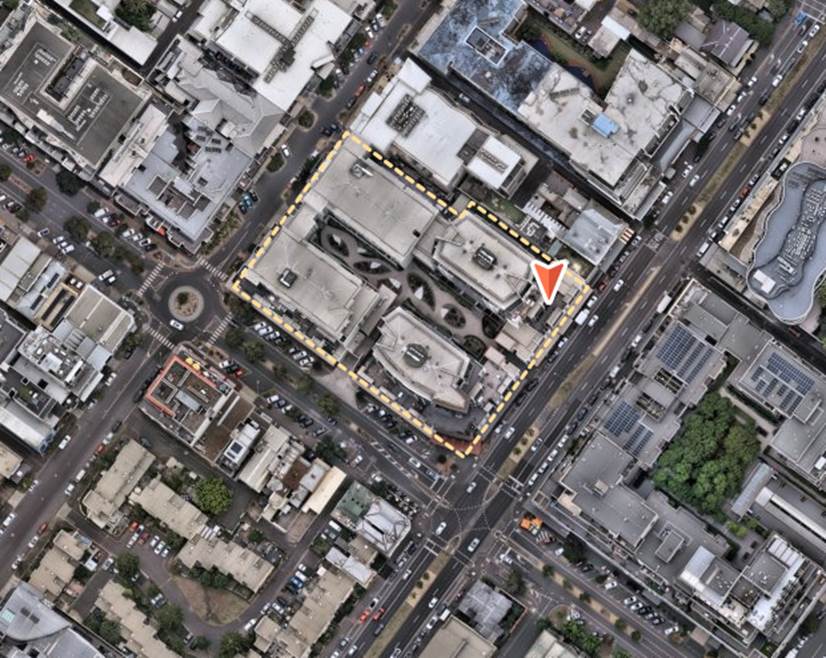
Figure 1 – Site Aerial (Source: Nearmaps, photo dated 1 December 2024)
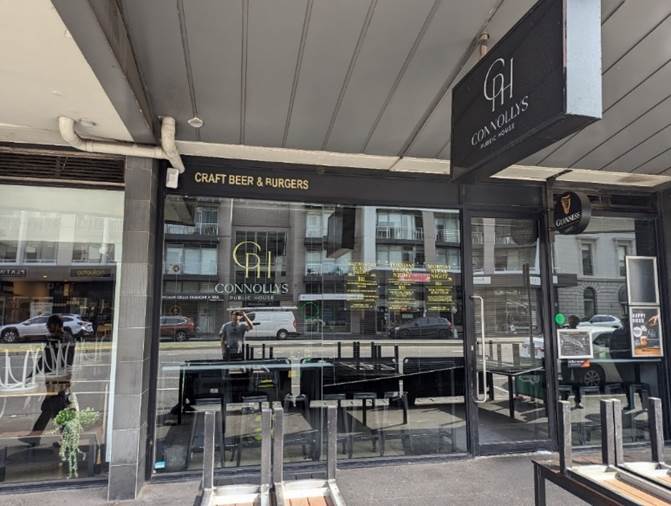
Figure 2 – Site Frontage (Source: Council officer site inspection, 17 October 2024)
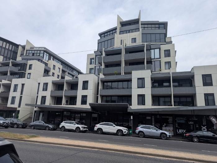
Figure 3 – Site Frontage (Source: Council officer site inspection, 13 February 2025)
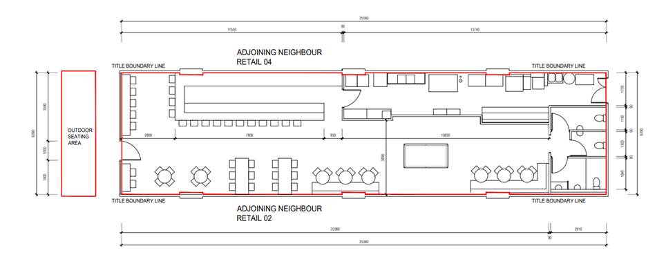
Figure 4 – Proposed floor plan
7. Permit Triggers
7.1 The following zone and overlay controls apply to the site, with planning permission required as described.
|
Zone or Overlay |
Why is a permit required? |
|
Clause 32.04-2 Mixed Use Zone (MUZ) |
Pursuant to Clause 32.09-10 a permit is required to use the land as a ‘bar’. A ‘bar’ is nested under ‘food and drink premises’ where a permit is required if the leasable floor area exceeds 150 square metres. The floor area is 162 square metres. No change to the floor area is proposed, however the use is proposed to be changed from a restaurant to a bar. Therefore, a permit is required under the MUZ. |
|
Clause 52.27 – Licensed Premises |
A permit is required to use land to sell or consume liquor if: · A licence is required under the Liquor Control Reform Act 1998. · A different licence or category of licence is required from that which is in force. · The hours of trading allowed under a licence are to be extended. · The number of patrons allowed under a licence is to be increased. The proposal seeks to change the license type currently in force from a restaurant or café license to an on-premises license, to increase hours of trading, and to increase the amount of patrons able to be served under the license. Therefore a permit is required under Clause 52.27. |
7.2 A zoning map is attached at Appendix 2 of this report.
8. PLANNING SCHEME PROVISIONS
8.1 Municipal Planning Strategy (“MPS”)
Clause 02.03 Strategic Directions
Clause 02.03-1 Settlements, including neighbourhoods.
8.2 Planning Policy Framework (“PPF”)
The application needs to be assessed against the state provisions of the PPF, including:
Clause 11 Settlement
11.03 Planning for Places
11.03-1L-02 Bay Street Major Activity Centre
Clause 17 Economic Development
8.3 Other Relevant General or Particular Provisions
Clause 52.27 Licenced Premises
Clause 65.01 Decision Guidelines
9. REFERRALS
9.1 The application was not required to be referred to any internal council department or external authority.
10. PUBLIC NOTIFICATION/OBJECTIONS
10.1 Notice of the proposal was given by ordinary mail to the owners and occupiers of surrounding properties (346 letters) and directed that the applicant give notice of the proposal by posting one notice on the site.
10.2 The application has received 37 objections. The key concerns raised are summarised below (officer comment will follow in italics where the concern is not be addressed in Section 9):
· Excessive noise
· The extension to trading hours and associated amenity impacts (i.e. unruly and violent behaviour)
· Use unsuitable in an area of residential character.
· Car parking impacts
The site is located within the Principal Public Transport Network Area. Clause 52.06-5 (Car Parking) provides a required rate of carparking for both a restaurant and a bar of 3.5 spaces to each 100sqm of leasable floor area. As the proposal does not change the leasable floor area, no further carparking reduction is required.
10.3 A consultation meeting was held on 20 February 2025. The meeting was attended by a Ward Councillor, applicants, objectors and Planning Officers. The meeting resulted in changes to the proposal to address concerns via a s57A amendment to the application as described in Section 2.7 of this report.
11. OFFICER’S ASSESSMENT
11.1 In considering the proposal, regard has been given to the MPS and PPF, the objections received and the merits of the application.
11.2 The key issues that require assessment are:
· Is there strategic planning policy support for the proposed amendments??
· Are the off-site amenity impacts acceptable?
Is there strategic planning policy support for the proposed amendments??
11.3 There is clear planning policy support for a bar with extended hours and patron numbers in this location within an identified Major Activity Centre. The application is supported by Councils vision as outlined in Clause 02.02 (Vision) of the Municipal Planning Strategy that states Port Phillip will be a city that ‘is creative and prosperous with a dynamic economy that connects and grows business…’.
11.4 Clause 11 (Settlement) recognises plannings role in contributing towards economic viability as well noting that planning is to prevent ‘amenity problems created by siting incompatible land uses together’. The change of use to a bar, and extension to hours and increase to patron capacity will support the ongoing viability of the business. Amenity impacts associated with the proposal are assessed in this report.
11.5 Clause 13.05-1S (Noise management) seeks to assist in the management of noise effects on sensitive land uses through adopting strategies to minimise the impact on human health from noise exposure to occupants of sensitive land uses.
11.6 Clause 13.07-1S (Land use compatibility) has strategies which aim to ensure that use of land is compatible with adjoining and nearby land uses. It seeks to avoid or otherwise minimise adverse off-site impacts from commercial, industrial and other land uses through land use separation, siting, building design and operational measures. As the site is located within a mixed use area it is important to consider the potential impact of the change of use to a bar, extension to hours, increase to patron capacity and allowance for live music. Subject to conditions, noise impacts are considered acceptable. A noise impact assessment is contained further below.
11.7 Noise attenuation measures and conditions of permit will also ensure that the proposal is consistent with Clause 13.07-1L -04 (Tourism, entertainment uses and licenced premises) that seeks to minimise possible amenity impacts from licenced premises on the amenity of surrounding land uses.
11.8 The venue is an established food and drink premises. This use was first approved in 2007 under the parent application, and the change of use from a restaurant to a bar remains an appropriate use for the area.
11.9 Clause 32.04-15 (Decision Guidelines) provides decision guidelines about the use of land in the mixed- use zone. The relevant decision guidelines applicable to this application are:
· The effect that existing uses on adjoining or nearby land may have on the proposed use.
· Whether the use is compatible with adjoining and nearby land uses.
· For non-residential uses, the proposed hours of operation, noise and any other likely off-site amenity impacts.
These are discussed below under the section ‘are the off-site amenity impacts acceptable?’
11.10 Bay Street is a major activity centre, as referred to in Clause 11.03-1L-02 of the planning scheme – Bay Street Major Activity Centres. The objective of the Bay Street Major Activity Centre is ‘to ensure the continued development of the centre as a multi-functional and sustainable bayside activity centre, a local civic and community hub, with a strong sense of identity and community, and a wide range of goods and services, for locals and visitors’.
11.11 The relevant strategy to this application is ‘to encourage use and development that leverage off the Port Melbourne waterfront as a visitor destination, particularly hospitality uses that support visitation to the activity centre, including after hours and weekends’. The proposal is for a hospitality venue that would encourage visitation to the activity centre, including after hours and weekends. The application is supported by the strategies applicable to the Bay Street Major Activity Centre.
11.12 In summary there is clear strategic support for the proposed use of the venue as a bar with extended patrons and hours, subject to the off-site amenity impacts being acceptable. This is assessed below.
Are the off-site amenity impacts acceptable?
11.13 The key off site amenity impacts relate to noise, patron numbers and hours of operation. These are found in the decision guidelines of Clause 52.27 (licence premises).
11.14 These three issues can be compounded where there is a change in the licence type and where there are many licence premises clustered in a small area. The ‘cumulative impact’ and ‘type of licence’ are also decision guidelines in Clause 52.27 (licence premises).
Cumulative impact – ‘cluster’
11.15 Planning Practice Note 61 - Assessing Cumulative Impact (PPN61) provides guidance on cumulative impact assessments. PPN61 states that the guidelines should be used for all applications for a new or expanded licensed premises that:
1. will be licensed and open after 11pm; and
2. is in an area where there is a cluster of licensed premises
11.16 A cluster is defined as three or more licensed premises (including the proposed premises) within a radius of 100 metres from the subject land, or 15 or more licensed premises (including the proposed premises) within a radius of 500 metres from the subject land.
11.17 There is a cluster of licensed premises in proximity to the site. This is predominantly comprised of venues with a restaurant and café license along Bay Street. There are several existing venues with on premises license, with one venue on the same street block and another on the corner of Bay Street and Graham Street. There are five (5) venues that cater to more than 200 patrons and four (4) venues that operate after 11pm within a 500m radius of the site. These are provided in detail in the table below.
|
VENUE NAME |
LICENCE NO. |
LICENCE TYPE |
ADDRESS |
HOURS |
PATRON CAPACITY |
|
Exchange Hotel |
31905342 |
LATE NIGHT (GENERAL) LICENCE |
39 Bay Street, Port Melbourne |
Friday: Between 7am and 3am (the following morning) Saturday: Between 7am and 3am (the following morning) Sunday:Between 10am and 12am (midnight) |
290 |
|
The Local Port Melbourne |
31912886 |
LATE NIGHT (GENERAL) LICENCE |
24 Bay Street Port Melbourne |
Friday: Between 7am and 3am (the following morning) Saturday: Between 7am and 3am (the following morning) Sunday:Between 10am and 1am (the following morning) |
330 |
|
Port Melbourne Yacht Club |
32102599 |
FULL CLUB LICENCE |
Beach Street, Port Melbourne |
Friday: At any time Saturday: At any time until 1am (Sunday morning) Sunday:Between 10am and 11:30pm |
1000 |
|
The Pier Bar & Bakehouse |
31910478 |
LATE NIGHT (GENERAL) LICENCE |
1 Bay Street, Port Melbourne |
Friday: Between 7am and 3am (the following morning) Saturday: Between 7am and 3am (the following morning) Sunday:Between 10am and 1am (the following morning) |
270 |
|
Ta Brockie Pty Ltd |
31908201 |
GENERAL LICENCE |
92 Beach Street, Port Melbourne |
Friday: Between 7am and 1am (the following morning) Saturday: Between 7am and 1am (the following morning) Sunday:Between 10am and 11pm |
300 |
|
The Rex |
32122735 |
FULL CLUB LICENCE |
145 Bay Street, Port Melbourne |
Friday: Between 7am and 3am (the following morning) Saturday: Between 7am and 3am (the following morning) Sunday:Between 10am and 3am (the following morning) |
300 |
11.18 The site is located within a cluster as defined by the Practice Note. The below assessment of noise, patron number and hours of operation are considered in light of the cumulative impact of the cluster of venues and the change in the license to a bar license.
Change from restaurant to on premises licence
11.19 The change from a restaurant and café to an on premises has potential to cause additional impacts to the surrounding area. The main change in a licence of this type is that meals are not required to be served, and that the ratio of 75% of patrons to be seated for a restaurant and café licence is not required to be provided for an on premises licence. This can result in more ‘vertical drinking’ which is people standing and drinking, as opposed to drinking alcohol with a meal. This type of alcohol consumption can give rise to greater potential for amenity impacts associated with excessive drinking. This acknowledgment of potential for greater impacts is reflected in Planning Practice Note 61.
11.20 The scale of the premises being limited to 100 people, and the requirement of a venue management plan and security being provided on Friday and Saturday nights will help to mitigate adverse impacts. In addition, the applicant has also included as part of the application that a food offering will always be available whilst the bar is open, and that seating always be provided in accordance with the endorsed plan. This reduces the area of the site available for ‘vertical drinking’.
11.21 The proposed use and licence type will be acceptable.
Noise
Music Noise
11.22 The proposal includes the deletion of Condition 4 which will allow for the playing of amplified music at the premises. This condition currently states that no amplified music is to be played at any time. The question is whether playing of amplified music will result in unreasonable off-site amenity impacts.
11.23 In considering off-site amenity impacts, it is relevant to understand the impact to the closest and most affected sensitive use. The closest and most impacted sensitive use is Apartment 203, 57 Bay Street, located directly above the venue. If impacts are considered reasonable at this apartment, it stands to reason that impacts will be reasonable for other apartments further away.
11.24 The applicant has submitted an acoustic report (prepared by Renzo Tonin & Associates). The acoustic report includes findings from on-site and off-site noise measurements. Noise was measured from within the venue, on the balcony of Apartment 203 and within the apartment itself. The analysis included when the venue was in operation with amplified music at various levels.
11.25 The criteria for assessing music noise limits from public venues (i.e. what is deemed reasonable) is contained in Environment Protection Authority (EPA) Publication 1826 ‘Noise Limit and Assessment Protocol for the Control of Noise from Commercial, Industrial and Trade Premises and Entertainment Venues’. The criteria have different noise levels for day, evening and night-time periods.
11.26 The acoustic report concludes that subject to conditions, the music noise will comply with the EPA criteria. Key conditions include:
· Amplified live solo/duo /DJ music must not be played after 10 pm Sundays and 11pm on other days
· Amplified live duo/solo/DJ music must be maintained at L90 dB(C) at 2 metres from the speaker
· No acoustic drums
· All doors and windows to areas where playing amplified music must be closed apart for access and egress
· Music other than amplified live /DJ music must be maintained at ‘background level’ as defined by Clause S. 9A of the Liquor Control Reform Act 1998. This is music at ‘a level that enables patrons to conduct a conversation at a distance of 600mm without having to raise their voices to a substantial degree’.
· No live music is to played outdoors at any time.
· Proposal to include a music noise limiter on site
· Installation of a weather screen over outdoor area to provide a buffer between outdoor area and residences across Bay Street.
· Requirement for live music to be played only in a designated area to the rear of site.
11.27 The above conditions are contained in the officer recommendations, with some adjustments to further protect the amenity of nearby dwellings. These include:
· Restricting all music outdoors, not just live music.
· Applying the conditions to all live music, not just ‘solo/duo’ performances
11.28 The above conditions are readily able to be monitored and enforced by Council’s Planning Compliance team. In addition, the recommendation includes a new condition of permit that enables Council to request further expert acoustic testing to ensure compliance in the event of allegation and concern by Council that the venue is not complying with requirements.
11.29 Subject to the above conditions, the additional noise generated by music being played in this venue is acceptable. The noise generated from music will be acceptable at the most sensitive receiver, and other sensitive receivers in the area.
Patron Noise
11.30 The acoustic report includes patron noise testing on site and computer modelling to assess noise impacts to Apartment 203, being the closest dwelling, directly above the venue. This included analysis of the proposed hours and number of patrons.
11.31 The application proposes a maximum total patrons of 100, with a maximum of 18 in the outdoor footpath trading area at any one time.
11.32 As the EPA Noise protocol does not control patron noise, the report uses noise targets from City of Yarra ‘Guidelines – Managing Noise Impacts in Urban Development’. While these targets do not apply to City of Port Phillip, in the absence of patron noise targets, the acoustic report uses these as an example of what would be considered reasonable.
11.33 The acoustic report concludes that patron noise from the operation outdoors would be acceptable even at 1am.The proposal includes outdoor use to only 11 pm. The officer recommendation restricts the outdoor area to the proposed hours of 11pm.
11.34 The cumulative impact of patron noise when considered in the context of the surrounding area may have some impact on surrounding properties. However, through the provision of a patron management plan and security, these impacts can be managed. As provided above, there are other late night venues that operate within the surrounding area, however several of these venues are licensed to operate until 3am. As this proposal is to operate until 11:30pm and 12am, patrons can move on form the premises to later operating venues or they may go home. The staggered closing times of different venues means the cumulative effect of patrons on the street at closing time will be reduced. This will also cause less demand on transport services than if all surrounding venues closed at the same time.
Extension to Hours
11.35 The proposal includes an extension of one hour per night on Friday and Saturday nights and an extension of thirty minutes on Sunday nights. There is no proposed extension to any other night of the week. Subject to conditions, including the restriction of the outdoor footpath trading area to 11pm on any day, the extension to operating hours is acceptable in the context of a major activity centre.
11.36 As per the above, the proposed extension does not seek to operate later than other venues within the surrounding area. The proposed earlier closing time comparative to other venues will still allow for patrons leaving the area to be distributed across transport options more evenly. This is acceptable.
Increase to Patron Numbers
11.37 The increase to patron numbers is acceptable. The acoustic report demonstrates that noise from the increase in patron numbers will be acceptable. The additional noise from inside the venue will be imperceptible from outside. Restrictions on patron numbers and hours will minimize the impact of the outdoor area. Requirements for a patron management plan, including security staff will assist in managing adverse patron behaviour.
11.38 Increased parking demand is not in scope of the application as the statutory rate for parking provision, is calculated on leasable floor area, is not proposed to increase.
11.39 The increase of 48 patrons will not cause an unreasonable impact to the surrounding area when considered cumulatively with other venues operating in the area. The increase to 100 patrons is modest compared to other venues that operate in the area.
12. COVENANTS
12.1 The subject site is identified as Lot 103 on Plan of Subdivision 500744M. There is no restrictive covenant on the subject site that is applicable to the proposal.
13. OFFICER material OR general INTEREST
13.1 No officers involved in the preparation of this report has declared a material or general interest in the matter.
14. INTEGRATED DECISION MAKING AND CONCLUSION
14.1 Clause 71.02-3 of the planning scheme requires the decision maker to integrate the range of policies relevant to the issues to be determined and balance the positive and negative environmental, social, and economic impacts of the proposal in favour of net community benefit and sustainable development. When considering net community benefit, fair and orderly planning is key; the interests of present and future Victorians must be balanced; and the test is one of acceptability.
14.2 It is considered that the proposal is acceptable for the Bay Street Major Activity Centre. Subject to conditions the proposal will not have an unacceptable impact from noise, patron number or extended hours of operation.
|
ATTACHMENTS |
1. Plans and Documents 2. Zoning Map |
Planning Committee
23 April 2025
|
31 Tribe Street, South Melbourne - PDPL/00565/2024 |
|
|
location/address: |
31 Tribe Street, South Melbourne |
|
Executive Member: |
Brian Tee, General Manager, City Growth and Development |
|
PREPARED BY: |
Peter Grose, Senior Urban Planner |
1 PURPOSE
1.1 To consider and determine a planning application PDPL/00565/2024 for the full-demolition of the existing dwelling and construction of a new double-storey dwelling and garage with studio above on a site greater than 300sqm in the Heritage Overlay.
2. EXECUTIVE SUMMARY
|
Ward: |
Montague |
|
Trigger
for determination |
More than 16 Objectors. |
|
ApplicATION NO: |
PDPL/00565/2024 |
|
Applicant: |
Odyssey Architecture |
|
Existing use: |
Single residential dwelling. |
|
Abutting uses: |
Residential dwellings. |
|
Zoning: |
Neighbourhood Residential Zone – Schedule 1 |
|
Overlays: |
Heritage Overlay |
2.1 The subject site is a narrow rectangular block (approximately 324sqm) and is currently developed with a single storey dwelling fronting Tribe Street with a brick garage at the rear accessed from Little Tribe Street.
2.2 The land is within a Neighbourhood Residential Zone – Schedule 1 (NRZ1) and Heritage Overlay – Schedule 442 (HO442). As the lot is greater than 300sqm, an assessment against the residential development standards at Clause 54 of the Port Phillip Planning Scheme (Scheme) is not required. A planning permit is only required under the Heritage Overlay.
2.3 The application was advertised with 22 objections received. Concerns are centred around scale, built form, amenity impacts and neighbourhood character, notably regarding the proposed double-storey garage structure at the rear of the site.
2.4 A consultation meeting was held on 27 February 2025 and was attended by the applicant, landowners, objectors and planning officers. No amendments to the plans were made because of issues raised at the consultation period.
2.5 The application is generally considered acceptable. The proposed complete demolition is supported as the existing dwelling and garage are non-original and have no original heritage value. The contributory heritage grading that applies to the site under the Port Phillip Heritage Review has been applied in error.
2.6 The proposed new dwelling design responds sufficiently to the heritage streetscape of Tribe Street contained in HO442 (Montague Precinct). The scale and massing of the proposed development would in turn not detract from or overwhelm the heritage features of the streetscape and wider precinct. In addition to the replacement dwelling, the proposed replacement front fence is also considered an appropriate response to its heritage setting.
2.7 The proposed garage to the rear of the site would replace an existing garage with a matching footprint. The increase to a double-storey form is supported in part due to the diverse nature of the Little Tribe Street streetscape.
2.8 With regard to materials, colours and finishes, these would largely consist of brickwork and textured renders in neutral light greys with dark highlights. Again, this is an acceptable response within the existing heritage setting.
2.9 It is recommended that the Council issues a Notice of Decision to Grant a Planning Permit, subject to conditions.
|
3.1 That the Responsible Authority, having caused the application to be advertised and having received and noted the objections, issue a Notice of Decision to Grant a Permit for application PDPL/00565/2024 at 31 Tribe Street, South Melbourne. 3.2 That the Notice of Decision be issued subject to the following permissions:
3.3 That the decision be issued subject to the following conditions: Amended plans required 1. Before the development starts, amended plans to the satisfaction of the Responsible Authority must be submitted to and approved by the Responsible Authority. When approved, the plans will be endorsed and will then form part of the permit. The plans must be drawn to scale with dimensions and an electronic copy must be provided. The plans must be generally in accordance with the plans submitted with the application but modified to show: a) Any change resulting from WSUD condition 7. No alterations 2. The extent of demolition and works shown on the endorsed plans must not be modified for any reason without the prior written consent of the Responsible Authority. Satisfactory continuation and completion 3. Once the development has started it must be continued and completed to the satisfaction of the Responsible Authority. Walls on or facing the boundary 4. Before the development is occupied, all new or extended walls on or facing the boundary of adjoining properties and/or a laneway must be cleaned and finished to a uniform standard to the satisfaction of the Responsible Authority. Unpainted or unrendered masonry walls must have all excess mortar removed from the joints and face and all joints must be tooled or pointed also to the satisfaction of the Responsible Authority. Painted or rendered or bagged walls must be finished to a uniform standard to the satisfaction of the Responsible Authority. No equipment or services 5. No plant, equipment or domestic services (including any associated screening devices) or architectural features, other than those shown on the endorsed plan are permitted, except where they would not be visible from a street (other than a lane) or public park without the written consent of the Responsible Authority. Vehicle crossing 6. Before the development is occupied, all vehicle crossings must be constructed in accordance with Council’s current Vehicle Crossing Guidelines and standard drawings to the satisfaction of the Responsible Authority. All redundant crossings must be removed and the footpath, naturestrip, kerb and road reinstated as necessary at the cost of the applicant/owner and to the satisfaction of the Responsible Authority. Water sensitive urban design 7. Concurrent with the endorsed of plans under condition 1 of the planning permit, a Water Sensitive Urban Design (Stormwater Management) Report must be submitted to the Responsible Authority in electronic format. When approved, the Water Sensitive Urban Design Report will be endorsed and will then form part of this permit. The report must: Demonstrate how the development meets the water quality performance objectives as set out in the Urban Stormwater – Best Practice Environmental Management Guidelines (CSIRO, 1999) or its updated equivalent. This must include: · Design details of the water sensitive urban design stormwater treatments to be used, including cross-sections and connection to legal point of discharge. · A STORM report with a score of 100 per cent (%) or greater (or MUSIC modelling for large scale developments). · A plan showing all stormwater catchment areas, permeable and impermeable areas in square metres. · A plan illustrating the location of the nominated water sensitive urban design stormwater treatment measures in relation to buildings, sealed surfaces and landscaping areas, with connection notations. · Details of how the water sensitive urban design stormwater treatment measures will be maintained on an on-going basis. This must be demonstrated by providing a maintenance manual including the following information: i. A full list of maintenance tasks. ii. The required frequency of each maintenance task (monthly, annually etc.). iii. Person responsible for each maintenance task. Incorporation of water sensitive urban design measures 8. Before the development is occupied, the provisions, recommendations and requirements of the endorsed Water Sensitive Urban Design Report must be implemented and complied with to the satisfaction of the Responsible Authority. Construction management water sensitive urban design 9. The developer must ensure that throughout the construction of the building(s) and construction and carrying out of works allowed by this permit: a) No water containing oil, foam, grease, scum or litter will be discharged to the stormwater drainage system from the site. b) All stored wastes are kept in designated areas or covered containers that prevent escape into the stormwater system. c) The amount of mud, dirt, sand, soil, clay or stones deposited by vehicles on the abutting roads is minimised when vehicles are leaving the site. d) No mud, dirt, sand, soil, clay or stones are washed into or are allowed to enter the stormwater drainage system. e) The site is developed and managed to minimise the risks of stormwater pollution through the contamination of run-off by chemicals, sediments, animal wastes or gross pollutants in accordance with currently accepted best practice. No reticulated gas 10. Any new dwelling allowed by this permit must not be connected to a reticulated gas service (within the meaning of Clause 53.03 of the Port Phillip Planning Scheme). This condition continues to have force and effect after the development authorised by this permit has been completed. Time for starting and completing the development 11. This permit will expire if one of the following circumstances applies: a) The development is not started within two years of the date of this permit. b) The development is not completed within four years of the date of this permit. In accordance with Section 69 of the Planning and Environment Act 1987, an application may be submitted to the responsible authority for an extension of the periods referred to in this condition. |
4. RELEVANT BACKGROUND
4.1 There is no relevant history or background for this application.
5. PROPOSAL
5.1 The plans which are the subject of this report are those plans received by Council on 5 December 2024, prepared by Odyssey Architecture consisting of drawings:
TP-0000 – TP-0007 (inclusive), TP-0100, TP-0101, TP-0102, TP-1000, TP-1009 (inclusive), TP-2000, TP-2001, TP-2002, TP-3000, TP-3001, TP-3002, TP-4000, TP-6000, TP-7000 - TP-7004 (inclusive). Revision C, 05.12.2024.
5.2 Specifically, the application proposes the following:
Demolition
· Complete demolition of the existing dwelling, garage, and the front fence.
· Also to be removed are the existing shed and all existing vegetation on site.
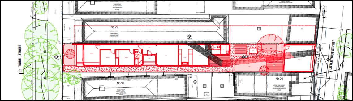
Figure 1. Proposed Demolition Plan.
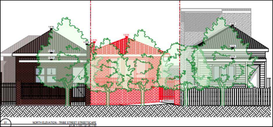
Figure 2. Streetscape Demolition Elevation.
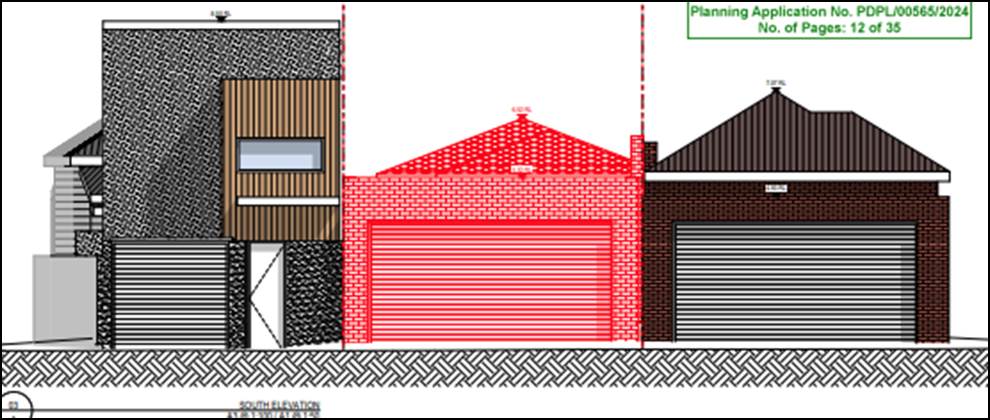
Figure 3. Rear garage Demolition Elevation.
Proposed new works.
· A new, double-storey dwelling would be built to a similar-sized footprint as the existing dwelling.
· The new dwelling would have 4 bedrooms, 3 bathrooms, study, laundry, rumpus room, open-plan kitchen/living/dining area, south-facing courtyard with an in-ground swimming pool.
· A new, double-storey garage/studio would be built to a similar sized footprint as the existing garage. This building would have a double-width garage at ground level, with a studio, ensuite and kitchenette on the first floor.
· A new mid-height front fence is proposed to Tribe Street.
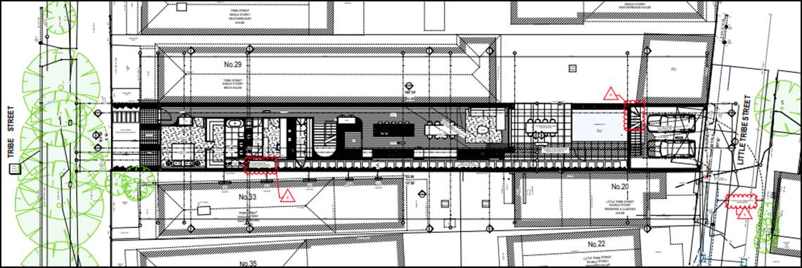
Figure 4. Proposed Site / Ground-Floor Plan.
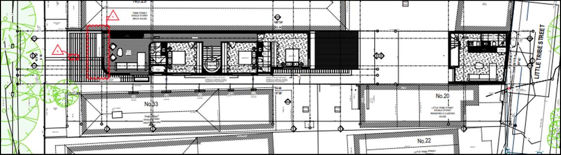
Figure 5. Proposed Site / First-floor plan.
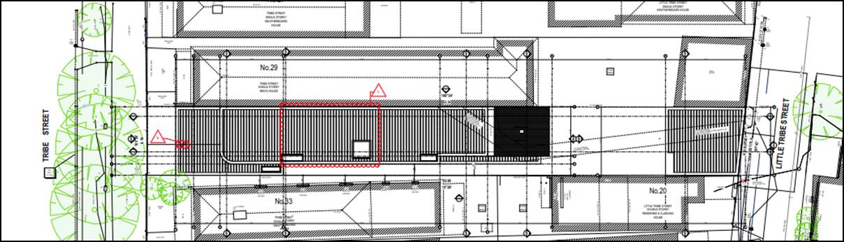
Figure 6. Proposed Site / Roof Plan.
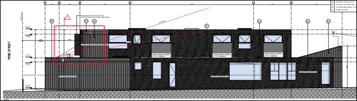
Figure 7. Proposed West Elevation of dwelling.
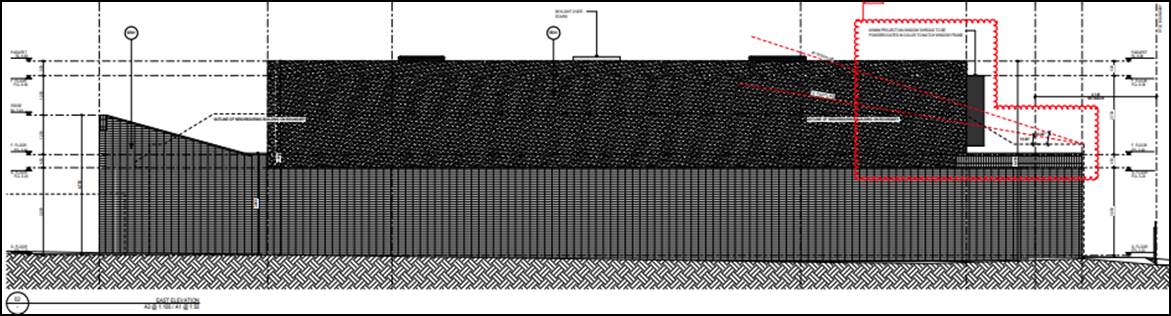
Figure 8. Proposed East Elevation of dwelling.
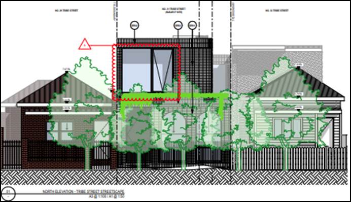
Figure 9. Proposed Tribe Street elevation.
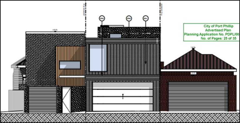
Figure 10. Proposed Little Tribe Street Elevation.
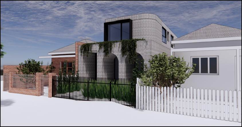
Figure 11. Proposed 3D view from Tribe Street.
6. SUBJECT SITE AND SURROUNDS
|
|
Description of Site and Surrounds |
|
Site Area |
Street frontage to Tribe Street is 6.16m. Depth is between 52.34m – 53.68m. Site area is 324sqm. Landform is flat. |
|
Existing building and site conditions |
The site is developed with a non-original, single-storey terrace dwelling (built in recent decades). The dwelling is built adjoining the neighbour at 29 Tribe Street. Material finishes for the dwelling are exposed brick, aluminum window-frames, and a terracotta tile roof. Minimal trees and landscaping are present on the site. |
|
Surrounds/neighbourhood character |
a) The surrounding area is characterised by its fine grain subdivision pattern, accommodating mostly residential dwellings. b) Many nearby dwellings along Tribe Street are single-storey terrace dwellings with heritage facades, but recent rear additions are commonplace. c) Dwellings along Little Tribe Street in the rear (south) of the subject site are a mix of original heritage terrace dwellings, and modern houses (in both single and double-storey forms). d) Tribe street itself is a wide street, with mature canopy street trees (and perpendicular carparking) along both sides of the street. e) Little Tribe Street is a narrow street providing both a street frontage for some smaller lots, and for garage access to the rear of Tribe Street properties (including the subject site). |
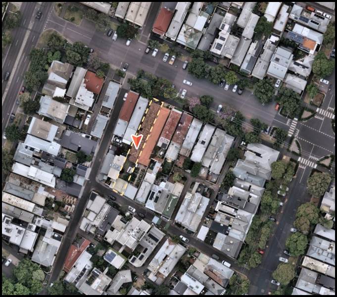
Figure 12. Aerial view of the subject site and surrounds. Source: Nearmaps. 01.12.2024
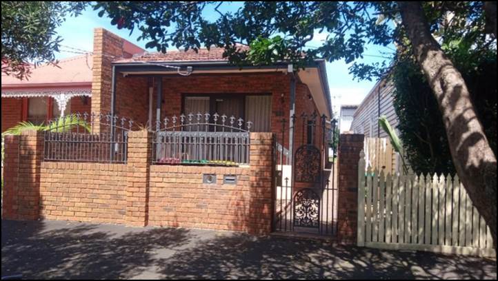
Figure 13. 31 Tribe Street frontage. Author Photograph.
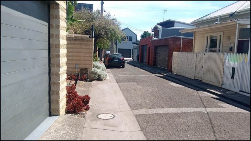
Figure 14. Streetscape of Little Tribe Street. Author Photograph.
7. Permit Triggers
7.1 The following zone and overlay controls apply to the site, with planning permission required as described.
|
Zone or Overlay |
Permit Trigger |
|
Clause 32.09 Neighbourhood Residential Zone – Schedule 1 |
Under Clause 32.09-4 of the Scheme, a permit is not required to construct or extend a dwelling on a lot greater than 300 sqm. |
|
Clause 43.01 Heritage Overlay – Schedule 442 (Albert Park Residential Precinct). |
Under Clause 43.01-1 of the Scheme, a permit is required to: · Demolish or remove a building. · Construct a building or construct or carry out works. |
8. PLANNING SCHEME PROVISIONS
8.1 State Planning Policy Frameworks (SPPF)
The following State Planning Policies are relevant to this application:
Clause 02 Metropolitan Planning Strategy
Clause 11 Settlement
Clause 15 Built Environment and Heritage
15.01-2S Building Design
15.01-5S Neighbourhood Character
15.02-1.1 Sustainable Development
15.03 Heritage
15.03-1S Heritage Conservation
15.03-1L Heritage Policy
Clause 16 Housing
Clause 19 Infrastructure
19.03-3L Stormwater management (water sensitive urban design)
General Provisions
Clause 65 Decision Guidelines
Operational Provisions
Clause 71 Operation of this Planning Scheme
9. REFERRALS
9.1 Internal referrals
The application was referred to the following areas of Council for comment.
|
Internal Department |
Referral comments |
|
Heritage Officer |
f) No objection · This is a replacement dwelling and the current heritage grading has been made in error. The current dwelling is listed as “Contributory” however this grading has been applied erroneously. · This property and its neighbour will be re-assessed as non-contributory in future amendments of the Heritage Overlay. · The setback of the ground floor, the side door and two windows under an arched front verandah, are all good responses to the predominate forms in the street. · The flat roof and square form of the first floor is in stark contrast to the peaked roofs of the other houses in the street. The first-floor appears over-scale, as is the size of the front facing window. Because this area is not set back enough from the street. · If the first-floor is adjusted to bring it into line with the neighbouring roofs and the size of the front window is reduced, the general design of the proposal could be supported. Comments in response to heritage advice. The design was amended to increase the first-floor setback from the street (the north). · The first-floor setback was increased by around 2.4m (from 4.1m to be 6.5m from the street boundary) · The size and design of the new front window was also revised. (See elevations below). · It is also noted that a proposed Roof Terrace level was removed. · All these changes were considered acceptable by heritage officer. · Heritage officer had no objection to (or conditions on) the rear garage/studio building. |
9.2 External referrals
The application was not required to be referred to any authority under Clause 66 of the Scheme or Section 55 of the Planning and Environment Act 1987.
10. PUBLIC NOTIFICATION/OBJECTIONS
10.1 Notice of the application was given by ordinary mail to the owners and occupiers of surrounding properties (9 letters sent) and by the display of a notice on the site. in accordance with Section 52 of the Planning and Environment Act 1987.
10.2 22 objections were received. The key relevant concerns raised are summarised below:
· Negative impact of the garage on the Little Tribe Street streetscape.
· Negative impact to the local heritage value of the area.
· The garage is out of context for the heritage area.
· Negative response to the two-storey form of the garage along Little Tribe Street.
· It is alongside terraces etc. (Requests additional setbacks from this street).
· Excessive height, visual bulk, and mass (for the garage).
· No setback to the garage wall along Little Tribe Street.
· Garage will have an impact on the streetscape (and nearby contributory heritage dwellings).
· Overshadowing from garage/loss of light - Particularly to Little Tribe Street properties.
· Insufficient regard for ESD and WSUD principles.
· Minimal green spaces.
· Safety concerns for pedestrians along Little Tribe Street
· Suggest using Tribe Street for carparking/garaging instead.
· Loss of property values.
· Loss of city views.
· This will encourage other inappropriate development proposals.
10.3 Notice of the application was also given to Melbourne Water as the site is site is affected by flooding from Sea Level Rise in the year 2100.
The proposed dwelling development has a finished ground-floor level of 2.23m (AHD). The garage would be 2.00m AHD.
· In a response, Melbourne Water advised they did not support the proposal based on the proposed finished floor levels of both the dwelling and the garage. They also provided some recommended conditions regarding fence and gate design, finished ground levels, fill, and the swimming pool.
· This referral response was shared with the applicant, who did not wish to amend their design.
10.4 As Melbourne Water is not a Determining Referral Authority, their conditions will not be included on any permit that may issue. A permit note would be included to advise that sea-level rise will be considered at the Building Permit stage and if the floor levels are required to be increased and this impacts the overall height of the building, further planning approval will be required.
10.5 A consultation meeting was held on 27 February 2025. The meeting was attended by a Ward Councillor, applicants, objectors and Planning Officers. The meeting did not result in any changes to the proposal.
10.6 It is considered that the objectors do not raise any matters of significant social effect under Section 60(1B) of the Planning and Environment Act 1987.
11. OFFICER’S ASSESSMENT
11.1 A planning permit is required under the provisions of the Heritage Overlay only.
Is the heritage response acceptable?
11.2 The purpose of the Heritage Overlay is to conserve and enhance places of natural or cultural significance, to conserve those elements which contribute to the significance of the place and to ensure that development does not adversely affect the significance of heritage places. This purpose is consistent with the broader heritage conservation objectives of the Planning Policy Framework at Clause 15.03-1S. Clause 15.03-1L provides the principal policy guidance in assessing an application within the heritage overlay.
11.3 An assessment of the proposal against the purpose and decision guidelines of the Heritage Overlay and relevant strategies and guidelines of Clause 15.03-1L - Heritage Policy is provided below.
11.4 The subject site is within HO442 at Clause 43.01 (heritage overlay) which is identified as the “Albert Park Residential Precinct / Part Montague Precinct.”. The statement of significance for this precinct is summarised below:
Statement of significance
The Albert Park Residential Precinct, nominally bounded by Kerferd Road, Beaconsfield Parade, Pickles Street, Nelson Road and Bridport Street, covers the most intact portion of an area that largely developed from the mid-1870s to the early 1890s. Formerly occupied by low-lying land that was flood prone in parts and elsewhere occupied by a military battery, the area underwent little residential development until military presence with withdrawn and land reclamation commenced in the early 1880s. Today, it remains strongly characterised by late Victorian housing, which demonstrate a broad range of typologies: from the humblest single-fronted timber cottages through to larger villas in brick and timber, to grander double-storey brick terraces and townhouses.
Why is it significant
Historically, the precinct is significant as an early, ambitious and notable attempt to encourage residential development beyond the boundaries of the Emerald Hill township of 1852.
The predominantly residential character is enhanced by a number of contemporaneous non-residential buildings, such as churches, schools and shops, which provide evidence of the expansion of community facilities during the precinct’s key phase period of development over the last three decades of the nineteenth century.
Aesthetically and architecturally, the precinct is significant for its fine collection of late Victorian dwellings. These demonstrate a range of typical housing types of the 1870s and ‘80s: modest single-storeyed cottages in both timber and brick (mostly concentrated in the south-east and south of the precinct) as well as grander villas, double-storeyed terraces and townhouses (mostly concentrated in the east of the precinct).
11.5 The proposal is considered acceptable because the extent of demolition and the design of the new dwelling sufficiently responds to those elements considered significant in the HO442.
Demolition
11.6 The proposal includes full demolition of the existing dwelling. Heritage policy 15.03-1L seeks to “Prioritise the conservation, restoration or adaption of a heritage place over demolition” and “Avoid the demolition of a Significant or Contributory building unless new evidence has become available to demonstrate that the building is not of heritage significance and does not contribute to the heritage place”. It is noted that the current dwelling on site is a non-original (replacement) dwelling. It is also noted that the current contributory heritage grading has been applied erroneously through the City of Port Phillip Heritage Review.
11.7 The full demolition of the existing dwelling is supported based on the above considerations.
Proposed new buildings
11.8 Clause 15.03-1L (heritage) seeks to “Support new buildings that respect and complement Significant and Contributory buildings in relation to form, scale, massing, siting, details and materiality.
11.9 The replacement dwelling features a similar footprint to the existing building. This includes a ground-floor setback from the western side boundary.
11.10 At approximately 4.1m (including the protruding verandah), the proposed front setback is consistent with the neighbouring properties at 29 and 33 Tribe Street. It is acknowledged there is a minor increase (approximately 1.2m) to the eastern wall-on-boundary adjacent to the open space area at 29 Tribe Street. This would however be contained to the rear of the site and not visible from the principal Tribe Street façade.
11.11 The garage area would also occupy a similar ground-floor footprint as the existing garage with a minor increase of approximately 200mm.
11.12 It is considered that the proposed built form respects the heritage streetscape insofar as its height, proportions and setbacks. The new dwelling façade features large arched window porticos at ground level. It is considered that the proposed façade design and materials would result in a contemporary appearance which is considered a more favoured outcome for replacement architecture in a heritage context.
11.13 At a distance of 6.49m, the proposed first-floor level is sufficiently set back from the principal street frontage of Tribe Street.
11.14 It is acknowledged that the proposed development is for a replacement building as opposed to an addition to an existing one. Despite this, the 3Ds renders provided with the application (Drawing sheets: TP7000, TP7001, TP7002, TP7004) demonstrate that the first-floor would be substantially concealed when viewed from the opposite side of the road - which is consistent with Councils heritage policy at Clause15.03-1L.
11.15 The overall height of the first-floor element would be approximately 6.65m which is appropriate and not excessive within this context.
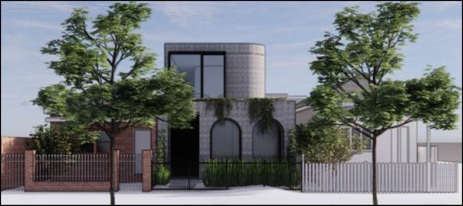
Figure 15. 3D view of the streetscape.
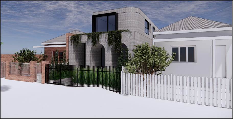
Figure 16. 3D view of the streetscape.
11.16 The external, street-facing masonry walls of the new dwelling would be finished in an off-white textured render (with darker colour window highlights). This is considered to an appropriate heritage material and finish for this heritage streetscape.
Little Tribe Street streetscape
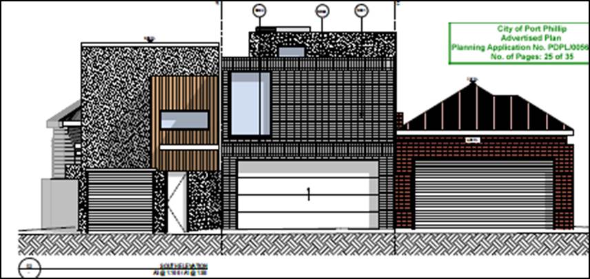
Figure 17. Elevation of garage / studio from Little Tribe Street
11.17 The garage/studio building would be built on a very similar footprint as the existing garage. Perimeter walls would increase in height from 3.5 to 5.9m above ground. No side and rear setbacks are proposed (including a sheer wall facing Little Tribe Street). This is however considered an acceptable outcome due to the highly diverse nature of Little Tribe Street in the vicinity of the subject site.
11.18 While certain buildings further along Little Tribe Street are original, single-storey, terrace dwellings with heritage value (such as 8 -14 Little Tribe Street to the north side of the street) a greater number of properties are replacement dwellings. Many of these are double storey in height. This is particularly apparent along the south side of the street.
11.19 Modern double-storey built form is present next door and nearby at numbers: 7, 9, 11, 13, 15, 20, 22 Little Tribe Streets (and the rear of 76 Iffla Street to the east).
11.20 Furthermore, it is noted that Little Tribe Street is not referred to the City of Port Phillip 2021 Heritage Review. No individual property is cited, nor is the streetscape as a whole cited or discussed in the Statement of Significance for HO442.
11.21 Heritage gradings are shown on the policy map below. The map indicates no heritage listing whatsoever for all immediately surrounding properties to the rear of the subject site (i.e. 11, 13, 15 and 20 Little Tribe Street, and 29 Tribe Street).
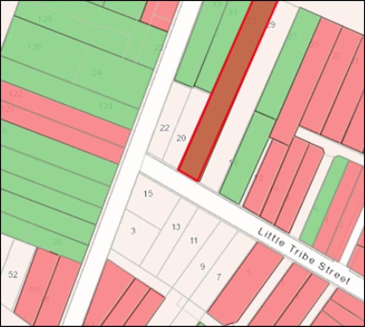
Figure 18. Heritage policy map of the area (Green and Red are listed heritage buildings)
Fencing
11.22 The existing non-original 1.8m-high brick and steel fence will be removed and replaced with a 1.5m-high, steel picket fence. The proposed fence would be of simple design utilising wide spaced steel pickets with a high degree of visual transparency. The fence would be a modern interpretation of Victorian-era, timber picket fences which are a common feature in the Tribe Street vicinity.
Vehicle Access
11.23 The existing vehicle crossing would be re-used. No new (or expanded) crossover onto Little Tribe Street would be required. The rebuilt garage would not require the alteration or removal of any feature that contributes to the significance of the heritage place.
Does the proposal result in amenity impacts based on the relevant planning controls?
11.24 As the site is larger than 300sqm, the Clause 54 Standards for on and off-site amenity (such as overshadowing, overlooking, site coverage and permeability) are not required to be assessed as part of this application. Amenity impacts raised by objectors (such as side and rear setbacks, and overshadowing) are matters that are considered at the Building Permit stage.
Water Sensitive urban Design (stormwater)
11.25 The new development will be required to demonstrate that it can suitably manage stormwater and this will form a condition on any permit to issue.
12. COVENANTS
12.1 The applicant has completed a declaration that the subject land, being all land contained within volume 08546, folio 672 - commonly known as lot 1 on plan of subdivision 045878 is not encumbered by a restrictive covenant or section 173 agreement.
13. OFFICER material OR general INTEREST
13.1 No officers involved in the preparation of this report has declared a material or general interest in the matter.
14. CONCLUSION
14.1 On balance, the proposal is considered acceptable.
14.2 The extent of demolition is considered appropriate as the existing dwelling is non-original and does not contribute to the heritage value of the area.
14.3 The proposed new dwelling and garage are considered acceptable. The size and extent of the new dwelling is respectful of the heritage features of the Montague Precinct – including immediately adjacent dwellings along the principal streetscape of Tribe Street.
14.4 The proposed garage design is also considered responsive to the diverse streetscape along Little Tribe Street to the rear.
|
ATTACHMENTS |
1. Proposed Development Plans 2. Design Statement 3. Heritage Statement |
Planning Committee
23 April 2025
|
49A Pakington Street, St Kilda - PDPL/00073/2025 |
|
|
location/address: |
49A Pakington Street ST KILDA VIC 3182 |
|
Executive Member: |
Brian Tee, General Manager, City Growth and Development |
|
PREPARED BY: |
Max England, Urban Planner |
1. PURPOSE
1.1 To determine a planning application involving full demolition of a significant graded dwelling and associated outbuildings and structures on land subject to a Heritage Overlay.
2. EXECUTIVE SUMMARY
|
Ward: |
Balaclava Ward |
|
Trigger
for determination |
The application involves substantive non-compliance with Council’s Heritage Policy at Clause 15.03 of the Scheme in relation to the demolition of a significant graded dwelling. |
|
ApplicATION NO: |
PDPL/00073/2025 |
|
Applicant: |
Ratio Consultants on behalf of City of Port Phillip |
|
Existing use: |
Dwelling |
|
Abutting uses: |
The site directly abuts residential uses and the Pakington Street Reserve |
|
Zoning: |
Neighbourhood Residential Zone – Schedule 1 |
|
Overlays: |
Heritage Overlay – Schedule 7 (St Kilda, Elwood, Balaclava, Ripponlea precinct) Special Building Overlay – Schedule 1 |
2.1 The application seeks planning permission for the demolition of a significant graded dwelling and associated outbuildings and structures on site at 49A Pakington Street, St Kilda (site).
2.2 The demolition would enable the expansion and upgrade to Pakington Street Reserve. However, the development of the park does not form part of this application. The scope of Council’s consideration relates only to the proposed demolition of the existing dwelling.
2.3 The site is within the Neighbourhood Residential Zone – Schedule 1 (NRZ1). There are no permit requirements for demolition under the Neighbourhood Residential Zone. A zoning map is contained at Attachment 1.
2.4 The site is subject to a Special Building Overlay – Schedule 1 (SBO1). There are no permit requirements for demolition under the Special Building Overlay.
2.5 The site is also subject to a Heritage Overlay – Schedule 7 (HO7). Pursuant to Clause 43.01-1 of the Port Phillip Planning Scheme, a permit is required to demolish or remove a building on land subject to a Heritage Overlay.
2.6 The dwelling is graded as a ‘significant heritage place’. Significant heritage places:
Includes buildings and surrounds that are individually important places of either Victorian, regional or local heritage significance, or are places that, together within an identified area, are part of the significance of a Heritage Overlay. These places are included in a Heritage Overlay either as an area, or as an individually listed heritage place.
2.7 The site is not considered to be individually significant and does not have an individual heritage citation within the City of Port Phillip Heritage Review.
2.8 The proposal is subject to the local heritage policy of Clause 15.03-1L of the Port Phillip Planning Scheme (Scheme). Applicable strategies are for ‘Demolition and relocation’ which discourage the complete demolition of a significant or contributory building and encourage conservation unless a building is structurally unsound and cannot be repaired.
Places for People: Public Space Strategy 2022-32 (City of Port Phillip, 2021) (Strategy).
2.9 On 8 December 2021, Council resolved to adopt Places for People: Public Space Strategy 2022-32 (City of Port Phillip, 2021) (Strategy). The Strategy guides the planning of existing and future public open space within the municipality. Expansion and upgrade of Pakington Street Reserve is Priority Action 17 of the Strategy. This resolution has since guided the planning of the Pakington Street Reserve and adjoining land, including the following activities:
2.9.1 Lodgement and approval of Planning application No. PDPL/00142/2024 in June 2024 to allow for ‘Clause 43.01-1 – Demolish or remove a building’ at 49 Pakington Street, St Kilda.
2.9.2 Lodgement and approval of Planning Application No. PDPL/00053/2023 in July 2023 to allow for the ‘Demolition of a dwelling, fencing and outbuildings in the Heritage Overlay (Schedule 7)’ at 43 Pakington Street, St Kilda.
2.9.3 Lodgement and approval of Planning application No. PDPL/00529/2024 in February 2025 to allow for ‘Clause 43.01-1 – Demolish or remove a building in a Heritage Overlay’ at 51 Pakington Street, St Kilda.
2.10 Council consulted with the community during the development of the Strategy. This provided opportunity for the public to input the future planning of public open spaces in the City of Port Phillip. Community feedback supported the expansion of public open space.
2.11 The dwelling on site has been heavily modified from its original state and is of low integrity. Modifications include removal of a chimney, extensions to the east and south and the enclosing of the existing verandah.
2.12 The dwelling has limited visibility from the Pakington Streetscape due to its location at the rear of numbers 49 and 51 Pakington Street, with access via a right of way between the sites. This obscured location reduces its contribution to the streetscape and the wider HO7 precinct.
2.13 The demolition of the existing dwelling is considered acceptable where it would not adversely affect the heritage significance of the wider precinct. The HO7 precinct would retain its significance and heritage value, despite the removal of the dwelling. This is due to the heritage significance coming from the collective heritage significance of the area rather than the individual significance of any one single ‘significant’ dwelling, particularly one with limited visibility from the public realm.
2.14 It follows that the demolition of the dwelling at 49A Pakington Street would not adversely affect the heritage significance of the place and is an acceptable heritage outcome. It is recommended that Council grants a planning permit.
|
3.1 That a Planning Permit be issued for the land at 49 Pakington Street St Kilda with the following permissions: · Clause 43.01-1 – Demolish or remove a building in a Heritage Overlay 3.2 That the decision be issued subject to the following conditions: No alterations 1. The extent of demolition and works shown on the endorsed plans must not be modified for any reason without the prior written consent of the Responsible Authority. Satisfactory continuation and completion 2. Once the development has started it must be continued and completed to the satisfaction of the Responsible Authority. Heritage Interpretation Strategy 3. Before the demolition starts, a Heritage Interpretation Strategy (HIS) must be submitted to and approved to the satisfaction of the Responsible Authority. When approved, the HIS will form part of this permit. The HIS must be prepared by a suitably qualified heritage expert to identify how the history (Indigenous and post-contact) and significance of the heritage place will be incorporated into the planning and design of the Pakington Street Reserve Permit expiry 4. This permit will expire if one of the following circumstances applies: a) The development is not started within two years of the date of this permit. b) The development is not completed within four years of the date of this permit. In accordance with Section 69 of the Planning and Environment Act 1987, an application may be submitted to the Responsible Authority for an extension of the periods referred to in this condition. |
4. RELEVANT BACKGROUND
4.1 There is no relevant history or background for this application.
5. PROPOSAL
5.1 Demolition of the existing significant heritage building and associated outbuildings and structures on site.
5.2 Removal of vegetation on site, the removal of the existing vegetation on site would not require planning permission.
5.3 A copy of the proposal demolition plan is contained within Attachment 2.
6. SUBJECT SITE AND SURROUNDS
|
|
Description of Site and Surrounds |
|
Site Area |
The site has a total area of 385sqm. The has a northern boundary length of 20.8 metres and a depth of 18.83 metres. |
|
Existing building & site conditions |
The subject site is located on the south side of Pakington Street, at the end of a right of way between 49 and 51 Pakington Street. The site is occupied by a single storey detached weatherboard dwelling and associated outbuildings. This dwelling is graded as ‘significant’ within the HO7. The dwelling is of the Victorian era, has a gabled roof, front verandah which has been partially filled in and corrugated iron roof sheeting. Refer figures 1-11 below for existing building and site conditions. |
|
Surrounds/neighbourhood character |
Pakington Street has a diverse neighbourhood character. The streetscape is not consistent and exhibits a range of building typology. There are heritage dwellings comprising of significant and contributory graded buildings of single storey construction, some with first floor rear extensions. There are several non-contributory dwellings within the streetscape that have no heritage value. There are also examples of medium density development, both in a postwar style and newer contemporary development. There are also commercial buildings and uses, with part of the street zoned for Mixed Use. Immediate interfaces: East: 53 Pakington Street a single dwelling graded ‘contributory’ within the Heritage Overlay. South: The subject site directly adjoins an open drain at its southern boundary. West: The subject site directly adjoins Pakington Street Reserve at its western boundary. North: the dwelling directly adjoins 49 Pakington Street, a single dwelling graded contributory and approved to be demolished under planning permit PDPL/00142/2024 and 51 Pakington Street, a single dwelling graded significant and approved to be demolished under planning permit PDPL/00529/2024. Refer figures 1-11 below for examples of the surrounds and neighbourhood character of the area. |
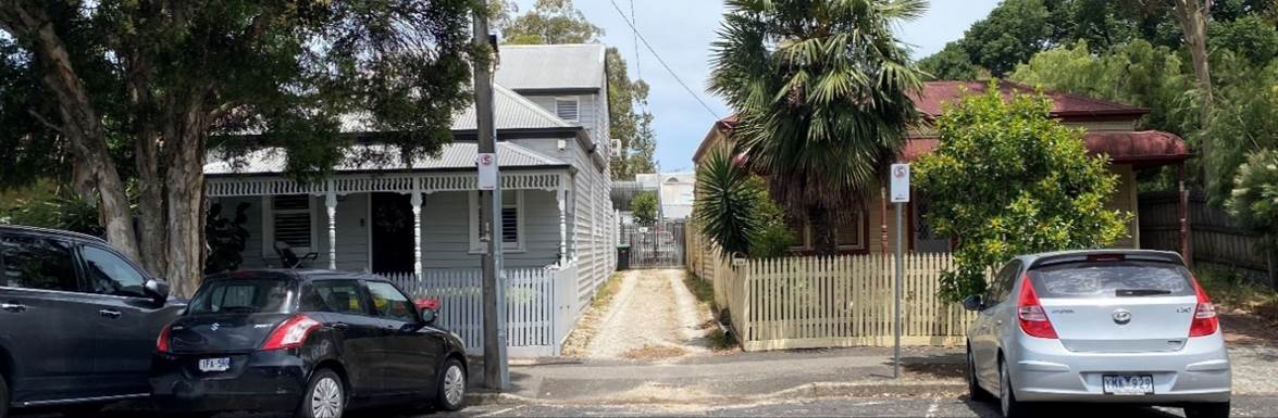
Figure 1 Subject site viewed from Pakington Street via right of way (source: officer site visit December 2024)
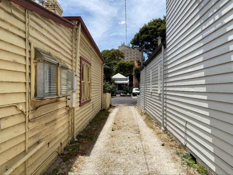
Figure 2 Right of Way access to subject site, facing north towards Pakington Street (source: officer site visit December 2024)
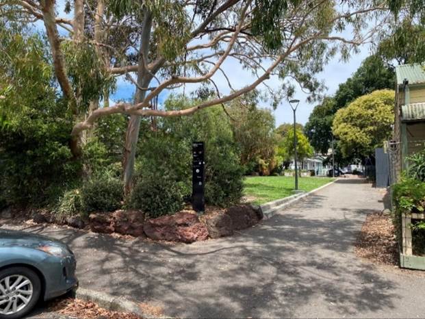
Figure 3 Pakington Street Reserve viewed from Pakington Street, (source: officer site visit December 2024)
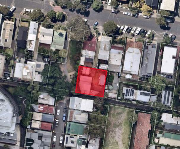
Figure 4 Subject site aerial of surrounds, (source: Intramaps, captured 12 March 2025)
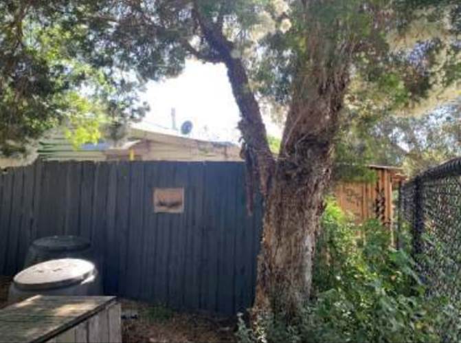
Figure 5 View from Pakington Street Reserve, (source: Heritage Impact Assessment as prepared by GML Heritage with date on report being 12 February 2025)
Figure 6 Subject dwelling (source: Heritage Impact Assessment as prepared by GML Heritage with date on report being 12 February 2025)
Figure 7 51 Pakington Street, (source: officer site visit December 2024)
Figure 8 49 Pakington Street, (source: officer site visit December 2024)
Figure 9 Pakington Street facing west from outside subject site, ( source: officer site visit December 2024)
Figure 10 Facing West along Pakington Street, (source: officer site visit December 2024)
Figure 11 Heritage dwellings within Pakington Street and surrounds, green = contributory and red = significant (source: Intramaps)
7. Permit Triggers
The following zone and overlay controls apply to the site, with planning permission required as described.
|
Zone or Overlay |
Why is a permit required? |
|
Clause 32.09-5 Neighbourhood Residential Zone – Schedule 1 (NRZ1) |
A planning permit is not required under Clause 32.09-5 of the Scheme as the proposal does not involve the construction or extension of a dwelling. |
|
Clause 44.05-2 Special Building Overlay – Schedule 1 (SBO1) |
A planning permit is not required under Clause 44.05-2 of the Scheme as the proposal is not to construct a building or to construct or carry out works. |
|
Clause 43.01-1 Heritage Overlay – Schedule 7 (HO7) |
A planning permit is required under Clause 43.01-1 of the Scheme to demolish or remove a building. |
8. PLANNING SCHEME PROVISIONS
8.1 Municipal Planning Strategy
Clause 02 Municipal Planning Strategy
02.1 Context
02.02 Vision
02.03 Strategic Directions
02.04 Strategic Framework Plans
8.2 Planning Policy Framework
15.03-1S Heritage conservation
15.03-1L Heritage policy
8.3 Particular Provisions
Clause 52.31 Local Government Projects
52.31-2 Exemption from notice and review
8.4 General Provisions
Clause 65 Decision Guidelines
65.01 Approval of an Application or Plan
8.5 Operational Provisions
Clause 71 Operation of this Planning Scheme
71.01 Operation of the Municipal Planning Strategy
71.02 Operation of the Planning Policy Framework
71.03 Operation of Zones
71.04 Operation of Overlays
71.05 Operation of Particular Provisions
8.6 Incorporated Documents
§ City of Port Phillip Heritage Policy Map (December 2021)
§ Port Phillip Heritage Review – Volumes 1-6 (December 2021)
8.7 Background Documents
§ Heritage Design Guidelines (City of Port Phillip, 2022)
§ Places for People: Public Space Strategy (City of Port Phillip, 2021)
8.8 Relevant Planning Scheme Amendment/s
There are no planning scheme amendments relevant to this application.
9. REFERRALS
9.1 Internal referrals
The application was referred to the following areas of Council for comment. The comments are discussed in detail in Section 9.
Heritage Advisor
‘While the house contributes to the significance of the HO7 precinct, I agree the level of contribution is diminished by its relatively low level of integrity, and limited visibility from the public realm (I note it is not visible from Pakington St and only partially visible in side profile from the adjoining reserve). Also, this type of dwelling is well represented throughout the precinct (there are several more intact examples in nearby Lynott Street) and this altered example is not distinguished by its construction date (built c.1890 it is not an early example but one of many built at this time) or any other features.
While full demolition of heritage buildings is strongly discouraged this is a situation where demolition may be permitted as there is a strategic ‘balancing’ argument in relation to community benefit, which is the improved and enlarged open space that will be enabled by the demolition. The potential impacts may also be further mitigated by a Heritage Interpretation Strategy, which can be required as a condition of permit.
The HIS also recommends a photographic survey of the demolished house. Given its generic design and very altered state a formal photographic survey is not required and does not need to be included as a condition of permit – the images in the HIS and the heritage interpretation strategy are sufficient to provide a record of this building’.
9.2 External referrals
The application was not required to be externally referred.
10. PUBLIC NOTIFICATION/OBJECTIONS
10.1 Clause 52.31 (Local Government Projects) is applicable and provides exemptions for the development of land undertaken by or on behalf of a municipal council. The application meets the following exemption requirements in Clause 52.31-2 in that:
§ The permit application is an application to develop land by or on behalf of the Council.
§ The permit application does not have an estimated cost of development of more than $10 million.
10.2 Of relevance, ‘the demolition or removal of a building or works’ falls within the definition of ‘development’ as defined at section 3 of the Planning and Environment Act 1987 (Act).
10.3 The application is therefore exempt from the notice requirements of section 52(1)(a), (b) and (d), the decision requirements of section 64(1), (2) and (3) and the review rights of section 82(1) of the Act.
11. OFFICER’S ASSESSMENT
Policy
11.1 There is policy support for the conservation of heritage buildings at both a state and local level.
11.2 State policy for Heritage conservation at Clause 15.03-1S has the following objective:
To ensure the conservation of places of heritage significance
11.3 Local Heritage policy includes the following general relevant strategies:
Conserve and enhance Significant and Contributory buildings as identified in the incorporated document in Schedule to Clause 72.04 ‘City of Port Phillip Heritage Policy Map’.
Avoid development that would result in the incremental or complete loss of significance of a heritage place by:
§ Demolishing or removing a building or feature identified as Significant or Contributory in the incorporated document in Schedule to Clause 72.04 ‘City of Port Phillip Heritage Policy Map.’
11.4 Specific local strategies for demolition and relocation include the following:
Discourage the complete demolition of any building or feature that contributes to the significance of a heritage place unless the building or feature is structurally unsound and the defects cannot be rectified.
11.5 The above policy outlines that the demolition of significant heritage buildings is to be discouraged. Conservation of heritage places is prioritised over demolition.
11.6 The decision guidelines of the Heritage Overlay include:
§ Whether the demolition, removal or external alteration will adversely affect the significance of the heritage place
Structural soundness
11.7 The heritage policy does provide support for the demolition of a heritage building where they are found to be structurally unsound with defects that cannot be rectified.
11.8 The
application does not submit that the dwelling is structurally unsound. Council
officers’ assessment also accepts that the dwelling is not structurally
unsound.
Planning Report
11.9 The report identifies that this proposal is consistent with Council’s strategic proprieties for proposed public open space as outlined in Places for People: Public Space Strategy 2022-32.
11.10 The report contends that there would be net community benefit as a result of the subject land being used for the purposes of a public park.
11.11 The report acknowledges that policy support for the demolition of the existing dwelling at Clause 43.01 and 15.03 is limited, especially as the dwelling is not considered to be structurally unsound.
Heritage Referral comments
11.12 Council’s heritage advisor is supportive of the application and recommends the inclusion of a condition for a Heritage Interpretation Strategy (HIS).
11.13 Council’s heritage advisor has noted ‘this is a situation where demolition may be permitted as there is a strategic ‘balancing’ argument in relation to community benefit, which is the improved and enlarged open space that will be enabled by the demolition’.
Is the demolition of the existing dwelling and associated outbuildings and structures on the site an acceptable planning outcome?
Public Park
11.14 This planning application is for the demolition of the buildings and structures on site only. The application does not include buildings and works for a new public park, or the rezoning of the land for a public park use.
11.15 Consideration can only be given to the Heritage Overlay and relevant heritage policy in determining this application.
Demolition
11.16 The proposed demolition of the dwelling would affect the significance of the subject site by removing the significant building.
11.17 It is important to consider whether the removal of the dwelling would have unreasonable impacts on the Heritage Overlay precinct (Elwood, St Kilda, Balaclava, Ripponlea – HO7).
11.18 The statement of significance for the Elwood, St Kilda, Balaclava, Ripponlea – HO7 at section 6.11.4 of the City of Port Phillip Heritage Review is as follows:
The Elwood – St. Kilda Botanical Gardens – Balaclava Ripponlea Area is both extensive and architecturally diverse. It is culturally important especially on account of the influence of the St. Kilda Botanical Gardens, the Brighton road, the Brighton Beach railway and the public buildings precinct at the site of the former market reserve which collectively impart civic distinction. The residential areas are noteworthy for their late Victorian, Federation period and inter-war housing; the apartments of the latter period and the terraces of the former being especially noteworthy. The intact inter-war buildings within the Brunning’s Estate demonstrate the development of that nursery post 1926. The capacity of the Area to inform the observer about past lifestyles and living standards is important, there being great diversity evident during the major contributory development periods. The Brighton road has further distinction for the manner in which it has attracted residential development of a high standard. Finally, the street trees and smaller parks are invariably important elements, having their origins in the interwar period and on occasions being also overlooked by buildings of the period to create urban landscapes representative of the highest urban planning standards of the day. The shopping centres are also distinguished for their high levels of integrity, Carlisle Street reflecting through its buildings the phases in its growth. The Glen Eira Road centre, in conjunction with the railway station and railway gardens, is highly representative of the era of the Great War, enhanced by the group of inter-war banks towards its east end.
11.19 Pakington Street is not mentioned within the above Statement of Significance at section 6.11.4 of the City of Port Phillip Heritage Review.
11.20 The proposed demolition of the dwelling is not considered to have an unreasonable impact on the significance of the Heritage Overlay Precinct (Elwood, St Kilda, Balaclava, Ripponlea – HO7) for the following reasons:
Prior Modification of subject dwelling
· The existing dwelling on site has been heavily modified and has a low integrity. Extensive non-sympathetic modification includes:
o The infilling and enclosing of the existing verandah structure
o Demolition of a chimney
o Extensions to the east and south of the dwelling running alongside the rear boundary.
o A pergola attached to the northern side of the dwelling
As noted by council’s heritage advisor ‘the level of contribution is diminished by its relatively low level of integrity’. It is considered that the above modifications have reduced the integrity of the dwelling and by extension, its contribution to the Heritage Overlay area.
Limited visibility of dwelling from streetscape and limited contribution to the public realm.
· The Pakington Street streetscape is inconsistent and presents with a wide range of dwelling typologies. Dwelling era’s, street setbacks, roof forms and materials all differ in this section of Pakington Street.
· The dwelling has limited visibility from the public realm, being Pakington Street Reserve and Pakington Street. Small glimpses are available looking down the right of way access and over the side fence of the reserve.
· The dwelling does contribute to the significance of the Heritage Overlay area. However, this contribution is not to the extent that its demolition would adversely affect the Heritage value of the wider precinct. The HO7 would retain its significance and heritage value, despite the removal of the dwelling.
· As noted by council’s heritage advisor the dwellings contribution is diminished by its ‘limited visibility from the public realm (I note it is not visible from Pakington St and only partially visible in side profile from the adjoining reserve)’
Approved demolition of surrounding sites
· The previous approvals for the demolition of the dwellings at 43, 49 and 51 Pakington Street would result in a large gap within the streetscape, further reducing the consistency of the streetscape.
· The streetscape in these instances where demolition has been approved, has been assessed as being of a fragmented nature. The streetscape will ultimately be further fragmented because of these approvals.
· There is an existing gap within the streetscape for the entry to Pakington Street Reserve, which would become wider due to the approved demolition of 43, 49 & 51 Pakington Street.
Retention of the significance of the Heritage Overlay Precinct (Elwood, St Kilda, Balaclava, Ripponlea – Ho7)
· This Heritage Overlay precinct covers a large area through four different suburbs.
· The Pakington Street area forms a small part of the wider Heritage Overlay precinct. This is unlike some Heritage Overlay areas which may only cover only one specific street or a small precinct of a suburb.
· Given the size and scope of the HO7, the demolition of a single dwelling within Pakington Street would not significantly affect the value of the Heritage Overlay area.
· The unique Heritage character of the Elwood, St Kilda, Balaclava and Ripponlea areas as described in the above statement of significance would be maintained.
12. COVENANTS
12.1 The registered search statement produced 19/02/2025 indicates that there is no restrictive covenant on the titles for the subject site known as Lot 1 of Title Plan 705027M [Parent Title Volume 01948 Folio 448].
13. conclusion
13.1 Clause 71.02 - integrated decision making of the planning scheme requires the decision maker to integrate the range of polices relevant to the issues to be determined and balance the positive and negative environmental, social and economic impacts of the proposal in favour of net community benefit and sustainable development. In this instance, the range of policies that can be considered are limited to those polices relevant to heritage where the only permit trigger is demolition of an existing dwelling within a Heritage Overlay.
13.2 The demolition of the existing dwelling is considered acceptable where it would not adversely affect the heritage significance of the wider precinct. The Heritage Overlay Precinct (Elwood, St Kilda, Balaclava, Ripponlea – HO7) would retain its significance and heritage value, despite the removal of the dwelling. This is due to the heritage significance coming from the collective heritage significance of the area as a whole rather than the individual significance of any one heritage building.
13.3 The dwelling on site has been heavily modified from its original state. It’s contribution to the streetscape and the wider precinct has been diluted.
13.4 The Pakington Streetscape is fragmented, presenting with a wide range of dwelling typologies. There is great variation in the era’s, street setbacks, roof forms and materials of dwellings. The retention value of the individual dwelling is therefore lower than if the dwelling formed part of a consistent row or pair within a highly consistent streetscape.
13.5 The dwelling has limited visibility from the public realm, being Pakington Street Reserve and Pakington Street. Small glimpses are available looking down the right of way access and over the side fence of the reserve. This reduces its contribution to the precinct.
13.6 The demolition of the dwelling at 51 Pakington Street would not adversely affect the heritage significance of the place and is an acceptable heritage outcome.
13.7 While not requiring a planning permit, the intended use of the land as a park would provide community benefit in an area that is lacking in accessible public open space. In dense inner-city areas, the delivery of new open space is challenging.
13.8 It is therefore recommended to support the demolition of the existing dwelling.
14. OFFICER material OR general INTEREST
14.1 No officers involved in the preparation of this report has declared a material or general interest in the matter.
|
ATTACHMENTS |
1. Zoning Map 2. Demolition Plan |
Planning Committee
23 April 2025
|
51-59 Thistlethwaite Street and 476-484 City Road, South Melbourne - 39/2015/D |
|
|
location/address: |
51-59 Thistlethwaite Street and 476-484 City Road, South Melbourne |
|
Executive Member: |
Brian Tee, General Manager, City Growth and Development |
|
PREPARED BY: |
Samuel Laing, Principal Planner |
1. PURPOSE
1.1 To consider and determine an application to amend a permit “to demolish existing buildings, construct a mixed use 4, 6 and 8 level development plus basement, use the land for dwellings and alter access to a Road Zone Category 1” at a site in the Fishermans Bend Urban Renewal Area (FBURA).
2. EXECUTIVE SUMMARY
|
Ward: |
Montague Ward |
|
Trigger for determination BY Committee: |
To decide an amendment to a planning permit in Fishermans Bend Urban Renewal Area for accommodation and buildings that exceed four storeys |
|
ApplicATION NO: |
|
|
Applicant: |
P C Td Investment Unit Trust |
|
Existing use: |
Industry/Restricted Retail Premises |
|
Abutting uses: |
Industry/Restricted Retail Premises/Dwelling |
|
Zoning: |
Capital City Zone, Schedule 1 (CCZ1) |
|
Overlays: |
Design and Development Overlay, Schedule 30 (DDO30) Special Building Overlay, Schedule 2 (SBO2) Environmental Audit Overlay (EAO) Parking Overlay, Schedule 1 (PO1) Infrastructure Contributions Overlay, Schedule 1 (ICO1) |
2.1 This report provides Council with an assessment of amended permit application 39/2015/D. The application seeks to change the scale, use, and architectural design of the building fronting City Road that currently comprises the second and final stage of the development on the land at 51-59 Thistlethwaite Street and 476, 478 and 480 City Road, South Melbourne.
2.2 The first stage of the development has been completed and is currently occupied.
2.3 The second stage of the development has not commenced. Under the existing permit, the second stage of the development involves:
· The demolition of all existing buildings and structures on the land at 476, 478 and 480 City Road, South Melbourne;
· The construction of a part four-, part six- and part-eight storey mixed-use building comprising predominantly residential dwellings; and
· The construction of a laneway along the northwestern and northeastern edges of the building, connecting with the Stage 1 laneway and providing a thoroughfare through to Thistlethwaite Street.
2.4 It is proposed in this application to effectively replace the existing Stage 2 building with a new building. The new building will comprise seven storeys above one level of basement carparking. It has been generally designed to fit within the permitted envelopes, with conditions recommended to address the identified minor non-compliances.
2.5 Its primary use will be as a residential hotel, which is a different type of accommodation use under the Port Phillip Planning Scheme (Planning Scheme). A total of 137 hotel rooms are proposed, as are two areas of communal open space.
2.6 The residential hotel use will be supported by commercial offerings and public amenity areas at ground level. Specifically, the proposal includes a food and drink premises that has been integrated into and accessible from the hotel lobby and a separate retail tenancy. Both have shopfronts to City Road. The previous pedestrian laneway connection from City Road to the laneway that was delivered in Stage 1 of the development has been retained, albeit with a slightly different layout and design.
2.7 The car parking provision has increased from 19 spaces to 37. All car parking has been provided within the new basement level.
2.8 There is no change to the extent of the demolition allowed by the existing permit.
2.9 The application is largely exempt from the public notice and third-party review requirements of the Planning and Environment Act 1987 (Act). The sole exception is for the awnings on the front elevation, which project over the footpath on City Road. Notice of the application was not given on the basis that the views of the relevant transport manager were sought through the referral process and subsequently considered in forming the recommendation.
2.10 As with any amendment made under section 72 of the Act, the scope of consideration is limited to the amendments or changes sought. Anything allowed by the existing permit that is not proposed to change is not open to repeat considerations.
2.11 Notwithstanding, the application has been assessed against the relevant planning policies and provisions contained within the Planning Scheme, including the purpose and decision guidelines of the Capital City Zone, the built form requirements of the relevant Schedule to the Design and Development Overlay, the vehicle access and car parking requirements of the Parking Overlay and Clause 52.06, and the bicycle facilities requirements of Clause 52.34, and has been considered in the context of the existing approval.
2.12 Subject to the recommended conditions, the proposal represents an acceptable planning outcome. The changing accommodation use (from dwellings to a residential hotel) is appropriate for an area where employment-generating development is encouraged, and the standard of architectural design, materials and detailing is appropriate to the building type and location.
2.13 The proposal is recommended for approval, as detailed below.
|
3.1 That an Amended Permit be issued for the demolition of the existing buildings construction of two, mixed use, multi-storey buildings, use the land for accommodation (dwellings and residential hotel) and retail premises (other than hotel, shop and tavern) over two stages, and alter access to a road in a Transport Zone 2 at 51-59 Thistlethwaite Street and 476, 478, 480 and 486 City Road, South Melbourne. 3.2 That the decision be issued as follows: 1 Condition 1 of the existing permit be amended by deleting the words struck through and inserting the words in bold as follows: 1 Amended plans required Before
the development of Stage 2 starts, amended plans to the satisfaction of the
Responsible Authority must be submitted to and approved by the Responsible
Authority. When approved, the plans will be endorsed and will then form part
of the permit. The plans must be drawn to scale with dimensions and an
electronic copy must be provided. The plans must be generally in accordance
with the plans a) The “commercial” spaces annotation amended to state “Retail premises (other than a Supermarket, Adult sex bookshop, Hotel or Tavern) or Offices”. b) The grey face brick (BR01) (not the white glazed brick) replaced with red brick. c) The steel reveals (frames, feature fins, louvres and canopies) (AL02) replaced with a darker colour (such as charcoal/ monument). d) The light grey and pale yellow aluminium composite panels (AC01) replaced with darker panelling. e) The proposed stair and ramp adjacent to the lobby to the Stage 1 building located within the building line to provide a defined hard edge to the street. f) An accessible space in the Stage 2 building, if required under the relevant regulations. g) The roller doors to the waste rooms annotated on the plans. h) Annotate the intended use/ function of the “indoor amenities” areas. i) Remove all inconsistencies between the Finishes Schedule and the plans. j) Indicate the proposed finishes to balconies and soffits. k) One motor-cycle or scooter space. l) Separate residential and commercial bin rooms. m) Hard waste storage areas. n) The finished floor level of the substation/s being a minimum of 2.599 m to AHD. o) The height for installation of any electrical/ gas points or switches being a minimum of 0.6 m above the flood level (which is 2.449 m to AHD). p) A
minimum of q) A
minimum of r) At least 20% of the bicycle parking spaces provided being horizontal. s) Improved access from Thistlethwaite Street and/or City Road (via the internal laneway) into the bicycle storage area of Stage one. t) u) Provision of one communal roof terrace and one green roof area for each stage. v) w) Any changes required to meet the requirements of the Sustainable Management Plan (condition 2). x) Any changes required to meet the requirements of the Water Sensitive Urban Design response (condition 4). y) A notation added to the South Elevation and schedule of external materials and finishes specifying that all materials and finishes used on the south elevation of the Stage 2 building facing City Road must have a perpendicular reflectivity of less than 15 per cent, measured at 90 degrees to the facade surface. aa) A notation that the ground floor cafe furniture, adjacent to the food and drink premises, is not fixed in place. bb) The tree planters along City Road deleted. cc) The southernmost bay of bicycle parking spaces within the pedestrian laneway, closest to City Road, relocated further into the site as to not impede pedestrian movements near the junction between the laneway and City Road. dd) Details of the amenities/facilities provided in the communal areas at Levels 2 and 6. ee) Dimensions confirming that the entry to the loading dock of the Stage 2 building can accommodate a small rigid vehicle as defined in Australian Standard AS 2890.2. ff) Dimensions confirming that each bicycle space provided in Stage 2 of the development meets the requirements of Clause 52.34-6 (Design of bicycle spaces) of the Port Phillip Planning Scheme. gg) Bicycle signage for Stage 2 of the development in accordance with Clause 52.34-7 (Bicycle signage) of the Port Phillip Planning Scheme. hh) Any changes required by the Wind Climate Assessment Report required by Condition 23 for the Stage 2 building. ii) Any changes required by the Amended Waste Management Plan required by Condition 47. jj) Any changes required to achieve the ratings required by Condition 49. kk) The rainwater tank required for the Stage 2 building by Condition 53. ll) Openable windows within the street wall to City Road and laneway. 2 Condition 2 of the existing permit be amended by deleting the words struck through and inserting the words in bold as follows: 2 Sustainable Management Plan Before the development of Stage 1 starts
(other than demolition or works to remediate contaminated land), a Sustainable
Management Plan for the Stage 1 building that outlines proposed sustainable design initiatives
must be submitted to and approved by the Responsible Authority. Upon approval
the Plan will be endorsed as part of the planning permit and the 3 Condition 3 of the existing permit be amended by deleting the words struck through and inserting the words in bold as follows: 3 Incorporation of Sustainable Design initiatives Prior to the occupation
of the Stage 1 building 4 Condition 4 of the existing permit be amended by deleting the words struck through and inserting the words in bold as follows: 4 Water Sensitive Urban Design Response Before the development of Stage 1 starts (other than demolition or works to remediate contaminated land) a Water Sensitive Urban Design Response must be submitted to and approved by the Responsible Authority. The Response must: a) Set out proposed stormwater treatment measures for the development and how they would meet the relevant Policy objectives of Clause 22.12 Stormwater Management (Water Sensitive Urban Design) of the Planning Scheme; b) Include justification for how the development meets the objectives of Clause 22.12 if the water quality performance objectives set out in the Urban Stormwater Best Practice Environmental Management Guidelines, CSIRO 1999 (or as amended) are not met. Upon approval the
Response will be endorsed as part of the planning permit and the 5 Condition 5 of the existing permit be amended by deleting the words struck through and inserting the words in bold as follows: 5 Incorporation of Water Sensitive Urban Design initiatives Prior to the occupation
of the Stage 1 building 6 Condition 6 of the existing permit be amended by inserting the words in bold as follows: 6 Landscape Plan Prior to the commencement of Stage 1 of the development hereby permitted, a landscape plan and schedule must be submitted to and approved by the responsible authority. When approved the plan will be endorsed and will then form part of the permit. Landscaping for the Stage 1 building in accordance with such approved plan and schedule must be completed before the commencement of the occupation of the Stage 1 building hereby permitted, and thereafter maintained (including replacement of any dead, diseased or damaged plants) to the satisfaction of the Responsible Authority. 7 Condition 7 of the existing permit be amended by deleting the words struck through and inserting the words in bold as follows: 7 Noise Attenuation for Apartments Before a) Between 10pm and 7am in bedrooms areas must not exceed LAeq (9 hour) 40dB(A); b) Between 7am and 10pm in living rooms must not exceed LAeq (15 hour) 45dB(A). 8 Condition 11 of the existing permit be amended by inserting the words in bold as follows: 11 Public Services Before the occupation of each stage of the development allowed by this permit, any modification to existing infrastructure and services within the road reservation (including, but not restricted to, electricity supply, telecommunications services, gas supply, water supply, sewerage services and stormwater drainage) necessary to provide the required access to the site, must be undertaken by the applicant/owner to the satisfaction of the relevant authority and the Responsible Authority. All costs associated with any such modifications must be borne by the applicant/owner. 9 Condition 14 of the existing permit be amended by inserting the words in bold as follows: 14 Contaminated Land Before the development of Stage 1 starts (other than demolition or works to remediate contaminated land), the Responsible Authority must be provided with: a) A certificate of Environmental Audit for the land issued in accordance with Section 53Y of the Environment Protection Act 1970; or b) A Statement of Environmental Audit for the land issued under Section 53Z of the Environment Protection Act 1970 confirming that the environmental conditions of the land are suitable for the use and development allowed by this permit. 10 Condition 15 of the existing permit be amended by inserting the words in bold as follows: 15 Compliance with Statement of Audit Where a Statement of Environmental Audit is issued for the land in Stage 1 of the development, the buildings and works and the use(s) of the land in Stage 1 of the development that are the subject of this permit must comply with all directions and conditions contained within the statement. Where a Statement of Environmental Audit is issued for the land in Stage 1 of the development, before the commencement of the use in Stage 1 of the development, and before the issue of a Statement of Compliance under the Subdivision Act 1988 for the Stage 1 building, and before the issue of an occupancy permit under the Building Act 1993 for the Stage 1 building, a letter prepared by an Environmental Auditor appointed under Section 53S of the Environment Protection Act 1970 must be submitted to the 11 Condition 18 of the existing permit be amended by deleting the words struck through and inserting the words in bold as follows: 18
Before the development starts, excluding demolition, excavation, piling, site preparation works, and works to remediate contaminated land, the owner of the land must enter into agreement(s) pursuant to section 173 of the Planning and Environment Act 1987 with the Responsible Authority and make application to the Registrar of Titles to have the agreement(s) registered on the title to the land under section 181 of the Act to the satisfaction of the Responsible Authority. The agreement(s) must: a) Require · $15,900 per dwelling · $180 per sqm of gross commercial floor area; · $150 per sqm of gross retail floor area;
b) Require that development contributions are to be indexed quarterly from 1 July 2015 using the Price Index of Output of the Construction Industries (Victoria) by the Australian Bureau of Statistics. c) Require registration of the Agreement on the titles to the affected lands as applicable. d) e) f)
h) Require that payment of 10% of the contribution is at the time of issue of the building permit and 90% to be made prior to the issue of a Statement of Compliance in accordance with the Subdivision Act 1988. i) j) k) Require the owner of the Land to pay all reasonable legal cost and expense of this agreement including preparation, execution and registration on title. 12 Condition 20 of the existing permit be amended by inserting the words in bold as follows: 20 Walls on or facing the boundary Before the occupation of each stage of the development allowed by this permit, all new or extended walls on or facing the boundary of adjoining properties and/or a laneway must be cleaned and finished to a uniform standard to the satisfaction of the Responsible Authority. Unpainted or unrendered masonry walls must have all excess mortar removed from the joints and face and all joints must be tooled or pointed also to the satisfaction of the Responsible Authority. Painted or rendered or bagged walls must be finished to a uniform standard to the satisfaction of the Responsible Authority. 13 Condition 22 of the existing permit be amended by inserting the words in bold as follows: 22 Dual Water Reticulation Before the occupation of Stage 1 of the development allowed by this permit, the development must include dual reticulation and a connection point to connect to a potential future precinct scale alternative water supply via a third pipe network to the satisfaction of the relevant water authority to the satisfaction of the Responsible Authority. 14 Condition 23 of the existing permit be amended by inserting the words in bold as follows: 23 Environmental Wind Assessment Before the development of Stage 2 starts, and concurrent with the submission of amended plans as required by Condition 1, a suitably qualified person must undertake a comprehensive wind tunnel test of the entire development and a Wind Climate Assessment Report to the satisfaction of the Responsible Authority must be provided for the written endorsement of the Responsible Authority. Any modifications required to the development in order to ensure acceptable wind conditions must be submitted to and approved by the Responsible Authority as part of the plans for endorsement. The design details of any wind mitigation works must receive the endorsement of the owners wind climate experts, referencing the use of architectural features and planting to resolve any issues identified, to the satisfaction of the Responsible Authority. 15 Condition 25 of the existing permit be amended by inserting the words in bold as follows: 25 Satisfactory continuation Once the development associated with each stage has started it must be continued and completed to the satisfaction of the Responsible Authority. 16 Condition 31 of the existing permit be amended by inserting the words in bold as follows: 31 Mechanical Car Parking Stacker Maintenance and Provision The mechanical car stackers are to be maintained in a good working order and be permanently available for the parking of vehicles in accordance with their purpose, to the satisfaction of the Responsible Authority. Prior to the occupation of Stage 1 of the approved development, the owner/permit holder must prepare and have approved in writing by the Responsible Authority, a car stacker system management plan including but not limited to the following: a) Allocation of car parking spaces according to vehicle size and type; b) Ongoing maintenance of the car stacker system; c) Instructions to owners/occupiers about the operation of the car stacker system; and d) Communicating to prospective residents about the availability of car stacker spaces and sizes. Once approved this document must be complied with to the satisfaction of the Responsible Authority and must not be varied except with the written approval of the Responsible Authority. 17 Condition 39 of the existing permit be amended by deleting the words struck through and inserting the words in bold as follows: 39 Waste Management An adequate waste
management arrangement must be provided for the Without the further
written consent of the Responsible Authority, waste management for the 18 Condition 41 of the existing permit be amended by deleting the words struck through and inserting the words in bold as follows: 41 Laneway Management The 'stop linemarking
and detector loop' arrangement proposed at the exit of 19 A new Condition 44 be added as follows: 44 Amended Landscape Plan (Stage 2) Concurrent with the submission of amended plans in accordance with Condition 1, an amended landscape plan for Stage 2 of the development must be approved and endorsed by the responsible authority. The amended landscape plan must: a) Be prepared to the satisfaction of the responsible authority; b) Be prepared by a suitably qualified person; c) Have plans drawn to scale with dimensions; d) Be submitted to the responsible authority in electronic form; and e) Be generally in accordance with the landscape plan forming part of the application and identified as drawing numbers TP01-TP04 (all Revision A), prepared by John Patrick Landscape Architects and dated 16 December 2024, but amended to show the following details: i. The green roof area required by Condition 1(u) of this permit (39/2015/D). ii. The planters within the verge on City Road deleted. 20 A new Condition 45 be added as follows: 45 Completing of Landscaping (Stage 2) Before the use of Stage 2 starts, the landscaping shown on the approved landscape plan for Stage 2 must be carried out and completed to the satisfaction of the responsible authority. 21 A new Condition 46 be added as follows: 46 Landscaping Maintenance (Stage 2) At all times the landscaping shown on the approved landscape plan for Stage 2 must be maintained (including the replacement of any dead, diseased or damaged plants) to the satisfaction of the responsible authority. 22 A new Condition 47 be added as follows: 47 Amended Waste Management Plan (Stage 2) Concurrent with the submission of amended plans in accordance with Condition 1, an amended Waste Management Plan for the Stage 2 building to the satisfaction of the responsible authority must be submitted to and approved by the responsible authority. When approved, the Waste Management Plan will be endorsed and will then form part of the permit. The amended Waste Management Plan must be generally in accordance with the Waste Management Plan forming part of permit application 39/2015/D (identified as Waste Management Plan (Document Reference G33552R-02C(WMP)), prepared by Traffix Group and dated 20 March 2024), but amended to include the following details: a) Provision of an electronic waste (e-waste) bin within the waste room; b) Provision of a hard waste storage area within the waste room; and c) A scaled drawing of the waste room that shows: i. Each waste stream colour-coded; ii. Bin sizes; and iii. The e-waste bin and hard waste storage area as detailed above. 23 A new Condition 48 be added as follows: 48 Implementation of the Waste Management Plan (Stage 2) The provisions, recommendations and requirements of the endorsed Waste Management Plan (Stage 2) must be implemented and complied with to the satisfaction of the Responsible Authority and must not be varied except with the prior written consent of the Responsible Authority. 24 A new Condition 49 be added as follows: 49 Green Star rating #1 Prior to the commencement of buildings and works associated with Stage 2 of the development, evidence must be submitted to the satisfaction of the responsible authority, that demonstrates the project (Stage 2 building only) has been registered to seek a minimum 5 Star Green Star Design and As-Built rating (or equivalent) with the Green Building Council of Australia. Note. This condition applies to Stage 2 of the development only. 25 A new Condition 50 be added as follows: 50 Green Star rating #2 Within 12 months of occupation of the Stage 2 building, certification must be submitted to the satisfaction of the responsible authority, that demonstrates that the Stage 2 building has achieved a minimum 5 Star Green Star Design and As-Built rating (or equivalent). Note. This condition applies to Stage 2 of the development only. 26 A new Condition 51 be added as follows: 51 Third pipe and rain tank #1 A third pipe must be installed for recycled and rain water to supply all non-potable outlets within Stage 2 of the development for toilet flushing, irrigation and washing machine unless otherwise agreed by the relevant water authority. Note. This condition applies to Stage 2 of the development only. 27 A new Condition 52 be added as follows: 52 Third pipe and rain tank #2 An agreed building connection point must be provided from the third pipe associated with the Stage 2 building, designed to the satisfaction of the relevant water supply authority, to ensure readiness to connect to a future precinct-scale recycled water supply. Note. This condition applies to Stage 2 of the development only. 28 A new Condition 53 be added as follows: 53 Third pipe and rain tank #3 A rainwater tank must be provided in Stage 2 of the development that: a) Has a minimum effective volume of 0.5 cubic metres for every 10 square metres of catchment area to capture rainwater from 100 per cent of suitable roof rainwater harvesting areas (including podiums); b) Is fitted with a first flush device, meter, tank discharge control and water treatment with associated power and telecommunications equipment approved by the relevant water authority. Note. This condition applies to Stage 2 of the development only. 29 A new Condition 54 be added as follows: 54 Third pipe and rain tank #4 Rainwater captured from roof harvesting areas must be re-used for toilet flushing, washing machine and irrigation or, controlled release. Note. This condition applies to Stage 2 of the development only. 30 A new Condition 55 be added as follows: 55 Roads and laneways Before the development of Stage 2 starts, excluding demolition, excavation, piling, site preparation works, works required to undertake an environmental assessment or audit, works to remediate contaminated land (or as otherwise agreed by the Responsible Authority), the owner of the land must: a) Enter into an agreement under section 173 of the Planning and Environment Act 1987 with the responsible authority (Port Phillip City Council); b) Register the Agreement on the Title for the Land in accordance with section 181 of the Planning and Environment Act 1987; and c) Provide Port Phillip City Council with the dealing number confirming the registration on the Title. The agreement must be in a form to the reasonable satisfaction of Port Phillip City Council, and the owner must be responsible for the expense of the preparation and registration of the agreement, including Port Phillip City Council’s reasonable costs and expense (including legal expenses) incidental to the preparation, registration of the agreement. The agreement must provide the following in relation to the land: d) Full construction of the laneway that sits within the title boundaries and along the northeastern and northwestern sides of the Stage 2 building as per the endorsed plans, to the satisfaction of and no cost to Port Phillip City Council before the occupation of the Stage 2 building; e) Give rights of public access to the laneway located within the subject land 24 hours, 7 days a week but for the lane to remain at all times in private ownership as part of the subject land; f) The owner must, at its cost, maintain the laneway to the same standards as is reasonably required by Port Phillip City Council for the adjoining road(s); g) The design and physical treatment of the laneway which sits within the title boundaries including landscaping, street furniture, lighting to AS/NZS 4282:2019 (Control of the obtrusive effects of outdoor lighting) and servicing infrastructure is to be to the satisfaction of Port Phillip City Council. Note. This condition applies to Stage 2 of the development only. 31 A new Condition 56 be added as follows: 56 Environmental Audit Overlay Before the development of Stage 2 starts, excluding demolition, excavation, piling and site preparation works, and works to remediate contaminated land, or a sensitive use that forms part of Stage 2 of the development commences or before the construction or carrying out of buildings and works in association with a sensitive use that forms part of Stage 2 of the development commences (excluding any works necessary to undertake a required assessment or audit, or works exempted by Clause 45.03-1 of the Port Phillip Planning Scheme) or as otherwise agreed by the responsible authority: · A preliminary risk screen assessment statement in accordance with the Environment Protection Act 2017 must be issued stating that an environmental audit is not required for the use or the proposed use and a copy of this statement must be provided to the responsible authority; or · An environmental audit statement under Part 8.3 of the Environment Protection Act 2017 must be issued stating that the land is suitable for the use or proposed use and a copy of this statement must be provided to the responsible authority. Note. This condition applies to Stage 2 of the development only. 32 New Conditions 57, 58 and 59 be added as follows: 57 Compliance with Environmental Audit Statement #1 Before the development of Stage 2 starts, excluding demolition, excavation, piling and site preparation works, and works to remediate contaminated land, or a sensitive use that forms part of Stage 2 of the development commences or before the construction or carrying out of buildings and works in association with a sensitive use that forms part of Stage 2 of the development commences (excluding any works necessary to undertake a required assessment or audit, or works exempted by Clause 45.03-1 of the Port Phillip Planning Scheme) or as otherwise agreed by the responsible authority (or the certification or issue of a statement of compliance under the Subdivision Act 1988 for the Stage 2 building) the owner must provide: a) An environmental audit statement under Part 8.3, Division 3 of the Environment Protection Act 2017 which states that the site is suitable for the use and development allowed by this Incorporated Document; or b) An environmental audit statement under Part 8.3, Division 3 of the Environment Protection Act 2017 which states that the site is suitable for the use and development allowed by this Incorporated Document if the recommendations made in the statement are complied with. Note. This condition applies to Stage 2 of the development only. 58 Compliance with Environmental Audit Statement #2 All the recommendations of the environmental audit statement must be complied with to the satisfaction of the responsible authority, prior to commencement of use of Stage 2 of the development. Written confirmation of compliance must be provided by a suitably qualified environmental consultant or other suitable person acceptable to the responsible authority. Compliance sign off must be in accordance with any requirements in the environmental audit statement recommendations regarding verification of works. Note. This condition applies to Stage 2 of the development only. 59 Compliance with Environmental Audit Statement #3 Where there are recommendations on the environmental audit statement that require significant ongoing maintenance and/or monitoring, the owner of the land in Stage 2 of the development must enter into a section 173 agreement under the Planning and Environment Act 1987. The section 173 agreement must be executed on the title of the relevant land (Stage 2 only) prior to the commencement of the use that forms part of Stage 2 of the development and prior to the issue of a statement of compliance under the Subdivision Act 1988 for the Stage 2 building. The owner must meet all costs associated with drafting and execution of the Agreement, including those incurred by the responsible authority. Note. This condition applies to Stage 2 of the development only. 33 The preamble of the existing permit be amended by deleting the words struck through and inserting the words in bold as follows: To
demolish existing buildings, construct
34 The following table of all previous extensions to the permit and accompanying note included on the permit: The permit has been extended as follows:
35 The following added to the table of amendments within the permit: The permit has been amended as follows:
36 The following added as a note to the permit: The plans submitted in accordance with condition 1 must show all buildings and works associated with Stage 1. These buildings and works must be clearly labelled as being part of Stage 1 and must be shown to the same level of detail, including floor plans, elevations, sections, and a material of external materials and finishes, as the current set of endorsed plans (identified as drawing numbers TP-1.00 (Revision L3), TP-2.00 (Revision L3), TP-2.01 (Revision M), TP-2.01a (Revision L4), TP-2.02 (Revision L3), TP-2.03 (Revision L3), TP-2.04 (Revision L3), TP-2.05 (Revision L3), TP-2.06 (Revision L3), TP-2.07 (Revision L3), TP-2.08 (Revision M), TP-2.09 (Revision M), TP-3.00 (Revision M), TP-3.01 (Revision M), TP-3.02 (Revision M), TP-4.00 (Revision M), and TP-7.00 (Revision L3), all prepared by Bruce Henderson Architects and dated 10 May 2019 (Revision L3) or 22 October 2019 (Revision M)). |
4. RELEVANT BACKGROUND
Original permit application
4.1 Council resolved to approve the original permit application (Permit Application No. 39/2015) at the Statutory Planning Committee Meeting on 9 December 2015. The original permit was issued on 19 February 2016, allowing
Demolish existing buildings, Construct a mixed use, 4, 6 and 8 level development including dwellings, retail and commercial, and community spaces. Alter access to a Road Zone Category 1 (i.e. remove an existing vehicle crossing on City Road)
on the land at 51-59 Thistlethwaite Street and 476, 478, 480 and 486 City Road, South Melbourne.
Previous amendments
4.2 The permit has been amended on four previous occasions, with details in chronological order as follows:
4.2.1 Amended Permit Application No. 39/2015/A (Amendment A) was approved by Council at the Ordinary Council Meeting on 16 August 2017 and an amended permit was issued on 30 August 2017. This approval enabled the development to be carried out in two stages, with the first stage comprising the eight-storey building in the northern part the site (facing Thistlethwaite Street) and the second stage comprising the part four-, part six- and part-eight storey building in the southern part of the site (facing City Road). Changes were also made to the conditions on the permit to facilitate the new staging arrangement.
4.2.2 Amended Permit Application No. 39/2015/B (Amendment B) was approved by Council at the Statutory Planning Committee on 25 July 2018 and an amended permit was issued on 26 July 2018. This approval allowed for the amendment of the preamble to delete references to uses that were ‘as of right’, correction of the permit issue date, Conditions 1, 16, 19 and 32, consolidation of the commercial tenancies, with a net reduction in commercial floorspace, changes to the number and layout of car and bicycle parking spaces, and minor changes to the building envelope and materials.
4.2.3 The endorsed plans were modified by way of secondary consent on 23 May 2019, with changes made to the internal layouts of the dwellings and common areas within Stage 1.
4.2.4 Amended Permit Application No. 39/2015/C (Amendment C) was approved under officer delegation on 29 June 2020. This approval allowed for the amendment of Conditions 12 and 13 to facilitate the occupation of Stage 1 prior to the installation of the required urban art.
4.3 The permit has been extended on two previous occasions, with details in chronological order as follows:
4.3.1 A first extension of time was approved on 22 January 2018 and provided for a two-year extension to the commencement expiry date for Stage 1, from 19 February 2018 to 19 February 2020.
4.3.2 A second extension of time was approved on 1 August 2019 and provided for a two-year extension to the completion expiry date for Stage 1, from 30 May 2020 to 30 May 2022.
4.4 On 11 June 2020, a staged subdivision permit was issued effectively allowing the Stage 1 building (51-59 Thistlethwaite Street) to be separated from the Stage 2 building.
4.5 The land at 476, 478 and 480 City Road, South Melbourne was consolidated on 25 February 2025 and now exists as one parcel (Certification Application No. PDSU/00079/2024).
Validity of existing permit
4.6 Condition 42(c) of the existing permit provides that:
This permit will expire if… subsequent stages of the development are not completed within four years from the completion of the first stage.
4.7 Stage 1 of the development was completed on 19 May 2021, which is the date of issue of the occupancy permit in respect of the building work (Occupancy Permit No. 201400529/OP).
4.8 The existing permit therefore remains valid as four years have not elapsed since Stage 1 was completed. It will, however, expire on 19 May 2025 if Stage 2 is not completed. The applicant has been informed of the expiry date.
4.9 The impending expiry date does not prohibit Council’s statutory requirement to determine this application.
4.10 The existing permit can be extended by way of an application made under section 69 of the Planning and Environment Act 1987.
5. PROPOSAL
5.1 The application seeks to change the scale, use, and architectural design of the building fronting City Road that currently comprises the second and final stage of the development (the Stage 2 building) on the land at 51-59 Thistlethwaite Street and 476, 478 and 480 City Road, South Melbourne.
Scale
5.2 The revised proposal has generally been designed to fit within the envelopes created by its predecessor and Schedule 30 to the Design and Development Overlay (there are some encroachments, and these are discussed later in this report).
5.3 The maximum building height of the proposal has been reduced by one storey, from eight storeys to seven, and this continues to be concentrated near the northern corner of the site.
5.4 The building continues to provide a four-storey street wall presentation to City Road; however, this has been broken up by a new communal open space area at Level 2. Communal open space also continues to be provided on the roof.
5.5 Additional volume has been added to the levels above the street wall. Specifically, the space between the previous two ‘towers’ has been filled in with hotel rooms, and this has resulted in a more solid form.
5.6 The previous pedestrian sky link to the Stage 1 building has been deleted. Both buildings are now physically independent from one another.
Use
5.7 It is proposed to change the predominant use of the Stage 2 building from dwellings to a residential hotel. Both uses fall under the umbrella term ‘accommodation’.
5.8 The building continues to provide active commercial uses at ground floor. These include a food and drink premises and a retail tenancy.
Architectural design
5.9 The architectural design of the building remains contemporary, with a greater emphasis on verticality. Specifically, the windows in the street wall are now larger and are punctuated into the concrete with vertical proportions reminiscent of traditional buildings.
Figure 1 - Render of the proposed building (the grey block building massing to the right of the image is a drafting error and not indicative of any existing, proposed or scale of built form that would be permitted under the DDO30 controls).
5.10 The previous red brick finish to the lowest levels of the street wall has been deleted in favour of a simple materials palette that includes ribbed, rendered, and plain concrete in various shades of grey with bronze-coloured metal detailing.
5.11 The public pedestrian laneway connection along the northeastern and northwestern sides of the building to Stage 1 and Thistlethwaite Street has been retained, with changes to its layout and design.
5.12 Car parking has been located within an expanded basement, as has some of the building services, mechanical plant, bicycle parking, and associated end-of-trip facilities. The remainder of the building services have been located at ground level, towards the rear of the building, and at Level 6.
5.13 The previous dwellings within the building have been replaced by hotel rooms. As such, the internal layouts at each floor level have changed considerably.
5.14 A comparison of the approved and proposed buildings is presented in the table below:
|
Description |
Existing Approval (Stage 2 only) |
Revised Proposal (Stage 2 only) |
|
Land use and floor areas |
· Commercial (retail premises) – 382.2sqm · Accommodation (dwellings) – 55 dwellings · Communal open space – 413.5sqm |
· Commercial: o Retail premises – 109.6sqm o Food and drink premises – 300.9sqm o Total – 410.5sqm · Accommodation (residential hotel) – 137 rooms · Communal open space – 352.1sqm |
|
Demolition |
Yes |
Yes (no change) |
|
Height |
27.4m to top of parapet 8 storeys |
24.15m above natural ground level (to top of parapet), 24.75m above natural ground level (to top of building services/lift overrun) 7 storeys (reduction of one storey) |
|
Street wall |
4 storeys – 14.4m |
4 storeys (no change) – 13.85m |
|
Design and form |
Four-storey podium with two ‘towers’, one two storeys and the other four storeys, stepping up in height towards the northwest corner of the site and the Stage 1 building |
A more conventional podium form, with a four-storey street wall presentation to City Road and a three-storey ‘tower’ |
|
Open space provision |
Each dwelling provided with secluded private open space in the form of a terrace Communal open space at Levels 1 and 6 |
Communal open space at Levels 2 and 6 |
|
Car parking provision and allocation |
19 spaces within at Ground Level, allocated as follows: · Dwellings – 13 spaces within car stackers · Commercial – 2 spaces · Shared spaces – 4 spaces, including 1 DDA space |
37 spaces (increase of 18 spaces) within an expanded Basement Level, allocated as follows: · Accommodation (residential hotel) – 33 spaces · Commercial: o Retail premises – 1 space o Food and drink premises – 2 spaces o Total – 3 spaces · DDA spaces – 1 space |
|
Bicycle parking provision and allocation |
132 bicycle spaces, with: · 92 spaces within a bike store at Ground Level · 30 spaces in the pedestrian laneway on the western side of the building |
36 bicycle spaces (reduction of 96 spaces), with: · 16 spaces within a bike store at Basement Level · 20 spaces in the pedestrian laneway on the western side of the building |
|
Vehicle access |
From Thistlethwaite Street via the rear laneway |
From Thistlethwaite Street via the rear laneway (no change) |
|
Loading |
All loading and waste collection associated with Stage 2 is to occur outside of the building, in the northeast corner of the site. Access to this area is from Thistlethwaite Street via the rear laneway. |
Loading and waste collection is to occur from a new purpose-built loading dock that has been incorporated into the north elevation of the building. This loading dock is accessible from Thistlethwaite Street via the rear laneway. Provision has been made to ensure that a 6.34m long small rigid vehicle (SRV) can enter and exit the site in a forward direction. |
5.15 The table below lists the assessment plans and documents:
|
Documents summary |
|
|
Proposed plans |
The drawings titled ‘Macro Context Analysis’, ‘Site Analysis’, ‘Planning Zones’, ‘Street Views’, ‘Site Survey’, ‘The Street Address’ (two pages), ‘The Laneway’ (two pages), ‘The Garden Court’ (two pages), ‘The Façade' (four pages), and ‘Materiality’, prepared by Rothelowman and date stamped as being received by Council on 25 March 2024. Drawing numbers TP00.02 (Revision D), TP01.01-TP01.08 (all Revision E), TP01.09 (Revision D), TP02.01-TP02.04 (all Revision D), and TP03.01-TP03.03 (all Revision D), all prepared by Rothelowman and dated 3 December 2024 (Revisions D and E). |
|
Supporting Documents |
Planning Report, prepared by ProUrban and dated 26 June 2024. Urban Context Report and Design Response, prepared by Rothelowman, Revision C, dated 8 March 2024. Landscape Plan, prepared by John Patrick Landscape Architects Pty Ltd and dated 16 December 2024. Sustainability Management Plan: prepared by Sustainable Development Consultants and dated December 2024. Traffic Engineering Assessment: prepared by Traffix Group and dated March 2024. A further memorandum by Traffix Group was also provided, prepared 17 June 2024. Waste Management Plan: prepared by Traffix Group and dated March 2024. |
6. SUBJECT SITE AND SURROUNDS
|
|
Description of site and surrounds |
|
Site area |
At the time the application was made, the site comprised four lots, being: · 476 City Road: o Lot 1 on Title Plan 409314K (Parent Title Volume 01887 Folio 210); o Lot 1 on Title Plan 875315D (Parent Titles Volume 04312 Folio 309 and Volume 09320 Folio 778); and o Lots 1 and 2 on Title Plan 824899K (Parent Title Volume 07341 Folio 144) · 478 City Road: o Lot 1 on Title Plan 749722U (Parent Title Volume 00532 Folio 224) · 480 City Road: o Lot 1 on Title Plan 875316B (Parent Titles Volume 08856 Folio 002 and Volume 09320 Folio 779) These lots have recently been consolidated into a single lot with overall area of 1730 square metres (0.173 ha). There are no easements or encumbrances associated with the titles. The original Planning Permit also comprises land at 51-59 Thistlethwaite Street. |
|
Existing building & site conditions |
The subject site is located on the north side of City Road, South Melbourne, approximately 90 metres east of the intersection with Montague Street. The site has a frontage of approximately 40 metres to City Road, and a maximum depth of 41.5 metres. There is also a discontinued roadway at the rear of the site that measures 3.7m wide by 32.9m long, which makes the overall area of 1730 square metres. The land is generally flat with no discernible slope in any direction and generally sits at the same level as the abutting laneway to the north. The land is developed as follows: · 476 City Road – contains a single storey industrial building that is presently used for Motor Repairs. The building is constructed of brick, has a sawtooth roof style, and a crossover to City Road. · 478 City Road – contains a single storey commercial building, located at the rear of the lot, with a small car parking area in the front of the lot. The building is presently used for Restricted Retail Premises. The building is a simple masonry building. · 480 City Road (addressed as “484 City Road”) contains a two storey commercial/industrial building with two premises – a Motor Repairs and a Restricted Retail Premises. The building is constructed of painted masonry, with a two storey Victorian era element.
Figure 2 – Aerial Photograph of site and surrounds (Source: Nearmap, February 2025). |
|
Surrounding area |
The surrounding land in all directions on the north side of City Road is mostly developed for one or two-storey commercial/industrial buildings, used for offices, motor repairs, light industry/warehouses, food and drink premises and restricted retail. However, a growing number of residential uses are being introduced, including the eight-storey mixed use approval at 51-59 Thistlethwaite Street (which forms Stage 1 of this permit – 39/2015) and the eight-storey mixed use development at 21 Thistlethwaite Street approved under Planning Permit 277/2015. To the south of City Road, the built forms are primarily commercial developments with a scale of two storeys. The southern part of the Montague Precinct is distinguished by its laneways and heritage buildings. The adaptive re-use of heritage buildings is promoted in policy, including three nearby buildings to the west at 496, 498 and 506 City Road (individual citations 2370 and 2371). South (City Road Frontage): City Road, a Transport Road Zone 2 (TRZ2), an arterial road with four carriageway lanes. Directly opposite is a number of commercial properties. West: Adjacent to the west of the site are commercial buildings ranging from 1 to 2 storeys. Directly abutting the site at 486 City Road is a two storey Restricted Retail Premises. Further along City Road, there are three heritage properties at 496, 498 and 506 City Road, a four storey office building at 508-510 City Road, and the Hotel Nelson (518 City Road) on the corner of Montague Street. North: Directly abutting the northern boundary of the site is the eight storey mixed use development approved under this permit (51-59 Thistlethwaite Street, 39/2015). Adjacent to that development to the east is an unnamed laneway which provides access to the discontinued road at the rear of the subject site. This laneway runs north to Thistlethwaite Street. At the southern end of the laneway is a substation (proposed to be relocated as a part of this development). Adjacent to the east side of the lane is 41 Thistlethwaite Street, a two storey commercial building which contains an education use. East: Adjacent to the east of the site are commercial buildings ranging from 1 to 2 storeys. Directly abutting the site at 474 City Road is a single storey industrial building currently used as Motor Repairs. There are no other buildings of note in this section of the street – other than the Wayside Inn (446 City Road) located at the corner of Ferrars Street.
Figure 3 – Extract from site context plan. The subject site is located within close proximity of two light rail stops served by two separate tram routes to the Melbourne central business district (CBD). The City Road light rail stop is 280m from the site. The 96 service stops here, connecting East Brunswick to St Kilda Beach via the CBD. The Montague Street light rail stop is approx. 500m from the site. Route 109 service stops here, connecting Port Melbourne to Box Hill via the CBD. Limited bus services run along City Road (234 service) between Port Melbourne and the CBD. The South Melbourne Central Major Activity Centre including South Melbourne Market is located approximately 500m to the east of the site, providing a wide range of employment, shopping opportunities and community services. |
|
Fishermans Bend Framework (October 2018) |
The Fishermans Bend Framework and the Planning Scheme propose: For the subject site: · City Road proposed for an on-road cycling path between CBD and Port Melbourne with no new crossovers permitted. · Mixed use medium / high (non-core activity) · Low-rise commercial and residential development of up to 6 storeys and 23 metres in height. For the surrounding area: Medium term · Bay Street to City bike connection · Buckhurst linear park · Johnston Street road closure · Buckhurst/Montague Streets intersection upgrade · Montague sports and recreation hub · Montague arts and cultural hub. Long term · Montague North open space · Buckhurst Street open space Montague Street route 109 (Stop 126) tram stop upgrade |
7. Permit Triggers
7.1 The following zone and overlay controls apply to the site, with planning permission required as described.
|
Zone or overlay |
Why is a permit required? |
|
Clause 36.04 Transport Road Zone 2 (TRZ2) |
City Road is in a Transport Road Zone (Schedule 2), meaning that it forms part of the Principal Road Network. Pursuant to Clause 36.04-2, a permit is required to construct a building or construct or carry out works for any use in Section 2 of 36.04-1. A permit is required under this clause as the proposal includes the construction of eighteen (small) awnings over the footpath on City Road and the proposed land uses, which include Accommodation (Residential hotel) and Retail premises (Retail premises and Food and drink premises), are both in Section 2 in the Capital City Zone, Schedule 1 (by virtue of not being in Sections 1 or 3). |
|
Clause 37.04 Capital City Zone, Schedule 1 (CCZ1) |
Use of land The proposal is for a seven-storey mixed-use building comprising a residential hotel, retail premises (other than hotel, shop and tavern), and food and drink premises. Residential hotel Pursuant to Clause 1.0 of Schedule 1 to the Capital City Zone, a residential hotel is a Section 1 use if all the following conditions are met: · Must not be within an Amenity buffer shown on Map 4. · Must not be within 450 metres of the South Melbourne to Brooklyn or Dandenong to West Melbourne pipeline as shown on Map 5. · Must not be within 100 metres of the Port Melbourne to Symex Holdings pipeline as shown on Map 5. The land is within 450 metres of the South Melbourne to Brooklyn pipeline as shown on Map 5 to the CCZ1. As the condition opposite the use will not be met, the use is in Section 2 and therefore requires a permit, as set out in Clause 73.01-1. Retail premises (other than hotel, shop and tavern) Pursuant to Clause 1.0 of Schedule 1 to the Capital City Zone, a retail premises (other than hotel, shop and tavern) is a Section 1 use if all the following conditions are met: · Must not exceed 1,000 square metres gross leasable floor area, and be located in a Core area. · Must not be within 450 metres of the South Melbourne to Brooklyn or Dandenong to West Melbourne pipeline as shown on Map 5. · Must not be within 100 metres of the Port Melbourne to Symex Holdings pipeline as shown on Map 5. Again, the land is within 450 metres of the South Melbourne to Brooklyn pipeline as shown on Map 5 to the CCZ1. As the condition opposite the use will not be met, the use is in Section 2 and therefore requires a permit. Food and drink premises Food and drink premises is nested under retail premises pursuant to Clause 73.04-11 and is therefore a Section 2 use requiring a permit for the reasons given above. Demolition and buildings and works Clause 37.04-4 provides that a permit is required to: · Construct a building or construct or carry out works unless the schedule to this zone specifies otherwise; and · Demolish or remove a building or works if specified in the schedule to this zone. Clause 4.1 of Schedule 1 to the CCZ specifies a permit requirement for the demolition or removal of a building or works and the construction of a building or the construction or carrying out of works, except in limited circumstances. None of those circumstances apply in this instance and therefore a permit is required for both the demolition and construction components of the proposal, pursuant to the two abovementioned clauses. |
|
Clause 43.02 Design and Development Overlay (Schedule 30) (DDO30) |
Schedule 30 to the Design and Development Overlay (DDO) applies to the Fishermans Bend – Montague Precinct. Clause 43.02-2 effectively provides that a permit is required to construct a building or construct or carry out works unless a schedule specifies otherwise. In this instance, Clause 2.0 of Schedule 30 to the DDO only exempts the construction or carrying out of works for a new or modified verandah, awning, sunblind or canopy to an existing building from requiring a permit. A permit is therefore required pursuant to Clause 43.02-2. |
|
Clause 44.05 Special Building Overlay - Schedule 2 (SBO2) |
Pursuant to Clause 44.05-2, a permit is required to construct a building or construct or carry out works. |
|
Clause 45.03 Environmental Audit Overlay (EAO) |
Clause 45.03-1 specifies the following requirement: Before a sensitive use (residential use, child care centre, kindergarten, pre-school centre, primary school, even if ancillary to another use), children's playground or secondary school commences or before the construction or carrying out of buildings and works in association with these uses commences: · A preliminary risk screen assessment statement in accordance with the Environment Protection Act 2017 must be issued stating that an environmental audit is not required for the use or the proposed use; or · An environmental audit statement under Part 8.3 of the Environment Protection Act 2017 must be issued stating that the land is suitable for the use or proposed use; or · A certificate of environmental audit must be issued for the land in accordance with Part IXD of the Environment Protection Act 1970; or · A statement of environmental audit must be issued for the land in accordance with Part IXD of the Environment Protection Act 1970 stating that the environmental conditions of the land are suitable for the use or proposed use. A residential hotel is a type of residential use and therefore a ‘sensitive use’ under the terms of the EAO. The above environmental audit requirement therefore applies to the application. A Statement of Environment Audit with respect to Stage 1 was endorsed on 18 April 2019, pursuant to Condition 14 of the existing permit. This condition requires amendment to include reflect to the development staging; however, is otherwise suitable to meet the requirements of the EAO. |
|
Clause 45.09 Parking Overlay (PO1) |
Schedule 1 to the Parking Overlay (PO) applies to the Fishermans Bend Urban Renewal Area. Pursuant to Clause 2.0 of Schedule 1 to the PO, a permit is required to provide more than the maximum car parking provision specifies for uses in Table 1, which includes retail premises. In this instance, the proposed car parking provision for the retail premises component of the development does not exceed the maximum car parking provision under Table 1 of the PO1. A permit is therefore not required under the provisions of the PO. |
|
Clause 45.11 Infrastructure Contribution Overlay (IC01) |
Pursuant to Clause 45.11-2, a permit must not be granted to subdivide land, construct a building or construct or carry out works until an infrastructure contributions plan has been incorporated into the Planning Scheme. Pursuant to Schedule 1 to the ICO, a permit may be granted to subdivide land, construct a building or construct or carry out works before an infrastructure contributions plan has been incorporated into the scheme for: · An existing use of land provided the site coverage is not increased. · A sign. · Consolidation of land or a boundary realignment. · Subdivision of buildings and works approved by a permit granted before the approval date of Amendment GC81. · Subdivision of an existing building used for non-residential purposes provided each lot contains part of the building and each lot is not intended for a residential purpose. It has been determined that a planning permit may be granted under the ICO. The proposed amendment would change an Accommodation use (Dwellings) to another Accommodation use (Residential Hotel), without increasing the existing site coverage. |
|
Clause 52.06 Car Parking |
Pursuant to Clause 45.09-1 (Parking Overlay), the Parking Overlay operates in conjunction with the requirements of Clause 52.06. Pursuant to Clause 52.06-6, where a use of land is not specified in Table 1 or where a car parking requirement is not specified for the use in another provision of the Planning Scheme or in a schedule to the Parking Overlay, before a new use commences or the floor area or site area of an existing use is increased, car parking spaces must be provided to the satisfaction of the responsible authority. As noted above the car parking rates associated with Residential Hotel is not listed in Table 1 of the Parking Overlay, or Table 1 of the Clause 52.06. As such parking will be assessed under Clause 52.06-6 to the satisfaction of Council. |
|
Clause 52.34 Bicycle Facilities |
Clause 52.34 provides that a permit may be granted to vary, reduce or waive any requirement of Clauses 52.34-5 and 52.34.6, which pertain to the number/type and design of any required bicycle facilities, respectively. A new use must not commence, or the floor area of an existing use must not be increased until the required bicycle facilities have been provided on the land pursuant to Clause 52.34-1. A planning permit is required to vary, reduce or waive any bicycle facilities requirement of Clause 52.34-3 and Clause 52.34-4. A total of 28 spaces are required for Accommodation (Residential Hotel) (14 resident/14 visitor), and 1 space (1 employee, 0 visitor) for the Retail Premises.36 spaces (16 within a bike store, 20 adjacent to the proposed laneway) have been provided meeting that required under this Clause. A planning permit would not be required under this clause as bicycle spaces and facilities are provided in accordance with this clause. |
8. PLANNING SCHEME PROVISIONS
8.1 Municipal Planning Strategy (MPS)
The following provisions of the MPS are relevant to this application:
Clause 02 Municipal Planning Strategy, including the following sub-clauses:
02.01 Context
02.02 Vision
02.03 Strategic Directions
02.04 Strategic Framework Plans
8.2 Planning Policy Framework (PPF)
The following provisions of the PPF are relevant to this application:
Clause 11 Settlement, including the following sub-clauses:
11.01-1R1 Settlement – Metropolitan Melbourne
11.02-2S Structure planning
11.03-6L-04 Fishermans Bend Urban Renewal Area
11.03-6L-05 Fishermans Bend Urban Renewal Area – Montague Precinct
Clause 13 Environmental Risks and Amenity, including the following sub-clauses:
13.01 Climate change impacts
13.03 Floodplains
13.05 Noise
13.07-1L-03 Interfaces and amenity
Clause 15 Built Environment and Heritage, including the following sub-clauses:
15.01-1S Urban design
15.01-1R Urban design – Metropolitan Melbourne
15.01-1L-02 Urban design
15.01-2S Building design
15.01-2L-01 Building design
15.01-2L-02 Environmentally sustainable development
15.01-2L-03 Urban art
15.01-5S Neighbourhood character
Clause 16 Housing, including the following sub-clauses:
16.01-1S Housing supply
16.01-1R Housing supply – Metropolitan Melbourne
16.01-1L-2 Location of residential development
Clause 17 Economic Development, including the following sub-clauses:
17.02-1L Mixed use and office areas
Clause 18 Transport, including the following sub-clauses:
18.01-1L-01 Land use and transport integration
18.01-3L-01 Sustainable and safe transport in Port Phillip
18.02-4L-01 Car parking
18.02-4L-02 Loading facilities
Clause 19 Infrastructure, including the following sub-clauses:
19.01-3S Pipeline infrastructure
19.03-1S Development and infrastructure contributions plans
19.03-3L Stormwater management (water sensitive urban design)
19.03-5L Waste and resource recovery
8.3 Other relevant provisions
The following provisions are relevant to the application:
Clause 52.06 Car parking
Clause 52.29 Land adjacent to the Principal Road Network
Clause 52.34 Bicycle Facilities
Clause 65 Decision Guidelines, including the following sub-clauses:
65.01 Approval of an application or plan
Clause 72.04 Incorporated Documents.
8.4 Relevant Planning Scheme Amendment/s
Draft Planning Scheme Amendment GC224
Draft Planning Scheme Amendment GC224 (the Draft Amendment) implements the ‘Fishermans Bend Urban Renewal Area Development Contributions Plan’ (the DCP), and ‘Fishermans Bend Open Space Uplift Mechanism’ (the OSU) by introducing new planning provisions into the Melbourne and Port Phillip Planning Schemes for the four Capital City Zone precincts within the Fishermans Bend Urban Renewal Area. In the City of Port Phillip, these are the Montague, Sandridge, and Wirraway Precincts. The remaining precinct is within the City of Melbourne.
The DCP and OSU are part of the funding solution for the infrastructure required to facilitate the development of the Fishermans Bend Urban Renewal Area.
The DCP proposes a single, state-administered Development Infrastructure Levy (DIL) that integrates contributions towards community infrastructure, open space, and major drainage and flood mitigation infrastructure into a single, consolidated charge. This levy will replace the current interim and voluntary contributions regime, and the open space contribution previously collected under Clause 53.01 of the Planning Scheme.
The DIL is capped at $36,635.00 per dwelling (adjusted annually) and $286.00 per square metre of non-residential development gross floor area (adjusted annually).
The DCP will not be introduced into the Planning Scheme until after the Advisory Committee Report has been prepared and provided to the State Government along recommendations for a final decision. This report was due to be finalised in February 2025.
9. REFERRALS
Internal referrals
9.1 The application was referred to Council’s Urban Design, Environmentally Sustainable Design, Development Engineering, Traffic, and Landscaping Departments for comment. Refer to Appendix 5 for summaries of and responses to each internal referral response.
External referrals
9.2 The application was required to be referred to the following referral agencies pursuant to Clause 66.03 of the Planning Scheme and section 55 of the Act:
9.2.1 Head, Transport for Victoria
The application was referred to the Head, Transport for Victoria on 15 April 2024.
A response was provided under delegation of the Head, Transport for Victoria on 27 June 2024 stating that the Head, Transport for Victoria has considered the application and, pursuant to section 56(1) of the Act, does not object to the grant of an amended permit in this instance subject to the retention of existing Condition 35 on the amended permit if one were to issue.
10. NOTIFICATION
Transport Zone 2
10.1 The awnings on the street-facing elevation of the Stage 2 building require permission under the provisions of the Transport Zone 2. Whilst not exempt, notice was not considered necessary as the views of the relevant transport manager were sought and considered and the fact that the awnings themselves were unlikely to cause material detriment to any other person.
Capital City Zone, Schedule 1
10.2 Pursuant to Clause 2.3 in Schedule 1, an application for the use of land is exempt from the notice requirements of section 52(1)(a), (b) and (d), the decision requirements of section 64(1), (2) and (3) and the review rights of section 82(1) of the Act.
10.3 Pursuant to Clause 4.5 in Schedule 1, an application to demolish or remove a building or to construct a building or construct or carry out works is exempt from the notice requirements of section 52(1)(a), (b) and (d), the decision requirements of section 64(1), (2) and (3) and the review rights of section 82(1) of the Act.
Design and Development Overlay, Schedule 30
10.4 Pursuant to Clause 3.1 in Schedule 30, an application to subdivide land is exempt from the notice requirements of section 52(1)(a), (b) and (d), the decision requirements of section 64(1), (2) and (3) and the review rights of section 82(1) of the Act.
Clause 66.06: Notice of Permit Applications Under Local Provisions
10.5 Pursuant to Schedule 1.0 to Clause 66.06, notice of the application was given to the Secretary of the Department of Transport and Planning (DTP) and APA Group for the following reasons:
10.5.1 DTP - Where a permit is required for the construction of a building or the construction and carrying out of works pursuant to Clause 4.0 of Schedule 1 to Clause 37.04 (CCZ1).
10.5.2 APA Group - Where a permit is required to use and develop land for Accommodation and Retail Premises.
10.6 Both notified bodies did not object to the proposal.
11. OFFICER’S ASSESSMENT
11.1 The application seeks to make several changes to the existing permit and previously considered plans. As such, the scope of consideration is limited to those changes.
11.2 The key issues that require assessment are considered under the following headings:
11.2.1 Is the proposed amendment consistent with the Planning Policy Framework?
11.2.2 Does the revised proposal meet the requirements of the Capital City Zone?
11.2.3 Is the built form consistent with the Design and Development Overlay, Schedule 30 – Fishermans Bend Montague Precinct?
11.2.4 Are the proposed traffic movements, car parking, and access arrangements acceptable?
11.2.5 Would the proposal achieve best practice environmentally sustainable design and water sensitive urban design?
11.2.6 Do the changes sought in this application require further changes to the preamble and conditions of the existing permit?
11.3 These questions are considered in turn below.
Is the proposed amendment consistent with the Planning Policy Framework?
11.4 Clauses 11.03-6L-04 to -07 outline policy relating to the FBURA. This policy aims to achieve the following objectives (in summary):
· To create a thriving urban renewal area by offering a modern, fresh design which will incorporate environmental sustainability principles and will help improve amenity of the area through design excellence.
· To create a prosperous community that supports diverse employment opportunities within the Montague Precinct.
· To promote employment generating floor space through office and retail uses to supports growth in the Montague Precinct.
· To create thriving, lively mixed-use neighbourhoods that have distinct identity and character consistent with the preferred character in the Montague Precinct.
· To encourage affordable housing through delivery of at least six percent of dwelling yield and the provision of community infrastructure in the form of improved pedestrian connections (new laneway) through the Montague Precinct.
· To ensure development is carried out in accordance with ecologically sustainable development principles.
· To encourage the transition over time from a primarily industrial area to a high-density mixed-use area and to support the continued operation of existing uses which are of strategic importance to the urban renewal of Fishermans Bend.
11.5 Consideration of these policies, as relevant, are outlined in the below table.
|
Clause 11.03-6L-04 Fishermans Bend Urban Renewal Area Policy |
Officer Assessment |
|
Employment floor area objective |
|
|
Development in a Core Area should provide a minimum floor area ratio not used for dwelling of: Montague: 1.6:1. Exceptions apply. |
Not applicable The site is not in a Core Area.
|
|
Design Excellence objective |
|
|
· Encourage varied built form typologies that align with the preferred precinct character specified in the relevant Schedule to the Design and Development Overlay. · Encourage fine grain, pedestrian scale environments. · Ensure buildings contribute to a high quality public realm. · Encourage developments to deliver spaces, including open spaces, for people to meet, gather, socialise, exercise and relax. · Ensure developments to deliver variation in massing, building height, and roof forms and the staggering or offsetting of tower footprints.
|
Achieved Recommended: Area M6 – Predominantly low-rise developments (i.e., up to and including 6 storeys) that responds to the context and character of the adjacent low-rise neighbourhoods. The subject site has a mandatory height of 23 metres and 6 storeys, with a maximum 4 storey podium height with 10 metre mandatory setback from the street wall (see Table 3 and Map 2 of the DDO30). Proposed: 7-storey building (including the roof top terrace) comprising a 4-storey podium · Podium: 4 storeys / 13.85m · Tower: 24.15m above natural ground level (to top of parapet), 24.75m above natural ground level (to top of building services/lift overrun) The proposal would contribute to a “varied and architecturally interesting skyline”. As illustrated in the Design Response provided by the project architect and discussion at Sections 11.6-11.14 of this report. |
|
Achieving a climate adept, water sensitive, low carbon, low waste community |
|
|
Energy: Assess against: Should achieve a 20% improvement on current National Construction Code energy efficiency standards including for building envelopes, lighting and building services. |
Can be addressed through conditions of permit: The SMP provided does not assess the proposal against the mandatory Green Star requirements. For a development of this scale, the SMP will need commit to a 5-star certified Green Star Design (with potential for achieving a 6-star rating) and Buildings rating, which is appropriate for a development of this scale and is consistent with mandatory condition requirements in the Capital City Zone (CCZ1). |
|
Urban heat island: Assess against: · At least 70% of total site to comprise building or landscape elements that reduce impact of urban heat island effect, including: - Vegetation, green roofs and water bodies. - Roof materials, shade structures, solar panels or hard scaping materials with high solar reflectivity index. - Non-glazed facade materials exposed to summer sun that have a low solar absorptance. |
Achieved in part: An amended SMP which commits to achieving a 5 Star Green Star Design will require compliance with this standard. The Urban Heat Island Effect is to be partially mitigated by the provision of vegetation, confirming the Solar Reflectance Index (SRI) of the non-glazing materials, light-coloured materials which should reduce the absorption of light and heat. As the majority of the north and west elevations are glazed additional shading devices may be required to demonstrate that the solar absorption can be mitigated. |
|
Flooding: Assess against: · Applying design elements and materials that are resilient to flooding, including waterproof doors and windows, elevated power outlets and the like. |
Achieved: The design proposes at grade access to the hotel lobby and ground floor retail tenancy while achieving Melbourne Water’s minimum FFL’s of 3.00 AHD. |
|
Flooding: Assess against: · Encouraging land uses at ground floor level that can easily recover from the impacts of temporary flooding.
|
Achieved: The areas of ground floor level set at 3.0m AHD would have satisfactory protection from predicted flooding and so would be able to easily recover, noting that larger areas are occupied by furniture which could easily be relocated in such an event. |
|
Flooding: Assess against: · Integrating changes in floor levels between the street and internal ground floor into the design of the development.
|
Achieved: The Melbourne Water minimum ground floor level of 3.0 AHD, only 0.04m above the footpath level. The at grade access from City Road supports universal access and allows for good visual connection between street and interior. |
|
Flooding: Assess against: Locating essential services, such as power connections, switchboards and other critical services to avoid disruption in potential flooding events. |
Achieved The plans and elevation drawings show that the core area, and other critical services, will be sited at 3 metres AHD as per the Melbourne Water flood advice. Melbourne Water supported the levels of the Fire Pump Room, Sprinkler value Room and Fire Storage Tank. |
|
WSUD: Assess against · Development and public realm layout and design should integrate best practice Water Sensitive Urban Design.
|
Achieved It is proposed to capture stormwater from non-trafficable areas and store it on site for reuse. Council’s Sustainable Design officer requested details to confirm the proposal would collect stormwater from all podium and tower roofs, and tank sizes be increased to meet FBURA requirements. Council’s Drainage Engineer noted that a 16.5kl rainwater tank as proposed in the SMP is generous. However, note that the CCZ1 requirements are for an effective tank capacity, meaning that the overall capacity may be slightly larger. |
|
Communal open spaces |
|
|
Create private and communal spaces within developments with a range of facilities, garden and recreation areas to supplement the public open space network. |
Achieved: The design includes no private outdoor space for the occupants, instead providing two key communal open space areas. The main area is the roof top terrace and a second smaller area located on top of the podium. Both areas include indicative planters around the edges of the spaces to help soften the extent of hard surface. Council’s Landscape Architect has reviewed the plans and is requesting an improved landscape outcome and details of furniture to be places in these areas which will be discussed below. |
|
Ensure landscape areas: Contribute to creation of sense of place and identity and preferred character for the precinct. |
Can be addressed through conditions of permit: The design includes indicative planters to the edge of the pedestrian laneway and communal terraces. A Landscape Plan providing further details should be provided as a condition of any permit. |
|
Ensure landscape areas: Incorporate innovative approaches to flood mitigation and stormwater run-off, and best practice WSUD. |
Can be addressed through conditions of permit: Information provided does not include any innovative approaches regarding flood mitigation and stormwater run off however conditions of permit require compliance with Green Star ESD requirements, third pipe and rainwater tank capacity and will therefore meet this policy requirement (Conditions 49-54). |
|
Encourage plant selection to: Support complex and biodiverse habitat including native and indigenous flora and fauna. |
Achieved: Council’s Landscape Architect is satisfied with the proposed Landscape Plan subject to amendments discussed at Section 9.1 of this report. |
|
Encourage plant selection to: Balance provision of native and indigenous plants with exotic climate resilient plants that provide opportunity for biodiversity. |
Achieved: Council’s Landscape Architect is satisfied with the proposed Landscape Plan subject to amendments discussed at Section 9.1 of this report. |
|
Encourage plant selection to: Support creation of vegetation links within FB to surrounding areas of biodiversity, plant selection design. |
Achieved: Council’s Landscape Architect is satisfied with the proposed Landscape Plan subject to amendments discussed at Section 9.1 of this report. |
|
Encourage plant selection to: Incorporate green facades, rooftop, podium or terrace planting into development that is water efficient, responds to micro-climate conditions and is located and designed to be sustainable and resilient. |
Achieved: Council’s Landscape Architect is satisfied with the proposed Landscape Plan subject to amendments discussed at Section 9.1 and Attachment 5 of this report. |
|
Consider as relevant: Minimum deep soil areas with a minimum depth of 1.5 metres for canopy trees. |
Can be addressed through conditions of permit: The raised planter bed along the pedestrian laneway provide adequate soil volume but remain silent on the depth of the planters. This requirement is captured as a condition of permit. |
|
Sustainable transport |
|
|
Ensure development does not compromise the delivery of future public transport including new tram, train and bus routes. |
Achieved: The development would not compromise the delivery of future public transport including new tram, train and bus routes. |
|
Reduce impacts of new vehicle access points on pedestrian, public transport and bicycle priority routes. |
Achieved: The redevelopment of the site would not impact any new vehicle access points on pedestrian, public transport and bicycle priority routes. It is noted there is an opportunity to improve the public realm to City Road by removing the redundant crossover. The application has been referred to Head, Transport for Victoria who do not object to the grant of an amended permit in this instance subject to the retention of existing Condition 35 on the amended permit. |
|
Design internal connections to give priority to pedestrian and bicycle movements. Provide easy access to bicycle parking facilities, including end of trip change rooms, showers and lockers.
|
Achieved in part: As there is only on-site loading provided, there is limit opportunity for traffic conflicts with pedestrian and bicycles. The plans show details of bicycle parking facilities, including change rooms, showers and lockers but do not detail the design and dimensions of bike parking spaces and associated areas / enclosures and can be required as a modification as part of any permit issued. |
|
Encourage developments to provide less than preferred maximum number of car spaces. |
Achieved: On-site car parking provision is provided to the satisfaction of Council for the reasons discussed in Section 11.14.6 of this report. |
|
Encourage developments to provide for future conversion of car parking to alternative uses.
|
Achieved in part: Basement level car parking could be converted for alternative uses which do no rely on natural lighting. |
|
Land use transition |
|
|
Ensure new uses and expansion of existing uses with potential adverse amenity impacts do not prejudice the urban renewal of Fishermans Bend. |
Achieved: The proposed uses would not prejudice the urban renewal of Fishermans Bend. |
|
Ensure new development addresses the amenity impacts of nearby existing uses. |
Achieved: Condition 7 and 8 of the existing permit measures to mitigate potential amenity impacts from the existing use and incorporation of noise attenuation measures as to not cause noise impacts off-site. All permits issued in the Capital City Zone are required to achieve these requirements as the agent of change would otherwise give rise to incompatible land uses in the short-term. |
Does the revised proposal meet the requirements of the Capital City Zone?
11.6 The proposed residential hotel is considered appropriate for a site outside, but within reasonable walking distance to, the core area of the Montague Precinct as shown on Map 1 to Schedule 1 to the Capital City Zone (CCZ1) and, more broadly, an area that is effectively envisaged as an extension to the Melbourne CBD. It is complementary to a broad range of uses, will provide a necessary form of accommodation, and is in itself an employment-generating activity.
11.7 Clause 4.3 of CCZ1 lists several mandatory conditions that must be included in a permit where relevant, in accordance with section 62(1)(b) of the Act.
11.8 Based on the nature of the application/proposal, the following conditions are required to be included in the permit:
11.8.1 Green Star rating
· Prior to the commencement of buildings and works, evidence must be submitted to the satisfaction of the responsible authority, that demonstrates the project has been registered to seek a minimum 5 Star Green Star Design and As-Built rating (or equivalent) with the Green Building Council of Australia.
· Within 12 months of occupation of the building, certification must be submitted to the satisfaction of the responsible authority, that demonstrates that the building has achieved a minimum 5 Star Green Star Design and As-Built rating (or equivalent).
11.8.2 Third pipe and rain tank
· A third pipe must be installed for recycled and rain water to supply all non-potable outlets within the development for toilet flushing, irrigation and washing machine unless otherwise agreed by the relevant water authority.
· An agreed building connection point must be provided from the third pipe, designed to the satisfaction of the relevant water supply authority, to ensure readiness to connect to a future precinct-scale recycled water supply.
· A rainwater tank must be provided that:
o Has a minimum effective volume of 0.5 cubic metres for every 10 square metres of catchment area to capture rainwater from 100 per cent of suitable roof rainwater harvesting areas (including podiums);
o Is fitted with a first flush device, meter, tank discharge control and water treatment with associated power and telecommunications equipment approved by the relevant water authority.
· Rainwater captured from roof harvesting areas must be re-used for toilet flushing, washing machine and irrigation or, controlled release.
11.8.3 Roads and laneways
A condition that requires the following:
· An agreement under section 173 of the Act must be entered into between the landowner, the responsible authority and the local council (if not the responsible authority) which provides for the:
o Construction of the new road or laneway to the satisfaction of the responsible authority and the relevant road management authority; and
o Transfer of the new road or laneway to, or vesting in the relevant road authority as a public road at no cost to the relevant road authority. This does not apply to a new laneway that is agreed to be retained in private ownership to the satisfaction of the responsible authority.
Is the built form consistent with the Design and Development Overlay, Schedule 30 – Fishermans Bend Montague Precinct (DDO30)?
11.9 The DDO30 specifies a number of prescriptive requirements that seek to manage the design and built form of new development. These requirements are contained in subclauses and sit alongside a set of performance-based outcomes.
11.10 Those requirements expressed with the term ‘should’ are discretionary and may be varied with a permit. Conversely, a permit cannot be granted vary a requirement made by the use of the expression ‘must’.
11.11 An application for buildings and works that does not meet a discretionary built form requirement must meet the relevant built form outcomes.
11.12 Importantly, Clause 2.2 of the DDO30 also includes what is effectively a transitional provision without being labelled as such that exempts an application to amend an existing permit from its requirements if both conditions below are met:
· The existing permit must have been granted before the approval date of Planning Scheme Amendment GC81 (i.e., 5 October 2018); and
· The extent of any non-compliance must not be increased.
11.13 In this instance, the original permit (39/2015) was granted before the 5 October 2018, meaning that this application can benefit from this ‘transitional provision’.
11.14 Determining the level of the compliance of the proposal with the requirements of the DDO30 is therefore a two-step process that begins with an assessment of the approved building shown on the endorsed plans against each built form requirement to ascertain the scope or extent of any accrued right and is followed by a similar assessment with the proposed building to determine whether the ‘transitional provision’ is enacted or not. This process has been completed below:
11.14.1 Clause 2.4 – Building typologies
Table 1 to the DDO30 specifies discretionary building typology and preferred precinct character requirements for each of the six precincts within the broader Montague Precinct of Fishermans Bend, as identified on Map 1.
The site is identified on Map 1 as within Area M6. The suggested building typology for Area M6 is “low-rise”, which is defined in this schedule as “development up to and including six storeys”. Further, the preferred precinct character is “[l]ow-rise development that responds to the context and character of the adjacent low-rise neighbourhoods”.
The maximum building height of the proposal is seven storeys, which is one less than the approved building, noting that commercial land uses generally adopt higher floor-to-ceiling heights. The proposal is also no less responsive to the context and character of the surrounding area than the approved building.
The requirements of this clause therefore do not apply as the extent of the existing non-compliance is not increased.
11.14.2 Clause 2.5 – Building height
Map 2 to the DDO30 specifies a mandatory height limit of 23 metres and six storeys, a maximum street wall height of four storeys, and a setback of 10 metres for built form above the street wall for the site. Non-habitable architectural features may encroach up to 3 metres into the specified height limit. Building services and communal recreation facilities may also encroach up to 3 metres into the specified height limit providing that they are set back at least 3 metres behind the building facade.
The table below demonstrates that the proposal is either compliant with or exempt from the built form requirements of this clause:
|
Built form requirement |
Approved building |
Proposed building |
DDO30 requirement |
|
Height, measured to the roof |
27.4m |
24.15m |
23m max. |
|
Assessment The ‘transitional provision’ in Clause 2.2 applies as the extent of non-compliance is not increased. The proposal is therefore exempt from this built form requirement and is deemed acceptable. For completeness, the maximum height of all building services and communal recreation facilities in the proposal (24.75m) is well below the 27.4m maximum that has been accrued under the existing permit. |
|||
|
Number of storeys |
8 storeys |
7 storeys |
6 storeys max. |
|
Assessment The ‘transitional provision’ in Clause 2.2 applies as the extent of non-compliance is not increased. The proposal is therefore exempt from this built form requirement and is deemed acceptable. |
|||
|
Street wall height |
4 storeys |
4 storeys |
4 storeys |
|
Assessment Both buildings, approved and proposed, are compliant with the DDO30 requirement. The proposal is therefore deemed acceptable. |
|||
|
Upper level setbacks
|
2.5m (to balcony), 5.0m (to wall) |
5.0m (to wall) |
10m min. |
|
Assessment The ‘transitional provision’ in Clause 2.2 applies as the extent of non-compliance is not increased. The proposal is therefore exempt from this built form requirement and is deemed acceptable. |
|||
11.14.3 Clause 2.6 – Overshadowing
With respect to overshadowing, Clause 2.6 of the DDO30 provides that buildings must not cast any additional shadow above the shadows cast by hypothetical buildings built to the maximum street wall height (which in this instance is 18.4m, based on the four-storey maximum street wall height applying to the site and calculated using the specified formula) and existing buildings over, relevantly, the existing residential zoned land south of City Road between the hours of 11:00am and 2:00pm on 22 September.
The shadow assessments for the approved and proposed buildings demonstrate that no shadow will be cast over the existing residential zoned land south of City Road between the hours of 11:00am and 2:00pm on 22 September. The proposal is therefore deemed to meet this built form requirement.
11.14.4 Clause 2.7 – Street wall height
Table 3 to the DDO30 specifies a preferred street wall height of four storeys for the site and both the approved and proposed buildings present a four-storey street wall to City Road. This built form requirement is therefore met.
11.14.5 Clause 2.8 – Setbacks above the street wall
Pursuant to Clause 2.8 and Map 2 of the DDO30, any part of the building above the maximum street wall height (i.e., four storeys) must be set back at least 10 metres from the street wall to City Road.
Both the upper levels of the approved and proposed buildings are both set back at least 5 metres from the street wall, in line with the existing approval. The proposal is therefore deemed to meet this built form requirement.
11.14.6 Clause 2.9 – Side and rear setbacks
Clause 2.9 of the DDO30 provides that any part of the building below the maximum street wall height (i.e., four storeys) should be built on or within 300 millimetres of a side boundary or, where not on or without 300 millimetres of a boundary, in accordance with Table 5, of which has been summarised below:
|
Preferred setback |
Minimum setback |
|
Below the maximum street wall height |
|
|
9.0m |
6.0m |
|
Above the maximum street wall height |
|
|
10.0m |
10.0m |
There are parts of the approved building shown on the endorsed plans that extend outwards beyond the envelope created by Clause 2.9 of the DDO30. In these instances, the envelope of the approved building becomes the assessment benchmark, and any further noncompliance (encroachment) cannot be approved pursuant to Clause 2.2.
Conveniently, the envelopes of both the DDO30 and the approved building have been shown on the submitted architectural plans. Specifically, the lines shown in purple represent the DDO30 envelope, and the lines shown in red and blue represent the walls and terraces of the approved building, respectively.
On review, it is apparent that there are parts of the proposed building that extend outwards beyond both envelopes and are effectively prohibited (examples provided below).
Figure 4 - Snip of the assessed Floor Plan - Level 1 (Drawing Number TP01.03), with the encroaching parts of the proposal highlighted in yellow.
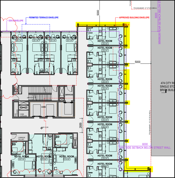
Figure 5 – Snip of the assessed Floor Plan - Level 2 (Drawing Number TP01.04), with the encroaching parts of the proposal highlighted in yellow.
The encroaching parts are generally limited to the northeastern and southeastern elevations below the maximum street wall height. The fact that some parts are architectural features is irrelevant as this clause does not contain an exemption for such (this contrasts with Clause 2.5 of the DDO30 which does contain an exemption for architectural features).
As a permit cannot be granted to vary a built form requirement expressed with the term ‘must’, a condition has been recommended at ensure that all parts of the proposed building are set back to fit inside the envelope of either Clause 2.9 of the DDO30 or the approved building, whichever is the lesser. Given the nature and extent of the encroachments, such a condition is unlikely to have any significant consequential impacts.
The recommended condition has been presented to the applicant, who response advised that it was achievable, with the likely approach being to realign the columns to sit flush with the glass surfaces. This will enable the retention of the expressed grid design that features in the street wall and some of its ‘depth’.
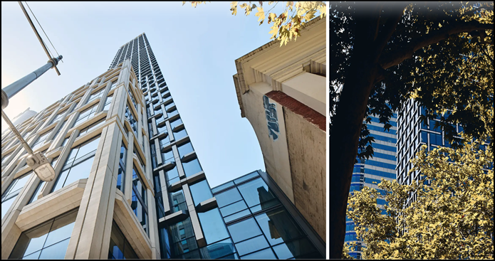
Figure 6 – An example of the likely approach adopted by the applicant to address the requirements of the condition recommended to achieve compliance with the side and rear setbacks of Clause 2.9 of the DDO30.
11.14.7 Clause 2.10 – Building separation within a site
The built form requirements and outcomes of this clause do not apply as the proposed building will be the only building on the site.
11.14.8 Clause 2.11 – Wind effects on the public realm
This clause does not specify any built form requirements for buildings and works that are not higher than 40 metres and the revised proposal has a maximum building height of 24.75 metres.
Turning to the relevant built form outcome, which generally seeks to ensure that the development is designed to maintain a safe and pleasant pedestrian environment on footpaths and other public spaces for walking, sitting, or standing, it is noted that the existing permit includes a condition (Condition 23) that requires the preparation, submission, and approval of a Wind Climate Assessment Report for the development. This condition is to be updated to reflect the development staging and ensure that any changes required by the report are shown on the amended plans required by Condition 1 but is otherwise sufficient to ensure that the relevant built form outcome will be met.
11.14.9 Clause 2.12 – Active street frontages
Under this clause, buildings are required to provide, firstly, openable windows and balconies within the street wall along streets and laneways. The approved building provides openable windows and balconies within the street wall along City Road and the northeastern and northwestern laneway interfaces and therefore meets this built form requirement. The proposed building does not provide any openable windows or balconies within its street wall and therefore does not meet this built form requirement. It is considered that openable windows within the street wall are required as a minimum to achieve the “activated building facade" sought by the corresponding built form outcomes. A permit condition has been recommended accordingly, noting this will likely need to be addressed at lower podium levels with sash/sliding profiles as to avoid encroachment over the footpath.
The second requirement for entrances to buildings to be no deeper than one-third of the width of the entrance does not apply in this instance as the entrances to both buildings, approved and proposed, are on the City Road frontage.
Similarly, the proportion of the ground floor of the proposed building that will be occupied by building services, which under the terms of the DDO30 includes waste, loading, and car parking, is greater than the 40 per cent maximum specified in this clause it is less than the extent of noncompliance allowed by the existing permit. The requirement therefore does not apply.
City Road is designated as a Secondary Type 1 active frontage on Map 3 to the DDO30. Table 8 to the DDO30 therefore specifies a clear glazing requirement of at least 60 per cent along the ground level frontage to a height of 2.5 metres excluding any solid plinth or base. The existing approval meets this requirement; the revised proposal, however, does not, with only about 55 per cent of the ground level frontage to a height of 2.5 metres being clear glazing. This notwithstanding, the extent of clear glazing proposed is considered acceptable on the basis that all street-facing windows and doors at ground level are openable (as required by a condition of permit) and will therefore provide a similar (if not greater) level of activation to the building facade than what a fixed floor-to-ceiling window would.
Finally, the only aspect of the proposed car parking arrangement that will be visible from the public realm or an adjoining site is the basement entry, of which is no more visible than the entry to the at-grade car parking area of the approved building. This requirement is met, but technically does not apply.
11.14.10 Clause 2.13 – Adaptable buildings
A detailed assessment of the approved and proposed buildings against the built form requirements of this clause is presented in the below table:
|
Building element |
Adaptability opportunity |
Approved building |
Proposed building |
|
Lower levels up to the height of the street wall |
At least 4.0m floor to floor height at ground level. |
ü (4.92m) |
ü (4.1m) |
|
At least 3.8m floor to floor height for other lower levels. |
û (3.05-3.35m) |
Transitional provision applies (3.1m) |
|
|
Assessment The ‘transitional provision’ in Clause 2.2 applies as the extent of non-compliance is not increased. The proposal is therefore exempt from this built form requirement and is deemed acceptable. |
|||
|
Car parking areas |
In areas not in a basement: · Level floors. · A floor-to-floor height at least 3.8m. |
ü (4.92m) |
N/A (all car parking is in a basement) |
|
Mechanical parking systems to reduce the area required for car parking. |
ü |
û |
|
|
Assessment The intent of this clause is to ensure that parts of buildings that could be used for commercial purposes are used for commercial purposes or are capable of being used for commercial purposes. Its provisions are therefore more relevant to a building where car and bicycle parking is located at or above ground level. The proposed basement car and bicycle parking arrangement is considered acceptable as it means it has resulted in a greater proportion of commercial floorspace at ground level. |
|||
|
Dwelling layout |
The ability for one and two-bedroom dwellings to be combined or adapted into three or more bedroom dwellings. |
ü |
N/A |
|
Assessment The revised proposal does not include any dwellings. |
|||
|
Internal layout |
Minimal load bearing walls to maximise flexibility for retail or commercial refits. |
ü |
ü |
|
Assessment Both buildings meet this requirement. |
|||
11.14.11 Clause 2.14 – Building finishes
A detailed assessment of the approved and proposed buildings against the built form requirements of this clause is presented in the below table:
|
Built form requirement |
Approved building |
Proposed building |
|
Buildings should avoid blank façades. |
ü |
ü |
|
Building walls facing a street or public place should be detailed to provide visual interest. |
ü |
ü |
|
Buildings fronting main roads should use materials and finishes with a perpendicular reflectivity less than 15 per cent, measured at 90 degrees to the facade surface. |
ü |
ü (subject to a condition) |
|
Assessment With respect to the third built form requirement, it is noted that the existing permit includes a condition that requires “glazing materials used on all external walls must be of a type that does not reflect more than 15 [per cent] of visible light, when measured at an angle of 90 degrees to the glass surface, to the satisfaction of the responsible authority”. The scope of the built form requirement, however, extends beyond just glazing and includes all materials and finishes on a street-facing elevation. The endorsed plans do not specify the perpendicular reflectivity of the other materials incorporated into the south elevation of the Stage 2 building, meaning that it is not possible to establish, without speculating, whether the application benefits from the ‘transitional provision’. A condition has therefore been recommended to ensure that all external materials and finishes used on the south elevation facing City Road have a perpendicular reflectivity of less than 15 per cent, as required by this clause. |
||
Are the proposed traffic movements, car parking and access arrangements acceptable?
11.15 The below assessment demonstrates that the proposed traffic movements, car parking, and access arrangements are broadly acceptable, with permit conditions sufficient to address any areas of uncertainty or to ensure compliance.
11.15.1 Traffic
The change in traffic generation resulting from the changes to the car parking provision and design and predominant use of the Stage 2 building is expected to be nominal for the following reasons:
· Vehicle movements to and from the residential hotel will typically occur during the ‘shoulder periods’, consistent with standard check-in (3:00pm) and check-out (10:00am) times. This contrasts with dwellings, where vehicle movements typically occur during peak hours.
· The approved and proposed buildings will generate a similar amount of traffic as the increased car parking provision will be offset by the likely lower number of vehicle movements to each space in the residential hotel.
· It is more likely that the previous dwellings would be fully occupied than the proposed residential hotel.
11.15.2 Access
All private and service vehicle access to the site will be via the northeastern part of the Stage 2 laneway, of which connects to Thistlethwaite Street via the Stage 1 laneway. The application was accompanied by a set of swept path diagrams demonstrating safe and efficient access and egress to the loading dock for a small rigid vehicle (SRV) and a 6.4 metre long, rear-lift waste collection vehicle (“mini loader”) and to the car park entry for a B99 design vehicle, which is representative of the 99.8th percentile class of all cars and light vehicles on the road.
Council’s Traffic Engineer did not raise any concern with the submitted swept path diagrams.
11.15.3 Loading
The revised proposal includes a separate loading dock that will accommodate all loading and unloading activities, including waste collection. The loading dock is provided at the rear of the building, nestled between building services and the car park entry. It will be accessed from Thistlethwaite Street via the Stage 1 and 2 laneways and has been designed to accommodate an SRV, which is the largest service vehicle likely to regularly access the site.
Internally, a circulation path will provide each use with back-of-house access. There is also direct access from the shared waste room.
Its entry is architecturally resolved and integrates into the design of the building. A permit condition has been recommended to have a dimension added to the entry on the architectural plans to confirm that sufficient clearance height for an SRV will be provided.
11.15.4 Car parking
The development will provide a total of 37 car parking spaces within one level of basement. Three of these spaces will be allocated to the food and drink premises and one space to the retail premises. The remaining 33 spaces will be allocated to the residential hotel.
Before delving into an assessment of the car parking provision/allocation for each use in the proposal, it is important to understand the strategic context in which the site is located, being the FBURA. The expectations of the Planning Scheme in relation to the FBURA are centred on sustainable transport with policy encouraging people away from private transport to alternative modes such as buses, trams, car sharing, walking, and cycling. The Montague Precinct of the FBURA, in particular, is well serviced by existing public transport options, with the 96 and 109 trams and 234 bus within reasonable walking distance of the site.
Residential hotel
A ‘residential hotel’ is a defined term but is not specified in Table 1 to Clause 52.06-5 or Schedule 1 to the Parking Overlay (PO1). Car parking is therefore required to be to the satisfaction of the responsible authority, pursuant to Clause 52.06-6 of the Planning Scheme.
As previously discussed, 33 spaces will be allocated to the 137-room residential hotel. The application therefore proposes a rate of 0.24 spaces per hotel room, which for context is about half the maximum rate specified for a one- or two-bedroom dwelling with a permanent occupant in the FBURA (i.e., 0.5 spaces).
The submitted Traffic Engineering Assessment, prepared by Traffix Group and dated March 2024, cites comparison rates of 0.2 spaces per hotel room and 0.25 spaces per hotel room for 3- or 4-star and 5-star hotels, respectively, from a technical report published by the NSW Roads and Traffic Authority. Council has also previously accepted a rate of 0.3 spaces per hotel room for another residential hotel on City Road. The proposed rate is seen to occupy a middle ground between the rates provided in the above empirical examples/studies.
The car parking spaces allocated to the residential hotel will be managed by its operator through a reservation system that will form part of the hotel room booking process. Specifically, prospective guests will be required to select whether they require a car park and, subsequently, advised of availability at the time of booking. This approach is also sufficient to manage the number of vehicles entering and exiting the site.
Ultimately, the proposed parking allocation is reasonable given the operational characteristics of the residential hotel, its location within the FBURA, and the anticipated mode shift towards sustainable transport options over time.
Food and drink premises
A maximum car parking requirement applies to the proposed food and drink premises for the reasons as follows:
· ‘Food and drink premises’ falls under the umbrella term ‘retail premises’; and
· ‘Retail premises’ is specified in the PO1.
Pursuant to Table 1 of the PO1, the maximum number of car parking spaces to be provided for a ‘retail premises’ comprising 300.9 square metres gross floor area is three (after rounding down to the nearest whole number in accordance with Clause 52.06-5 of the Planning Scheme). In this instance, three spaces will be allocated to the proposed food and drink premises, meaning that a permit is not required under the provisions of the PO1.
Retail premises
Similarly to the above, the maximum number of car parking spaces to be provided for a ‘retail premises’ comprising 109.6 square metres gross floor area is one (again, after rounding down to the nearest whole number in accordance with Clause 52.06-5 of the Planning Scheme). One space will be allocated to the proposed retail premises, which means that a permit is not required under the PO1.
Disabled car parking
The proposal is required to provide one disabled car parking space pursuant to Clause 52.06-5 of the Planning Scheme and, by extension, Condition 1(f) of the existing permit and one disabled car parking space has been provided within the basement of the Stage 2 building. Importantly, this space has been designed to meet the requirements of Australian Standard AS2890.6:2009.
11.15.5 Motorcycle parking
The proposal does not include any motorcycle parking.
The motorcycle parking requirement under Clause 4.2 of Schedule 1 to the Capital City Zone does not apply as the proposal is not a development of more than 50 dwellings or a development with over 10,000 square metres of non-residential floor space. There are no other provisions within the Planning Scheme that require the provision of motorcycle parking.
Further to this, the one space required by Condition 1(k) of the existing permit was provided in Stage 1.
11.15.6 Bicycle parking and facilities
Bicycle parking
The alternative bicycle parking requirement under Clause 4.2 of Schedule 1 to the Capital City Zone does not apply for the reasons given above under the heading ‘Motorcycle parking’. The assessment benchmark with respect to bicycle parking provision therefore defaults back to Clause 52.34 (Bicycle facilities) of the Planning Scheme.
Under Clause 52.34-5, the revised proposal generates a minimum bicycle parking requirement of 30 spaces, as demonstrated in the below table.
|
Use |
Measure |
Rate |
Quantity |
Required |
|
Residential hotel |
||||
|
Residential building other than specified in this table [Table 1 to Clause 52.34-5] |
Employee/ Resident |
In developments of four or more storeys, 1 to each 10 lodging rooms |
137 rooms |
14 spaces, after rounding to the nearest whole number |
|
Visitor/ Shopper/ Student |
In developments of four or more storeys, 1 to each 10 lodging rooms |
137 rooms |
14 spaces, after rounding to the nearest whole number |
|
|
Subtotal |
28 spaces |
|||
|
Food and drink premises |
||||
|
Retail premises other than specified in this table [Table 1 to Clause 52.34-5] |
Employee/ Resident |
1 to each 300sqm of leasable floor area |
300.9sqm |
1 space, after rounding to the nearest whole number |
|
Visitor/ Shopper/ Student |
1 to each 500sqm of leasable floor area |
300.9sqm |
1 space, after rounding to the nearest whole number |
|
|
Subtotal |
2 spaces |
|||
|
Retail premises |
||||
|
Retail premises other than specified in this table [Table 1 to Clause 52.34-5] |
Employee/ Resident |
1 to each 300sqm of leasable floor area |
109.6sqm |
0 spaces, after rounding to the nearest whole number |
|
Visitor/ Shopper/ Student |
1 to each 500sqm of leasable floor area |
109.6sqm |
0 spaces, after rounding to the nearest whole number |
|
|
Subtotal |
0 spaces |
|||
|
Total |
30 spaces |
|||
The development will provide a total of 36 bicycle parking spaces, with 16 of these spaces provided within the storage compound at basement level and the remainder at bicycle rails within the pedestrian laneway that runs along the northwestern edge of the building.
The storage compound is located to provide convenient access to other bicycle facilities, including showers and change rooms, fully enclosed, and able to be locked, in accordance with Clause 52.34-6 of the Planning Scheme. A permit condition has been recommended to ensure that each bicycle parking space measures at least 1.7 metres in length, 1.2 metres in height, and 0.7 metres in width at the handlebars, as required by Clause 52.34-6 of the Planning Scheme.
End-of-trip facilities
In terms of end-of-trip facilities, the revised proposal is also required to provide at least two showers and two change rooms for employees, as demonstrated in the below tables. Importantly, there are no end-of-trip facility requirements for visitors/shoppers under the Planning Scheme.
|
Use |
Rate |
Quantity |
Required |
|
Residential hotel |
If 5 or more employee bicycle spaces are required, 1 shower for the first 5 employee bicycle spaces, plus 1 to each 10 employee bicycle spaces thereafter |
14 employee bicycle spaces |
2 showers, after rounding to the nearest whole number |
|
Food and drink premises |
1 employee bicycle space |
0 showers |
|
|
Retail premises |
0 employee bicycle spaces |
0 showers |
|
|
Total |
2 showers |
||
|
Use |
Rate |
Quantity |
Required |
|
Residential hotel |
1 change room or direct access to a communal change room to each shower. The change room may be a combined shower and change room |
2 showers |
2 change rooms |
|
Food and drink premises |
0 showers |
0 change rooms |
|
|
Retail premises |
0 showers |
0 change rooms |
|
|
Total |
2 change rooms |
||
The development provides two combined shower and change rooms, thereby satisfying the requirements of Tables 2 and 3 to Clause 52.34-5. Both combined shower and change rooms are also located at basement level, next to the storage compound. They are also fully enclosed and able to be locked, as required by Clause 52.34-6.
A permit condition has been recommended to secure bicycle signage in accordance with Clause 52.34-7 of the Planning Scheme.
Existing permit considerations
The existing permit contains several requirements (conditions) that pertain to the design and provision of bicycle parking in the development. The implications of those conditions that relate to Stage 2 of the development or both stages are discussed in the table below. Those conditions that relate solely to Stage 1 of the development do not need to be revisited as this stage has already been completed.
|
Condition Requirement |
Assessment |
|
Condition 1(p) Amended plans to show… a minimum of 190 bicycle parking spaces for residents. |
This condition is no longer relevant as a residential hotel does not have ‘residents’. The above assessment demonstrates that adequate bicycle parking will be provided as part of the amended Stage 2 development. In addition, it is not proposed to change the resident bicycle parking provision in Stage 1. Therefore, it is recommended that the condition be amended to reference “98 bicycle parking spaces” and to only apply to Stage 1. |
|
Condition 1(q) Amended plans to show… a minimum of 34 bicycle parking spaces for visitors, including some on Thistlethwaite Street, some on or near City Road and some along the internal laneway/s. |
Under the existing approval, four visitor spaces are to be provided in Stage 1 and the remaining 30 spaces are to be provided in Stage 2. It is now proposed to provide 20 visitor spaces in Stage 2. It is not considered necessary to require additional visitor bicycle parking to be provided in Stage 2 to address the deficit for the following reasons: · Bicycle parking provision in Stage 1 is a satisfaction matter pursuant to Clause 4.2 of Schedule 1 to the Capital City Zone and may be varied; · Stage 1 is currently operating without issue with four visitor spaces; and · The above assessment demonstrates that the visitor bicycle parking provision in Stage 2, which is not a satisfaction matter, is in accordance with the requirements of Clause 52.34 of the Planning Scheme. It is therefore recommended that this condition be amended to reflect the proposed aggregate visitor bicycle parking provision (i.e., 24 spaces across both stages of the development). |
|
Condition 1(r) Amended plans to show… at least 20% of the bicycle parking spaces provided being horizontal. |
There is no formal requirement within the Planning Scheme to provide horizontal bicycle parking. That notwithstanding, 20 of the proposed 36 bicycle parking spaces to be provided in Stage 2 will be ‘horizontal’. This is considered acceptable. |
|
Condition (t) Amended plans to show… direct access from City Road into the bicycle storage area of stage two. |
This condition is no longer relevant as the storage compound has been relocated to the new basement level in the revised proposal, meaning that direct access from City Road is not feasible. The above assessment demonstrates that the location of the proposed storage compound meets the requirements of Clause 52.34 and is therefore acceptable. This condition should be deleted on this basis. |
Would the proposal achieve best practice environmentally sustainable design and water sensitive urban design?
11.16 The submitted BESS Report is inaccurate as the proposal has been incorrectly assessed as a ‘non-residential development’ site type. A consequence of this is that the proposal has not been assessed against all applicable categories in BESS. It therefore unlikely that the overall score shown on the submitted BESS Report is a true reflection of its level of environmentally sustainable development. The correct site type for the proposal, in Council’s view, is ‘mixed use development’ as this accounts for the residential nature of the residential hotel and the categorisation of the individual hotel rooms (sole occupancy units) under the National Construction Code (NCC).
11.17 However, it is noted that under the provisions of the CCZ1 the revised proposal is required to demonstrate a minimum 5 Star Green Star Design and As-Built rating (or equivalent, which is now upgraded to ‘Buildings’) with the Green Building Council of Australia, which is a different tool for assessing environmentally sustainable design (ESD) performance in a building. The conditions listed under Clause 4.2 of the CCZ1 have been included in the officer’s recommendation.
11.18 It is therefore considered that an amended SMP is not required as the abovementioned conditions require the submission of evidence to the satisfaction of the responsible authority (Council). Importantly, there is a level of confidence that the proposal can achieve the necessary rating.
Changes required to the existing preamble
11.19 The preamble of the existing permit requires amendment to reflect the changes to the otherwise approved development and to include reference to the specific permissions granted by the permit and whether those permissions are exempt from the notice and review requirements of the Act, as required following the decision of the Supreme Court in Myers v Southern Grampians Shire Council [2023] VSC 658.
11.20 For a permit being amended pursuant to section 72 of the Act, the updated preamble will include the existing ‘useful description’, amended as required, followed by a list of the specific permissions granted by the permit.
11.21 In this instance, the updated preamble must have regard to the Stage 1 building, of which continues to take the benefit of the existing permit.
11.22 There is also an opportunity with this application to simplify the existing ‘useful description’ of the development and ensure that all phrasing and terminology is up to date, noting specifically that the phrase ‘Road Zone Category 1’ has since been superseded by ‘Transport Zone 2’.
11.23 It is therefore recommended that the existing preamble be amended by deleting the words struck through and inserting the words in bold as follows:
To demolish existing buildings,
construct a two, mixed use 4, 6 and 8 level,
multi-storey buildings development plus
basement, use the land for dwellings accommodation (dwelling and residential hotel) and retail premises
(other than hotel, shop and tavern) over two stages, and alter access to a Road Zone Category 1 road in a Transport Zone 2,
generally in accordance, with the endorsed plans and subject to the
following conditions permissions:
|
Planning Scheme Clause |
Matter for which a permit is required |
|
Clause 36.04-2 |
· Construct a building or construct or carry out works for any use in Section 2 of Clause 36.04-1 |
|
Clause 37.04-1 |
· Use the land for accommodation (dwelling) · Use the land for accommodation (residential hotel) · Use the land for retail premises (other than hotel, shop and tavern) |
|
Clause 37.04-4 |
· Demolish or remove a building or works · Construct a building or construct or carry out works |
|
Clause 43.02-2 |
· Construct a building or construct or carry out works |
|
Clause 44.05-2 |
· Construct a building or construct or carry out works |
|
Clause 52.29-2 |
· Create or alter access to a road in a Transport Zone 2 |
Changes required to the existing conditions
Condition 18
11.24 Condition 18 of the existing permit pertains to development contributions. Specifically, it requires the permit holder to enter into an agreement with the responsible authority pursuant to section 173 of the Act that provides for the calculation and payment of development contributions.
11.25 This condition was originally imposed to ensure that the development was liable for development contributions in the absence of a development contributions plan for Fishermans Bend.
11.26 The condition remains relevant as a development contribution plan for Fishermans Bend has not been approved.
11.27 It is recommended, however, that its wording be amended to ensure that it reflects current drafting practice and that there is sufficient flexibility built in to respond to any changes to the collecting agency.
11.28 The modified condition as detailed in ‘recommendation’ section of this report was developed in consultation with the Victorian Planning Authority (VPA) and reflects their current/preferred drafting style.
Conditions 2, 3 ,4, 5, 7, 11, 14, 15, 20, 22, 23, 25, 31, 39, and 41
11.29 Several conditions on the existing permit require amendment to reflect the development staging or to facilitate the use and the development of the site in accordance with the provisions of the Planning Scheme.
11.30 The changes required to Conditions 2, 3 ,4, 5, 7, 11, 14, 15, 20, 22, 23, 25, 31, 39, and 41 of the existing permit are discussed in the table to Appendix 6.
Other changes required to the permit
11.31 In line with the recent changes to the Planning and Environment Regulations 2015, which included changes to the prescribed form for permits granted under the Act, it is recommended that the details of all previous extensions to the existing permit be included in the permit within a new table.
11.32 As such, the following table is required to be included in the permit and, as such, forms part of the officer’s recommendation.
The permit has been extended as follows:
|
Date of extension |
Brief description of the extension |
Duration of the extension |
|
22 January 2018 |
Extension to commencement date for Stage 1 |
Two years |
|
1 August 2019 |
Extension to completion date for Stage 1 |
Two years |
11.33 Lastly, it is recommended that details of this amendment, including any date of approval and a brief description of any approved changes, be added to the table of amendments at the end of the permit as follows:
|
Date of amendment |
Brief description of amendment |
|
[Date of approval] 39/2015/D |
· Modifying the wording of Conditions 1 and adding sub-conditions (y) through (ll). · Modifying the wording of Conditions 2, 3 ,4, 5, 7, 11, 14, 15, 20, 22, 23, 25, 31, 39, and 41 to reflect the development staging and/or to apply to Stage 1 only and/or to respond to the change in use of the Stage 2 building from dwellings to a residential hotel. · Modifying the wording of Condition 18. · Adding Conditions 44 through 59 as new conditions. · Updating the permit preamble to reflect the changes made to the Stage 2 building including its use as a residential hotel and include reference to the approved staging arrangement and all relevant permissions in accordance with the expectations of Myers v Southern Grampians Shire Council. · Adding a table of all previous extensions to the permit. |
12. COVENANTS
12.1 The register search statement (title search) submitted with the application demonstrates that the subject land is not burdened by a restrictive covenant.
13. OFFICER material OR general INTEREST
13.1 No officers involved in the preparation of this report has declared a material or general interest in the matter.
14. CONCLUSION
14.1 Having assessed the proposal against the relevant policies and provisions of the Planning Scheme and having had regard to what the existing permit already allows, it is considered that it represents an acceptable planning outcome, subject to the recommended conditions.
14.2 The proposal demonstrates a suitably high level of architectural design, consistent with that shown on the endorsed plans. Specifically, its massing manifests a legible base with distinct upper levels, as sought by the DDO30, and an acceptable interface with the public realm will be provided.
14.3 The proposed uses are complementary to themselves but also to a range of uses in the surrounding area.
14.4 On this basis, it is recommended that an Amended Permit be issued.
|
ATTACHMENTS |
1. Site location plan 2. Copy of existing permit (39/2015/C) 3. Copy of existing endorsed plans (39/2015/C) 4. Assessment plans 5. Summary of and officer response to internal referral
comments 6. Table of changes to existing conditions |